Stafford County, Kansas
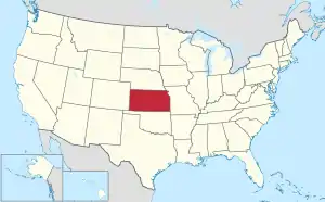
Stafford County (standard abbreviation: SF) is a county in the U.S. state of Kansas. In 2020, 4,072 people lived there.[1] Its county seat is St. John.[2] The county is named after Lewis Stafford. He was captain of Company E, First Kansas Infantry, who was killed at the Battle of Young's Point in Madison Parish, Louisiana on June 7, 1863.[3]
Stafford County | |
|---|---|
 Stafford County Museum in Stafford (2017) | |
 Location within the U.S. state of Kansas | |
 Kansas's location within the U.S. | |
| Coordinates: 38°04′00″N 98°43′00″W | |
| Country | |
| State | |
| Founded | 1879 |
| Named for | Lewis Stafford |
| Seat | St. John |
| Largest city | St. John |
| Area | |
| • Total | 795 sq mi (2,060 km2) |
| • Land | 792 sq mi (2,050 km2) |
| • Water | 2.9 sq mi (8 km2) 0.4% |
| Population | |
| • Total | 4,072 |
| • Density | 5.1/sq mi (2.0/km2) |
| Time zone | UTC−6 (Central) |
| • Summer (DST) | UTC−5 (CDT) |
| Congressional district | 4th |
| Website | staffordcounty |
History
19th century
In 1879, Stafford County was created.
The borders of Stafford County were defined by the Kansas Legislature of 1870. For several years, the county was still unorganized. The Legislature of 1875 gave the territory in Stafford County to other counties. They wanted to get rid of Stafford County. They gave the part in Range 15 West to Pawnee County; the portion included in Ranges 11, 12, 13 and 14 to Barton County; and the south half of the county, excepting the portion in Range 15, was added to Pratt County. But after each of the counties had taken its part, a strip six miles wide and twelve miles long (two townships) remained as Stafford County. This was the county until April 25, 1879. The Supreme Court of Kansas said that dividing the county was unconstitutional. The county was restored to its original borders.[4]
Geography
The U.S. Census Bureau says that the county has a total area of 795 square miles (2,060 km2). Of that, 792 square miles (2,050 km2) is land and 2.9 square miles (7.5 km2) (0.4%) is water.[5]
People
| Historical population | |||
|---|---|---|---|
| Census | Pop. | %± | |
| 1880 | 4,755 | — | |
| 1890 | 7,520 | 58.1% | |
| 1900 | 9,829 | 30.7% | |
| 1910 | 12,510 | 27.3% | |
| 1920 | 11,559 | −7.6% | |
| 1930 | 10,460 | −9.5% | |
| 1940 | 10,487 | 0.3% | |
| 1950 | 8,816 | −15.9% | |
| 1960 | 7,451 | −15.5% | |
| 1970 | 5,943 | −20.2% | |
| 1980 | 5,694 | −4.2% | |
| 1990 | 5,365 | −5.8% | |
| 2000 | 4,789 | −10.7% | |
| 2010 | 4,437 | −7.4% | |
| 2020 | 4,072 | −8.2% | |
| U.S. Decennial Census[6] 1790-1960[7] 1900-1990[8] 1990-2000[9] 2010-2020[1] | |||

Government
Stafford County is often won by Republican Candidates. The last time Stafford County was won by a democratic candidate was in 1976 by Jimmy Carter.
Presidential elections
| Year | Republican | Democratic | Third Parties |
|---|---|---|---|
| 2020 | 80.9% 1,645 | 17.6% 357 | 1.6% 32 |
| 2016 | 78.6% 1,490 | 16.0% 304 | 5.4% 102 |
| 2012 | 75.3% 1,385 | 22.0% 404 | 2.7% 50 |
| 2008 | 72.1% 1,495 | 26.1% 542 | 1.8% 37 |
| 2004 | 75.4% 1,649 | 23.2% 506 | 1.4% 31 |
| 2000 | 70.3% 1,546 | 25.8% 567 | 4.0% 87 |
| 1996 | 63.0% 1,604 | 25.6% 651 | 11.4% 290 |
| 1992 | 38.6% 1,064 | 28.2% 777 | 33.3% 919 |
| 1988 | 56.0% 1,532 | 40.9% 1,121 | 3.1% 85 |
| 1984 | 69.7% 2,062 | 28.5% 844 | 1.8% 52 |
| 1980 | 62.7% 1,865 | 29.3% 872 | 8.0% 239 |
| 1976 | 45.2% 1,430 | 52.5% 1,659 | 2.3% 73 |
| 1972 | 70.4% 2,200 | 27.0% 844 | 2.7% 83 |
| 1968 | 55.8% 1,851 | 36.3% 1,205 | 8.0% 264 |
| 1964 | 41.6% 1,516 | 57.3% 2,087 | 1.0% 38 |
| 1960 | 65.5% 2,531 | 33.8% 1,305 | 0.7% 26 |
| 1956 | 68.4% 2,728 | 31.1% 1,242 | 0.5% 20 |
| 1952 | 71.3% 3,162 | 26.5% 1,174 | 2.3% 100 |
| 1948 | 51.7% 2,304 | 46.0% 2,049 | 2.3% 100 |
| 1944 | 56.3% 2,493 | 43.1% 1,908 | 0.7% 31 |
| 1940 | 52.2% 2,795 | 46.8% 2,509 | 1.0% 53 |
| 1936 | 37.5% 1,939 | 62.1% 3,212 | 0.4% 20 |
| 1932 | 41.2% 1,945 | 56.2% 2,651 | 2.6% 122 |
| 1928 | 75.3% 3,278 | 23.5% 1,025 | 1.2% 52 |
| 1924 | 68.6% 3,100 | 21.2% 957 | 10.2% 463 |
| 1920 | 70.0% 2,779 | 26.6% 1,057 | 3.3% 132 |
| 1916 | 41.9% 1,812 | 49.6% 2,148 | 8.5% 368 |
| 1912 | 16.1% 422 | 41.9% 1,094 | 42.0% 1,098[lower-alpha 1] |
| 1908 | 51.0% 1,334 | 43.4% 1,135 | 5.6% 147 |
| 1904 | 63.1% 1,419 | 26.0% 585 | 10.9% 244 |
| 1900 | 46.8% 1,055 | 50.5% 1,139 | 2.7% 60 |
| 1896 | 35.3% 710 | 63.5% 1,276 | 1.1% 23 |
| 1892 | 39.3% 840 | 60.7% 1,300 | |
| 1888 | 47.5% 975 | 23.5% 483 | 29.0% 594 |
Laws
Although the Kansas Constitution was changed in 1986 to allow the sale of alcohol, Stafford County was still a "dry" county[11] until an election in 2016 when this prohibition was removed by 1,304 to 535, 71% of the vote.[12]
Education
Unified school districts
Communities

Cities
- Hudson
- Macksville
- Radium
- Seward
- Stafford
- St. John
References
- "QuickFacts: Stafford County, Kansas". United States Census Bureau. Retrieved October 3, 2023.
- "Find a County". National Association of Counties. Retrieved 2011-06-07.
- A History of Stafford County, Frank A. Steele, 1982
- Stafford County, Kansas 1870-1990, Stafford County Historical & Genealogical Society, 1990, p.5
- "US Gazetteer files: 2010, 2000, and 1990". United States Census Bureau. 2011-02-12. Retrieved 2011-04-23.
- "U.S. Decennial Census". United States Census Bureau. Retrieved July 29, 2014.
- "Historical Census Browser". University of Virginia Library. Archived from the original on August 11, 2012. Retrieved July 29, 2014.
- "Population of Counties by Decennial Census: 1900 to 1990". United States Census Bureau. Retrieved July 29, 2014.
- "Census 2000 PHC-T-4. Ranking Tables for Counties: 1990 and 2000" (PDF). United States Census Bureau. Retrieved July 29, 2014.
- "Dave Leip's Atlas of U.S. Presidential Elections".
- "Map of Wet and Dry Counties". Alcoholic Beverage Control, Kansas Department of Revenue. November 2004. Archived from the original on 2007-10-08. Retrieved 2007-01-21.
- "Two Kansas counties approve liquor by the drink". Retrieved 2018-11-14.
- Notes
- This total comprises 938 votes (35.9%) for Progressive Theodore Roosevelt and 160 votes (6.1%) for Socialist Eugene V. Debs.
More reading
- Standard Atlas of Stafford County, Kansas; Geo. A. Ogle & Co; 56 pages; 1904.
Other websites
- County
- Maps
- Stafford County Maps: Current, Historic, KDOT
- Kansas Highway Maps: Current, Historic, KDOT
- Kansas Railroad Maps: Current, 1996, 1915, KDOT and Kansas Historical Society
