Sherman County, Kansas
Sherman County (standard abbreviation: SH) is a county in the U.S. state of Kansas. In 2020, 5,927 people lived there.[2] Its county seat is Goodland.[3] Sherman County was created by the Kansas Legislature in 1873. It is named after General William Tecumseh Sherman.[4]
Sherman County | |
|---|---|
 Sherman County courthouse in Goodland (2012) | |
 Location within the U.S. state of Kansas | |
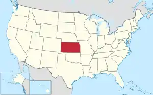 Kansas's location within the U.S. | |
| Coordinates: 39°21′N 101°43′W | |
| Country | |
| State | |
| Founded | September 20, 1886 |
| Named for | William Tecumseh Sherman[1] |
| Seat | Goodland |
| Largest city | Goodland |
| Area | |
| • Total | 1,056 sq mi (2,740 km2) |
| • Land | 1,056 sq mi (2,740 km2) |
| • Water | 0.2 sq mi (0.5 km2) 0.02% |
| Population | |
| • Total | 5,927 |
| • Density | 5.6/sq mi (2.2/km2) |
| Time zone | UTC−7 (Mountain) |
| • Summer (DST) | UTC−6 (MDT) |
| Congressional district | 1st |
| Website | www |
History
19th century
In 1886, Sherman County was created.
Geography
The U.S. Census Bureau says that the county has a total area of 1,056 square miles (2,740 km2). Of that, 1,056 square miles (2,740 km2) is land and 0.2 square miles (0.52 km2) (0.02%) is water.[5]
Sherman County is one of only four Kansas counties in Mountain Time. Since Sherman County is part of the Wichita media market, prime-time television in the county is aired from 6 to 9 p.m. local time, rather than 7 to 10 p.m. as is normal in the Central and Mountain time zones. However, cable providers carry the ABC and NBC affiliates from both Wichita and Denver. This allows viewers to view programs on those networks at the normal prime-time hours.
Major highways
 Interstate 70
 US-24
US-24 K-27
K-27
People
| Historical population | |||
|---|---|---|---|
| Census | Pop. | %± | |
| 1880 | 13 | — | |
| 1890 | 5,261 | 40,369.2% | |
| 1900 | 3,341 | −36.5% | |
| 1910 | 4,549 | 36.2% | |
| 1920 | 5,592 | 22.9% | |
| 1930 | 7,400 | 32.3% | |
| 1940 | 6,421 | −13.2% | |
| 1950 | 7,373 | 14.8% | |
| 1960 | 6,682 | −9.4% | |
| 1970 | 7,792 | 16.6% | |
| 1980 | 7,759 | −0.4% | |
| 1990 | 6,926 | −10.7% | |
| 2000 | 6,760 | −2.4% | |
| 2010 | 6,010 | −11.1% | |
| 2020 | 5,927 | −1.4% | |
| U.S. Decennial Census[6] 1790-1960[7] 1900-1990[8] 1990-2000[9] 2010-2020[2] | |||

Government
Sherman county is often won by Republican Candidates, like most rural counties. However, Lyndon B. Johnson barely won the county in 1964.
Presidential elections
| Year | Republican | Democratic | Third Parties |
|---|---|---|---|
| 2020 | 83.2% 2,269 | 14.5% 396 | 2.3% 62 |
| 2016 | 79.6% 2,089 | 13.2% 347 | 7.2% 189 |
| 2012 | 75.3% 1,976 | 22.0% 577 | 2.7% 70 |
| 2008 | 72.5% 1,959 | 25.4% 688 | 2.1% 57 |
| 2004 | 75.6% 2,088 | 22.9% 632 | 1.5% 42 |
| 2000 | 70.6% 1,894 | 25.4% 681 | 4.0% 107 |
| 1996 | 68.4% 2,110 | 23.9% 736 | 7.7% 238 |
| 1992 | 49.7% 1,630 | 24.7% 810 | 25.6% 838 |
| 1988 | 62.9% 1,929 | 35.3% 1,082 | 1.8% 54 |
| 1984 | 78.0% 2,702 | 20.6% 714 | 1.4% 47 |
| 1980 | 68.9% 2,315 | 23.2% 779 | 8.0% 268 |
| 1976 | 50.2% 1,671 | 47.2% 1,573 | 2.6% 88 |
| 1972 | 69.9% 2,225 | 24.7% 785 | 5.4% 172 |
| 1968 | 57.5% 1,803 | 30.4% 954 | 12.0% 377 |
| 1964 | 48.6% 1,463 | 50.6% 1,522 | 0.8% 25 |
| 1960 | 65.1% 2,030 | 34.4% 1,074 | 0.5% 15 |
| 1956 | 65.0% 1,825 | 34.3% 962 | 0.8% 22 |
| 1952 | 70.4% 2,403 | 27.6% 941 | 2.0% 69 |
| 1948 | 50.0% 1,380 | 46.7% 1,289 | 3.3% 91 |
| 1944 | 60.1% 1,608 | 38.1% 1,021 | 1.8% 48 |
| 1940 | 52.2% 1,569 | 46.5% 1,399 | 1.3% 40 |
| 1936 | 38.3% 1,159 | 59.9% 1,814 | 1.9% 56 |
| 1932 | 32.2% 1,112 | 61.1% 2,110 | 6.7% 232 |
| 1928 | 74.6% 2,028 | 23.2% 630 | 2.2% 60 |
| 1924 | 45.9% 1,122 | 21.6% 528 | 32.5% 795 |
| 1920 | 54.3% 1,066 | 40.2% 789 | 5.5% 107 |
| 1916 | 30.8% 582 | 63.4% 1,196 | 5.8% 110 |
| 1912 | 13.1% 129 | 47.3% 465 | 39.6% 390 |
| 1908 | 43.6% 439 | 50.5% 508 | 5.9% 59 |
| 1904 | 60.6% 465 | 30.1% 231 | 9.4% 72 |
| 1900 | 46.5% 380 | 51.2% 418 | 2.3% 19 |
| 1896 | 39.8% 291 | 59.8% 437 | 0.4% 3 |
| 1892 | 43.2% 571 | 56.8% 752 | |
| 1888 | 55.7% 803 | 33.4% 481 | 11.0% 158 |
Education
Unified school districts

Related pages
References
- "Welcome To the Official Sherman County Website". Sherman County, Kansas. Archived from the original on 2009-02-18. Retrieved 2012-11-04.
- "QuickFacts: Sherman County, Kansas". United States Census Bureau. Retrieved October 3, 2023.
- "Find a County". National Association of Counties. Retrieved 2011-06-07.
- William G. Cutler's History of the State of Kansas, published 1883 by A. T. Andreas, Chicago, Il., http://www.kancoll.org/books/cutler/unorganized/unorganized-co-p1.html
- "US Gazetteer files: 2010, 2000, and 1990". United States Census Bureau. 2011-02-12. Retrieved 2011-04-23.
- "U.S. Decennial Census". United States Census Bureau. Retrieved July 29, 2014.
- "Historical Census Browser". University of Virginia Library. Archived from the original on August 11, 2012. Retrieved July 29, 2014.
- "Population of Counties by Decennial Census: 1900 to 1990". United States Census Bureau. Retrieved July 29, 2014.
- "Census 2000 PHC-T-4. Ranking Tables for Counties: 1990 and 2000" (PDF). United States Census Bureau. Retrieved July 29, 2014.
- "Dave Leip's Atlas of U.S. Presidential Elections".
More reading
- Standard Atlas of Sherman County, Kansas; Geo. A. Ogle & Co; 61 pages; 1907.
Other websites
- County
- Maps
- Sherman County Maps: Current, Historic, KDOT
- Kansas Highway Maps: Current, Historic, KDOT
- Kansas Railroad Maps: Current, 1996, 1915, KDOT and Kansas Historical Society