Bourbon County, Kansas
Bourbon County (county code BB) is a county in Southeast Kansas. In 2020, 14,360 people lived there.[1] Its county seat is Fort Scott. Fort Scott is also the biggest city in Bourbon County.[2]
Bourbon County | |
|---|---|
 Bourbon County Courthouse in Fort Scott (2016) | |
 Location within the U.S. state of Kansas | |
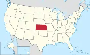 Kansas's location within the U.S. | |
| Coordinates: 37°51′N 94°51′W | |
| Country | |
| State | |
| Founded | August 25, 1855 |
| Named for | Bourbon County, Kentucky |
| Seat | Fort Scott |
| Largest city | Fort Scott |
| Area | |
| • Total | 639 sq mi (1,660 km2) |
| • Land | 635 sq mi (1,640 km2) |
| • Water | 3.6 sq mi (9 km2) 0.6% |
| Population | |
| • Total | 14,360 |
| • Density | 22.6/sq mi (8.7/km2) |
| Time zone | UTC−6 (Central) |
| • Summer (DST) | UTC−5 (CDT) |
| Area code | 620 |
| Congressional district | 2nd |
| Website | BourbonCountyKS.org |
History
19th century
In 1855, Bourbon County was founded.
Geography
The U.S. Census Bureau says that the county has a total area of 639 square miles (1,660 km2). Of that, 635 square miles (1,640 km2) is land and 3.6 square miles (9.3 km2) (0.6%) is water.[5]
Major highways
Sources: National Atlas,[6] U.S. Census Bureau[7]
- U.S. Route 54
- U.S. Route 69
- Kansas Highway 3
- Kansas Highway 7
- Kansas Highway 31
- Kansas Highway 39
- Kansas Highway 65
People
| Historical population | |||
|---|---|---|---|
| Census | Pop. | %± | |
| 1860 | 6,101 | — | |
| 1870 | 15,076 | 147.1% | |
| 1880 | 19,591 | 29.9% | |
| 1890 | 28,575 | 45.9% | |
| 1900 | 24,712 | −13.5% | |
| 1910 | 24,007 | −2.9% | |
| 1920 | 23,198 | −3.4% | |
| 1930 | 22,386 | −3.5% | |
| 1940 | 20,944 | −6.4% | |
| 1950 | 19,153 | −8.6% | |
| 1960 | 16,090 | −16.0% | |
| 1970 | 15,215 | −5.4% | |
| 1980 | 15,969 | 5.0% | |
| 1990 | 14,966 | −6.3% | |
| 2000 | 15,379 | 2.8% | |
| 2010 | 15,173 | −1.3% | |
| 2020 | 14,360 | −5.4% | |
| U.S. Decennial Census[8] 1790-1960[9] 1900-1990[10] 1990-2000[11] 2010-2020[1] | |||

Government
Presidential elections
Bourbon County is a strongly Republican county. Only six presidential elections from 1888 to the present have resulted in Republicans failing to win the county, with the last of these being in 1964.
Presidential election results
| Year | Republican | Democratic | Third Parties |
|---|---|---|---|
| 2020 | 75.2% 5,023 | 23.1% 1,541 | 1.7% 112 |
| 2016 | 71.6% 4,424 | 21.6% 1,336 | 6.7% 415 |
| 2012 | 65.6% 4,102 | 31.9% 1,996 | 2.5% 156 |
| 2008 | 62.5% 4,240 | 35.3% 2,394 | 2.2% 147 |
| 2004 | 65.4% 4,372 | 33.1% 2,216 | 1.5% 98 |
| 2000 | 61.1% 3,852 | 35.1% 2,211 | 3.9% 245 |
| 1996 | 50.2% 3,318 | 37.7% 2,491 | 12.2% 805 |
| 1992 | 40.2% 2,876 | 35.1% 2,509 | 24.8% 1,774 |
| 1988 | 57.8% 3,660 | 41.4% 2,623 | 0.8% 49 |
| 1984 | 68.4% 4,858 | 30.6% 2,175 | 1.0% 69 |
| 1980 | 59.2% 4,263 | 36.2% 2,605 | 4.6% 331 |
| 1976 | 51.8% 3,589 | 46.7% 3,237 | 1.5% 103 |
| 1972 | 70.1% 4,776 | 28.1% 1,912 | 1.9% 126 |
| 1968 | 56.9% 3,983 | 32.0% 2,241 | 11.1% 780 |
| 1964 | 44.9% 3,290 | 54.4% 3,980 | 0.7% 53 |
| 1960 | 63.0% 5,062 | 36.5% 2,928 | 0.5% 41 |
| 1956 | 62.4% 5,306 | 37.1% 3,151 | 0.6% 47 |
| 1952 | 65.3% 5,785 | 34.1% 3,023 | 0.6% 56 |
| 1948 | 51.4% 4,225 | 47.2% 3,879 | 1.4% 111 |
| 1944 | 56.7% 4,790 | 42.9% 3,622 | 0.5% 39 |
| 1940 | 53.6% 5,751 | 45.7% 4,898 | 0.7% 78 |
| 1936 | 48.6% 5,402 | 51.4% 5,714 | 0.0% 4 |
| 1932 | 42.6% 4,277 | 55.6% 5,577 | 1.8% 181 |
| 1928 | 75.9% 7,251 | 23.3% 2,223 | 0.9% 82 |
| 1924 | 49.0% 4,210 | 33.2% 2,850 | 17.9% 1,538 |
| 1920 | 52.1% 4,194 | 45.1% 3,632 | 2.8% 225 |
| 1916 | 37.6% 3,370 | 58.1% 5,209 | 4.3% 388 |
| 1912 | 27.0% 1,448 | 41.3% 2,209 | 31.7% 1,698 |
| 1908 | 47.8% 2,695 | 47.7% 2,686 | 4.5% 253 |
| 1904 | 59.3% 3,234 | 33.1% 1,808 | 7.6% 415 |
| 1900 | 51.4% 3,024 | 47.5% 2,799 | 1.1% 65 |
| 1896 | 48.2% 2,900 | 51.0% 3,067 | 0.8% 50 |
| 1892 | 49.2% 2,803 | 50.8% 2,889 | |
| 1888 | 57.1% 3,569 | 29.3% 1,831 | 13.7% 854 |
Communities

2005 KDOT Map of Bourbon County (map legend)
Notable people
- Jonathan M. Davis, 22nd Governor of Kansas; born in Bourbon County.[13]
References
- "QuickFacts: Bourbon County, Kansas". United States Census Bureau. Retrieved September 27, 2023.
- "Find a County". National Association of Counties. Archived from the original on 2011-05-31. Retrieved 2011-06-07.
- "New details on mystery virus that killed Kansas man". CBS News.
- "New so-called Bourbon virus linked to Kansas man's death after tick bite". UPI.
- "US Gazetteer files: 2010, 2000, and 1990". United States Census Bureau. 2011-02-12. Retrieved 2011-04-23.
- National Atlas Archived December 5, 2008, at the Wayback Machine
- "U.S. Census Bureau TIGER shape files". Archived from the original on 2017-05-23. Retrieved 2017-12-05.
- "U.S. Decennial Census". United States Census Bureau. Archived from the original on April 26, 2015. Retrieved July 21, 2014.
- "Historical Census Browser". University of Virginia Library. Archived from the original on August 11, 2012. Retrieved July 21, 2014.
- "Population of Counties by Decennial Census: 1900 to 1990". United States Census Bureau. Retrieved July 21, 2014.
- "Census 2000 PHC-T-4. Ranking Tables for Counties: 1990 and 2000" (PDF). United States Census Bureau. Retrieved July 21, 2014.
- "Dave Leip's Atlas of U.S. Presidential Elections".
- "Jonathan M. Davis". The Political Graveyard. Retrieved 30 September 2012.
More reading
- Standard Atlas of Bourbon County, Kansas; Geo. A. Ogle & Co; 67 pages; 1920.
- History of Bourbon County, Kansas: To the Close of 1865; Thomas F. Robley; 269 pages; 1894.
- An Illustrated Historical Atlas of Bourbon County, Kansas; Edwards Brothers of Missouri; 55 pages; 1878.
Other websites
Wikimedia Commons has media related to Bourbon County, Kansas.
- County
- Maps
- Bourbon County Maps: Current, Historic, KDOT
- Kansas Highway Maps: Current, Historic, KDOT
- Kansas Railroad Maps: Current, 1996, 1915, KDOT and Kansas Historical Society
This article is issued from Wikipedia. The text is licensed under Creative Commons - Attribution - Sharealike. Additional terms may apply for the media files.