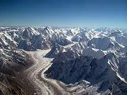
A glacier is a slowly moving river of compacted ice and snow that moves by the strength of gravity. As with rivers of water, a glacier usually follows its stream bed from a high altitude source to sea level.
Planetary sciences
"It has been recognized from previous studies that human, as opposed to automated, delineation of glacier outlines tended to digitize only a subset of all glaciers in a region, in general the largest ones. This can lead to biased size class distributions and may hide important information about ongoing changes, as in many regions the smallest glaciers may exhibit the strongest changes and can make a significant contribution to the total change (e.g. Paul and others, 2004b)."[1]
Robust, "automated mapping techniques (e.g. band ratios) [map] the entire glacier sample and then use manual delineation to correct this classification (e.g. for water bodies, debris cover, shadow, snowfields, and ice on water)."[1]
Theoretical glaciers
{{fairuse}}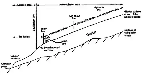
Def. "a mass of ice that originates on land, usually having an area larger than one tenth of a square kilometer"[2] is called a glacier.
"[M]any believe that a glacier must show some type of movement; others believe that a glacier can show evidence of past or present movement."[2]
At the center above is an idealized diagram of an alpine or mountain glacier. "Glaciers are composed of an ablation and an accumulation area. Within these two areas several facies might be present [as indicated in the center diagram]. The facies represent distinctive areas with characteristics that reflect the environment under which the snow or ice was formed."[3]
"The accumulation area is typically composed of wet-snow facies, percolation facies and dry-snow facies [...] due to long periods of mild weather which influence the glacier surface at all altitude levels, the accumulation area [may consist] predominantly of wet- snow facies at the end of the ablation period."[3]
"Superimposed ice is formed by (1) the refreezing of meltwater during the autumn and/or during the ablation period and (2) the refreezing of meltwater on the glacier surface below the snow line at the end of the ablation period [...] net loss by melting occurs in the ice facies."[3]
Hypotheses:
- every 10° of longitude on Earth has at least one glacier, buried glacier, or buried ice.
- every 5° of latitude on Earth has at least one glacier, buried glacier, or buried ice.
To test these hypotheses, each 10° of longitude or 5° of latitude is sampled.
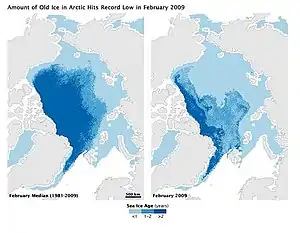
Usually, Arctic old sea ice is covered with fresh water snow and some fresh water ice. The minimum extent of Arctic old sea ice is usually attached to land and may qualify as an ice sheet of some glacial extent. The image on the right apparently shows the minimum extent of Arctic old sea ice that occurred about 2009.
Longitude:
- 0 to < 10°E: Christensen Glacier 54°28'S 3°24'E, Bouvetøya.
- 10 to < 20°E: Mount Dallman 71°45'S 10°18'E, Queen Maud Land.
- 20 to < 30°E: Øksfjordjøkelen (Ákšovunjiehkki) 70°10′N 22°03′E, Finland.
- 30 to < 40°E: Mount Kenya 0°9'03"S 37°18'27"E, Kenya.
- 40 to < 50°E: Mount Kazbek 42°41'57"N 44°31'06"E, Georgia.
- 50 to < 60°E: Mount Damavand 35°57′20″N 52°06′36″E, Iran.
- 60 to < 70°E: Cook Glacier 49°25'39"S 69°10'53.74"E, Grande Terre.
- 70 to < 80°E: Fedchenko Glacier 38.767°N 72.283°E, Tajikistan.
- 80 to < 90°E: Kafni Glacier 30°13'05"N 80°03'20"E, India.
- 90 to < 100°E: Mount Norin Kang 28°56'48"N 90°10'42"E, Tibet.
- 100 to < 110°E: Scott Glacier 66°30'S 100°20'E, Shackleton Ice Shelf.
- 110 to < 120°E: Budd Land 115°33'E.
- 120 to < 130°E: Cape Southard 66°32'S 122°5'E, Banzare Land.
- 130 to < 140°E: Morse Glacier 66°31'S 130°5'E, Claire Land.
- 140 to < 150°E: Sakhalin Island 50°33'N 142°36'E.
- 150 to < 160°E: Mount Koryaksky 53°19'15"N 158°42'45"E, Kamchatka.
- 160 to < 170°E: Canada Glacier 77°37'S 162°59'E, Victoria Land.
- 170 to < 180°E: South Island 43°30'S 170°30'E, New Zealand.
- 170 to < 180°W: Gareloi Volcano 51°47′18″N 178°47′39″W, Aleutian Islands.
- 160 to < 170°W: Amak Volcano 55°25′02″N 163°08′49″W, Aleutian Islands.
- 150 to < 160°W: Yentna Glacier 62°43′07″N 151°40′57″W, Alaska.
- 140 to < 150°W: Meares Glacier 61°14′23″N 147°25′03″W, Alaska.
- 130 to < 140°W: Bacon Glacier 58°38′59″N 133°48′29″W, Juneau.
- 120 to < 130°W: Ha-Iltzuk Icefield 51°25'N 125°55'W, British Columbia.
- 110 to < 120°W: Conness Glacier 37°58'13"N 119°19'07"W, Sierra Nevada.
- 100 to < 110°W: Mount Hector 51°34′24″N 116°15′30″W Alberta.
- 90 to < 100°W: Iztaccihuatl 19°10'44"N 98°38'30"W, Mexico.
- 80 to < 90°W: Devon Ice Cap 75°20′52″N 82°10′26″W, Nunavut, Canada.
- 70 to < 80°W: Chimborazo 1°28'9"S 78°49'3"W, Ecuador.
- 60 to < 70°W: Shambles Glacier [67°20′S 68°13′W], Antarctic Peninsula.
- 50 to < 60°W: Nuussuaq Peninsula 70°25'N 52°30'W, Greenland.
- 40 to < 50°W: Hemmen Ice Rise 77°57'S 49°46'W, Berkner Island in Ronne Ice Shelf.
- 30 to < 40°W: Apusiaajik Glacier 65°39′10″N 37°03′25″W, Apusiaajik Island.
- 20 to < 30°W: Edward Bailey Glacier, Renland 71°18’N 26°43’W.
- 10 to < 20°W: Langjökull 64°45′N 19°59′W, Iceland.
- 0 to < 10°W: Mulhacén has coordinates 37°03′12″N 3°18′41″W, Spain.
Latitude:
- 90 to > 85°N: some Arctic old sea ice may be just north of 85°N.
- 85 to > 80°N: Petermann Glacier 80°45′N 60°45′W, North-West Greenland.
- 80 to > 75°N: Devon Ice Cap 75°20′52″N 82°10′26″W, Nunavut, Canada.
- 75 to > 70°N: Edward Bailey Glacier, Renland 71°18’N 26°43’W.
- 70 to > 65°N: Apusiaajik Glacier 65°39′10″N 37°03′25″W, Apusiaajik Island.
- 65 to > 60°N: Langjökull 64°45′N 19°59′W, Iceland.
- 60 to > 55°N: Bacon Glacier 58°38′59″N 133°48′29″W, Juneau.
- 55 to > 50°N: Mount Hector 51°34′24″N 116°15′30″W Alberta.
- 50 to > 45°N: Grauspitz glaciers 47°03′10″N 9°34′55″E.
- 45 to > 40°N: Mount Kazbek 42°41'57"N 44°31'06"E, Georgia.
- 40 to > 35°N: Mulhacén has coordinates 37°03′12″N 3°18′41″W, Spain.
- 35 to > 30°N: Kafni Glacier 30°13'05"N 80°03'20"E, India.
- 30 to > 25°N: Mount Norin Kang 28°56'48"N 90°10'42"E, Tibet.
- 25 to > 20°N:
- 20 to > 15°N: Iztaccihuatl 19°10'44"N 98°38'30"W, Mexico.
- 15 to > 10°N:
- 10 to > 5°N:
- 5 to > 0°N:
- 0 to < 5°S: Chimborazo 1°28'9"S 78°49'3"W, Ecuador.
- 5 to < 10°S:
- 10 to < 15°S:
- 15 to < 20°S:
- 20 to < 25°S:
- 25 to < 30°S:
- 30 to < 35°S:
- 35 to < 40°S:
- 40 to < 45°S: South Island 43°30'S 170°30'E, New Zealand.
- 45 to < 50°S: Cook Glacier 49°25'39"S 69°10'53.74"E, Grande Terre.
- 50 to < 55°S: Christensen Glacier 54°28'S 3°24'E, Bouvetøya.
- 55 to < 60°S:
- 60 to < 65°S:
- 65 to < 70°S: Shambles Glacier [67°20′S 68°13′W], Antarctic Peninsula.
- 70 to < 75°S: Canada Glacier 77°37'S 162°59'E, Victoria Land.
- 75 to < 80°S: Hemmen Ice Rise 77°57'S 49°46'W, Berkner Island in Ronne Ice Shelf.
- 80 to < 85°S:
- 85 to < 90°S:
Glaciology
Def. the study of the internal dynamics and effects of glaciers is called glaciology.
More than one glacier with a common source is an ice field. Several ice fields can become an ice cap. When the ice cap becomes large enough it is an ice sheet.
Classification of glaciers
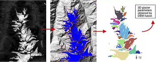
"The low reflectivity of snow and glacier ice in the middle infrared part of the spectrum allows glacier classification".[4]
In the set of images at the center top of this section, glacier mapping steps are shown from left to right with the Landsat 7 enhanced Thematic Mapper (TM) and a geographic information system (GIS).[4]
The images are part of the "102 glaciers of the Mischabel mountain range."[4]
The first image on the left is a ratio image from TM4 and TM4, specifically (TM4 / TM5).[4]
The second is a "derived glacier map after thresholding (blue) and overlay with digitized basins (red)."[4]
The third image from the left identifies "[i]ndividual glaciers after basin intersection (colour-coded) ready for [digital elevation model] DEM-fusion."[4]
The thermal emission and reflectivity have been measured "using the sensors ASTER (Advanced Spaceborne Thermal Emission and reflection Radiometer) on board [the] Terra [satellite]".[4]
Glaciers may be classified on the basis of areal extent or size. "With [a standard deviation of] σ = 3% the values obtained [...] are (resolution / minimum useful glacier size (in km2)): 5 m / all, 10 m / 0.01, 15 m / 0.03, 20 m / 0.05, 25 m / 0.1, 30 m / 0.2, 60 m / 0.5."[4]
"The comparison with higher-resolution satellite imagery reveals: (a) an overall good corre- spondence of the TM-derived glacier outlines with the manual delineation, (b) mapping of debris-covered glacier ice is not possible with TM data alone, and (c) also manual glacier delineation is problematic in the case of debris cover or snowfields."[4]
Alpine glaciers
.jpg.webp)
Def. "a glacier that is confined by surrounding mountain terrain; also called a mountain glacier"[2] is called an alpine glacier.
For "alpine glaciers the imbalance [the change of mass balance/altitude profiles from years with positive to those with negative mean balance] is nearly independent of altitude, in dry, continental regions the imbalance is largest near the equilibrium line, where albedo changes are most pronounced."[5]
Maritime glaciers

Def. a glacier that is
- found on or near the sea,
- bordering on the sea,
- in a moist and temperate climate owing to the influence of the sea,
- related to the sea,
- near or in the sea
is called a maritime glacier.
"Maritime glaciers owe their mass balance variations mainly to changes in the accumulation area".[5]
Tidewater glaciers

Def. a glacier occurring in water affected by the flow of the tide, especially tidal streams is called a tidewater glacier.
Piedmont glaciers
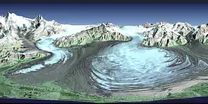
Def. a glacier that occurs on a gentle slope leading from the base of mountains to a region of flat land, any region of foothills of a mountain range, or formed or lying at the foot of a mountain range is called a piedmont glacier.
Polar glaciers
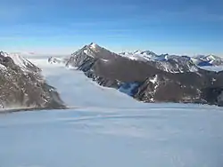
Def. a high-latitude glacier that is covered by ice is called a polar glacier, or napajäätikkö.
Polar "glaciers [owe their mass balance variations] to the varying duration of ablation in their lowest parts."[5]
Rock glaciers
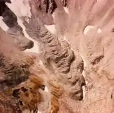
Def. "looks like a mountain glacier and has active flow; usually includes a poorly sorted mess of rocks and fine material; may include: (1) interstitial ice a meter or so below the surface ("ice-cemented"), (2) a buried core of ice ("ice-cored"), and/or (3) rock debris from avalanching snow and rock"[2] is called a rock glacier.
Def. "a mass of rock fragments and finer material, on a slope, that contains either an ice core or interstitial ice, and shows evidence of past, but not present, movement"[2] is called an inactive rock glacier.
At the right, "Frying Pan Glacier, Colorado, is almost entirely covered by rocks and debris in this photograph from 1966."[2]
Tributary glaciers
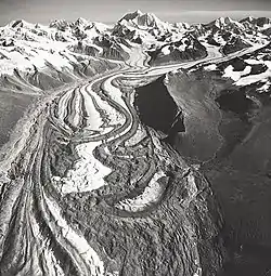
The photo on the left shows many tributary glaciers coming into the Susitna Glacier, including surge effects.
Valley glaciers
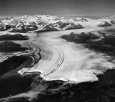
Def. a "glacier that has one or more tributary glaciers that flow into it"[2] is called a branched-valley glacier.
"In this photograph from 1969 [at the right], small glaciers flow into the larger Columbia Glacier from mountain valleys on both sides. Columbia Glacier flows out of the Chugach Mountains into Columbia Bay, Alaska."[2]
Outlet glaciers
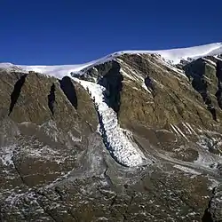
"Close to the edges [of an ice sheet], much of the ice flows in narrow and fast-moving outlet glaciers along bedrock troughs [...] Roughly half of the mass loss occurs by iceberg calving from the fronts of these outlets; the other half, by surface melt around the periphery of the whole ice sheet."[6]
Isolated glaciers
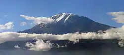
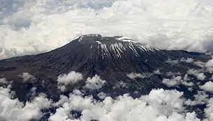
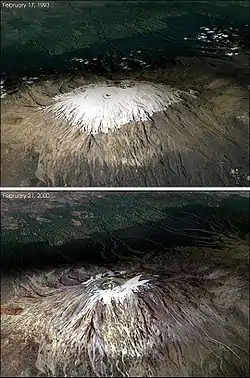
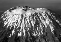
"Mount Kilimanjaro is the highest [...] "stand-alone" [...] mountain in the world. [...] Mount Kilimanjaro started to be formed about 750000 years ago being currently constituted by three major volcanic cones, Kibo, Mawenzi, and Shira. The first reaches approximately 5900m."[7]
Its "location [is] close to [the] equator associated with the existence of permanent glaciers and its almost perfect volcano shape"[7]
For "the Uhuru Peak with respect to the KILI2008 datum ... a final value of 5890.79m was determined for the orthometric height of the highest point in Africa considering the Tanzanian vertical datum."[8]
Kilimanjaro is located at 3°04.6'S and 37°21.2'E.[8]
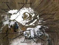
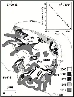
"Aerial photographs taken on 16 February 2000 allowed production of a recent detailed map of ice cover extent on the summit plateau [diagram at the lower left]."[8]
"Total ice area calculated from successive maps (1912, 1953, 1976, 1989, and 2000) reveals [diagram at the lower left, inset] that the areal extent of Kilimanjaro’s ice cover has decreased approximately 80% from ~12 km2 in 1912 to ~2.6 km2 in 2000 and that since 1989, a hole has developed near the center of the NIF. A nearly linear relationship (R2 = 0.98) suggests that if climatological conditions of the past 88 years continue, the ice on Kilimanjaro will likely disappear between 2015 and 2020."[8]
Crater glaciers
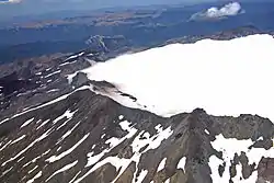
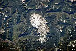
"While active volcanoes are obvious targets of interest because they pose natural hazards, there are some dormant volcanoes that also warrant concern because of their geologic history. One such volcano is Sollipulli, located in central Chile near the border with Argentina. The volcano sits in the southern Andes Mountains within Chile’s Parque Nacional Villarica. This photograph by an astronaut on the International Space Station features the summit (2,282 meters, or 7,487 feet, above sea level) and the bare slopes above the tree line. Lower elevations are covered with green forests indicative of Southern Hemisphere summer."[9]
"The summit of Sollipulli is occupied by a four-kilometer wide caldera, currently filled with a snow-covered glacier. While most calderas form after violent, explosive eruptions, the types of rock and other deposits associated with such events have not been found at Sollipulli. Geologic evidence does indicate explosive activity occurred about 2,900 years ago, and lava flows were produced approximately 700 years ago. Together with the craters and scoria cones along the outer flanks of the caldera, this history suggests Sollipulli could erupt violently again, presenting a potential hazard to towns such as Melipeuco and the wider region."[9]
Cirque glaciers
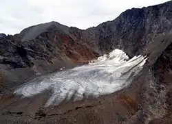

Cirques, as diagrammed at the left, are formed by a glacier (the cirque glacier) and usually exhibit a Bergschrund, randkluft and the headwall gap. The image at the right shows a glacier on Baffin Island that has retreated back to a cirque glacier.
Hanging glaciers
.jpg.webp)
The image at the right shows the Casaño Overa glacier (Argentina, see w:Tronador) which spills down over cliffs, leaving waterfalls and the 'thunder' of falling ice that gives the mountain its namesake.
Surging glaciers
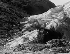
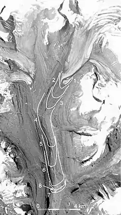
Def. "a glacier that experiences a dramatic increase in flow rate, 10 to 100 times faster than its normal rate; usually surge events last less than one year and occur periodically, between 15 and 100 years"[2] is called a surging glacier.
"In 1941, Hole-in-the-Wall Glacier [Montana, in w:Glacier National Park (U.S.)] [imaged at the right] surged, also knocking over trees during its advance."[2]
An "outlet glacier of the Sermersauq Ice Cap [on Disko Island, West Greenland, shown at the left with progressive surges marked] has surged 10.5 km downvalley to within 10 km of the fjord. [...] surging of the glacier, begun in 1995, was undetected until July 1999, when it was discovered during a geomorphic survey of the valley. Mapping from TM, Landsat and SPOT satellite imagery, and subsequent field work have documented the history of the event. On 17 June 1995 the terminus of the glacier was about where it appears in the 1985 air photography [...]. By 24 September 1995 the glacier had advanced 1.25 km and by 12 October another 1.25 km (mean advance during the second period : 70 m day-1). The advance slowed from 18 m day-1 in 1996 to 5 m day-1 in 1997 and <1 m day-1 between 1997 and 1999. By summer 1999 the advance ceased; the maximum extension of the terminus, about 10.5 km down-valley to about 10 km from the head of the fjord, was mapped from imagery on 9 July 1999 [...]."[10]
Temperate glaciers
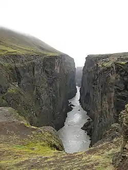
At the right is an image of a temperate glacier; i.e., one flowing through a temperate region, as evidenced by the green plants.
Ice streams
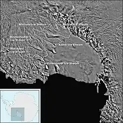
Flagged "poles planted in the ice [show that the] ice sheet [Whillans Ice Stream in West Antarctica] is moving. Parts of it are moving rapidly—more than 2 meters per day."[11]
“When ice moves rapidly, it can experience stresses large enough to crack it. Some of these cracks, called crevasses, can be quite large and dangerous—30, 50, even 100 feet deep. Some crevasses are covered by thin bridges of snow so they are hard to spot.”[11]
In "West Antarctica [...] the ice sheet is draped over a layer of marine sediments that is much more slippery than rock."[12]
This "slippery sediment layer and the above-average amount of subterranean heat the Earth vents in West Antarctica, including numerous volcanoes, [may have] made the West Antarctic Ice Sheet more prone to movement".[12]
On the West Antarctic Ice Sheet, there is "a vast network of coalescing tributaries feeding into ice streams flowing toward the ocean."[11]
One "stream [...] spends most of its time stationary, and during periods of falling tide it lurches forward suddenly, moving forward half a meter in 20 minutes before stopping suddenly."[12]
“One of our findings that was hardest to believe is that movements of some ice streams are linked to rising and falling tides. We discovered that as tides go up and down a meter or so, some ice streams change speed by anywhere from plus or minus 50 percent. That finding shook our understanding of ice stream dynamics right to the core.”[11]
“We discovered that parts of the West Antarctic Ice Sheet are thinning more than a meter per year—faster than anyone imagined.”[11]
"The mass balance of the West Antarctic Ice Sheet is about 10 percent of all the ice on the planet, and some sections are shrinking at alarming rates. These most active sections are adding about 0.2 millimeters per year to sea level, or about 7 percent of the recent annual rise."[12]
Ogives
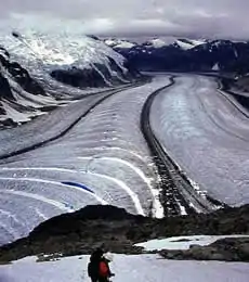
Def. "alternate bands of light and dark ice seen on a glacier surface"[2] are called ogives.
Def. "alternate bands of light and dark on a glacier; usually found below steep narrow icefalls and thought to be the result of different flow and ablation rates between summer and winter"[2] is called banded ogives.
Def. "ogives that show some vertical relief on a glacier; usually the dark bands are in the hollows and the light bands are in the ridges; form at the base of steep, narrow ice falls"[2] are called wave ogives.
Def. an "arcuate, convex, down-glacier-pointing band or undulation that forms on the surface of a glacier at the base of an icefall"[13] is called an ogive.
"Two types of ogives occur: wave ogives, which are undulations of varying height and band ogives, which are alternating light- and dark-colored bands."[13]
Def. a shallow troughlike depression that can carry water during rainstorms or snow melts is called a swale.
"Higher concentrations of debris are found in the swales."[14]
Dirt cones
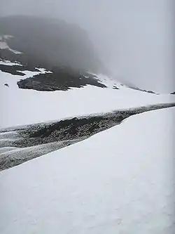
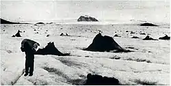
Def. an irregular, or conically-shaped, formation of snow or ice with a veneer of debris occurring on snow or ice is called a dirt cone.
"In Iceland it is not unusual to see many hundreds of them from 1 to 3 m. high, scattered like so many ash heaps over the marginal areas of the glaciers. In exceptional circumstances they may be 30 m. high. Similar forms have been described on the Malaspina Glacier. There they frequently reach a height of 24 m.1 On the Hispar Glacier a cone was estimated to rise to 8S m. above the level of the surrounding ice surface.2"[15]
"The mounds are seldom perfectly conical, being found in a great variety of irregular shapes. The term is also misleading in that it implies that the cones are formed entirely of debris. They are in fact cones formed of pure snow or ice, covered with but a thin veneer of material. Ice pyramids are distinguished from dirt cones by the absence of any such covering."[15]
"The majority occur along crevasse lines."[15]
"In the ablation area, where almost all dirt cones occur, dust is moved by the action of melt water and rain into every little crevice on the surface of the ice. Larger masses are concentrated in hollows, and melt-water streams carry quantities of the dust into crevasses, where it forms sometimes stratified and sometimes irregular deposits."[15]
"The majority of dirt cones on Vatnajökull have sides sloping at about 40 degrees."[15]
"Another type of dirt cone, of different origin to those already described, is found interspersed among the others on Vatnajökull. In places where the surface is covered with considerable quantities of debris there are numerous parallel lines of brown-coloured cones. The individual examples are sometimes so close together in a line that they form almost continuous ridges. The distinctive features are almost always the colour and coarser nature of the debris, which consists of anything from boulders to fine mud, and sometimes contains large fragments of clear ice. This type is only found within 200 m. or so of the ice margin, where the surface itself is becoming steeper. Frequently the ice on the upstream side is thrust over that on the downstream side. Some of the overthrusts meet the surface along a line of these brownish cones. Lewis4 has explained the origin of similar features on the northern margins of Vatnajokull. Overthrusting carries the debris to the surface from beneath the glacier, and the cones develop as a result of protection from ablation, in the same manner as those formed from windblown material."[15]
"Russell describes some dirt cones, of wholly different origin, which occur in front of receding glaciers. Large, debris-covered masses of ice, "several tens of feet" high, become separated from the main mass and on melting assume conical shapes. He has seen cones like this in front of the Spencer and Meldenhall Glaciers."[15]
Locations on Earth
Glaciers occur on every continent, at least 49 countries, or 111 geographic regions, on Earth.
Antarctic Peninsula
%252C_Adelaide_Island%252C_Webb_Island.JPG.webp)
The Antarctic Peninsula has a nominal location of 69°30'S 65°00'W.
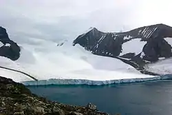
In the first image on the left, a glacier flows into Hope Bay near the northern tip of the Antarctic Peninsula.
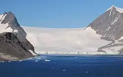
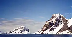
In the image on the second right, Booth Island and Mount Scott flank the narrow Lemaire Channel on the west side of the Antarctic Peninsula. Booth Island has coordinates 65.08°S 64.0°W.
This picture, image on the second left, is from the SW Antarctic Peninsula region. It's an aerial view from a position over Laubeuf Fjord, looking to the NW. In the foreground is Webb Island with its summit of 398 m. Behind it is a part of the Wright Peninsula on Adelaide Island's east coast. This coast's high ice cliffs are from the Wormald Ice Piedmont that covers most of the Wright Peninsula's east coast. The cloud-covered mountains on the left are the Stokes Peaks. The lone cloud-covered mountain at the right -at the NE extremity of the Wright Peninsula-is Sighing Peak; behind it is Stonehouse Bay. The maritime channel right of Sighing Peak is called Cole Channel (and is actually a part of Laubeuf Fjord). In the upper right hand corner of the picture is the Mount Bouvier Massif. At the foot of these mountains the Shambles Glacier [67°20′S 68°13′W] can just be seen through a hole in the clouds. It is Adelaide Island's largest glacier and is heavily crevassed.
Labrador
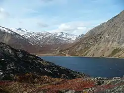
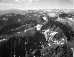
The Torngat Mountains have nominal coordinates of 59°25′N 64°30′W.
Ronne Ice Shelf
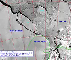
The Ronne Ice Shelf has a nominal location of 78°30'S 61°W.
Alanngorsuup Sermia
The tidewater glacier Alanngorsuup Sermia has coordinates 73°09'30"N 55°W south of Nunatarsuaq nunatak.
Naajaat

The camera location for the view above 73°08'35.3"N 55°48'36.7"W.
Nasaasaaq

Some snow and ice is seen on Nasaasaaq, Greenland, in the image on the right. Nasaasaaq has coordinates 66°55'35"N 53°33'10"W.
Nuussuaq Peninsula
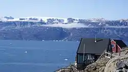
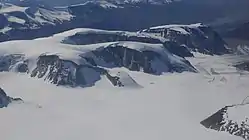
The Nuussuaq Peninsula is located at 70°25'N 52°30'W.
Salliaruseq
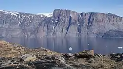
Salliaruseq Island in the image on the right is at 70°41"30"N 51°50'W.
Sermitsiaq
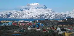
Sermitsiaq is an island north-east of Nuuk. The mountain at 1,210 m has the same name with coordinates 64°18'N 51°30'W.
Ilulissat

The panorama above is from February 2006. Ilulissat has coordinates of 69°13'N 51°06'W.
Hemmen Ice Rise
The Hemmen Ice Rise has a nominal location at 77°57'S 49°46'W.
The Hemmen Ice Rise is classified as a glacier.[16]
It is an "ice rise 11 mi long, located off the northwest corner of Berkner Island in Ronne Ice Shelf."[16]
Berkner Island
Berkner Island has a nominal location of 79°30'S 47°31'W.
Signy Island

Signy Island has a nominal location of 60°43'12"S 45°36'W.
Filchner Ice Shelf
The Filchner Ice Shelf has a nominal location of 79°S 40°W.
Apusiaajik Island
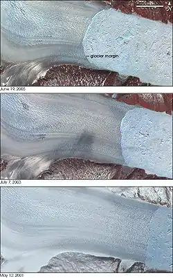
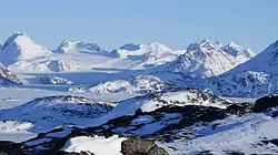
Helheim Glacier is located at 66°21′N 38°12′W.
Apusiaajik Glacier has coordinates 65°39′10″N 37°03′25″W.
Karale Glacier is at 66.13°N 36.81°W.
South Georgia
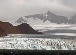
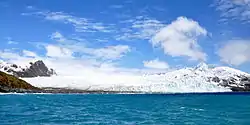
The Fortuna Glacier has a nominal location at 54°6'S 36°51'W on the island of South Georgia.
Azores

Pico Island has coordinates 38° 28′ 52″ N 28° 22′ 02″ W.
Renland
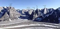
Renland has coordinates 71°18’N 26°43’W.
Iceland
.jpg.webp)
These are the locations of the thirteen largest glaciers.
Snæfellsjökull on the right is at 64°48′32″N 23°46′16″W.
Drangajökull has a nominal position of 66°09′N 22°15′W.
Þórisjökull is nominally located at 64°32′31″N 20°42′56″W.
Eiríksjökull has coordinates 64°46′24″N 20°24′34″W.
Langjökull is located at 64°45′N 19°59′W.
Eyjafjallajökull is at 63°38′N 19°36′W.
Tindfjallajökull is at 63°48′N 19°35′W.
Torfajökull has coordinates 63°53′39″N 19°07′37″W.
Mýrdalsjökull is at 63°40′N 19°06′W.
Tungnafellsjökull has coordinates 64°45′N 17°55′W.
Vatnajökull has nominal coordinates of 64°24′N 16°48′W.
Þrándarjökull is located at 64°42′08″N 14°54′09″W.
Spain
.jpg.webp)
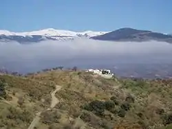
Mulhacén has coordinates 37°03′12″N 3°18′41″W.
The Sierra Nevada is located at 37°03′N 03°18′W.
Bouvetøya
Christensen Glacier has a nominal location of 54°28'S 3°24'E.
Posadowsky Glacier has a nominal location at 54°25'S 3°22'E.
France


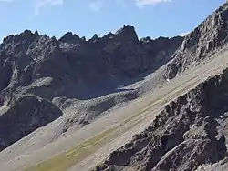
A small rock glacier [on the right] with the rock faces that feed it with debris. The steepness of the front suggests the activity of the rock glacier. It is on Combeynot Massif, French Alps, at 45°00′44″N 06°24′40″E.
Mont Blanc has a nominal position of 45°50'01"N 6°51'54"E.
Norway
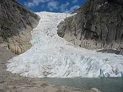
Ålfotbreen is in Fjordane at 61°44′N 05°38′E.
Søndre Folgefonna is at 60°00′N 06°20′E in Hordaland.
Grovabreen is in Fjordane at 61°29′N 06°31′E.
Jostedalsbreen has coordinates 61°40′N 06°59′E in Fjordane.
Tindefjellbreen is at 61°52′N 07°03′E in Fjordane.
Tystigbreen is at 61°55′N 07°22′E in Fjordane.
Hardangerjøkulen is at 60°32′N 07°25′E in Hordaland.
Sekkebreen/Sikilbreen has a nominal position at 61°51′N 07°34′E in Oppland.
Harbardsbreen has coordinates 61°40′N 07°39′E in Fjordane.
Holåbreen is in Oppland at 61°45′N 07°54′E.
Switzerland
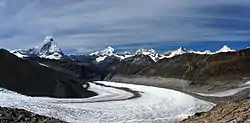
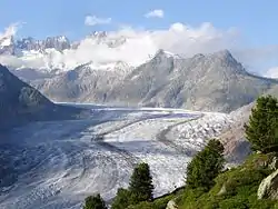
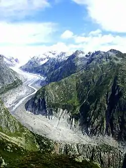
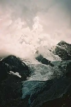
The Gorner Glacier is at 45°58'11"N 7°48'6"E.
The Aletsch Glacier has coordinates 46°26'32"N 8°04'38"E.
The Fiescher Glacier has a nominal location of 46°29'52"N 8°8'48"E.
Hochbalm Glacier, pictured on the second left is at 46°06′41.5″N 7°51′34.8″E.
Leichtenstein
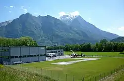
The Liechtenstein Alps have snow and glaciers. Leichtenstein's capital is at 47°08.5'N 9°31.4'E.
Italy
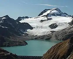
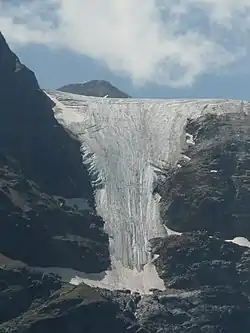
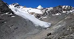
The Ofenhorn is nominally located at 46°23′13″N 8°19′07″E.
Langenferner has coordinates 46°28′43″N 10°34′6″E.
The Laaser Ferners has coordinates 46° 32′ 18″ N, 10° 39′ 36″ E.
Queen Maud Land
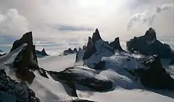
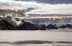
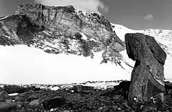
Queen Maud Land nominally lies between 20°W and 45°E.
The Drygalski Mountains have a nominal location of 71°45'S 8°15'E.
The Gagarin Mountains have a nominal location of 71°57'S 9°23'E.
The Conrad Mountains have a nominal location of 71°50'S 9°40'E.
Mount Dallman has a nominal location of 71°45'S 10°18'E.
Austria
.jpg.webp)
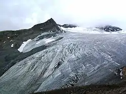
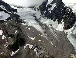
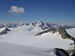
A view from Aperem Tower (2984 m) to the southeast of the Eastern Seespitze (3416 m) with the Alpeiner Kräulferner left and the right Seespitzferner in the image on the right.
On the left is an image of icefall from the Kesselwandferner in the Ötztal Alps of Tyrol.
The lower image on the right shows the U-shaped valley, lateral, ground, terminal, and medial moraines of the Fernerstube.
The Ehrichspitze has a nominal location at 46°50"57"N 10°46'34"E. Großglockner has a nominal location of 47°04'29,52"N 12°41'42.9"E.
Germany
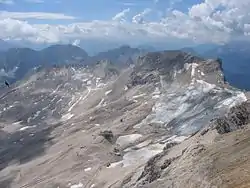

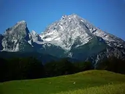
Schneeferner is located at 47.414°N 10.975°E.
Höllentalferner is located at 47°25′36″N 10°59′51″E in the western Wetterstein Mountains.
Watzmann Glacier has nominal coordinates of 47.5553°N 12.9233°E.
Slovenia
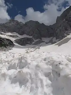

Skuta has coordinates 46°21′50″N 14°33′11″E.
Grintovec is located at 46°21′25″N 14°32′10″E.
Nordland
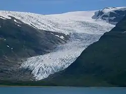
Vestre Svartisen has coordinates 66°38′N 14°00′E.
Østre Svartisen is at 66°38′N 14°00′E.
Okstindbreen has coordinates 65°59′N 14°9′E.
Simlebreen is at 66°50′N 14°27′E.
Blåmannsisen (Ålmåjalosjiegŋa) is at 67°15′N 16°04′E.
Salajekna (Sállajiegŋa) is at 67°08′N 16°10′E.
Gihtsejiegŋa is at 68°00′N 16°48′E.
Frostisen has nominal location at 68°14′N 17°11′E.
Svalbard
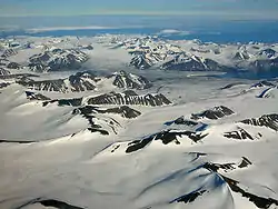
Svalbard has coordinates 78°N 16°E.
This image on the right is definitely Kvalvågen with Strongbreen at 77°30'N 17°30'E.
Sweden

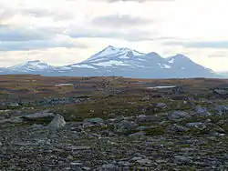
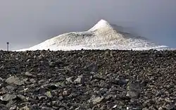
Áhkká has coordinates 67°35′N 17°29′E. The mountain in the far left of the picture [on the left] is Vartotjåkkå (1234 m).
Kebnekaise has coordinates of 67°53′N 18°33′E.
Finland
Øksfjordjøkelen (Ákšovunjiehkki) has coordinates of 70°10′N 22°03′E.
Uganda
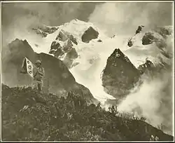
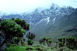
The Ruwenzori Mountains border Uganda and the Democratic Republic of the Congo. The highest peaks are permanently snow-capped.
The image at the right shows well-formed glaciers. The one on the left shows only a few lower down.
Mount Stanley has a nominal position of 0°23'09"N 29°52'18"E.
Kenya
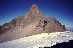
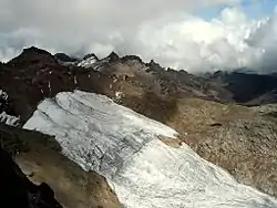
Nelion and the Lewis glacier are seen on Mount Kenya in the image on the right.
Mount Kenya has a nominal location of 0°9'03"S 37°18'27"E.
Tanzania
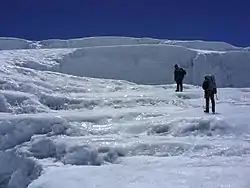
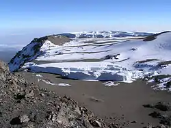
The Furtwängler Glacier has been rapidly disappearing, having lost a third of its thickness between 2000 and 2006.
Africa has glaciers on Mount Kilimanjaro in Tanzania, on Mount Kenya and in the Ruwenzori Range.
The Furtwängler Glacier has a nominal position of 3°4'15"S 37°21'07"E.
Georgia
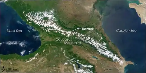
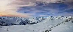
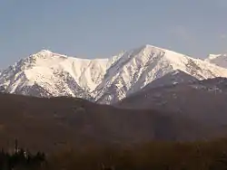
"Between the Black and Caspian Seas, the Caucasus Mountains [in the image above] separate Russia (north) from Georgia (southwest) and Azerbaijan (southeast). Elevations reach 5,642 meters (18,511 feet), and glaciers accumulate from heavy snowfall in the steep mountain valleys."[17]
Mount Kazbek has a nominal location of 42°41'57"N 44°31'06"E.
The Western Caucasus have a nominal location of 44°N 40°E.
Balkaria
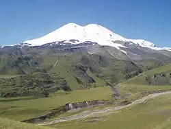
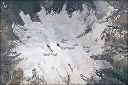
Mount Elbrus has a nominal position of 43°21'18"N 42°26'21"E in Balkaria or what is now called Kabardino-Balkaria.
"The Caucasus Mountains form a long (more than 1200 km) and steep spine connecting the Black Sea to the Caspian. Mt. Elbrus, the summit of the Caucasus Mountains, is located in southern Russia just north of the Georgian border, and is distinguished as Europe’s highest peak (5642 m). Elbrus is also an ancient volcano, although it has not erupted for nearly 2000 years. Elbrus’ profile comprises two volcanic peaks (East and West). They are popular trekking and mountain climbing destinations’the saddle between them provides access to the region."[18]
"In mid-September, the Russian and American crew aboard the International Space Station viewed Mt. Elbrus’ glaciated landscape as part of a study by Russian glaciologists. Elbrus is located west of the recent glacier slide on Mt. Kazbek, another giant peak in the Caucasus Mountains."[18]
Ossetia
.jpg.webp)
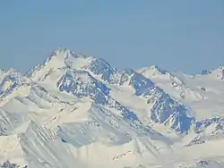
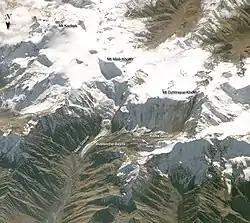
Mount Kazbek is at 42°41'57"N 44°31'06"E and is part of the Khokh Range of mountains north of the Greater Caucasus Range.
The glaciers of Mount Kazbek are named Dyevdorak (Devdaraki), Abano, Chata, Denkara, Gergeti, and the Mna.
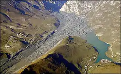
"When the Kolka Glacier collapsed in September 2002, ice, mud, and rocks partially filled the Karmadon Depression, destroying much of the village of Karmadon. The debris swept in through the Genaldon River Valley (lower left) and backed up at the entrance to a narrow gorge (top center). The debris acted as a dam, creating lakes upstream. This aerial photograph [second on the left] (looking north) was taken only 16 days after the disaster."[17]
Iran
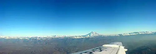
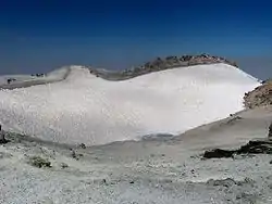
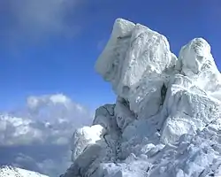
The crater of Mount Damavand contains apparently year-around snow. It has coordinates of 35°57′20″N 52°06′36″E.
Grande Terre
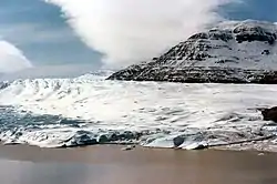
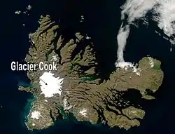
The camera for the image on the right has a nominal location of 49°25'39"S 69°10'53.74"E.
The images show Cook Glacier.
Tajikistan
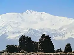
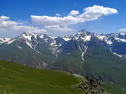
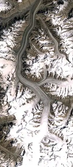
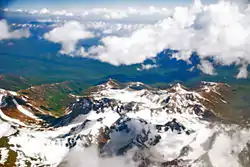
Ibn Sina Peak has a nominal position of 39°20'33"N 72°52'39"E.
The Pamir Mountains have a nominal location of 39°N 72°E.
The Fedchenko Glacier has a nominal position of 38.767°N 72.283°E.
Heard Island
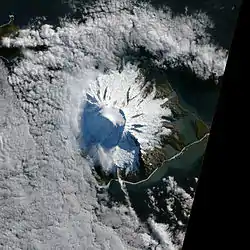
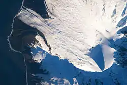
On the right is the ice cap on Mawson peak. Several valley glaciers lead away from the ice cap to the sea.
Heard Island and the McDonald Islands have a nominal location of 53°S 73°E.
"Heard Island is located in the southern Indian Ocean, approximately 1,550 kilometers (963 miles) north of Antarctica. The island is a visible part of the Kerguelen Plateau, a submerged feature on the seafloor. The plateau was formed when large amounts of volcanic rock erupted over a geologically short time period. (When large amounts of volcanic rock erupt beneath the ocean from processes other than seafloor spreading, geologists refer to them as large igneous provinces.) Most of Heard Island is formed from volcanic rocks associated with the Big Ben stratovolcano. The northeastern slopes of the volcano are visible in shadow at the lower right of this detailed astronaut photograph."[19]
"Recent volcanic activity at Heard Island has occurred at 2,745-meter (9,006-foot) Mawson Peak, which sits within a breached caldera on the southwestern side of the Big Ben Volcano. Calderas form when a magma chamber beneath a volcano empties and collapses. The shadow cast by Mawson Peak points directly to the crescent-shaped caldera rim. Detailed geologic study of Big Ben Volcano is complicated by the presence of several glaciers, including Gotley and Lied Glaciers on the southwestern slopes. This image, taken during Southern Hemisphere summer, also reveals non-glaciated volcanic rock (light to dark brown) on either side of Gotley Glacier."[19]
"In October 2012, satellites measured subtle signals that suggested volcanic activity on remote Heard Island. These images, captured several months later, show proof of an eruption on Mawson Peak. By April 7, 2013, Mawson's steep-walled summit crater had filled, and a trickle of lava had spilled down the volcano's southwestern flank. On April 20, the lava flow remained visible and had even widened slightly just below the summit."[20]
The Heard Island glaciers are named: "Downes, Ealey, Compton, Brown, Stephenson, Winston, Fiftyone, Deacock, Gotley, Lied, Abbotsmith, Allison, Schmidt, and Baudissin."[21]
Pakistan
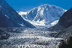
On the right is the Passu Glacier of Pakistan.
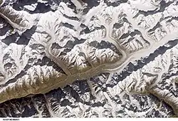
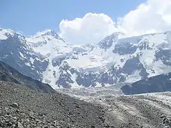
On the left is the Hispar glacier and Hispar Muztagh above (to the North) with Distaghil Sar, Kunyang Chhish, Pumari Chhish, Kanjut Sar and others.
Sarikoli
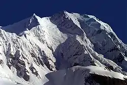

Kongur Tagh has a nominal location of 38°35'39"N 75°18'48"E.
Muztagh Ata has a nominal location of 38°16'42"N 75°06'57"E.
Baltistan
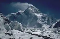
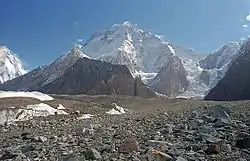
Baltistan has a nominal location of 35°18'N 75°37'E.
K2 has a nominal location of 35°52'57"N 76°30'48"E.
Broad Peak has a nominal location of 35°48'39"N 76°34'06"E.
Kashmir
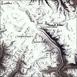
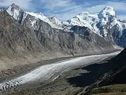
"At an altitude of roughly 5,400 meters (17,700 feet), the Siachen Glacier in Kashmir is a forbidding place. Blizzards can last for weeks, temperatures can drop to -55 degrees Celsius (-67 degrees Fahrenheit), and crevasses can swallow a person whole. At much lower altitudes, the glacier’s impact is benign: it is the source of the Nubra River, a tributary of the Indus River flowing into Pakistan and the Arabian Sea."[22]
"Sometimes described as a white snake, the Siachen Glacier is more than 70 kilometers long. Lying inside a rock-strewn trough roughly 2 kilometers wide, the glacier is covered with snow in the middle. Landsat 7 took this picture on May 18, 2001. The glacier’s central region is covered with snow, and that snow and the rest of the glacier’s icy surface appear white. Glaciers can merge together like rivers, and that is the case here. Several tributary rivers of ice flow together, such as the Lolofond and Teram Shehr glaciers, adding their ice to the Siachen Glacier as it winds southeast, where the Nubra River emerges from its terminus. In the scene, snow and ice cover most of the jagged peaks of the Himalaya Mountains. At an altitude far too high to support a forest, the bare mountainous surfaces appear in varying shades of beige."[22]
"India and Pakistan fought for control of this glacier starting in the 1980s. Long known as the world’s highest battleground, the glacier could enjoy a different status. By early 2006, some diplomats discussed making the area a peace park."[22]
The Drang-Drung, or Durung Drung, Glacier has a nominal location of 33°45'18.77"N 76°18'3.47"E.
The Siachen Glacier lies at 35°25'16"N 77°06'34"E.
Princess Elizabeth Land

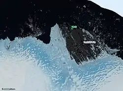
Princess Elizabeth Land has a nominal position of 80°S 78°E.
Sorsdal Glacier is located at 68°41'S 78°15'E.
The Landsat image on the right shows the region around Sordal Glacier.
The Vestfold Hills have a nominal location of 68°33'S 78°15'E.
Kyrgyzstan
.jpg.webp)
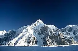
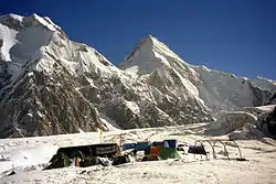
The South Inylchek Glacier on the right is viewed from Kyrgyzstan. The image on the left is a closeup of this glacier.
Engilchek Glacier has a nominal position of 42°09'30"N 79°56'E.
India
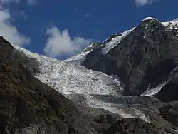
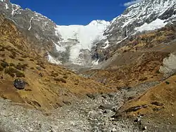
.JPG.webp)
The Pindari Glacier on the right is in the Kumaon Himalayas. The Kafni Glacier on the left is in the same mountains. The Kafni Glacier has a nominal position of 30°13'05"N 80°03'20"E.
The source of the Gangotri Glacier is on the lower right and has a nominal location of 30°50'N 79°10'E.
Kazakhstan

North Engilchek Glacier is in the image on the right in front of the North Wall of Khan Tengri, 7010 m, Tian Shan.
Kazakhstan has a nominal location of 48°N 68°E. It lies between longitudes 46° and 88°E and latitudes 40° and 56°N.
Khan Tengri has a nominal position of 42°12'39"N 80°10'30"E.
Uyghurstan
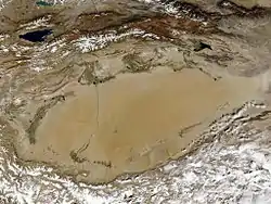
Turkestan, perhaps eastern Turkestan, or Uyghurstan, is currently called the Xinjiang Uyghur Autonomous Region of western China. It has a nominal location of 41°N 85°E.
The Taklamakan Desert has a nominal position of 38.9°N 82.2°E.
Altay
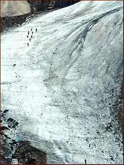
On the right is the Little Aktru Glacier in the Altai.
On the left are Mt Belukha and the Akkem glacier in the Altay Republic, Russia.
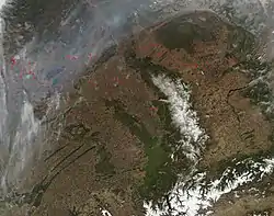
In the Altay region of south-central Russia, the Moderate Resolution Imaging Spectroradiometer (MODIS) on the Aqua satellite captured the image on the second right. This shows the ice fields of the Altay.
The Altai Republic has a nominal location of 50°55'N 86°55'E. Belukha Mountain has a location of 49°48'27"N 86°35'24"E.
Nepal
.jpg.webp)
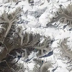
"Starting from the western face of Kali Himal, the Imja Glacier flows through eastern Nepal, part of a glacier network that ultimately feeds the Ganges River. In the 1960s, melt water began collecting at the foot of the glacier, creating Imja Tsho. A 2009 study described this lake of melt water as one of the fastest-growing in the Himalaya. Held in place by a terminal moraine, Imja Tsho threatens downstream communities with the potential for a glacial outburst flood."[23]
"On October 4, 2010, the Advanced Land Imager (ALI) on NASA’s Earth Observing-1 (EO-1) satellite captured this natural-color image of Imja Tsho and surrounding glaciers. Dirt and debris coat these rivers of ice; like the glaciers feeding it, Imja Tsho appears dull gray-brown. A thin trickle of water exits the lake on its western side, having carved through the natural earthen dam."[23]
"The 2009 study concluded that the Imja Glacier had retreated by 34 meters per year from 1976 to 2000, and by 74 meters per year from 2000 to 2007. Imja Tsho, meanwhile, grew rapidly. In the 1960s, the lake covered roughly 48,811 square meters. The lake grew to 848,742 square meters by 2000 and 945,662 by 2007."[23]
"As glaciers shrink and meltwater lakes grow, the threat to nearby communities increases. In 1985, another glacial lake in Nepal—Dig Tsho—burst and flooded a new hydropower station, 30 houses, and 14 bridges. The glacial outburst flooded agricultural lands and scraped vegetation from land surfaces, leading to increased erosion from wind and precipitation and increased undercutting by local rivers."[23]
The image on the left shows the Khumbu Glacier. It has a nominal position at 27°58'N 86°50'E.
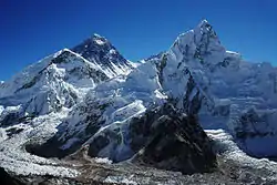
The second image on the right shows Mount Everest on the left and Mount Nubtse on the right with a glacier between them. Nuptse has a nominal position of 27°57'59"N 86°53'24"E.
Dzungaria
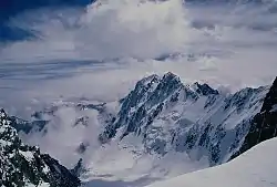
Dzungaria has a nominal location of 45°N 85°E.
The Tarbagatai Mountains have a nominal location at 47°11'18"N 82°27'59"E.
The Saur Mountains are nominally located at 47°04'N 85°34'E. The highest peak is Sauyr Zhotasy at 47°02'57"N 85°34'E which is ice-capped. It is considered in Kazakhstan.
The Potanin Glacier has a nominal location of 49.14°N 87.92°E. Alexander Glacier feeds into the Potanin Glacier which originates from Khuiten Uul.
Mount Bogda has a nominal location of 43°48'06"N 88°19'57"E.
Sikkim
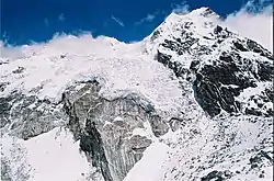
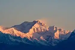
On the right is Rathong peak which has glaciers as seen from the Guicha la, Sikkim.
Sikkim has a nominal location of 27.33°N 88.62°E.
Tibet
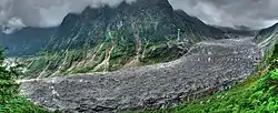
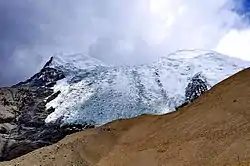
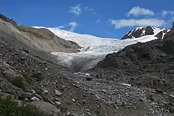
The image on the right shows a panorama of the Hailuogou Glacier in Tibet.
Laigu Glacier is located near 32° N, 87° E.
On the left is the ice field of Mount Norin Kang. Mount Norin Kang has a nominal location of 28°56'48"N 90°10'42"E.
Bhutan
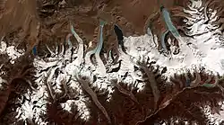
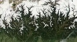
"This image from the ASTER (Advanced Spaceborne Thermal Emission and Reflection Radiometer) instrument aboard NASA’s Terra satellite shows the termini of the glaciers in the Bhutan-Himalaya. Glacial lakes have been rapidly forming on the surface of the debris-covered glaciers in this region during the last few decades."[24]
The image on the left shows the snow and ice cover of Bhutan in April 2002.
Bhutan is nominally located at 27°25'01"N 90°26'06"E.
Kunlun
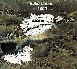
Bukadaban Feng has a nominal location of 36°01'27"N 90°51'57"E.
The image on the right clearly demonstrates glaciers in this nominal location.
Queen Mary Land
Queen Mary Land has a nominal location at 66°45'S 96°E.
Qinghai
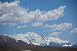
Amne Machlin has a nominal location of 34°47'54"N 99°27'45"E.
Shackleton Ice Shelf
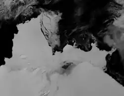
The Shackleton Ice Shelf has a nominal position of 66°S 100°E.
The Denman Glacier has a nominal location of 66°45'S 99°30'E.
Scott Glacier has a nominal location of 66°30'S 100°20'E.
Mill Island
Mill Island has a nominal position of 65°30'S 100°40'E
Sichuan
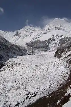
The Daxue Mountains have a nominal location of 29°35'48"N 101°52'43"E.
The Hailuogou glacier in Sichuan province, China, on the right, is just below Gonga Shan.
Mongolia

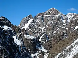
Mongolia has nominal coordinates of 46°N 105°E.
Dund Saikhany Nuruu has a nominal location of 43°38'06"N 103°46'45"E.
Buryatia
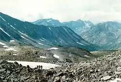
The Baikal Mountains have a position of 54°N 108°.
Buryatia has a nominal location of 53°48'N 109°20'E.
Knox Land
Knox Land has a nominal position of 100°31'E to 109°16'E.
The Hatch Islands have a nominal position of 66°32'S 109°16'E.
Budd Land
Budd Land has a nominal position of 109°16'E to 115°33'E.
Wilkes Land
Wilkes Land has a nominal position of 69°S 120°E.
Sabrina Land
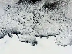
Sabrina Land has a nominal position of 115°33'E to 122°05'E.
The Moderate Resolution Imaging Spectroradiometer (MODIS) instrument on NASA's Terra satellite captured [the image on the right] of the Knox, Budd Law Dome, and Sabrina Coasts, Antarctica on November 2, 2011 at 01:40 UTC (Nov. 1 at 9:40 p.m. EDT).
Banzare Land
Banzre Land extends from 122°05'E to 130°10'E.
Cape Southard has a nominal position of 66°32'S 122°5'E.
Amur
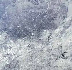
The Stanovoy Range has a nominal position of 56°20'N 126°E.
"In this snow-covered image we can see part of Amur Oblast, in eastern Russia. The large, dark body of water is the Zeyskoye Reservoir. The Gilyuy, Zeya and Tynda Rivers are visible below the reservoir, while the Stanovoy Mountain Range can be seen above it. The land south of this range is the Upper Zeysky Plain, which is primarily marshland with larch and pine forests."[25]
"The Stanovoy Range, visible in the image North of the Zeyskoye Reservoir, forms the dividing line between the Sakha Republic and Amur Oblast and spreads across the entire northern border of the territory. Dwarf Siberian pine and alpine tundra grow at higher elevations on these mountains and larch forests with small stands of flat-leaved birch and pine forests grow alongside the river plains."[25]
Manchuria
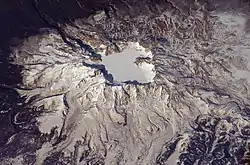
Paektu Mountain has a nominal location of 42°0'20"N 128°03'19"E.
"One of the largest known eruptions of the modern geologic period (the Holocene) occurred at Baitoushan Volcano (also known as Changbaishan in China and P'aektu-san in Korea) about 1000 A.D., with erupted material deposited as far away as northern Japan, a distance of approximately 1,200 kilometers. The eruption also created the 4.5-kilometer-diameter, 850-meter-deep summit caldera of the volcano, which is now filled with the waters of Lake Tianchi (or Sky Lake). This oblique astronaut photograph was taken during the winter season, and snow highlights frozen Lake Tianchi and lava flow lobes along the southern face of the volcano."[26]
"Baitoushan last erupted in 1702, and geologists consider it to be dormant. Gas emissions were reported from the summit and nearby hot springs in 1994, but no evidence of renewed activity of the volcano was observed. The Chinese-Korean border runs directly through the center of the summit caldera, and the mountain is considered sacred by the predominantly Korean population living near the volcano."[26]
Claire Land
Claire Land extends from 130°10'E to 136°11'E.
Morse Glacier has a nominal location of 66°31'S 130°5'E.
Papua
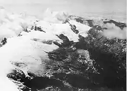
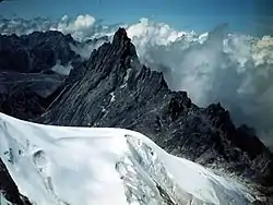
"Three small perennial ice fields with a total area of about 7.5 ± 0.5 km2 are situated on Puncak Jaya massif, Puncak Mandala, and Ngga Pilimsit in the Central Range of Irian Jaya."[27]
Puncak Jaya has a nominal position of 04°04'44"S 137°9'30"E.
The oblique "aerial photograph [on the right is] looking east at several of the glaciers on Puncak Jaya in 1936."[27]
The glaciers left to right are "Northwall Firn, Meren Glacier, and Carstensz Glacier."[27]
"Puncak Jaya was named "Carstensz Pyramid" after Dutch explorer Jan Carstensz who first sighted the glaciers on the peak of the mountain on a rare clear day in 1623. The sighting went unverified for over two centuries, and Carstensz was ridiculed in Europe when he said he had seen snow near the equator. This name is still used among mountaineers."[28]
Japan
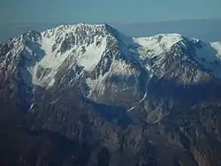
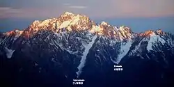
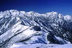
Mount Tate and Mount Masago are seen from Mount Kashimayari, in the Hida Mountains, Japan. Mount Tate and its glaciers are on the left of the image on the right. Mount Tate is located at 36°34'33"N 137°37'11"E.
The second image on the right shows Mount Tate, Mount Masago, Mount Betsu (Bessan), and Mount Tsurugi with the Mountain hut (Taneike Sanso in center) from Mount Jii, in the Hida Mountains, Japan.
Adélie Land
Adélie Land has a nominal location of 75°S 139°E.
Sakhalin Island
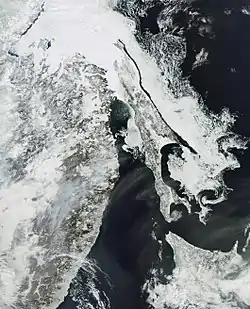
Sakhalin Island has a nominal position of 50°33'N 142°36'E.
"Ice is visible floating on the surface of the Sea of Okhotsk, along the eastern shore of Russia’s Sakhalin island, and the Gulf of Patience, the island’s southeastern coast."[29]
"The ice has a rippled or swirled appearance because it takes on the shape of eddy-currents moving beneath it."[29]
"Some ice can also be seen on the western side of Sakhalin, in the Strait of Tartary. However, much of this appears to have melted since the last time the area was observed (click here for article)."[29]
"La Pérouse Strait, the body of water dividing the southern part of the Russian island of Sakhalin from the northern part of the Japanese island of Hokkaidō (bottom right), is also ice-free, as is mainland Russia (left)."[29]
George V Land
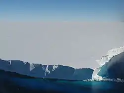

George V Land is defined by 142°02' E and 153°45' E, and by the 60°S parallel.
The Mertz Glacier has a nominal location at 67°30'S 144°45'E.
"At 94 kilometers (58 miles) by 39 kilometers (24 miles) in size, the B-09B iceberg is comparable to the state of Rhode Island, which is wider but not quite so long. After lingering near the Mertz Glacier in Eastern Antarctica for several years, the massive iceberg collided with the glacier tongue on February 12 or 13, breaking it away from the rest of the glacier. The former glacier tongue formed a new iceberg nearly as large as B-09B. These images, all from the Moderate Resolution Imaging Spectroradiometer (MODIS) sensor on NASA’s Aqua satellite, show the iceberg and glacier tongue immediately before and after the collision."[30]
"The B9 iceberg broke from the Ross Ice Shelf in West Antarctica some time in 1987. It took the massive iceberg more than two decades to drift slowly out of the Ross Sea and along the coast to the Mertz Glacier in East Antarctica. Along the way, it broke apart, one segment becoming the massive B-09B iceberg that collided with the glacier tongue in February 2010."[30]
New Guinea
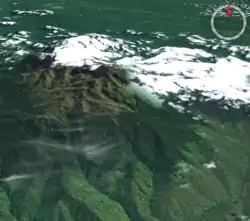
Mount Wilhelm has a nominal location of 5°48'S 145°02'E. In the image on the right, its glaciers are all to the north and northeast.
New Siberian Islands
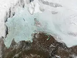
The New Siberian Islands north of Yakutia have a nominal position of 75°16′N 145°15′E.
"The winter sea ice in the east Siberian Sea is looking a bit like a cracked windshield in these true-color Moderate Resolution Imaging Spectroradiometer (MODIS) images from June 16 and 23, 2002. North of the thawing tundra, the sea ice takes on its cracked, bright blue appearance as it thins, which allows the reflection of the water to show through. Numerous still-frozen lakes dot the tundra."[31]
The Laptev Sea is on the left in the image on the right and part of the East Siberian Sea is on the right.
Tasmania
Tasmania has a nominal location of 42°S 147°E and apparently no current glaciers.
Australia
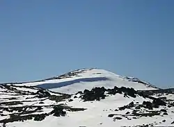
Mount Augustus has a nominal location of 24°S 117°E and no snowfall or glaciers.
Mount Kosciuszko has a nominal location of 36°27'21.53"S 148°15'48"E.
Macquarie Island has a nominal location of 54.6°S 159°E.
Kamchatka
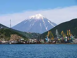
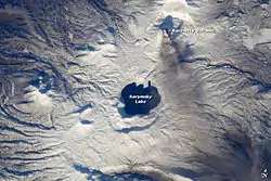
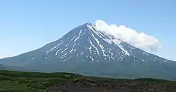
Kamchatka has a nominal location of 57°N 160°E.
Koryaksky has a nominal location of 53°19'15"N 158°42'45"E.
Karymsky has a nominal location at 54°3'N 159°26'E.
Opala is located at 52°32'36"N 157°20'21"E.
Victoria Land
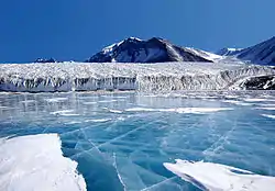
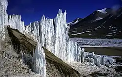
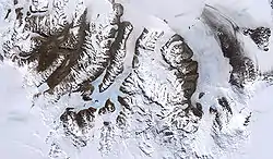
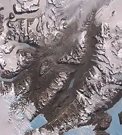
Canada Glacier has a nominal location of 77°37'S 162°59'E.
Victoria Land has a nominal location of 71°S 163°E.
Wright Lower Glacier at coordinates: 77°25′S 163°0′E is a stagnant glacier. On the left is an image of the decaying, pinnacled snout of Wright Lower Glacier in the polar desert area of the Dry Valleys of Antarctica.
One of the few areas of Antarctica not covered by thousands of meters of ice, the McMurdo Dry Valleys stand out in this satellite image on the second right. For a few weeks each summer temperatures are warm enough to melt glacial ice, creating streams that feed freshwater lakes that lie at the bottom of the valleys. Beneath a cap of ice these lakes remains unfrozen year-round, supporting colonies of bacteria and phytoplankton. Over the past 14 years, however, summers have been colder than usual, and the lakes are becoming more and more frozen.
Most of Antarctica has cooled along with the Dry Valleys, in contrast to much of the rest of the Earth, which has warmed over the past 100 years.
"The McMurdo Dry Valleys are a row of valleys west of McMurdo Sound, Antarctica, so named because of their extremely low humidity and lack of snow and ice cover. Photosynthetic bacteria have been found living in the relatively moist interior of rocks. Scientists consider the Dry Valleys to be the closest of any terrestrial environment to Mars."[32]
Auckland Islands
The Auckland Islands have a nominal location of 50.7°S 166.1°E.
South Island

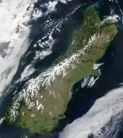
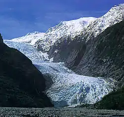
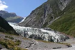
The Fox glacier in New Zealand is on South Island at 43°27′52″S 170°1′4″E.
The South Island of New Zealand has a nominal location of 43°30'S 170°30'E.
Franz Joseph Glacier has coordinates 43°28′1.19″S 170°11′29.5″E.
Ross Dependency
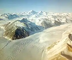
Beardmore Glacier has a nominal location of 83°45'S 171°E.
On the right is an aerial view of Dugdale Glacier, Antarctica.
North Island
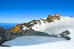
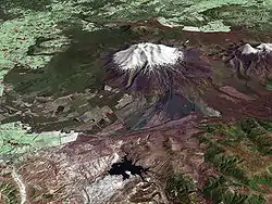
New Zealand is nominally located at 49.69°S 178.78°E.
Mount Ruapehu has a nominal location of 39°17'S 175°34'E.
Scott Island
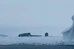
Scott Island has a nominal location of 67°22.7'S 179°54.7'W.
Aleutian Islands
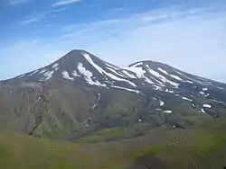
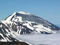
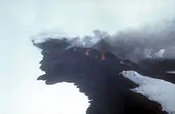
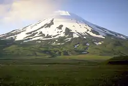
The Gareloi Volcano is at 51°47′18″N 178°47′39″W.
Tanaga volcano is at 51°53′02″N 178°08′29″W.
Korovin Volcano has coordinates of 52°22′49″N 174°10′06″W.
Mount Seguam is at 52°18′54″N 172°30′37″W.
Mount Vsevidof is located at 53°07′48″N 168°41′34.8″W.
Pogromni Volcano has coordinates 53°34′05″N 164°41′59″W.
Amak Volcano is at 55°25′02″N 163°08′49″W.
Hawaii
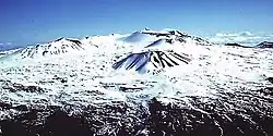
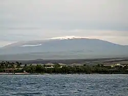
Mauna Kea has a nominal position of 19°49'14"N 155°28'05"W.
"Most people don't think about snow or glaciers in Hawai`i, but geologists have long recognized deposits formed by glaciers on Mauna Kea during recent ice ages. The latest work indicates that deposits of three glacial episodes since 150,000 to 200,000 years ago are preserved on the volcano. Glacial moraines on the volcano formed about 70,000 years ago and from approximately 40,000 to 13,000 years ago. If glacial deposits were formed on Mauna Loa, they have long since been buried by younger lava flows."[33]
"Even today, snow falls on both Mauna Kea and Mauna Loa. Both volcanoes are so high that snow falls during winter months, perhaps accumulating to a few meters depth. The seasonal snow cover on the steep slopes of Mauna Kea is easier to see from coastal areas than on the gentle, rounded slopes of Mauna Loa, whose summit cannot be seen from sea level."[33]
Alaska
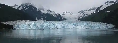
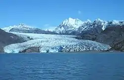
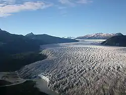
The Tatina Glacier is in the Kichatna Mountains of the Alaska Range at 62°27′03″N 152°48′44″W.
Yentna Glacier has coordinates 62°43′07″N 151°40′57″W. It is in the Alaska Range.
The Sargent Icefield is on the Kenai Peninsula at 60°17′48″N 148°35′09″W.
Meares Glacier is in Prince William Sound at 61°14′23″N 147°25′03″W.
Peters Glacier in the Brooks Range is at 69°16′51″N 144°57′23″W.
Riggs Glacier is in the Takhinsha Mountains at 59°10′08″N 136°14′37″W.
The Taku Glacier is in Tongass at 58°35′42″N 134°10′47″W. It is part of the Juneau Icefield.
Bacon Glacier has coordinates of 58°38′59″N 133°48′29″W in Juneau.
Yukon
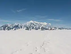
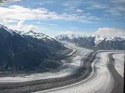
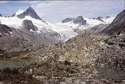
Two or more glaciers as in the image on the left and second right make the Kluane icefield. Mount Logan has a location at 60°34'02"N 140°24'10"W.
Mount Vancouver is at 60.3361°N 139.6947°W.
Keele Peak has coordinates 63°25′53″N 130°19′26″W.
British Columbia
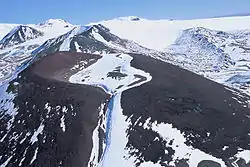
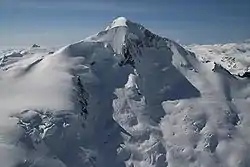
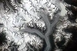
The ice on the young basaltic cinder cone in the image on the right is a glacier. The young cinder cone is on the flanks of Mount Edziza. Mount Edziza is located at 57°42'58"N 130°38'02"W.
Mount Silverthrone is located at 51°31'41.9"N 126°06'47.9"W.
Ha-Iltzuk Icefield has a nominal location at 51°25'N 125°55'W.
"The Heiltskuk (also written Ha-Iltzuk) Icefield covers an area of approximately 3,600 square kilometers (1,389 square miles) in the southern Coast Mountains of British Columbia. This detailed astronaut photograph illustrates the icefield—mostly covered by snow across the upper mountain slopes—and two major valley glaciers that extend from it. Valley glaciers are large masses of slowly flowing ice and entrained debris that move downhill, carving out wide U-shaped valleys in the process. The locations of former valley glaciers can frequently be identified by the presence of these U-shaped valleys on a now glacier-free landscape."[34]
"The two largest valley glaciers in the image, Silverthrone Glacier and Klinaklini Glacier, both flow towards Knight Inlet to the south (not shown). Several moraines—accumulations of rock and soil debris along the edges and surface of a glacier—are drawn out into long, dark lines by the flowing ice, and they extend along the length of both glaciers. The confluence of the two glaciers at image center illustrates how a moraine located along the side of a glacier can become a medial moraine, in the center of the joined ice mass. Smaller valley glaciers are visible near Mount Silverthrone""[34]
Mount Robson in British Columbia has coordinates 53.1106°N 119.1564°W.
Cascades

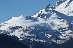

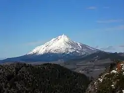
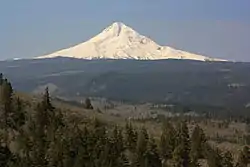
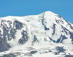
Mount Olympus is at 47°48′05″N 123°42′39″W.
Mount Shasta has coordinates 41°24′33″N 122°11′42″W in California, USA.
Crater Glacier is at 46°11′48″N 122°11′15″W.
Lathrop Glacier has a nominal location of 43°09′15″N 122°04′02″W in Oregon, USA.
Mount Jefferson is at 44°40′27″N 121°47′58″W.
Mount Hood is located at 45°22′25″N 121°41′45″W.
Fryingpan Glacier has coordinates 46°50'32"N 121°41'27"W.
Adam Glacier is at 46°13′02″N 121°30′42″W.
Banks Island
Banks Island has a nominal position at 73°N 121°30'W.
Sierra Nevada
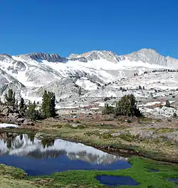
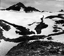
.jpg.webp)
Conness Glacier has a nominal location of 37°58'13"N 119°19'07"W.
Maclure Glacier is at 37°44′48″N 119°16′58″W.
The Dana Glacier is located at 37°54′02″N 119°13′04″W.
Goether Glacier is at 37°12′29″N 118°42′30″W.
Darwin Glacier is at 37°10′18″N 118°40′19″W.
Lilliput Glacier has coordinates of 36°34′53″N 118°33′07″W.
Norman Clyde Glacier is located at 37°04′45″N 118°28′43″W.
Alberta
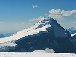
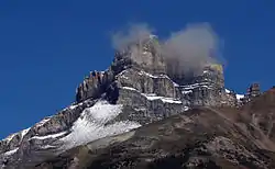
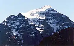
Mount Columbia has coordinates 52°08′50″N 117°26′30″W.
Mount Hector is at 51°34′24″N 116°15′30″W in Banff National Park, Canada.
Mount Temple is located at 51.3506°N 116.2067°W.
Mount Joffre has coordinates 50°31′40″N 115°12′30″W.
Idaho
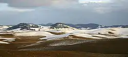
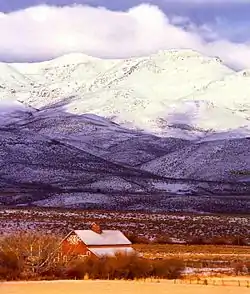
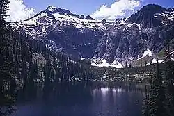
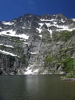
Benson Glacier has coordinates of 45°09′45″N 117°18′9″W in Oregon, USA.
The Palouse region has coordinates of 46.73°N 117.16°W.
The Owyhee Mountains are at 42°58′51″N 116°39′31″W.
Blackwell Glacier on Snowshoe Peak is located at 48°13′47″N 115°41′07″W in Montana, USA.
The Selway-Bitterroot Wilderness has coordinates 46°12′45″N 114°20′46″W.
Montana
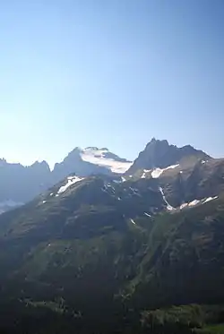
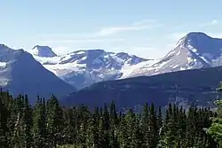
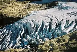
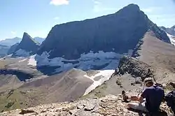
Harris Glacier is located in Glacier National Park at 48°57′00″N 114°13′44″W.
Agassiz Glacier is at 48°56′02″N 114°09′28″W.
Boulder Glacier is located at 48°57′27″N 114°05′16″W.
Chaney Glacier is at 48°51′06″N 113°49′48″W.
Ahern Glacier is at 48°50′34″N 113°47′02″W.
Old Sun Glacier is located at 48°52′21″N 113°46′38″W.
Jackson Glacier has coordinates 48°35′55″N 113°42′04″W.
Blackfoot Glacier has coordinates of 48°35′40″N 113°40′12″W.
Logan Glacier has a nominal position of 48°36′07″N 113°37′57″W.
Lupfer Glacier is at 48°28′38″N 113°30′44″W.
Utah
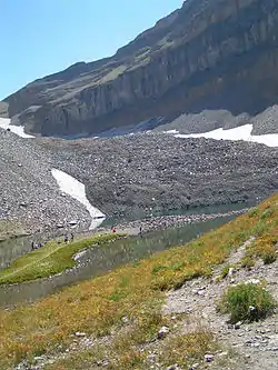
Timpanogos Glacier is a buried glacier that has coordinates 40°21′59″N 111°37′13″W.
Victoria Island
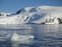
Victoria Island is at 71°N 110°W.
Yellowstone
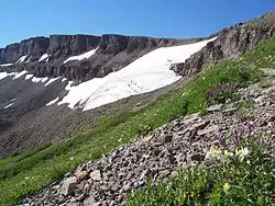
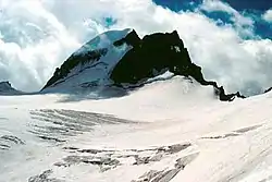
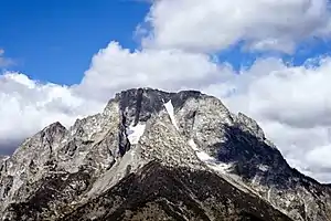
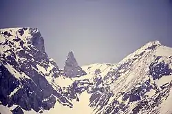
Schoolroom Glacier has coordinates 43°43′33″N 110°50′56″W.
Petersen Glacier is at 43°46′45″N 110°50′54″W.
Middle Teton Glacier has coordinates 43°43′57″N 110°48′15″W.
Falling Ice Glacier is at 43°50′00″N 110°46′13″W.
Grasshopper Glacier is in the Beartooth Mountains, Custer National Forest, Montana, USA, at 45°08′03″N 109°53′02″W.
DuNoir Glacier has a nominal location of 43°47′46″N 109°52′10″W.
The Beartooth Mountains are located in south central Montana and northwest Wyoming, USA, at 45°09′48″N 109°48′26″W.
Connie Glacier is at 43°16′07″N 109°41′37″W.
Baby Glacier has coordinates 43°10'16"N 109°41'01"W.
Castle Rock Glacier is in the U.S. state of Montana at 45°05′32″N 109°39′20″W.
Dinwoody Glacier has coordinates 43°10′24″N 109°38′19″W.
Beartooth Glacier is at 45°03′55″N 109°33′33″W in Montana, USA.
Dry Creek Glacier is at 43°10′38″N 109°30′30″W.
Hooker Glacier has coordinates 42°51′24″N 109°18′40″W.
Lizard Head Glacier is at 42°47′34″N 109°12′23″W.
Wind River Glacier has coordinates 42°42′31″N 109°07′41″W.
Bathurst Island
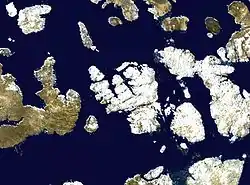
Bathurst Island is located at 75°46'N 99°47'W.
Mexico
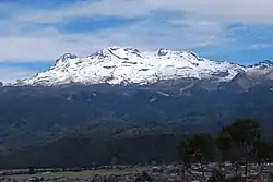
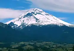
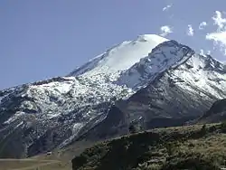
Iztaccihuatl has nominal coordinates of 19°10'44"N 98°38'30"W.
Popocatépetl has coordinates 19°01'20"N 98°37'40"W.
Citlaltépetl is at 19°01'48"N 97°16'12"W.
Devon Island
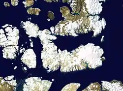
The Devon Ice Cap is on eastern Devon Island, Nunavut, Canada, at 75°20′52″N 82°10′26″W.
The Treuter Mountains (75°42′N 82°30′W are on eastern Devon Island, Nunavut, Canada. They are part of the Devon Ice Cap.
Ecuador
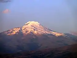
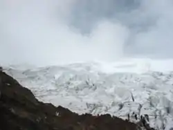
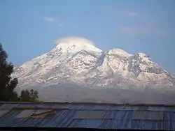
The only snow to occur exactly on the Equator is at 4,690 m (15,387 ft) on the southern slope of Volcán Cayambe in Ecuador.
Volcán Cayambe has a nominal location at 0.029°N 77.986°W.
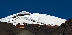
Cotopaxi has an approximate location of 0°39'33.19"S 78°26'19.01"W, 4768 masl.
Chimborazo has a nominal location of 1°28'9"S 78°49'3"W.
Peru
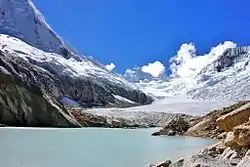
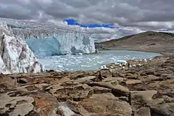
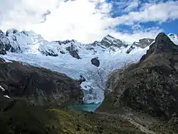
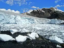
Artesonraju glacier has coordinates 08°57′35″S 77°37′07″W.
Arhuay glacier is located at 8°50′59″S 77°35′43″W.
Pastoruri glacier has coordinates of 09°55′12″S 77°10′56″W.
Quelccaya ice cap is located at 13°56′0″S 70°50′0″W
Ellesmere Island
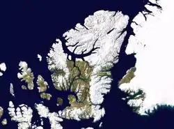
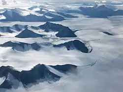
Ellesmere Island is located at 79°50'N 78°W.
The Agassiz Ice Cap is located at 80°30'N 75°W.
Colombia

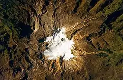

Colombia has a nominal position at 4°N 72°W.
Nevado del Ruiz is at 04°53′43″N 75°19′21″W.
"The volcano’s summit and upper flanks are covered by several glaciers that appear as a white mass surrounding the 1-kilometer- (0.6-mile-) wide Arenas Crater; meltwater from these glaciers has incised the gray to tan ash and pyroclastic flow deposits mantling the lower slopes. A well-defined lava flow is visible at image lower right. This astronaut photograph was taken at approximately 7:45 a.m. local time, when the Sun was still fairly low above the horizon, leading to shadowing to the west of topographic high points."[35]
Sierra Nevada de Santa Marta has coordinates 10°52′00″N 73°43′12″W.
"Small glacier fields at the top of the range [in the image on the left] cover an area of 6 sq. miles (16 sq. km). The Sierra Nevada de Santa Marta serves as the source of 36 streams and rivers."[36]
Chile
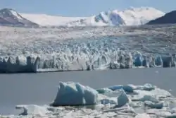
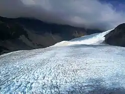
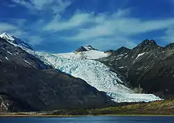
Grey Glacier in the image on the left is at 50°57′S 73°15′W.
"Ventisquero Gabriel Quiroz is a glacier(s) and is located in Aisén, Chile."[37] It is located at 48°24'0.01"S 73°11'59.99"W on Cerro Nublado.
Holanda Glacier in the image on the right has coordinates 54°55′S 69°07′W.
Argentina
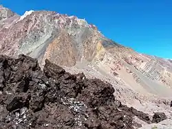
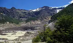

The black glacier in the Horcones Inferior Valley, Aconcagua Provincial Park, Argentina, imaged on the right, is a rock glacier.
Another dark glacier in Argentina is the Ventisquero Negro in Nahuel Huapi National Park, imaged on the left. The glacier itself is the lumpy brown, white and black part in the centre of the image. Brown icebergs calved by the glacier float in the foreground to the left. The glacier Río Manso, which feeds Ventisquero Negro, is seen high up on the right hand side.
The image second on the right is the Glacier Alerce, on Argentina's Mount Tronador, as seen from near Refugio Otto Meiling.
Mount Tronador has a nominal position of 41°09'39"S 71°53'15"W.
Venezuela
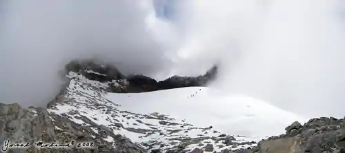
_(6).JPG.webp)
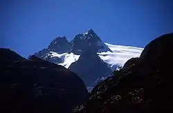
Pico Humboldt has coordinates 8°32′58.78″N 70°59′46.11″W.
Bolivia
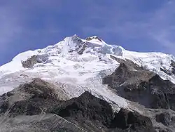
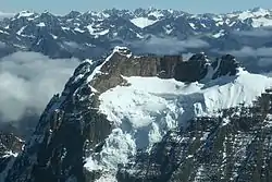
Huayna Potosí on the top right is 6088 m high, 25 km north of La Paz, Bolivia. It has a nominal geographic location of 16°15'45"S 68°09'13.5"W.
Western Greenland
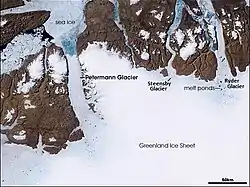
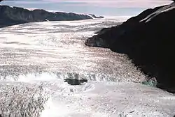
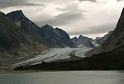
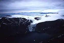
The Chamberlin Glacier is located in northwest Greenland at 76.71°N 68.44°W.
Petermann Glacier is located in North-West Greenland at 80°45′N 60°45′W.
Rink Glacier has coordinates of 71°45′N 51°40′W.
Frederikshaab Glacier is on the southwest coast of Greenland at 62°37′N 49°47′W.
Baffin Island
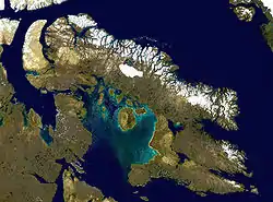
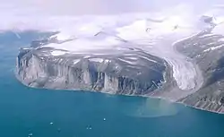
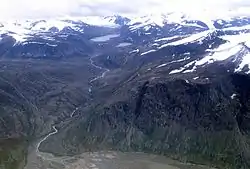
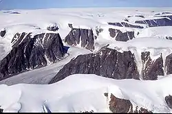
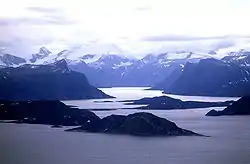
Baffin Island has a nominal position of 69°N 72°W.
The Penny Ice Cap has a nominal position at 67°15'N 66°W.
Glaciers over water
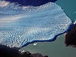
At right is an aerial view of the Perito Moreno Glacier, in Los Glaciares National Park, southern Argentina, in 2004, two weeks before the rupture of the glacier. The glacier is over the waters of Lake Argentino. As of October 2003, it is one of two "South American glaciers [that] have been growing, although their neighbors have shrunk due to a warming climate."[38]
Hypotheses
- Glaciers are rocks.
- every 10° of longitude on Earth has at least one glacier, buried glacier, or buried ice.
- every 5° of latitude on Earth has at least one glacier, buried glacier, or buried ice.
See also
References
- 1 2 F. Paul; R.G. Barry; J.G. Cogley; H. Frey; W. Haeberi; A. Ohmura; C.S.L. Ommanney; B. Raup et al. (2009). "Recommendations for the compilation of glacier inventory data from digital sources". Annals of Glaciology 50 (53): 119-26. http://m.glims.org/glacierdata/data/lit_ref_files/paul2009.pdf. Retrieved 2014-10-16.
- 1 2 3 4 5 6 7 8 9 10 11 12 13 Janet Beitler (2014). Cryosphere Glossary. National Snow and Ice Data Center. Retrieved 2014-09-20.
- 1 2 3 Jan-Gunnar Winther (June 1993). "Landsat TM derived and in situ summer reflectance of glaciers in Svalbard". Polar Research 12 (1): 37-55. doi:10.1111/j.1751-8369.1993.tb00421.x. http://www.polarresearch.net/index.php/polar/article/download/6702/7535. Retrieved 2014-09-27.
- 1 2 3 4 5 6 7 8 9 F. Paul; C. Huggel; A. Kääb; T. Kellenberger; M.Maisch (11 March 2002). Comparison of TM-derived glacier areas with higher resolution data sets, In: Proceedings of EARSeL-LISSIG-Workshop Observing our Cryosphere from Space (PDF). EARSeL-LISSIG. p. 15. Retrieved 2014-10-14.
- 1 2 3 Michael Kuhn (1984). "Mass Budget Imbalances as Criterion for a Climatic Classification of Glaciers". Geografiska Annaler. Series A, Physical Geography 66 (3): 229-38. http://www.jstor.org/discover/10.2307/520696?uid=3739552&uid=2&uid=4&uid=3739256&sid=21104337348461. Retrieved 2014-10-14.
- ↑ Kurt M. Cuffey; W. S. B. Paterson (2010). The Physics of Glaciers. Burlington, Massachusetts USA: Elsevier. p. 708. ISBN 978-0-12-369461-4. Retrieved 2014-10-15.
- 1 2 Rui M. S. Fernandes; John Msemwa; Machiel Bos; Joaquim Luís; Jorge Santos; André Sá; Saburi John; Essau Mligo et al. (3-8 May 2009). "Precise Determination of the Orthometric Height of Mt. Kilimanjaro". Surveyors Key Role in Accelerated Development TS 8C (Instruments and Calibration): 1-11. http://www.fig.net/pub/fig2009/papers/ts08c/ts08c_fernandes_teamkili2008_3438.pdf. Retrieved 2014-10-03.
- 1 2 3 4 Lonnie G. Thompson; Ellen Mosley-Thompson; Mary E. Davis; Keith A. Henderson; Henry H. Brecher; Victor S. Zagorodnov; Tracy A. Mashiotta; Ping-Nan Lin et al. (18 October 2002). "Kilimanjaro Ice Core Records: Evidence of Holocene Climate Change in Tropical Africa". Science 298: 589-93. doi:10.1126/science.1073198. ftp://ftp.soest.hawaii.edu/engels/Stanley/Textbook_update/Science_298/Thompson-02.pdf. Retrieved 2014-10-04.
- 1 2 William L. Stefanov (23 December 2013). Sollipulli Caldera, Chile and Argentina. Washington, DC USA: NASA. Retrieved 2014-10-15.
- ↑ Robert Gilbert; Niels Nielsen; Henrik Möller; Joseph R. Desloges; Morten Rasch (2002). "Glacimarine sedimentation in Kangerdluk (Disko Fjord), West Greenland, in response to a surging glacier". Marine Geology 191: 1-18. http://geog.queensu.ca/gilbert/surge%20paper.PDF. Retrieved 2014-09-24.
- 1 2 3 4 5 Robert Bindschadler. A Place of Absolute Stillness. Washington, DC: NASA. Retrieved 2014-11-23.
- 1 2 3 4 David Herring (12 July 2005). Time on the Shelf. Washington, DC: NASA. Retrieved 2014-11-23.
- 1 2 Eleyne Phillips (16 December 2004). Glossary of Glacier Terminology. Reston, Virginia USA: United States Geological Survey. Retrieved 2014-11-09.
- ↑ Martyn Tranter; Andrew G. Fountain; W. Berry Lyons; Thomas H. Nylen; Kathy A. Welch (1 January 2005). "The chemical composition of runoff from Canada Glacier, Antarctica: implications for glacier hydrology during a cool summer". Annals of Glaciology 40 (1): 15-19. doi:10.3189/172756405781813753. http://www.ingentaconnect.com/content/igsoc/agl/2005/00000040/00000001/art00004. Retrieved 2014-11-10.
- 1 2 3 4 5 6 7 Charles Swithinbank (1950). "The Origin of Dirt Cones on Glaciers". Journal of Glaciology 01 (08): 461-5. http://www.igsoc.org:8080/journal/1/8/igs_journal_vol01_issue008_pg461-465_439.pdf. Retrieved 2014-11-10.
- 1 2 GNIS Manager (14 November 2014). Antarctic Detail. Reston, VA, USA: U.S. Geological Survey. Retrieved 2014-11-14.
- 1 2 Jesse Allen (6 October 2002). Kolka Images. Washington, DC USA: NASA. Retrieved 2014-11-14.
- 1 2 Charles Ichoku (10 November 2002). Mt. Elbrus, Caucasus Range. Washington, DC USA: NASA. Retrieved 2014-11-15.
- 1 2 William L. Stefanov (16 March 2009). Mawson Peak, Heard Island. Washington, DC USA: NASA. Retrieved 2014-11-14.
- ↑ Brian Dunbar (20 April 2013). Lava Flow on Mawson Peak, Heard Island. Washington, DC USA: NASA. Retrieved 2014-11-11.
- ↑ John Seach (1 January 2014). Heard Island Volcano. Volcano Live. Retrieved 2014-11-11.
- 1 2 3 Jesse Allen (23 April 2006). Siachen Glacier. Washington DC USA: NASA. Retrieved 2014-11-13.
- 1 2 3 4 Jesse Allen (17 October 2010). Imja Tsho, Nepal. Washington, DC USA: NASA. Retrieved 2014-11-13.
- ↑ Charles Ichoku (4 June 2002). GLACIAL LAKES FROM RETREATING GLACIERS. Washington, DC USA: NASA. Retrieved 2014-11-11.
- 1 2 Chelys (16 November 2008). Amur Oblast and Zeyskoye Reservoir, Russia. Earth Snapshot. Retrieved 2014-11-19.
- 1 2 William Stefanov (April 2003). Baitoushan Volcano, China and North Korea. Houston, Texas USA: NASA Johnson Space Center. Retrieved 2014-11-16.
- 1 2 3 Ian Allison; James A. Peterson (28 April 2000). Glaciers of Irian Jaya, Indonesia. Reston, Virginia USA: USGS. Retrieved 2014-11-12.
- ↑ Indonesia Vacation (21 September 2010). Vacation at Indonesia. Indonesia Vacation. Retrieved 2014-11-12.
- 1 2 3 4 Chelys (22 March 2009). Ice Around Sakhalin Island, in the Sea of Okhotsk. Earth Snapshot. Retrieved 2014-11-19.
- 1 2 Holli Riebeek (27 February 2010). Collision Calves Iceberg from Mertz Glacier Tongue, Antarctica. Washington, DC USA: NASA. Retrieved 2014-11-14.
- ↑ Jacques Descloitres (22 June 2012). EAST SIBERIAN SEA, RUSSIA. Washington, DC USA: NASA. Retrieved 2014-11-19.
- ↑ Yvette Smith (December 4, 2009). Dry Valleys, Antarctica. Washington, DC USA: NASA. Retrieved 2014-12-17.
- 1 2 Wolfe E.W.; Wise S. W.; Dalrymple B. (22 May 2002). Mauna Kea Hawai`i's Tallest Volcano. Reston, Virginia USA: U.S. Geological Survey. Retrieved 2014-11-20.
- 1 2 William L. Stefanov (31 August 2009). Heiltskuk Icefield, British Columbia. Washington,DC USA: NASA. Retrieved 2014-11-14.
- ↑ William L. Stefanov (23 April 2010). Nevado del Ruiz Volcano, Colombia. Houston, Texas USA: NASA-JSC. Retrieved 2014-11-20.
- ↑ William Stefanov (January 1990). SANTA MARTA MTNS, COAST. Houston, Texas USA: Johnson Space Center. Retrieved 2014-11-20.
- ↑ Panoramio (November 2014). Ventisquero Gabriel Quiroz. GeoView. Retrieved 2014-11-20.
- ↑ Natacha Pisarenko (28 October 2010). Photo: Mystery Glaciers Growing as Most Others Retreat. National Geographic News. Retrieved 2014-10-13.