Lozère
Lozère (Occitan: Losera) is a department in the region of Occitanie in southern France near the Massif Central. It is named after Mont Lozère.
Lozère | |
|---|---|
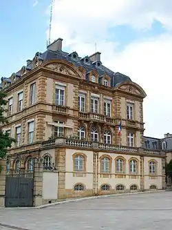 Prefecture building of the Lozère department, in Mende | |
 Flag  Coat of arms | |
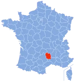 Location of Lozère in France | |
| Coordinates: 44°20′N 3°36′E | |
| Country | France |
| Region | Occitanie |
| Prefecture | Mende |
| Subprefectures | Florac Trois Rivières |
| Government | |
| • President | Sophie Pantel[1] |
| Area | |
| • Total | 5,166.9 km2 (1,995.0 sq mi) |
| Population (2014)[3] | |
| • Total | 76,360 |
| • Rank | 101st |
| • Density | 15/km2 (38/sq mi) |
| Demonym | Lozériens |
| Time zone | UTC+1 (CET) |
| • Summer (DST) | UTC+2 (CEST) |
| ISO 3166 code | FR-48 |
| Arrondissements | 2 |
| Cantons | 13 |
| Communes | 185 |
| Website | http://lozere.fr/ |
History
Lozère was created in 1790 during the French Revolution, when the whole of France was divided into departments, replacing the old provinces. Lozère was formed with part of the old province of Languedoc.
Les Sources and Hautes-Cèvennes were two other names proposed for this department but they were not accepted.[4]
Geography
Lozère has an area of 5,166.9 km2 (1,995 sq mi).[2] It is surrounded by 5 departments belonging to 2 regions:
- Auvergne-Rhône-Alpes region
- Occitanie region
The Lozère is divided into four natural regions, covering four mountain ranges:
- The Aubrac. It is a plateau in the northwest of the department that rises between 1,000 m (3,281 ft) and 1,450 m (4,757 ft), with a cold humid climate. The highest point is Signal de Mailhebiau with 1,469 m (4,820 ft).
- The Margeride. Located in the northeast of the department, these mountains are of granite and well forested. The climate here is cold, but dryer than the climate in Aubrac. The highest point is Signal de Randon with 1,551 m (5,089 ft).
- The Cévennes, a southern part of the Massif Central and that is found in the south-east of the department. Here is the highest point in the department, Mont Lozère at 1,702 m (5,584 ft).
Three important rivers start in the department:
Administration
The département is managed by the Departamental Council of Lozère in Mende. Lozère is part of the region of Occitanie.
Administrative divisions
There are 2 arrondissements (districts), 13 cantons and 176 communes (municipalities) in Lozère.[5]
| INSEE code | Arrondissement | Capital | Population[6] (2014) | Area[7] (km²) | Density (inh./km²) | Communes |
|---|---|---|---|---|---|---|
| 481 | Florac | Florac Trois Rivières | 13,313 | 1,687.5 | 7.9 | 44 |
| 482 | Mende | Mende | 63,047 | 3,479.4 | 18.1 | 132 |
The following is a list of the 13 cantons of the Lozère department (with their INSEE codes), following the French canton reorganisation which came into effect in March 2015:[8]
- Aumont-Aubrac (4801)
- La Canourgue (4802)
- Chirac (4803)
- Le Collet-de-Dèze (4804)
- Florac (4805)
- Grandrieu (4806)
- Langogne (4807)
- Marvejols (4808)
- Mende-1 (4809)
- Mende-2 (4810)
- Saint-Alban-sur-Limagnole (4811)
- Saint-Chély-d'Apcher (4812)
- Saint-Étienne-du-Valdonnez (4813)
Demographics
The inhabitants of Lozère are known, in French, as Lozériens (women: Lozériennes).[9]
Lozère is the least populated French department. It has a population, in 2014, of 76,360,[3] for a population density of 14.8 inhabitants/km2. The arrondissement of Mende, with 63,047 inhabitants, is by far the largest. The other arrondissement, Florac, have 13,313 inhabitants.[6]
The only important city is Mende with 11,542 people living there in 2014. The subprefecture, Florac Trois Rivières, has 2,107 inhabitants.[6]
Evolution of the population in Lozère
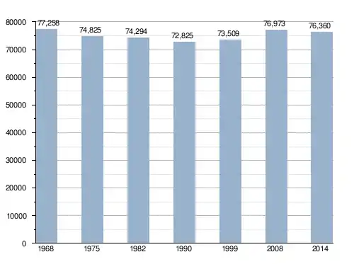
The cities with more than 2,000 inhabitants in the department are:
| City | Population[6] (2014) |
Arrondissement |
|---|---|---|
| Mende | 11,542 | Mende |
| Marvejols | 4,882 | Mende |
| Saint-Chély-d'Apcher | 4,169 | Mende |
| Langogne | 2,903 | Mende |
| Bourgs sur Colagne | 2,136 | Mende |
| La Canourgue | 2,108 | Mende |
| Florac Trois Rivières | 2,107 | Florac |
Gallery

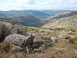 The Cévennes in Lozère.
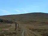 Mont Lozère
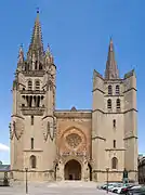 Cathedral of Mende.
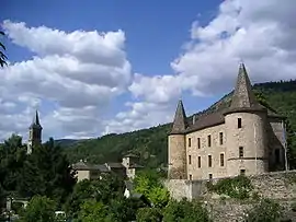
References
- "Le visage du Département". Départment de la Lozère. Retrieved 21 February 2017.
- "Département de La Lozère (48) - Résumé statistique". Publications et statistiques pour la France ou les régions (in French). Institut national de la statistique et des études économiques - INSEE. Retrieved 20 June 2015.
- "Populations légales 2014 des départements et des collectivités d'outre-mer" (in French). Institut national de la statistique et des études économiques - INSEE. Retrieved 21 February 2017.
- "Historique de la Lozère". Le SPLAF (in French). Retrieved 21 June 2015.
- "Département de la Lozère (48)". Géographie administrative et d'étude (in French). Institut national de la statistique et des études économiques - INSEE. Retrieved 21 February 2017.
- "Régions, départements, arrondissements, cantons et communes" (PDF). Populations légales 2014 (in French). Institut national de la statistique et des études économiques - INSEE. Retrieved 21 February 2017.
- "Département de la Lozère (48)". Comparateur de territoire (in French). Institut national de la statistique et des études économiques - INSEE. Retrieved 21 February 2017.
- "Décret n° 2014-245 du 25 février 2014 portant délimitation des cantons dans le département de la Lozère" (in French). Légifrance.gouv.fr. Retrieved 20 June 2015.
- "Lozère (48)" (in French). habitants.fr. Retrieved 24 June 2015.
Other websites
- General Council of Lozère (in French)
- Prefecture website (in French)
- Comité Départemental du Tourisme en Lozère (in French)