Allier
Allier is a department in the centre of France, in the Auvergne-Rhône-Alpes region. It is named after the river Allier, a tributary of the Loire. Its prefecture is Moulins.
Allier | |
|---|---|
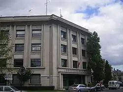 Prefecture building of the Allier department, in Moulins | |
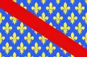 Flag .svg.png.webp) Coat of arms | |
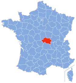 Location of Allier in France | |
| Coordinates: 46°20′N 3°10′E | |
| Country | France |
| Region | Auvergne-Rhône-Alpes |
| Département | 4 March 1790 |
| Prefecture | Moulins |
| Subprefectures | Montluçon, Vichy |
| Government | |
| • President | Gérard Dériot[1] |
| Area | |
| • Total | 7,340.1 km2 (2,834.0 sq mi) |
| Population (2014)[3] | |
| • Total | 343,062 |
| • Density | 47/km2 (120/sq mi) |
| Time zone | UTC+1 (CET) |
| • Summer (DST) | UTC+2 (CEST) |
| ISO 3166 code | FR-03 |
| Arrondissements | 3 |
| Cantons | 19 |
| Communes | 317 |
| Website | http://www.allier.fr |
History

Allier is one of the original 83 departments created during the French Revolution on 4 March 1790 with Moulins as its capital.[4] It was formed from most of all the former province of Bourbonnais (the Duchy of Bourbonnais); Saint-Amand-Montrond, in the Cher department, was the only part of the old province that was not made part of Allier.
It was divided in seven districts: Cérilly, Moulins, Le Donjon, Cusset, Gannat, Montmarault and Montluçon.
In 1800, with the creation of the arrondissements in France, the seven districts were changed into four arrondissements: Moulins, Gannat, Lapalisse and Montluçon.[4]
On 10 September 1926, the arrondissement of Gannat was eliminated and in 1941 Vichy became the capital of one arrondissement of the department instead of Lapalisse.[4]
In 1940, during World War II, the city of Vichy was the capital of Vichy France.
Geography
Allier is part of the Auvergne-Rhône-Alpes region. It has an area of 7,340.1 km2 (2,834 sq mi).[2]
It is 130 km (81 mi) long from east to west and 90 km (56 mi) wide from north to south.[5]
The department borders with 6 other departments in 4 regions:
- Bourgogne-Franche-Comté region
- Nièvre (north)
- Saône-et-Loire (east)
- Auvergne-Rhône-Alpes region
- Loire (southeast)
- Puy-de-Dôme (south)
- Nouvelle-Aquitaine region
- Creuse (west)
- Centre-Val de Loire region
- Cher (northwest)
Places next to Allier | ||||||||||
|---|---|---|---|---|---|---|---|---|---|---|
| ||||||||||
There are four main geographical zones in the department:
- The Bourbonnais Bocage covers about one third of the departement, covering most of the western and central parts of the department.
- The Bourbonnais Sologne is to the east of the department, between the valley of the river Allier and the borders of Nièvre and Saône-et-Loire departments in Bourgogne-Franche-Comté.
- The Bourbonnais Mountains are in the southeast of the department. In these mountains, where the departments Allier, Puy-de-Dome and Loire meet, is the highest point of the department, Puy de Montoncel (45°55′51″N 3°41′39″E); it is 1,287 m (4,222 ft) high.[6]
- The Bourbonnais Limagne, commonly called as Val d'Allier ("Valley of the Allier"), found on both sides of the river between Vichy and Saint-Pourçain-sur-Sioule.
The main rivers in the department are:
- Cher in the western part of the department.
- Allier and its tributary the Sioule, in the centre.
- Loire and its tributary the Besbre, in the east.
Climate
The Köppen climate classification type for the climate at Nevers is an "Oceanic climate" (also known as Maritime Temperate climate) and of the subtype "Cfb".
There are two periods of maximum precipitation in June and October and a minimum in January and February with average of 694 mm (27.3 in) Montluçon (altitude: 207 m), 763 mm (30.0 in) in Moulins (245 m) 778 mm (30.6 in) in Vichy (251 m); and 791 mm (31.1 in) in Lapalisse (285 m).
| Climate data for Vichy | |||||||||||||
|---|---|---|---|---|---|---|---|---|---|---|---|---|---|
| Month | Jan | Feb | Mar | Apr | May | Jun | Jul | Aug | Sep | Oct | Nov | Dec | Year |
| Average high °C (°F) | 6.7 (44.1) |
8.7 (47.7) |
11.7 (53.1) |
14.8 (58.6) |
18.7 (65.7) |
22.4 (72.3) |
25.5 (77.9) |
24.7 (76.5) |
22.2 (72.0) |
17.1 (62.8) |
10.8 (51.4) |
7.1 (44.8) |
15.9 (60.6) |
| Daily mean °C (°F) | 2.9 (37.2) |
4.3 (39.7) |
6.4 (43.5) |
9.1 (48.4) |
12.8 (55.0) |
16.3 (61.3) |
18.8 (65.8) |
18.3 (64.9) |
15.8 (60.4) |
17.1 (62.8) |
10.8 (51.4) |
7.1 (44.8) |
15.9 (60.6) |
| Average low °C (°F) | −0.9 (30.4) |
−0.2 (31.6) |
1.1 (34.0) |
3.4 (38.1) |
7.06 (44.71) |
10.2 (50.4) |
12.1 (53.8) |
11.8 (53.2) |
9.4 (48.9) |
6.4 (43.5) |
2.3 (36.1) |
−0.5 (31.1) |
5.2 (41.4) |
| Average precipitation mm (inches) | 52.1 (2.05) |
48.2 (1.90) |
51.0 (2.01) |
62.9 (2.48) |
107.6 (4.24) |
79.4 (3.13) |
60.6 (2.39) |
75.4 (2.97) |
77.0 (3.03) |
64.7 (2.55) |
56.9 (2.24) |
54.4 (2.14) |
790.2 (31.11) |
| Mean monthly sunshine hours | 66.1 | 88.1 | 136.6 | 170.9 | 197.1 | 232.6 | 270.7 | 237.8 | 197.9 | 135.9 | 82.3 | 64.2 | 1,880.2 |
| Source: Metereological data for Vichy-Charmeil, from 1961 to 1990 Dec 2014 | |||||||||||||
Administration
Allier is managed by the Departmental Council of Allier in Moulins. The department is part of the Auvergne-Rhône-Alpes region.
Administrative divisions
There are 3 arrondissements (districts), 19 cantons and 317 communes (municipalities) in Allier.[7]
| INSEE code | Arrondissement | Capital | Population[8] (2014) | Area[9] (km²) | Density (Inh./km²) | Communes |
|---|---|---|---|---|---|---|
| 031 | Montluçon | Montluçon | 114,756 | 2,327.9 | 49.3 | 89 |
| 032 | Moulins | Moulins | 106,039 | 2,996.2 | 35.4 | 109 |
| 033 | Vichy | Vichy | 122,267 | 2,016.0 | 60.6 | 119 |
The following is a list of the 19 cantons of the Allier department (with their INSEE codes), following the French canton reorganisation which came into effect in March 2015:[10]
- Bellerive-sur-Allier (0301)
- Bourbon-l'Archambault (0302)
- Commentry (0303)
- Cusset (0304)
- Dompierre-sur-Besbre (0305)
- Gannat (0306)
- Huriel (0307)
- Lapalisse (0308)
- Montluçon-1 (0309)
- Montluçon-2 (0310)
- Montluçon-3 (0311)
- Montluçon-4 (0312)
- Moulins-1 (0313)
- Moulins-2 (0314)
- Saint-Pourçain-sur-Sioule (0315)
- Souvigny (0316)
- Vichy-1 (0317)
- Vichy-2 (0318)
- Yzeure (0319)
Demographics
There is not a traditional demonym to name the inhabitants of the Allier department. Some names used are Alliérins, Bourbonnais, Elavérins, or simply habitants de l'Allier ("inhabitants of Allier").
Of these names, the most used is Bourbonnais followed by habitants de l'Allier.
Allier had a population, in 2014, of 343,062,[3] for a population density of 46.7 inhabitants/km2. The arrondissement of Vichy, with 122,267 inhabitants, is the arrondissement with more inhabitants.[8]
Evolution of the population in Allier

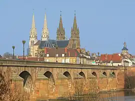
The 10 communes in the department with more inhabitants are:[8]
| City | Population (2014)[8] |
Arrondissement |
|---|---|---|
| Montluçon | 37,289 | Montluçon |
| Vichy | 25,279 | Vichy |
| Moulins | 19,762 | Moulins |
| Cusset | 13,386 | Vichy |
| Yzeure | 13,069 | Moulins |
| Domérat | 8,985 | Montluçon |
| Bellerive-sur-Allier | 8,533 | Vichy |
| Commentry | 6,395 | Montluçon |
| Gannat | 5,862 | Vichy |
| Saint-Pourçain-sur-Sioule | 5,039 | Moulins |
Gallery

References
- "Le Président". Allier.fr. Conseil Départemental de l'Allier. Archived from the original on 28 July 2017. Retrieved 18 September 2017.
- "Département de l'Allier (03) - Résumé statistique". Publications et statistiques pour la France ou les régions (in French). Institut national de la statistique et des études économiques - INSEE. Retrieved 18 September 2016.
- "Populations légales 2014 des départements et des collectivités d'outre-mer" (in French). Institut national de la statistique et des études économiques - INSEE. Retrieved 18 September 2017.
- "Historique de l'Allier". Le SPLAF (in French). Retrieved 22 December 2014.
- "Géographie du département de l'Allier". Allier.fr (in French). Retrieved 22 December 2014.
- "Puy de Montoncel, France". Peakbagger.com. Retrieved 18 September 2017.
- "Département de l'Allier (03)" (in French). Institut national de la statistique et des études économiques - INSEE. Retrieved 18 September 2017.
- "Régions, départements, arrondissements, cantons et communes" (PDF). Populations légales 2014 (in French). Institut national de la statistique et des études économiques - INSEE. Retrieved 18 September 2017.
- "Département de l'Allier (03) et Arrondissements". Comparateur de territoire (in French). Institut national de la statistique et des études économiques - INSEE. Retrieved 18 September 2017.
- "Décret n° 2014-265 du 27 février 2014 portant délimitation des cantons dans le département de l'Allier" (in French). Légifrance.gouv.fr. Retrieved 24 July 2015.
Other websites
- General Council website (in French)
- Prefecture website (in French)
- Allier tourism Archived 2015-02-13 at the Wayback Machine