Bouches-du-Rhône
Bouches-du-Rhône (Occitan: Bocas de Ròse, lit. "Mouths of the Rhône") is a department in the south of France named after the mouth of the Rhône River. It is the department of the Provence-Alpes-Côte d'Azur region with more people living in it.
Bouches-du-Rhône | |
|---|---|
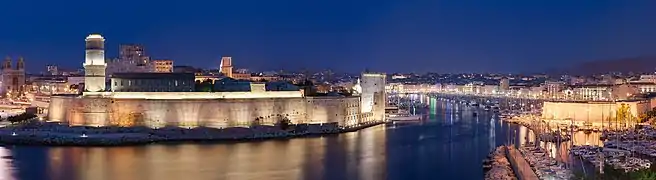
 Prefecture building of the Bouches-du-Rhône department, in Marseille | |
 Flag  Coat of arms | |
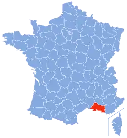 Location of Bouches-du-Rhône in France | |
| Coordinates: 43°30′N 5°5′E | |
| Country | France |
| Region | Provence-Alpes- Côte d'Azur |
| Département | 4 March 1790 |
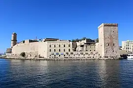
| Prefecture | Marseille |
| Subprefectures | Aix-en-Provence, Arles, Istres |
| Government | |
| • President | Martine Vassal |
| Area | |
| • Total | 5,087.5 km2 (1,964.3 sq mi) |
| Population (2014)[3] | |
| • Total | 2,006,069 |
| • Density | 390/km2 (1,000/sq mi) |
| Time zone | UTC+1 (CET) |
| • Summer (DST) | UTC+2 (CEST) |
| ISO 3166 code | FR-13 |
| Arrondissements | 4 |
| Cantons | 29 |
| Communes | 135 |
| Website | Bouches-du-Rhône Council |
History
Bouches-du-Rhône is one of the original 83 departments created during the French Revolution on 4 March 1790. It was made with part of the old province of Provence and was divided in six districts: Tarascon, Apt, Aix, Marseille, Salon and Arles, with Aix as is capital.[4]
In 1800, with the creation of the arrondissements in France, the six districts were changed into three arrondissements: Marseille, Aix and Tarascon. The prefecture was moved from Aix to Marseille.[4]
After the Battle of Waterloo (18 June 1815), the department was occupied by the Austrian army from June 1815 to November 1818.
In 1817, the subprefecture of Tarascon was moved to Arles. The arrondissement of Istres was created in 1981.[4]
Geography
The Bouches-du-Rhône department is part of the region of Provence-Alpes-Côte d'Azur. It has an area of 5,087.5 km2 (1,964 sq mi).[2]
The department is surrounded by 3 departments in 2 regions:
- Occitanie region
- Gard, to the west
- Provence-Alpes-Côte d'Azur region
The Mediterranean Sea is to the south and there is 190 km (120 mi) of coast.
Places next to Bouches-du-Rhône | ||||||||||
|---|---|---|---|---|---|---|---|---|---|---|
| ||||||||||
The highest mountain in Bouches-du-Rhône is Bertagne (43°18′44″N 05°41′21″E) in the Sainte-Baume Mountains. Bertagne is in the east of the department near the border with the Var department. It is 1,041 m (3,415 ft) high.[5]
The Rhone River is the western border of the department, and Durance River is its northern border. South of Arles, the Rhone divides into the Grand Rhone (Large Rhone) and the Petit Rhone (Small Rhone). The area between the Grand Rhone and the Petit Rhone is a large wetland called the Camargue.
The Frioul Archipelago is a group of 4 islands in the Mediterranean Sea almost 4 kilometres (2 miles) from Marseille.
Climate
The type of climate around Marseille is called the Mediterranean climate, with a subtype called Csa.[6] The area around Marseille, at an altitude of about 35 m (115 ft), has dry summers.
The average amount of precipitation for the year in Marseille is 584.2 mm (23.0 in). October has the highest average precipitation with 94 mm (3.7 in) and July the lowest with 15.2 mm (0.6 in).
The average temperature in Marseille is 15 °C (59 °F). July is warmest, with an average temperature of 23.9 °C (75.0 °F). January is coolest, with an average temperature of 6.7 °C (44.1 °F).
Administration
Bouches-du-Rhône is managed by a departmental council in Marseille. The department is part of the Provence-Alpes-Côte d'Azur region.
Administrative divisions
Bouches-du-Rhône has 4 arrondissements (districts), 29 cantons, and 135 communes (municipalities).[7]
| INSEE code | Arrondissement | Capital | Population[8] (2014) | Area[9] (km²) | Density (Inh./km²) | Communes |
|---|---|---|---|---|---|---|
| 131 | Aix-en-Provence | Aix-en-Provence | 429,436 | 1,532.4 | 280.2 | 44 |
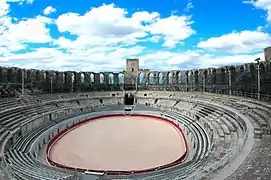
| 132 | Arles | Arles | 205,529 | 2,284.3 | 90.0 | 36 |
| 133 | Marseille | Marseille | 1,058,615 | 671.6 | 1,576.3 | 37 |
| 134 | Istres | Istres | 312,489 | 599.3 | 521.4 | 18 |
Recently the French government decided to reorganise all the nation's cantons. This change went into effect in March 2015. These are the 29 reorganised cantons of the Bouches-du-Rhône department:[10]
- Aix-en-Provence-1 (1301)
- Aix-en-Provence-2 (1302)
- Allauch (1303)
- Arles (1304)
- Aubagne (1305)
- Berre-l'Étang (1306)
- Châteaurenard (1307)
- La Ciotat (1308)
- Gardanne (1309)
- Istres (1310)
- Marignane (1311)
- Marseille-1 (1312)
- Marseille-2 (1313)
- Marseille-3 (1314)
- Marseille-4 (1315)
- Marseille-5 (1316)
- Marseille-6 (1317)
- Marseille-7 (1318)
- Marseille-8 (1319)
- Marseille-9 (1320)
- Marseille-10 (1321)
- Marseille-11 (1322)
- Marseille-12 (1323)
- Martigues (1324)
- Pélissanne (1325)
- Salon-de-Provence-1 (1326)
- Salon-de-Provence-2 (1327)
- Trets (1328)
- Vitrolles (1329)
Demographics
People who live in the Bouches-du-Rhône department are known, in French, as Buccorhodaniens (men) or Buccorhodaniennes (women).[11]
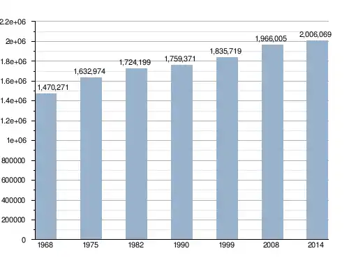
In 2014, Bouches-du-Rhône had 2,006,069 people living there, [2] or 394.3 people/km2. In the same year, the Marseille arrondissement had the highest population of the four arrondissements: 1,058,615.[8]
Population growth in Bouches-du-Rhône
These are the 10 communes with the highest population:[8]
| City | Population (2014) |
Arrondissement |
|---|---|---|
| Marseille | 858,120 | Marseille |
| Aix-en-Provence | 142,149 | Aix-en-Provence |
| Arles | 52,697 | Arles |
| Martigues | 48,870 | Istres |
| Aubagne | 45,128 | Marseille |
| Salon-de-Provence | 44,187 | Aix-en-Provence |
| Istres | 43,463 | Istres |
| La Ciotat | 35,631 | Marseille |
| Vitrolles | 34,236 | Istres |
| Marignane | 34,154 | Istres |


Related pages
References
- "L'Assemblée et les élus" (in French). Département des Bouches-du-Rhône. Retrieved 18 July 2017.
- "Département des Bouches-du-Rhône (13)". Comparateur de territoire (in French). Institut national de la statistique et des études économiques - INSEE. Retrieved 4 January 2017.
- "Populations légales 2014 des départements et des collectivités d'outre-mer" (in French). Institut national de la statistique et des études économiques - INSEE. Retrieved 18 July 2017.
- "Historique des Bouches-du-Rhône". Le SPLAF (in French). Retrieved 4 January 2017.
- "Bertagne, France". Peakbagger.com. Retrieved 4 January 2017.
- "Marseille, France - Köppen Climate Classification". Weatherbase. Retrieved 5 January 2017.
- "Département des Bouches-du-Rhône (13)". Géographie administrative et d'étude (in French). Institut national de la statistique et des études économiques - INSEE. Retrieved 18 July 2017.
- "Régions, départements, arrondissements, cantons et communes" (PDF). Populations légales 2014 (in French). Institut national de la statistique et des études économiques - INSEE. Retrieved 18 July 2017.
- "Département des Bouches-du-Rhône (13)". Comparateur de territoire (in French). Institut national de la statistique et des études économiques - INSEE. Retrieved 18 July 2017.
- "Décret n° 2014-271 du 27 février 2014 portant délimitation des cantons dans le département des Bouches-du-Rhône" (in French). Légifrance.gouv.fr. Retrieved 5 January 2017.
- "Habitants du départment: Bouches-du-Rhône" (in French). habitants.fr. Retrieved 5 January 2017.
Other websites
- Departmental Council website Archived 2010-03-01 at the Wayback Machine (in French)
- Prefecture of the Bouches-du-Rhône department (in French)