Gap, Hautes-Alpes
Gap is a commune in the Hautes-Alpes department in the Provence-Alpes-Côte d'Azur region in southeastern France. It is the préfecture (capital), and main city, of the department.
Gap | |
|---|---|
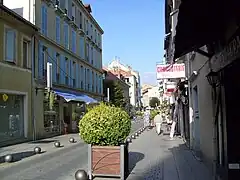
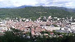 View of Gap. | |
 Coat of arms | |
Location of Gap | |
 Gap 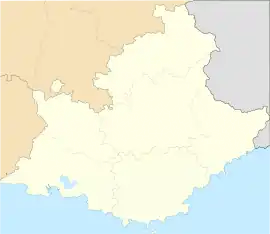 Gap | |
| Coordinates: 44°33′34″N 6°04′43″E | |
| Country | France |
| Region | Provence-Alpes-Côte d'Azur |
| Department | Hautes-Alpes |
| Arrondissement | Gap |
| Canton | Chief town of 4 cantons |
| Intercommunality | CA Gap-Tallard-Durance |
| Government | |
| • Mayor (2014-2020) | Roger Didier[1] |
| Area 1 | 110.43 km2 (42.64 sq mi) |
| Population (2014) | 40,225 |
| • Density | 360/km2 (940/sq mi) |
| Time zone | UTC+01:00 (CET) |
| • Summer (DST) | UTC+02:00 (CEST) |
| INSEE/Postal code | 05061 /05000 |
| Elevation | 625–2,360 m (2,051–7,743 ft) (avg. 1,493 m or 4,898 ft) |
| Website | www.ville-gap.fr |
| 1 French Land Register data, which excludes lakes, ponds, glaciers > 1 km2 (0.386 sq mi or 247 acres) and river estuaries. | |
Gap is the highest prefecture (departmental capital) of France; the city is in a valley whose bottom is at an altitude of about 735 m (2,411 ft) above sea level.
Geography
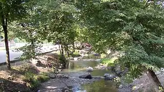
Gap is in the south central part of the Hautes-Alpes department. The Luye, a tributary of the Durance river, flows through the city.
It has an area of 110.4 km2 (42.6 sq mi).[2] Its average altitude is 1,493 m (4,898 ft); at the city hall, the altitude is 767 m (2,516 ft).[3]
The distances from Gap to other cities are:
- Paris, the national capital - 674 km (419 mi);
- Marseille, the regional capital - 180 km (110 mi);
- Strasbourg - 676 km (420 mi);
- Reims - 698 km (434 mi);
- Bordeaux - 775 km (482 mi);
- Toulouse - 538 km (334 mi);
- Montpellier - 299 km (186 mi);
- Lyon - 204 km (127 mi);
- Nice - 288 km (179 mi).
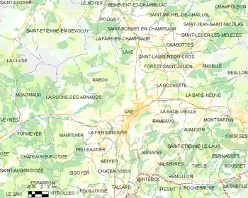 |
The commune of Gap is surrounded by 17 communes: Laye, Saint-Laurent-du-Cros, Forest-Saint-Julien, La Rochette, Rambaud, Jarjayes, Neffes, Châteauvieux, Lettret, Pelleautier, La Roche-des-Arnauds, La Freissinouse, La Fare-en-Champsaur, Poligny, Le Noyer, Le Dévoluy, Rabou
Places next to Gap, Hautes-Alpes | |
|---|---|
Climate
The climate of Gap, in the Köppen climate classification, is Cfb - Oceanic climate with template summers.
Population
The inhabitants of Gap are known, in French, as Gapençais (women: Gapençaises).[4]
With a population of 40,225,[5] Gap has a population density of 364 inhabitants/km2.
Evolution of the population in Gap

Gap forms with La Rochette the urban area of Gap with a population of 40,700 inhabitants (2014) and an area of 120.8 km2 (46.6 sq mi).[6] This urban area is the centre of the metropolitan area of Gap, formed by 39 communes, with a population of 62,567 inhabitants (2014) and an area of 756.6 km2 (292.1 sq mi).[7]
Administration
Gap is the prefecture of the Hautes-Alpes department, the capital of the arrondissement of Gap and the administrative centre (French: chef-lieu) of four cantons:
- Gap-1 formed by a part of Gap, with 9,895 inhabitants (2014).
- Gap-2 formed by a part of Gap, with 10,743 inhabitants (2014).
- Gap-3 formed by a part of Gap, with 10,346 inhabitants (2014).
- Gap-4 formed by a part of Gap, with 9,241 inhabitants (2014).
It is part of the intercommunality Gap-Tallard-Durance (French: Communauté d'agglomération Gap-Tallard-Durance).
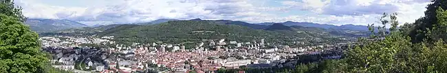
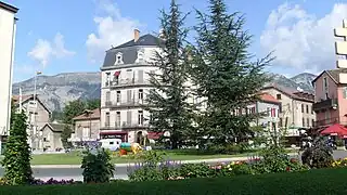
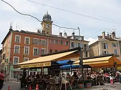
Gallery

References
- "L'équipe municipale" (in French). Ville de Gap. Retrieved 17 July 2017.
- "Commune de Gap (05061)". Comparateur de territoire (in French). Institut national de la statistique et des études économiques - INSEE. Retrieved 17 July 2017.
- "City of Gap". Map-France.com. Retrieved 17 July 2017.
- "Hautes-Alpes" (in French). habitants.fr. Retrieved 17 July 2017.
- "Régions, départements, arrondissements, cantons et communes" (PDF). Populations légales 2014 (in French). Institut national de la statistique et des études économiques - INSEE. Retrieved 17 July 2017.
- "Unité urbaine de Gap (05401)". Comparateur de territoire (in French). Institut national de la statistique et des études économiques - INSEE. Retrieved 17 July 2017.
- "Aire urbaine de Gap (136)". Comparateur de territoire (in French). Institut national de la statistique et des études économiques - INSEE. Retrieved 17 July 2017.
Related pages
Other websites
- Ville de Gap - official website (in French)