Carteret County, North Carolina
Carteret County is a county in the U.S. state of North Carolina. In 2020, 67,686 people lived there.[1] Its county seat is Beaufort. Most of the county is part of the Crystal Coast.
Carteret County | |
|---|---|
 Carteret County Courthouse | |
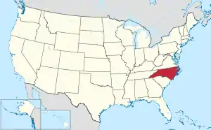
 Location within the U.S. state of North Carolina | |
 North Carolina's location within the U.S. | |
| Coordinates: 34°51′30″N 76°32′09″W | |
| Country | |
| State | |
| Founded | 1722 |
| Named for | Sir George Carteret |
| Seat | Beaufort |
| Largest community | Morehead City |
| Area | |
| • Total | 1,330.41 sq mi (3,445.7 km2) |
| • Land | 507.60 sq mi (1,314.7 km2) |
| • Water | 822.81 sq mi (2,131.1 km2) 61.85% |
| Population (2020) | |
| • Total | 67,686 |
| • Density | 133.35/sq mi (51.49/km2) |
| Time zone | UTC−5 (Eastern) |
| • Summer (DST) | UTC−4 (EDT) |
| Congressional district | 3rd |
| Website | www |
Government
Carteret County is part of the Eastern Carolina Council of Governments.
Connected Counties
- Craven County (north)
- Pamlico County (north)
- Onslow County (west-southwest)
- Jones County (west-northwest)
Cities and Towns
These cities and towns are in Carteret County:
- Atlantic Beach
- Beaufort
- Bogue
- Cape Carteret
- Cedar Point
- Emerald Isle
- Indian Beach
- Morehead City
- Newport
- Peletier
- Pine Knoll Shores
Schools
The county has its own public school system called Carteret County Schools.
References
- "QuickFacts: Carteret County, North Carolina". United States Census Bureau. Retrieved January 17, 2024.
Other websites

This article is issued from Wikipedia. The text is licensed under Creative Commons - Attribution - Sharealike. Additional terms may apply for the media files.