
The nearly black color of the cloud's base indicates the foreground cloud is probably cumulonimbus.
Precipitation
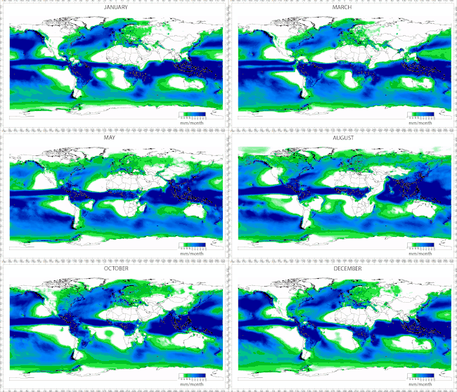
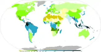
Def. any "or all of the forms of water particles, whether liquid or solid, that fall from the atmosphere""[1] is called precipitation.
Long-term mean precipitation by month for the Earth land surface areas has been documented.[2]
Short, intense periods of rain in scattered locations are called "showers."[3]
Most precipitation occurs within the tropics.[4]
Approximately 505,000 cubic kilometres (121,000 cu mi) of water falls as precipitation each year; 398,000 cubic kilometres (95,000 cu mi) of it over the oceans and 107,000 cubic kilometres (26,000 cu mi) over land.[5]
Mechanisms of producing precipitation include convective, stratiform,[6] and orographic rainfall.[7] Convective processes involve strong vertical motions that can cause the overturning of the atmosphere in that location within an hour and cause heavy precipitation,[8] while stratiform processes involve weaker upward motions and less intense precipitation.[9]
Precipitation can be divided into three categories, based on whether it falls as liquid water, liquid water that freezes on contact with the surface, or ice, where mixtures of different types of precipitation, including types in different categories, can fall simultaneously, and liquid forms of precipitation include rain and drizzle, and rain or drizzle that freezes on contact within a subfreezing air mass is called "freezing rain" or "freezing drizzle" and frozen forms of precipitation include snow, ice needles, ice pellets, hail, and graupel.[10]
Virgas
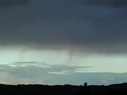

Def. "precipitation that evaporates before reaching the ground"[11] is called virga.
In meteorology, a virga' is an observable streak or shaft of precipitation falling from a cloud that evaporates or sublimates before reaching the ground.[12]
Mists


Def. water "or other liquid finely suspended in air"[13] is called a mist.
One difference between mist and fog is visibility.[14] The phenomenon is called fog if the visibility is 1 km (1,100 yd) or less. In the U.K., the definition of fog is visibility less than 100 m (330 ft) (for driving purposes, UK Highway Code rule 226),[15]
 Mist occurs lying in the folds of hills, Australia. Credit: benjamint444.
.jpg.webp) Sunlight occurs through mist on a crisp winter morning. Credit: Florian Fuchs.
Sunlight occurs through mist on a crisp winter morning. Credit: Florian Fuchs.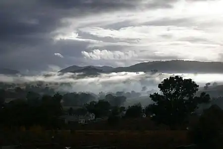 Misty morning occurs at Swifts Creek. Credit: fir0002.
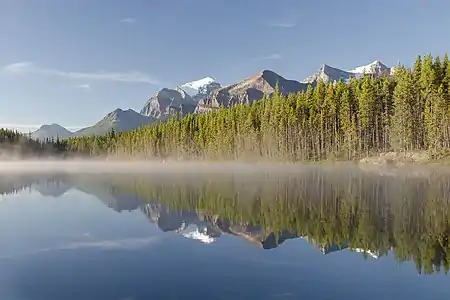 Mist occurs on a lake. Credit: Tate Strickland.
 Mist occurs in Curitiba, Brazil. Credit: SamirNosteb.
Drizzles


Def. very "small, numerous, and uniformly dispersed water drops, mist, or sprinkle ... that falls to the ground"[16] is called a drizzle.
Drizzle is a light liquid precipitation consisting of liquid water drops smaller than those of rain – generally smaller than 0.5 mm (0.02 in) in diameter.[17]
The METAR code for drizzle is DZ and for freezing drizzle is FZDZ.[18]
Freezing drizzle occurs when supercooled drizzle drops land on a surface whose temperature is below freezing.[19]
Rains

Def. "condensed water falling from a cloud"[20] is called rain.
Def. "the amount of rain that falls on a single occasion"[21] is called rainfall.
The globally averaged annual precipitation over land is 715 mm (28.1 in), but over the whole Earth it is much higher at 990 mm (39 in).[22]
Air contains water vapor, and the amount of water in a given mass of dry air, known as the mixing ratio, is measured in grams of water per kilogram of dry air (g/kg).[23][24] The amount of moisture in air is also commonly reported as relative humidity; which is the percentage of the total water vapor air can hold at a particular air temperature.[25] How much water vapor a parcel of air can contain before it becomes saturated (100% relative humidity) and forms into a cloud (a group of visible and tiny water and ice particles suspended above the Earth's surface)[26] depends on its temperature. Warmer air can contain more water vapor than cooler air before becoming saturated. Therefore, one way to saturate a parcel of air is to cool it. The dew point is the temperature to which a parcel must be cooled in order to become saturated.[27]
Rainbands
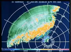
Rainbands are cloud and precipitation areas which are significantly elongated. Rainbands can be stratiform or convective,[28] and are generated by differences in temperature. When noted on weather radar imagery, this precipitation elongation is referred to as banded structure.[29] Rainbands in advance of warm occluded fronts and warm fronts are associated with weak upward motion,[30] and tend to be wide and stratiform in nature.[31]
Rainbands spawned near and ahead of cold fronts can be squall lines which are able to produce tornadoes.[32] Rainbands associated with cold fronts can be warped by mountain barriers perpendicular to the front's orientation due to the formation of a low-level barrier jet.[33] Bands of thunderstorms can form with sea breeze and land breeze boundaries, if enough moisture is present. If sea breeze rainbands become active enough just ahead of a cold front, they can mask the location of the cold front itself.[34]
Extratropical cyclones
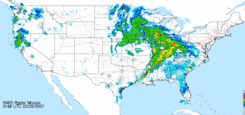
Rainbands in advance of warm occluded fronts and warm fronts are associated with weak upward motion,[35] and tend to be wide and stratiform in nature.[36] In an atmosphere with rich low level moisture and vertical wind shear,[37] narrow, convective rainbands known as squall lines generally in the cyclone's warm sector, ahead of strong cold fronts associated with extratropical cyclones.[38] Wider rain bands can occur behind cold fronts, which tend to have more stratiform, and less convective, precipitation.[39] Within the cold sector north to northwest of a cyclone center, in colder cyclones, small scale, or mesoscale, bands of heavy snow can occur within a cyclone's comma head precipitation pattern with a width of 32 kilometres (20 mi) to 80 kilometres (50 mi).[40] These bands in the comma head are associated with areas of frontogensis, or zones of strengthening temperature contrast.[41] Southwest of extratropical cyclones, curved flow bringing cold air across the relatively warm Great Lakes can lead to narrow lake effect snow bands which bring significant localized snowfall.[42]
Torrential rains

Cherrapunji, situated on the southern slopes of the Eastern Himalaya in Shillong, India is the confirmed wettest place on Earth, with an average annual rainfall of 11,430 mm (450 in). The highest recorded rainfall in a single year was 22,987 mm (905.0 in) in 1861. The 38-year average at nearby Mawsynram, Meghalaya, India is 11,873 mm (467.4 in).[43] The wettest spot in Australia is Mount Bellenden Ker in the north-east of the country which records an average of 8,000 mm (310 in) per year, with over 12,200 mm (480.3 in) of rain recorded during 2000.[44] The Big Bog on the island of Maui has the highest average annual rainfall in the Hawaiian Islands, at 10,300 mm (404 in).[45]Mount Waiʻaleʻale on the island of Kauaʻi achieves similar torrential rains, while slightly lower than that of the Big Bog, at 9,500 mm (373 in)[46]
Kerala red rain phenomenon

Def. liquid moisture that falls visibly in separate drops is called rain.
The Kerala red rain phenomenon was a blood rain (red rain) event that occurred from July 25 to September 23, 2001, when heavy downpours of red-coloured rain fell sporadically on the southern Indian state of Kerala, staining clothes pink.[47] Yellow, green, and black rain was also reported.[48][49][50] Colored rain was also reported in Kerala in 1896 and several times since,[51] most recently in June 2012.[52][53]
Red rains were also reported from November 15, 2012 to December 27, 2012 occasionally in eastern and north-central provinces of Sri Lanka,[54] where scientists from the Sri Lanka Medical Research Institute (MRI) are investigating to ascertain their cause.[55][56][57]
The colored rain of Kerala began falling on July 25, 2001, in the districts of Kottayam and Idukki in the southern part of the state. Yellow, green, and black rain was also reported.[48][49][50] Many more occurrences of the red rain were reported over the following ten days, and then with diminishing frequency until late September.[49]
According to locals, the first colored rain was preceded by a loud thunderclap and flash of light, and followed by groves of trees shedding shriveled grey "burnt" leaves. Shriveled leaves and the disappearance and sudden formation of wells were also reported around the same time in the area.[58][59][60] It typically fell over small areas, no more than a few square kilometers in size, and was sometimes so localized that normal rain could be falling just a few meters away from the red rain. Red rainfalls typically lasted less than 20 minutes.[49] Each milliliter of rain water contained about 9 million red particles, and each liter of rainwater contained approximately 100 milligrams of solids. Extrapolating these figures to the total amount of red rain estimated to have fallen, it was estimated that 50,000 kilograms (110,000 lb) of red particles had fallen on Kerala.[49]
The brownish-red solid separated from the red rain consisted of about 90% round red particles and the balance consisted of debris.[51] The particles in suspension in the rain water were responsible for the color of the rain, which at times was strongly colored red. A small percentage of particles were white or had light yellow, bluish gray and green tints.[49] The particles were typically 4 to 10 µm across and spherical or oval. Electron microscope images showed the particles as having a depressed center. At still higher magnification some particles showed internal structures.[49]
In November 2001, commissioned by the Government of India's Department of Science & Technology, the Center for Earth Science Studies (CESS) and the Tropical Botanical Garden and Research Institute (TBGRI) issued a joint report which concluded that:[51][61]
"The color was found to be due to the presence of a large amount of spores of a lichen-forming alga belonging to the genus Trentepohlia. Field verification showed that the region had plenty of such lichens. Samples of lichen taken from Changanacherry area, when cultured in an algal growth medium, also showed the presence of the same species of algae. Both samples (from rainwater and from trees) produced the same kind of algae, indicating that the spores seen in the rainwater most probably came from local sources."[61]
Clouds
Def. a "visible mass of
- water droplets suspended in the air ...
- dust,
- steam ...
- smoke ...
- a group or swarm"[62] is called a cloud.
Thunderstorms
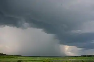
Def. a "storm consisting of thunder and lightning produced by a cumulonimbus, usually accompanied with rain and sometimes hail, sleet, freezing rain, or snow"[63] is called a thunderstorm.
"Thunderstorms are small, intense weather systems that make strong winds, heavy rain, lightning, and thunder."[64]
"Sudden flash floods that happen because of heavy rains is the biggest reason for weather-related deaths."[64]
"Plants receive lots of life-giving rain when they need it."[64]
"Clouds give us shades, and rain can cool down a hot day.[65]"[64]
"Rain from thunderstorms washes away many of these pollutants out of the air.[65]"[64]
Theoretical hydrometeors
Def. "precipitation products of the condensation of atmospheric water vapour"[66] are called hydrometeors.
"Condensation or sublimation of atmospheric water vapor produces a hydrometeor. It forms in the free atmosphere, or at the earth's surface, and includes frozen water lifted by the wind. Hydrometeors which can cause a surface visibility reduction, generally fall into one of the following two categories:
- Precipitation. Precipitation includes all forms of water particles, both liquid and solid, which fall from the atmosphere and reach the ground; these include: liquid precipitation (drizzle and rain), freezing precipitation (freezing drizzle and freezing rain), and solid (frozen) precipitation (ice pellets, hail, snow, snow pellets, snow grains, and ice crystals).
- Suspended (Liquid or Solid) Water Particles. Liquid or solid water particles that form and remain suspended in the air (damp haze, cloud, fog, ice fog, and mist), as well as liquid or solid water particles that are lifted by the wind from the earth’s surface (drifting snow, blowing snow, blowing spray) cause restrictions to visibility. One of the more unusual causes of reduced visibility due to suspended water/ice particles is whiteout, while the most common cause is fog."[67]
Radars

On the right, the Quill satellite radar image is shown of the flooded Eel River outflow current debris field in gray.
"Colored content is USGS-derived base map. Gray overlay is derived from a "Quill" satellite radar image made during the December 1964 flooding of California's Eel River. Accurate registration of the overlay onto the map is demonstrated by the excellent match of the stream-valley features in each."[68]
Ocean gyres
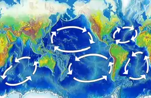
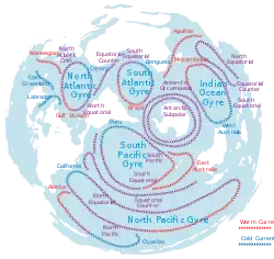
In oceanography, a gyre is any large system of circulating ocean currents, particularly those involved with large wind movements. Gyres are caused by the Coriolis effect; planetary vorticity along with horizontal and vertical friction, determine the circulation patterns from the wind stress curl (torque).[69]
North Pacific Gyre
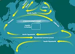
It is the largest ecosystem on Earth, located between the equator and 50° N latitude, and comprising 20 million square kilometers.[70]
The North Pacific Subtropical Gyre and the much smaller North Pacific Subpolar Gyre make up the two major gyre systems in the mid-latitudes of the Northern Pacific Ocean driven by the Trade winds and westerly winds.[71] Physical characteristics like weak thermohaline circulation in the North Pacific and it is mostly blocked by land in the north, also help facilitate this circulation. As depth increases, these gyres in the North Pacific grow smaller and weaker, and the high pressure at the center of the Subtropical Gyre will migrate poleward and westward.[71]
The North Pacific Subtropical Gyre is an anticyclone meaning the circulation is in a clockwise direction around its high pressure at the center because of its placement in the Northern Hemisphere. This circulation is also associated with equatorward Sverdrup transport and Ekman downwelling.[71] Ekman transport causes water to flow toward the center of the gyre, creating a sloped sea-surface, and initiating geostrophic flow. Harald Sverdrup applied Ekman transport while including pressure gradient forces to develop a theory for Sverdrup transport.[72]
North Atlantic Current
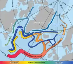
The North Atlantic Current (NAC), also known as North Atlantic Drift and North Atlantic Sea Movement, is a powerful warm western boundary current within the Atlantic Ocean that extends the Gulf Stream northeastward.[73]
It reaches speeds of 2 knots near the North American coast, directed by topography, the NAC meanders heavily, but in contrast to the meanders of the Gulf Stream, the NAC meanders remain stable without breaking off into eddies.[73]
As the warmer branch turns southward, most of the subtropical component of the Gulf Stream is diverted southward, and as a consequence, the North Atlantic is mostly supplied by subpolar waters, including a contribution from the Labrador Current recirculated into the NAC at 45°N.[74]
The principal cause for differences in winter climate between North America and Europe seems to be winds rather than ocean currents (although the currents do exert influence at very high latitudes by preventing the formation of sea ice).[75]
Gulf Stream
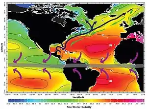
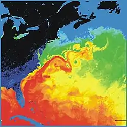
The Gulf Stream proper is a western-intensified current, driven largely by wind stress.[76] The North Atlantic Drift, in contrast, is largely thermohaline circulation–driven.
"[V]ery little water from the Gulf of Mexico is actually in the Stream".[77] By carrying warm water northeast across the Atlantic, it makes Western and especially Northern Europe warmer than it otherwise would be.[78]
The Antilles Current, flows north and east of the West Indies.[79]
The trade winds blow westward in the tropics,[80] and the westerlies blow eastward at mid-latitudes.[81] This wind pattern applies a stress to the subtropical ocean surface with negative curl across the north Atlantic Ocean.[82] The resulting Sverdrup transport is equatorward.[83]
Because of conservation of potential vorticity caused by the northward-moving winds on the subtropical ridge's western periphery and the increased relative vorticity of northward moving water, transport is balanced by a narrow, accelerating poleward current. This flows along the western boundary of the ocean basin, outweighing the effects of friction with the western boundary current, and is known as the Labrador current.[84] The conservation of potential vorticity also causes bends along the Gulf Stream, which occasionally break off due to a shift in the Gulf Stream's position, forming separate warm and cold eddies.[85] This overall process, known as western intensification, causes currents on the western boundary of an ocean basin, such as the Gulf Stream, to be stronger than those on the eastern boundary.[86]
As a consequence, the resulting Gulf Stream is a strong ocean current. It transports water at a rate of 30 million cubic meters per second (30 sverdrups) through the Florida Straits. As it passes south of Newfoundland, this rate increases to 150 million cubic metres per second.[87] The volume of the Gulf Stream dwarfs all rivers that empty into the Atlantic combined, which barely total 0.6 million cubic metres per second. It is weaker, however, than the Antarctic Circumpolar Current.[88] Given the strength and proximity of the Gulf Stream, beaches along the East Coast of the United States may be more vulnerable to large sea-level anomalies, which significantly impact rates of coastal erosion.[89]
The current velocity is fastest near the surface, with the maximum speed typically about 2.5 metres per second (5.6 mph).[90] As it travels north, the warm water transported by the Gulf Stream undergoes evaporative cooling. The cooling is wind-driven: Wind moving over the water causes evaporation, cooling the water and increasing its salinity and density. When sea ice forms, salts are left out of the ice, a process known as brine exclusion.[91] These two processes produce water that is denser and colder (or, more precisely, water that is still liquid at a lower temperature). In the North Atlantic Ocean, the water becomes so dense that it begins to sink down through less salty and less dense water. (The convective action is not unlike that of a lava lamp.) This downdraft of cold, dense water becomes a part of the North Atlantic Deep Water, a southgoing stream.[92] Very little seaweed lies within the current, although seaweed lies in clusters to its east.[93]
Azores current
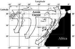
The diagram on the right shows the Azores current as it is deflected by the islands from the Gulf stream about 2014.
Mauritanian continental shelves

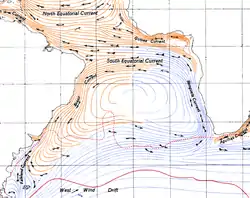

red = warm, blue = cold. Credit: Avsa.
The "sedimentary processes along the shelf are driven by long-term factors such as Quaternary glacial–interglacial periods and shelf morphology, and by short-term factors such as fluvial and aeolian sediment supply, local climate (temperature, rainfall and wind) and hydrodynamic conditions (tides, swell, longshore current, the Canary Current and upwelling)."[94]
The South Atlantic Gyre is the subtropical gyre in the south Atlantic Ocean. In the southern portion of the gyre, northwesterly (or southeastward-flowing) winds drive eastward-flowing currents that are difficult to distinguish from the northern boundary of the Antarctic Circumpolar Current.[95] Like other oceanic gyres, it collects vast amounts of floating debris.[96]
South of this gyre is the Antarctic Circumpolar Current which flows from West to East around Antarctica. Another name for this current is the West Wind Drift. This current allows Antarctica to maintain its huge ice sheet by keeping warm ocean waters away. At approximately 125 Sverdrup (Sv), this current is the largest ocean current.[97]
The Brazil Current is the western boundary current of the gyre that flows south along the Brazilian coast to the Rio de la Plata. The current is considerably weaker than its North Atlantic counterpart, the Gulf Stream.[98]
The Brazil Current begins at about 10-15˚S where the South Equatorial Current (SEC) splits near Cabo de São Roque, Brazil.[99] The current reaches a depth of 700m and the estimated transport at 12˚S is 2.5 Sv.[100]
The total transport can be from 70-80 Sv by 36˚S with half of it being in the recirculation gyre.[101]
The southern flowing waters become the Brazil Current which makes up the western boundary.[100] It joins the Falkland Current (Malvinas Current) at the Argentine Sea (see Brazil–Falkland Confluence), making it a temperate sea.[102] The Brazil-Falkland Confluence is where the Brazil Current begins to separate from the coast at about 36˚S and is when the saltier subtropical water of the Brazil Current meets the fresher subantarctic water of the Falkland Current.[100][103] The main transport of the current leaves the continental shelf at about 38˚S and the sea surface temperature at this latitude is estimated to be about 16-18˚C.[100][104] Although the latitude where the current separates from the coast has been thought to be farther north from July to September than from January to March.[105] If the Falkland Current has low transport then the path of the Brazil Current is dominated by wind stress curl. However, if the Falkland Current transport is increased then the Brazil Current separates from the coast at the observed 38˚S latitude.[106] The range of sea surface temperature and the salinity for the Brazil-Falkland Confluence is 7-18˚C and 33.6-36 psu.[103] The Brazil Current region also contains six major water masses within the system: Upper Circumpolar Water (UCPW), Lower Circumpolar Water (LCPW), Central Water (CW), Antarctic Intermediate Water (AAIW), Antarctic Bottom Water (AABW), and North Atlantic Deep Water (NADW).[101]
Southern oceans
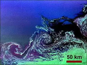
The geomorphology that composes the bottom form of the Southern Ocean is shown on the left.
"The [image on the right] shows two large ocean circulation features, called eddies, at the northernmost edge of the sea ice pack in the Weddell Sea, off Antarctica. The eddy processes in this region play an important role in the circulation of the global ocean and the transportation of heat toward the pole. The ... image is the first wide-swath, multi-frequency, multi-polarization radar image ever processed. To date, no other spaceborne radar sensors have obtained swaths exceeding 100 kilometers (62 miles) in width."[107]
"The image is oriented approximately east-west, with a center location of around 56.6 degrees south latitude and 6.5 degrees west longitude. Image dimensions are 240 km by 350 km (149 miles by 218 miles)."[107]
"The ocean eddies have a clockwise (or cyclonic) rotation and are roughly 40 km to 60 km (25 miles to 37 miles) in diameter. The dark areas are new ice and the lighter green areas are small sea-ice floes that are swept along by surface currents; both of these areas are shown within the eddies and to the south of the eddies. First year seasonal ice, typically 0.5 meter to 0.8 meter (1.5 feet to 2.5 feet) thick, is shown in the darker green area in the lower right corner. The open ocean to the north is uniformly bright and appears blue, due to high winds making the surface rough. The colors in both images were obtained using the following radar channels: red is C-band vertically transmitted and vertically received; green is L-band horizontally transmitted and vertically received; and blue is L-band vertically transmitted and vertically received."[107]
East Madagascar Current
The mean speed of the East Madagascar Current varies between 0.2–0–9 m/s (0.66–0.00–29.53 ft/s) with a peak in spring and the lowest point in summer.[108] It creates a high-pressure area and affects the Indian Monsoon.[109]
The East Madagascar Current is intense and narrow and retroflects into the central Indian Ocean south of Madagascar similarly to the Agulhas Current south of South Africa.[110]
Sea levels
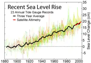
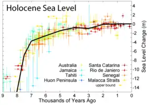
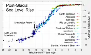
Mean sea level (MSL) is a measure of the average height of the ocean's surface (such as the halfway point between the mean high tide and the mean low tide); used as a standard in reckoning land elevation.[111] MSL also plays an extremely important role in aviation, where standard sea level pressure is used as the measurement datum of altitude at flight levels.
The upper figure at right shows the change in annually averaged sea level at 23 geologically stable tide gauge sites with long-term records as selected by Douglas (1997). The thick dark line is a three-year moving average of the instrumental records. This data indicates a sea level rise of ~27.5 cm from 1800-2000. Because of the limited geographic coverage of these records, it is not obvious whether the apparent decadal fluctuations represent true variations in global sea level or merely variations across regions that are not resolved.
For comparison, the recent annually averaged satellite altimetry data [1] from TOPEX/Poseidon are shown in red. These data indicate a somewhat higher rate of increase than tide gauge data, however the source of this discrepancy is not obvious. It may represent systematic error in the satellite record and/or incomplete geographic sampling in the tide gauge record. The month to month scatter on the satellite measurements is roughly the thickness of the plotted red curve.
The second figure at the right shows changes in sea level during the Holocene, the time following the end of the most recent glacial period, based on data from Fleming et al. 1998, Fleming 2000, & Milne et al. 2005. These papers collected data from various reports and adjusted them for subsequent vertical geologic motions, primarily those associated with post-glacial continental and hydroisostatic rebound. The first refers to deformations caused by the weight of continental ice sheets pressing down on the land, the latter refers to uplift in coastal areas resulting from the increased weight of water associated with rising sea levels. It should be noted that because of the latter effect and associated uplift, many islands, especially in the Pacific, exhibited higher local sea levels in the mid Holocene than they do today. Uncertainty about the magnitude of these corrections is the dominant uncertainty in many measurements of Holocene scale sea level change.
The black curve is based on minimizing the sum of squares error weighted distance between this curve and the plotted data. It was constructed by adjusting a number of specified tie points, typically placed every 1 kyr and forced to go to 0 at the modern day. A small number of extreme outliers were dropped. It should be noted that some authors propose the existence of significant short-term fluctuations in sea level such that the sea level curve might oscillate up and down about this ~1 kyr mean state. Others dispute this and argue that sea level change has been a smooth and gradual process for essentially the entire length of the Holocene. Regardless of such putative fluctuations, evidence such as presented by Morhange et al. (2001) suggests that in the last 10 kyr sea level has never been higher than it is at present.
The lower figure shows sea level rise since the end of the last glacial episode based on data from Fleming et al. 1998, Fleming 2000, & Milne et al. 2005.
At least one episode of rapid deglaciation, known as meltwater pulse 1A, is agreed upon and indicated on the plot. A variety of other accelerated periods of deglaciation have been proposed (i.e. MWP-1B, 2, 3, 4), but it is unclear if these actually occurred or merely reflect misinterpretation of difficult measurements. No other events are evident in the data presented above.
The lowest point of sea level during the last glaciation is not well constrained by observations (shown here as a dashed curve), but is generally argued to be approximately 130 +/- 10 m below present sea level and to have occurred at approximately 22 +/- 3 thousand years ago. The time of lowest sea level is more or less equivalent to the last glacial maximum. Prior to this time, ice sheets were still increasing in size so that sea level was decreasing almost continuously over a period of approximately 100,000 years.
Bays

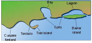
Def. a body of water more or less three-quarters surrounded by land is called a bay.
Fjords
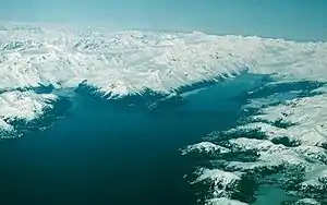
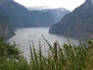
A fjord is usually understood to be a "glacial valley that has been invaded by the sea. A fjord generally has a U-shaped profile with deep water near shore. The two fjords in this picture [on the right] are Barry Arm on the left and College Fiord on the right, in Prince William Sound, Alaska."[112]
Def. a long, narrow, deep inlet between cliffs is called a fjord.
Gulfs
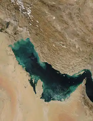
Def. a deep inlet of the sea almost surrounded by land, with a narrow mouth is called a gulf.
Def. a portion of an ocean or sea extending into the land; a partially landlocked sea is called a gulf.
Straits
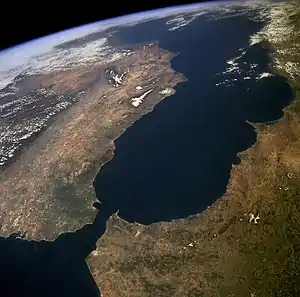
Def. a narrow channel of water connecting two larger bodies of water is called a strait.
"The Atlantic Ocean, Straits of Gibraltar, and Alboran Sea (the westernmost portion of the Mediterranean Sea) separate Spain on the [top] from Morocco on the [bottom]. Algeciras Harbor is the prominent notch cut out of the eastern end of the north shore of the Strait; the Rock of Gibraltar is the tiny arrowhead that separates the notch from the Alboran Sea. The Sierra Nevada, farther away down the Spanish coast, lives up to its name in this April scene. The difference in elevation between the Sierra Morena and the Guadalquivir River valley is highlighted nicely by cumulus clouds. Tangier, Morocco can be seen as a light-toned spot on the southern shore of the Strait, near the entrance to the Atlantic Ocean."[113]
Channels
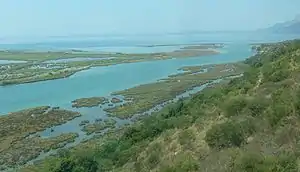
Def.
- a natural deeper course through a reef, bar, bay, or any shallow body of water,
- a navigable part of a river, or
- a narrow body of water between two land masses is called a channel.
Estuaries
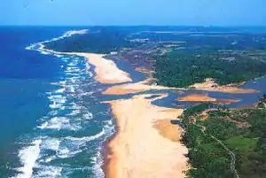
Def. coastal water body where ocean tides and river water merge or an ocean inlet also fed by fresh river water is called an estuary.
Great Lakes
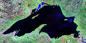
"Of all the world's freshwater lakes, North America's Great Lakes are unique. Their five basins combine to form a single watershed with one common outlet to the ocean. The total volume of the lakes is about 5,475 cubic miles, more than 6,000 trillion gallons."[114]
"The Huron Lobe and the Michigan Lobe are at the same elevation and are connected by the 120-foot-deep Mackinac Strait, also at the same elevation. Lakes are separated from each other by streams and rivers. The Strait of Mackinac is not a river. It is 3.6 to 5 miles wide, wider than most lakes are long. In essence, it is just a narrowing, not a separation of the two lobes of Lake Michigan-Huron."[114]
"The flow between the two lakes can reverse. Because of the large connecting channel, the two can equalize rapidly whenever a water level imbalance occurs. Gauge records for the lakes clearly show them to have identical water level regimes and mean long-term behavior; that is, they are hydrologically considered to be one lake."[114]
"The Great Lakes are Superior, with an area of 31,820 square miles (82,414 km) shared by the United States and Canada; Huron, with an area of 23,010 square miles (59,596 sq. km) shared by the United States and Canada; Michigan, with an area of 22,400 square miles (58,016 sq. km) entirely in the United States; Erie, with an area of 9,930 square miles (25,719 km) shared by the United States and Canada; and Ontario, with an area of 7,520 square miles (19,477 km) shared by the United States and Canada."[114]
Rivers
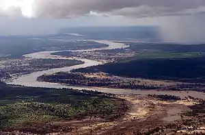

Def. a large and often winding stream which drains a land mass, carrying water down from higher areas to a lower point, ending at an ocean or in an inland sea is called a river.
Meanders
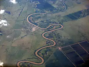
Def. a winding, crooked, or involved course or a tortuous or intricate movement of water as a stream or river is called a meander.
Rapids
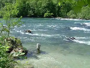
Def. a rough section of a river or stream which is difficult to navigate due to the swift and turbulent motion of the water is called a rapid.
On the right are rapids featuring white water before the Rhine Falls.
Waterfalls
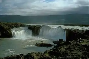
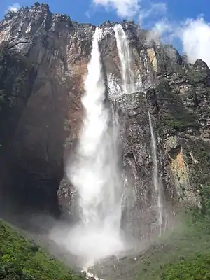
Def. a flow of water over the edge of a cliff is called a waterfall.
Angel Falls in the image on the left is the world's tallest at 979 m.
Mouths
Def. the end of a river out of which water flows into a sea or other large body of water is called the mouth.
Kolks
Def. an underwater vortex similar to a whirlwind that is capable of dislodging, picking up, and moving boulders is called a kolk.
Meltwaters
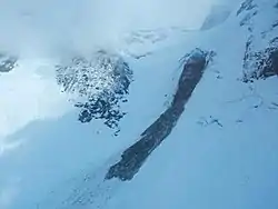
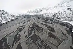
"On a summit flight, we were able to see the source of the meltwater stream. It appears to starts to the right of the dome where a fall face can be seen and continues down."[115]
The image on the left shows flooding some 7.6 m deep caused by the melting of Drift Glacier.
Lavas
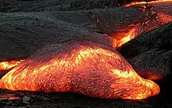
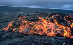
Def. melted rock ejected by a volcano from its crater or fissured sides is called a lava.
Usage notes
Geologists make a distinction between magma (molten rock underground) and lava (molten rock on the surface).
Def. molten matter within the earth, the source of the material of lava flows, dikes of eruptive rocks, etc is called a magma.
"Streams of molten rock that ooze from gaps or vents in the Earth’s surface are called lava flows. Though generally slow-moving, these rivers of rock pose a hazard to everything in their paths. They can bury or burn homes and roads, ruin farmland for generations, and transform glaciers into muddy landslides (lahars)."[116]
"Lava flows can take many shapes and move at very different rates depending on the viscosity of the magma, the slope of the land, and the rate of an eruption. Some of the speediest flows travel 60 kilometers (40 miles) per hour; the slowest creep along at less than 1 kilometer (0.6 miles) per hour. They can sometimes even flow for more than a year after an eruption has ended."[116]
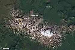
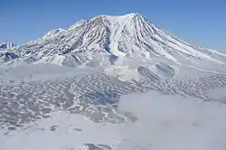
"While viscous lava flows are defined by steep flow fronts and pressure ridges, low-viscosity lavas tend to move faster and create longer, narrower shapes. They also tend to have smaller flow fronts and levee-like structure along their edges. Many characteristics of a low-viscosity lava flow are visible in [the image on the right second down] of Zhupanovsky and Dzenzursky volcanoes on Russia’s Kamchatka Peninsula. The image was acquired by the Operational Land Imager (OLI) on the Landsat 8 satellite on September 9, 2013."[117]
"In the image, younger lava flows appear grey, while older flows are covered by green vegetation. The exact ages of the flows are unclear, but the eruptions that produced them likely occurred during the past few thousand years. Distinctive lava levees are visible along the edges of many of the younger flows. These features form as lava cools and hardens along the edges or top of a flow while the center of a flow still advances."[117]
"In comparison to the Chao dacite in Chile (the product of viscous lava), the flows at Zhupanovsky [at lowest right] and Dzenzursky are much narrower and longer. They have smaller flow fronts (10 to 30 meters tall) in comparison to the sheer 400-meter cliffs at Chao, as well as more prominent lava levees along the edges. Like Chao, the flows shown above have pressure ridges caused by the compression of the cooling top of the lava as the flow advanced."[117]
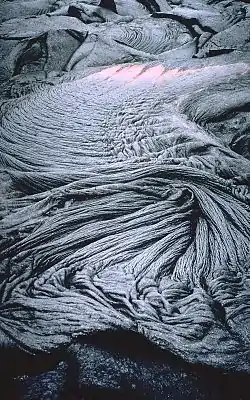
Def. a form of lava flow of basaltic rock, usually dark-colored with a smooth or ropey surface is called pahoehoe.
"Ropy pahoehoe [shown in the fourth image down on the right, taken 11 June 1995] is the most common surface texture of pahoehoe flows. The numerous folds and wrinkles ("ropes") that are characteristic of ropy pahoehoe form when the thin, partially solidified crust of a flow is slowed or halted (for example, if the crust encounters an obstruction or slower-moving crust). Because lava beneath the crust continues to move forward, it tends to drag the crust along. The crust then behaves like an accordian that is squeezed together--the crust is flexible enough to develop wrinkles or a series of small ridges and troughs as it is compressed and driven forward."[118]
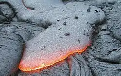
Def. a form of lava flow [shown on the right, fifth image down] consisting of basaltic rock, usually dark-colored with a jagged and loose, clinkery surface is called an aa.
"`A`a (pronounced "ah-ah") is a Hawaiian term for lava flows that have a rough rubbly surface composed of broken lava blocks called clinkers. The incredibly spiny surface of a solidified `a`a flow makes walking very difficult and slow. The clinkery surface actually covers a massive dense core, which is the most active part of the flow. As pasty lava in the core travels downslope, the clinkers are carried along at the surface. At the leading edge of an `a`a flow, however, these cooled fragments tumble down the steep front and are buried by the advancing flow. This produces a layer of lava fragments both at the bottom and top of an `a`a flow."[119]
Geysers
{{free media}}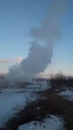
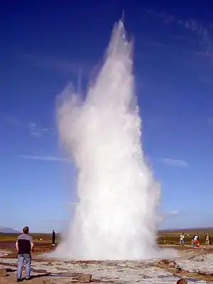
{{free media}}Def. a "boiling [natural] spring which throws forth at frequent intervals jets of water, mud etc., driven up by the expansive power of steam"[120] is called a geyser.
Castle Geyser

{{free media}}
{{free media}}Castle Geyser is a cone geyser in the Upper Geyser Basin of Yellowstone National Park noted for the particularly large geyserite sinter deposits, which form its cone that have been likened in appearance to a castle.[121]
On September 18, 1870, the Washburn-Langford-Doane Expedition entered the Upper Geyser Basin, where members of the expedition named seven geysers they observed in the basin and the appearance of this geyser led Lieutenant Gustavus Cheyney Doane to name it Castle Geyser.[122]
"The Castle," situated on the summit of an incrusted mound, has a turreted crater through which a large volume of water is expelled at intervals of two or three hours to the height of 50 feet (15 m), from a discharging orifice about 3 ft (0.91 m) in diameter. The architectural features of the silicious sinter surrounding it, which is very massive and compact, indicating that at some former period the flow of water must have been much greater than at present, suggested its name. A vent near it is constantly discharging a large stream of boiling water, and when the geyser is in action the water in this vent boils and bubbles with great fierceness."[123]
The Castle Geyser has a 10- to 12-hour eruption cycle. The geyser erupts hot water for about 20 minutes in a vertical column that reaches a height of 90 ft (27 m) before changing to a noisy steam phase that issues for 30 to 40 minutes.[124]
The sinter cone for Castle Geyser has been dated to around 1022 using carbon-14 dating rather than the much younger than the originally-presumed age of 5,000 to 15,000 years, where a 3-D laser scan made of the cone reveals evidence that this geyser has evolved through four to five distinct stages to reach its current configuration.[125]
In November 2002, the Denali earthquake in Denali National Park and Preserve, Alaska caused Castle Geyser, as well as other geysers in Yellowstone, to decrease in eruption frequency.[126]
Venus
Sulfuric acid rain in the atmosphere of Venus evaporates before reaching the ground due to the high heat near the surface.[127]
Mars
In September 2008, NASA's Phoenix lander discovered a snow variety of virga falling from Martian clouds.[128]
Titan
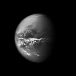
"As spring continues to unfold at Saturn, April showers on the planet's largest moon, Titan, have brought methane rain to its equatorial deserts ... Extensive rain from large cloud systems ... has apparently darkened the surface of the moon."[129]
“It's amazing to be watching such familiar activity as rainstorms and seasonal changes in weather patterns on a distant, icy satellite".[130]
"Clouds on Titan are formed of methane as part of an Earth-like cycle that uses methane instead of water. On Titan, methane fills lakes on the surface, saturates clouds in the atmosphere, and falls as rain. Though there is evidence that liquids have flowed on the surface at Titan's equator in the past, liquid hydrocarbons, such as methane and ethane, had only been observed on the surface in lakes at polar latitudes. The vast expanses of dunes that dominate Titan's equatorial regions require a predominantly arid climate."[129]
"An arrow-shaped storm appeared in the equatorial regions on Sept. 27, 2010 -- the equivalent of early April in Titan's “year” -- and a broad band of clouds appeared the next month. ... A 193,000-square-mile (500,000-square-kilometer) region along the southern boundary of Titan’s Belet dune field, as well as smaller areas nearby, had become darker. ... this change in brightness is most likely the result of surface wetting by methane rain."[129]
“These outbreaks may be the Titan equivalent of what creates Earth's tropical rainforest climates, even though the delayed reaction to the change of seasons and the apparently sudden shift is more reminiscent of Earth's behavior over the tropical oceans than over tropical land areas”.[131]
At right is an image that shows clouds over the equatorial region of Titan.
"Methane clouds in the troposphere, the lowest part of the atmosphere, appear white here and are mostly near Titan's equator. The darkest areas are surface features that have a low albedo, meaning they do not reflect much light. Cassini observations of clouds like these provide evidence of a seasonal shift of Titan's weather systems to low latitudes following the August 2009 equinox in the Saturnian system. (During equinox, the sun lies directly over the equator. See PIA11667 to learn how the sun's illumination of the Saturnian system changed during the equinox transition to spring in the northern hemispheres and to fall in the southern hemispheres of the planet and its moons.)"[132]
"In 2004, during Titan's late southern summer, extensive cloud systems were common in Titan's south polar region (see PIA06110, PIA06124 and PIA06241). Since 2005, southern polar systems have been observed infrequently, and one year after the equinox, extensive near-equatorial clouds have been seen. This image was taken on Oct. 18, 2010, a little more than one Earth year after the Saturnian equinox, which happens once in roughly 15 Earth years."[132]
"The cloud patterns observed from late southern summer to early southern fall on Titan suggest that Titan's global atmospheric circulation is influenced by both the atmosphere and the surface. The temperature of the surface responds more rapidly to changes in illumination than does the thick atmosphere. Outbreaks such as the clouds seen here may be the Titan equivalent of what creates the Earth's tropical rainforest climates, even though the delayed reaction to the change of seasons and the apparently sudden shift is more reminiscent of the behavior over Earth's tropical oceans than over tropical land areas."[132]
The climate—including wind and rain—creates surface features similar to those of Earth, such as sand dunes, rivers, lakes and seas (probably of liquid methane and ethane), and deltas, and is dominated by seasonal weather patterns as on Earth. With its liquids (both surface and subsurface) and robust nitrogen atmosphere, Titan's methane cycle is viewed as an analog to Earth's water cycle, although at a much lower temperature.
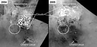
"These mosaics [at second right] of the south pole of Saturn's moon Titan, made from images taken almost one year apart, show changes in dark areas that may be lakes filled by seasonal rains of liquid hydrocarbons."[133]
"The images on the left (unlabeled at top and labeled at bottom) were acquired July 3, 2004. Those on the right were taken June 6, 2005. In the 2005 images, new dark areas are visible and have been circled in the labeled version. The very bright features are clouds in the lower atmosphere (the troposphere). Titan's clouds behave similarly to those on Earth, changing rapidly on timescales of hours and appearing in different places from day to day. During the year that elapsed between these two observations, clouds were frequently observed at Titan's south pole by observers on Earth and by Cassini's imaging science subsystem (see PIA06124)."[133]
"It is likely that rain from a large storm created the new dark areas that were observed in June 2005. Some features, such as Ontario Lacus, show differences in brightness between the two observations that are the result of differences in illumination between the two observations. These mosaics use images taken in infrared light at a wavelength of 938 nanometers. The images have been oriented with the south pole in the center (black cross) and the 0 degree meridian toward the top. Image resolutions are several kilometers (several miles) per pixel."[133]
"Evidence from Cassini's imaging science subsystem, radar, and visual and infrared mapping spectrometer instruments strongly suggests that dark areas near the poles are lakes of liquid hydrocarbons-an analysis affirmed by images capturing those changes in the lakes thought to be brought on by rainfall."[134]
Climatology

Climatology "is the study of climate, scientifically defined as weather conditions averaged over a period of time,[135] and is a branch of the atmospheric sciences.
Climate encompasses the statistics of temperature, humidity, atmospheric pressure, wind, rainfall, atmospheric particle count and numerous other meteorological elements in a given region over long periods of time.
Oceanography
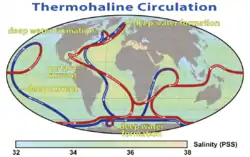
Oceanography, also called oceanology or marine science, studies the ocean. It covers a wide range of topics, including marine organisms and ecosystem dynamics; ocean currents, waves, and geophysical fluid dynamics; plate tectonics and the geology of the sea floor; and fluxes of various chemical substances and physical properties within the ocean and across its boundaries.
Rain gauges

Rain is measured in units of length per unit time, typically in millimeters per hour, [136] or in countries where imperial units are more common, inches per hour.[137] The "length", or more accurately, "depth" being measured is the depth of rain water that would accumulate on a flat, horizontal and impermeable surface during a given amount of time, typically an hour.[138] One millimeter of rainfall is the equivalent of one liter of water per square meter.[139]
The standard way of measuring rainfall or snowfall is the standard rain gauge, which can be found in 100-mm (4-in) plastic and 200-mm (8-in) metal varieties.[140] The inner cylinder is filled by 25 mm (0.98 in) of rain, with overflow flowing into the outer cylinder. Plastic gauges have markings on the inner cylinder down to 0.25 mm (0.0098 in) resolution, while metal gauges require use of a stick designed with the appropriate 0.25 mm (0.0098 in) markings. After the inner cylinder is filled, the amount inside it is discarded, then filled with the remaining rainfall in the outer cylinder until all the fluid in the outer cylinder is gone, adding to the overall total until the outer cylinder is empty.[141]
Technology

"Precipitation detection (PD) is often, but not always, regarded as the first essential step in the estimation of precipitation from remote sensing platforms. The basic purpose of detection is two-fold:
- To make an initial determination of which sensor pixels may contain precipitation, so that a more sophisticated rain rate retrieval algorithm may be brought to bear on those pixels while avoiding unnecessary computational effort elsewhere.
- To prevent the retrieval algorithm from attempting retrievals in situations where it is likely give spurious false-positives; e.g., due to problem background types.
"Launched by NASA and JAXA in 1997, [the Tropical Rainfall Measuring Mission] TRMM carries the first on-orbit active/passive instrument package to study the intensity and structure of tropical rainfall."[142]
"An international satellite mission to be launched by NASA and JAXA in 2014 that will set new standards for precipitation measurements worldwide using a network of satellites united by the [Global Precipitation Measurement] GPM Core Observatory."[142]
"The Global Precipitation Measurement (GPM) mission is an international network of satellites [shown in the image at right] that provide the next-generation global observations of rain and snow. Building upon the success of the Tropical Rainfall Measuring Mission (TRMM), the GPM concept centers on the deployment of a “Core” satellite carrying an advanced radar / radiometer system to measure precipitation from space and serve as a reference standard to unify precipitation measurements from a constellation of research and operational satellites. Through improved measurements of precipitation globally, the GPM mission will help to advance our understanding of Earth's water and energy cycle, improve forecasting of extreme events that cause natural hazards and disasters, and extend current capabilities in using accurate and timely information of precipitation to directly benefit society. GPM, initiated by NASA and the Japan Aerospace Exploration Agency (JAXA) as a global successor to TRMM, comprises a consortium of international space agencies, including the Centre National d’Études Spatiales (CNES), the Indian Space Research Organization (ISRO), the National Oceanic and Atmospheric Administration (NOAA), the European Organization for the Exploitation of Meteorological Satellites (EUMETSAT), and others. The GPM Core Observatory is scheduled for launch in early 2014."[142]
See also
References
- ↑ "precipitation". San Francisco, California: Wikimedia Foundation, Inc. February 10, 2013. Retrieved 2013-02-15.
- ↑ Karger, Dirk Nikolaus (2016-07-01). "Climatologies at high resolution for the Earth land surface areas". Scientific Data 4: 170122. doi:10.1038/sdata.2017.122. PMID 28872642. PMC 5584396. //www.ncbi.nlm.nih.gov/pmc/articles/PMC5584396/.
- ↑ Scott Sistek (December 26, 2015). "What's the difference between 'rain' and 'showers'?". KOMO-TV. Retrieved January 18, 2016.
- ↑ Adler, Robert F. (December 2003). "The Version-2 Global Precipitation Climatology Project (GPCP) Monthly Precipitation Analysis (1979–Present)". Journal of Hydrometeorology 4 (6): 1147–1167. doi:10.1175/1525-7541(2003)004<1147:TVGPCP>2.0.CO;2.
- ↑ Chowdhury's Guide to Planet Earth (2005). "The Water Cycle". WestEd. Retrieved 2006-10-24.
- ↑ Emmanouil N. Anagnostou (2004). "A convective/stratiform precipitation classification algorithm for volume scanning weather radar observations". Meteorological Applications 11 (4): 291–300. doi:10.1017/S1350482704001409.
- ↑ A.J. Dore; M. Mousavi-Baygi; R.I. Smith; J. Hall; D. Fowler; T.W. Choularton (June 2006). "A model of annual orographic precipitation and acid deposition and its application to Snowdonia". Atmospheric Environment 40 (18): 3316–3326. doi:10.1016/j.atmosenv.2006.01.043.
- ↑ Robert Penrose Pearce (2002). Meteorology at the Millennium. Academic Press. p. 66. ISBN 978-0-12-548035-2.
- ↑ Robert A. Houze, Jr. (1994). Cloud Dynamics. Academic Press. p. 348. ISBN 978-0-08-050210-6.
- ↑ Jan Jackson (2008). "All About Mixed Winter Precipitation". National Weather Service. Retrieved 2009-02-07.
- ↑ Jane Beitler (September 2014). Cryosphere Glossary. National Snow and Ice Data Center. Retrieved 2014-09-19.
- ↑ Glossary of Meteorology. American Meteorological Society. 2000. ISBN 1-878220-34-9. Archived from the original on 2011-06-06.
- ↑ Dmh (12 September 2004). "mist". San Francisco, California: Wikimedia Foundation, Inc. Retrieved 4 July 2019.
- ↑ "Mist and Fog". Archived from the original on 2012-12-10. Retrieved 2006-01-16.
- ↑ "Driving in adverse weather conditions (226 to 237)". gov.uk. Government of the United Kingdom.
- ↑ "drizzle". San Francisco, California: Wikimedia Foundation, Inc. August 1, 2013. Retrieved 2013-08-04.
- ↑ National Weather Service Observing Handbook No. 8, Aviation Weather Observations for Supplementary Aviation Weather Reporting Stations (SAWRS), Manual Observations, October 1996
- ↑ Spence, Charles F. (2006). Aim/Far. McGraw Hill Professional. p. 294. ISBN 978-0-07-147924-0.
- ↑ Henson, Robert; Guides, Rough (2007). The Rough Guide to Weather. Penguin. p. 63. ISBN 978-1-4053-8461-2.
- ↑ 216.239.74.69 (4 August 2003). "rain". San Francisco, California: Wikimedia Foundation, Inc. Retrieved 4 July 2019.
- ↑ "rainfall". San Francisco, California: Wikimedia Foundation, Inc. July 31, 2013. Retrieved 2013-08-03.
- ↑ "The Water Cycle". Planetguide.net. Archived from the original on 2011-12-26. Retrieved 2011-12-26.
- ↑ Steve Kempler (2009). "Parameter information page". NASA Goddard Space Flight Center. Archived from the original on November 26, 2007. Retrieved 2008-12-27.
- ↑ Mark Stoelinga (2005-09-12). Atmospheric Thermodynamics (PDF). University of Washington. p. 80. Archived from the original (PDF) on 2010-06-02. Retrieved 2010-01-30.
- ↑ Glossary of Meteorology (June 2000). "Relative Humidity". American Meteorological Society. Archived from the original on 2011-07-07. Retrieved 2010-01-29.
- ↑ Glossary of Meteorology (June 2000). "Cloud". American Meteorological Society. Archived from the original on 2008-12-20. Retrieved 2010-01-29.
- ↑ Naval Meteorology and Oceanography Command (2007). "Atmospheric Moisture". United States Navy. Archived from the original on January 14, 2009. Retrieved 2008-12-27.
- ↑ Glossary of Meteorology (2009). Rainband. 2011-06-06 Retrieved on 2008-12-24.
- ↑ Glossary of Meteorology (2009). Banded structure. 2011-06-06 Retrieved on 2008-12-24.
- ↑ Owen Hertzman (1988). Three-Dimensional Kinematics of Rainbands in Midlatitude Cyclones. Retrieved on 2008-12-24
- ↑ Yuh-Lang Lin (2007). Mesoscale Dynamics. Cambridge University Press. p. 405. ISBN 978-0-521-80875-0.
- ↑ Glossary of Meteorology (2009). Prefrontal squall line. [url=https://web.archive.org/web/20070817224959/http://amsglossary.allenpress.com/glossary/search?id=prefrontal-squall-line1] 2007-08-17 Retrieved on 2008-12-24.
- ↑ J. D. Doyle (1997). The influence of mesoscale orography on a coastal jet and rainband. 2012-01-06 Retrieved on 2008-12-25.
- ↑ A. Rodin (1995). Interaction of a cold front with a sea-breeze front numerical simulations. 2011-09-09 Retrieved on 2008-12-25.
- ↑ Owen Hertzman (1988). Three-Dimensional Kinematics of Rainbands in Midlatitude Cyclones. Retrieved on 2008-12-24
- ↑ Yuh-Lang Lin (2007). Mesoscale Dynamics. Retrieved on 2008-12-25.
- ↑ Richard H. Grumm (2006). 16 November Narrow Frontal Rain band Floods and severe weather 2011-07-20 Retrieved on 2008-12-26.
- ↑ Glossary of Meteorology (2009). Prefrontal squall line. 2007-08-17 Retrieved on 2008-12-24.
- ↑ K. A. Browning and Robert J. Gurney (1999). Global Energy and Water Cycles. Retrieved on 2008-12-26.
- ↑ KELLY HEIDBREDER (2007). Mesoscale snow banding. Retrieved on 2008-12-24.
- ↑ David R. Novak, Lance F. Bosart, Daniel Keyser, and Jeff S. Waldstreicher (2002). A CLIMATOLOGICAL AND COMPOSITE STUDY OF COLD SEASON BANDED PRECIPITATION IN THE NORTHEAST UNITED STATES. Retrieved on 2008-12-26.
- ↑ B. Geerts (1998). "Lake Effect Snow". University of Wyoming. Retrieved 2008-12-24.
- ↑ A. J. Philip (2004-10-12). "Mawsynram in India" (PDF). Tribune News Service. Retrieved 2010-01-05.
- ↑ Bureau of Meteorology (2010). "Significant Weather – December 2000 (Rainfall)". Commonwealth of Australia. Retrieved 2010-01-15.
- ↑ Burt, Christopher (15 May 2012). "New Wettest Location for U.S.A. Discovered?". Wunderground. Weather Underground. Retrieved 30 August 2018.
"30-year mean precipitation at Big Bog for the POR of 1978-2007 is 404.4”.
- ↑ "MT WAIALEALE 1047, HAWAII (516565)". WRCC. NOAA. 1 August 2008. Retrieved 30 August 2018.
- ↑ Gentleman, Amelia; Robin McKie (2006-03-05). Red rain could prove that aliens have landed. London: Guardian Unlimited. Retrieved March 12, 2006.
- 1 2 JULY 28, 2001, The Hindu: Multicolour rain
- 1 2 3 4 5 6 7 Louis, G.; Kumar A.S. (2006). "The red rain phenomenon of Kerala and its possible extraterrestrial origin". Astrophysics and Space Science 302: 175. doi:10.1007/s10509-005-9025-4.
- 1 2 Ramakrishnan, Venkitesh (2001-07-30). "Colored rain falls on Kerala". BBC. Retrieved March 6, 2006.
- 1 2 3 Sampath, S.; Abraham, T. K., Sasi Kumar, V., & Mohanan, C.N. (2001). "Colored Rain: A Report on the Phenomenon" (PDF). Cess-Pr-114-2001 (Center for Earth Science Studies and Tropical Botanic Garden and Research Institute). Archived from the original on June 13, 2006. http://web.archive.org/web/20060613135746/http://www.geocities.com/iamgoddard/Sampath2001.pdf. Retrieved August 30, 2009.
- ↑ Red rain in India may have alien origin by Arshdeep Sarao, Epoch Times 6 August 2012
- ↑ Morning shower paints rural Kannur red. The Times of India. June 29, 2012. Retrieved 2012-07-20.
- ↑ Red Rain in Sri Lanka in 2012
- ↑
- ↑
- ↑ Chandra Wickramasinghe says yellow rain is young red rain before growth
- ↑ Radhakrishnan, M. G. (2001). Scarlets Of Fire. India Today. Archived from the original on December 26, 2004. Retrieved March 6, 2006.
- ↑ Mystery of the scarlet rains and other tales — Times of India, 6 August 2001
- ↑ Now wells form spontaneously in Kerala — Times of India, 5 August 2001 (from the Internet Archive)
- 1 2 Red rain was fungus, not meteor. Indian Express. August 6, 2001. Retrieved 2008-05-31.
- ↑ "cloud". San Francisco, California: Wikimedia Foundation, Inc. February 13, 2013. Retrieved 2013-02-18.
- ↑ thunderstorm. San Francisco, California: Wikimedia Foundation, Inc. June 30, 2013. Retrieved 2013-08-03.
- 1 2 3 4 5 Shustov (October 31, 2011). Thunderstorm. Retrieved 2013-08-03.
- 1 2 Michael Oard (1997). The Weather Book. Green Forest, AR: Master Books. ISBN 0-89051-211-6.
- ↑ SemperBlotto (19 September 2007). "hydrometeor". San Francisco, California: Wikimedia Foundation, Inc. Retrieved 2013-02-15.
- ↑ Mark R. Mireles; Kirth L. Pederson; Charles H. Elford (February 21, 2007). Meteorologial Techniques. Offutt Air Force Base, Nebraska, USA: Air Force Weather Agency/DNT. Retrieved 2013-02-17.
- ↑ oldteched (December 1964). "File:"Quill" satellite radar image of flooded Eel River outflow current.JPG". U. S. National Reconnaissance Office. Retrieved 2016-09-20.
- ↑ Heinemann, B. and the Open University (1998) Ocean circulation, Oxford University Press: Page 98
- ↑ Karl, David M. (1999). "A Sea of Change: Biogeochemical Variability in the North Pacific Subtropical Gyre". Ecosystems (Springer) 2: 181–214. doi:10.1007/s100219900068.
- 1 2 3 Talley, Lynne D.; Pickard, George L.; Emery, William J.; Swift, James H. (2011). Descriptive Physical Oceanography: An Introduction. London, UK: Academic Press. ISBN 0750645520.
- ↑ Pond, S.; Pickard, G. L. (1983). Introductory Dynamical Oceanography. Pergamon Press. ISBN 978-0-08-028728-7.
- 1 2 Rossby 1996, Abstract
- ↑ Lozier, Owens & Curry 1995, Circulation: Figs 10 and 11, pp. 20–22
- ↑ Seager et al. 2002, Abstract
- ↑ Wunsch, Carl (November 8, 2002). "What Is the Thermohaline Circulation?". Science 298 (5596): 1179–1181. doi:10.1126/science.1079329. PMID 12424356. http://www.sciencemag.org/cgi/content/summary/298/5596/1179. (see also Rahmstorf.)
- ↑ Henry Stommel. (1958). The Gulf Stream: A Physical and Dynamical Description. Berkeley: University of California Press. p.22
- ↑ Barbie Bischof; Arthur J. Mariano; Edward H. Ryan (2003). "The North Atlantic Drift Current". The National Oceanographic Partnership Program. Retrieved 2008-09-10.
- ↑ Elizabeth Rowe; Arthur J. Mariano; Edward H. Ryan. "The Antilles Current". Cooperative Institute for Marine and Atmospheric Studies. Retrieved 2009-01-06.
- ↑ Glossary of Meteorology (2009). "trade winds". Glossary of Meteorology. American Meteorological Society. Archived from the original on 2008-12-11. Retrieved 2008-09-08.
- ↑ Glossary of Meteorology (2009). Westerlies. 2010-06-22 American Meteorological Society. Retrieved on 2009-04-15.
- ↑ Matthias Tomczak and J. Stuart Godfrey (2001). Regional Oceanography: an Introduction. Matthias Tomczak, pp. 42. ISBN 81-7035-306-8. Retrieved on 2009-05-06.
- ↑ Earthguide (2007). Lesson 6: Unraveling the Gulf Stream Puzzle - On a Warm Current Running North. University of California at San Diego. Retrieved on 2009-05-06.
- ↑ Angela Colling (2001). Ocean Circulation. Butterworth-Heinemann. p. 96. ISBN 978-0-08-053794-8.
- ↑ Maurice L. Schwartz (2006). Encyclopedia of Coastal Science. Springer Science & Business Media. p. 1037. Bibcode:2006ecs..book.....S. ISBN 978-1-4020-3880-8.
- ↑ National Environmental Satellite, Data, and Information Service (2009). Investigating the Gulf Stream [url=https://web.archive.org/web/20100503013457/http://www.science-house.org/nesdis/gulf/background.html] 2010-05-03 North Carolina State University. Retrieved on 2009-05-06.
- ↑ Joanna Gyory; Arthur J. Mariano; Edward H. Ryan. "The Gulf Stream". Cooperative Institute for Marine and Atmospheric Studies. Retrieved 2009-01-06.
- ↑ Ryan Smith; Melicie Desflots; Sean White; Arthur J. Mariano; Edward H. Ryan. "The Antarctic CP Current". Cooperative Institute for Marine and Atmospheric Studies. Retrieved 2009-01-06.
- ↑ Theuerkauf, Ethan J., et al. "Sea level anomalies exacerbate beach erosion". Geophysical Research Letters 41.14 (2014): 5139–5147.
- ↑ Phillips, Pamela. "The Gulf Stream". USNA/Johns Hopkins. Retrieved 2007-08-02.
- ↑ Russel, Randy. "Thermohaline Ocean Circulation". University Corporation for Atmospheric Research. Retrieved 2009-01-06.
- ↑ Behl, R. "Atlantic Ocean water masses". California State University Long Beach. Archived from the original on May 23, 2008. Retrieved 2009-01-06.
- ↑ Edward Blunt; George William Blunt (1857). The American Coast Pilot. Edward and George William Blunt. Retrieved 2009-01-06.
- ↑ Nadia Mhammdi; Maria Snoussi; Fida Medina; El Bachir Jaaïdi (2014). "Recent sedimentation in the NW African shelf". Geological Society, London, Memoirs 41: 131-146. doi:10.1144/M41.10. https://www.researchgate.net/profile/Nadia_Mhammdi/publication/283944649_Mhammdietal2014GSL/links/564a459a08ae9cd9c826b186.pdf. Retrieved 2017-04-27.
- ↑ Guhin, S.; Ray, P.; Mariano, A. J.; Ryan, E. H. (2003). "The South Atlantic Current". Ocean Surface Currents. Retrieved 21 October 2009.
- ↑ "National Geographic Endeavour: At Sea, South Atlantic Gyre (March 18, 2004)". Daily Expedition Report. Lindblad Expeditions - National Geographic. Retrieved 5 April 2014.
- ↑ Smith, R.; Desflots, M.; White, S.; Mariano, A. J.; Ryan, E. H. (2013). "The Antarctic Circumpolar Current". Ocean Surface Currents. Retrieved 21 October 2009.
- ↑ Bischof, B.; Rowe, E.; Mariano, A. J.; Ryan, E. H. (2004). "The Brazil Current". Ocean Surface Currents. Retrieved 21 October 2009.
- ↑ Stramma, Lothar; Ikeda, Yoshimine; Peterson, Ray G. (1990). "Geostrophic transport in the Brazil Current region north of 20˚S". Deep-Sea Research 37 (12): 1875–1886. doi:10.1016/0198-0149(90)90083-8. http://www.sciencedirect.com/science/article/pii/0198014990900838.
- 1 2 3 4 Talley, Lynne D.; Pickard, George L.; Emery, William J.; Swift, James H. (2011). Descriptive Physical Oceanography: An Introduction (6th edition). Burlington, MA: Academic Press. p. 555.
- 1 2 Zemba, J.C., 1991. The structure and transport of the Brazil Current between 27˚ and 36˚ South. Ph.D. Thesis, Massachusetts Institute of Technology and Woods Hole Oceanographic Institution, 160 pp.
- ↑ Ecorregión Mar Argentino 2013-11-05
- 1 2 Gordon, Arnold L. (1989). "Brazil-Malvinas Confluence-1984". Deep Sea Research Part A. Oceanographic Research Papers 36 (3): 359363–361384. doi:10.1016/0198-0149(89)90042-3. http://www.sciencedirect.com/science/article/pii/0198014989900423.
- ↑ Chelton, Dudley B.; Wentz, Frank J. (2005). "Global Microwave Satellite Observations of Sea Surface Temperature for Numerical Weather Prediction and Climate Research". Bulletin of the American Meteorological Society 86 (8): 1097–1115. doi:10.1175/bams-86-8-1097.
- ↑ Olson, Donald B.; Podesta, Guillermo P.; Evans, Robert H.; Brown, Otis B. (1988). "Temporal variations in the separation of Brazil and Malvinas currents". Deep-Sea Research 35 (12): 1971–1990. doi:10.1016/0198-0149(88)90120-3. http://www.sciencedirect.com/science/article/pii/0198014988901203.
- ↑ Matano, Ricardo P. (1993). "On the separation of the Brazil Current from the coast". Journal of Physical Oceanography 23 (1): 79–90. doi:10.1175/1520-0485(1993)023<0079:otsotb>2.0.co;2.
- 1 2 3 Dornier Spazio; Alenia Spazio (31 July 2013). Weddell Sea/ScanSAR. Pasadena, California USA: NASA/JPL. Retrieved 2014-12-16.
- ↑ Lutjeharms, Wedepohl & Meeuwis 2000, Abstract
- ↑ Lutjeharms, Wedepohl & Meeuwis 2000
- ↑ Lutjeharms 1988
- ↑ What is "Mean Sea Level"?. Proudman Oceanographic Laboratory.
- ↑ Hunter (2014). Glaciers. New York, USA: CUNY. Retrieved 2014-11-24.
- ↑ Maura White (14 April 1994). Morocco and border of spain as seen from STS-59. Houston, Texas USA: Johnson Space Center. Retrieved 2014-12-18.
- 1 2 3 4 Pearson Education, Inc. (2014). Michigan and Huron: One Lake or Two?. InfoPlease.com. Retrieved 2014-12-21.
- ↑ Alexandra Iezzi (14 July 2015). Image 79741. Alaska USA: AVO/USGS. Retrieved 2016-02-18.
- 1 2 Erik Klemetti; Adam Voiland (21 November 2013). The Shapes that Lavas Take, Part 1. Washington, DC USA: NASA. Retrieved 2015-02-18.
- 1 2 3 Erik Klemetti; Adam Voiland (22 November 2013). The Shapes that Lavas Take, Part 2. Washington, DC USA: NASA. Retrieved 2015-02-18.
- ↑ Tari Noelani Mattox (4 September 2000). Photo glossary of volcano terms. Menlo Park, California, USA: U.S. Geological Survey. Retrieved 2015-02-18.
- ↑ United States Geological Survey (17 July 2008). VHP Photo Glossary: AA. Menlo Park, California USA: USGS. Retrieved 2015-03-10.
- ↑ Poccil (18 October 2004). "geyser". San Francisco, California: Wikimedia Foundation, Inc. Retrieved 4 July 2019.
- ↑ Langford, Nathaniel Pitt (1905). The Discovery of Yellowstone Park; Diary of the Washburn Expedition to the Yellowstone and Firehole Rivers in the Year 1870. St. Paul, MN: Frank Jay Haynes. p. 123.
- ↑ Bauer, Clyde Max (1947). Yellowstone Geysers. Yellowstone Park, Wyoming: Haynes. OCLC 1517713.
- ↑ Langford, Nathaniel P. (May–June 1871). "The Wonders of the Yellowstone". Scribner's Monthly II (1-2): 124.
- ↑ "Castle Geyser". Old Faithful Area Tour. National Park Service.
- ↑ Foley, Duncan (May 3–5, 2004). "How Does Your Geyser Grow? 3-D Laser Scanning and Preliminary 14C Dating of Castle Geyser, Upper Geyser Basin, Yellowstone National Park, Wyoming". Rocky Mountain (56th Annual) and Cordilleran (100th Annual) Joint Meeting. Geological Society of America. Paper No. 11-11.
- ↑ "Quake in Alaska Changed Yellowstone Geysers". U News Center. University of Utah.
- ↑ "Planet Venus: Earth's 'evil twin'". BBC News. 7 November 2005.
- ↑ "NASA Mars Lander Sees Falling Snow, Soil Data Suggest Liquid Past". 2008-09-29. Retrieved 2008-10-03.
- 1 2 3 Jia-Rui C. Cook; Joe Mason; Michael Buckley (March 17, 2011). Cassini Sees Seasonal Rains Transform Titan's Surface. Pasadena, California USA: NASA/JPL. Retrieved 2013-04-12.
- ↑ Elizabeth Turtle (March 17, 2011). Cassini Sees Seasonal Rains Transform Titan's Surface. Pasadena, California USA: NASA/JPL. Retrieved 2013-04-12.
- ↑ Tony Del Genio (March 17, 2011). Cassini Sees Seasonal Rains Transform Titan's Surface. Pasadena, California USA: NASA/JPL. Retrieved 2013-04-12.
- 1 2 3 Sue Lavoie (March 17, 2011). PIA12810: Equatorial Titan Clouds. Pasadena, California USA: NASA/JPL. Retrieved 2013-04-12.
- 1 2 3 Sue Lavoie (January 29, 2009). PIA11147: Changes in Titan's Lakes. Pasadena, California USA: NASA/JPL. Retrieved 2013-06-13.
- ↑ Sue Lavoie (January 29, 2009). PIA11146: Maps of Titan - January 2009. Pasadena, California USA: NASA/JPL. Retrieved 2013-06-13.
- ↑ Climate Prediction Center Climate Glossary. Retrieved November 23, 2006.
- ↑ CIMO-Guide
- ↑ Chapter 5 - Principal Hazards in U.S.doc. p. 128.
- ↑ Rain gauge and cubic inches
- ↑ FAO.org. FAO.org. Retrieved 2011-12-26.
- ↑ National Weather Service Office, Northern Indiana (2009). 8 Inch Non-Recording Standard Rain Gauge. Retrieved 2009-01-02.
- ↑ Chris Lehmann (2009). 10/00. Central Analytical Laboratory. Retrieved 2009-01-02.
- 1 2 3 Arthur Hou (July 26, 2013). Precipitation Measurement Missions. Greenbelt, Maryland USA: Goddard Space Flight Center. Retrieved 2013-08-03.