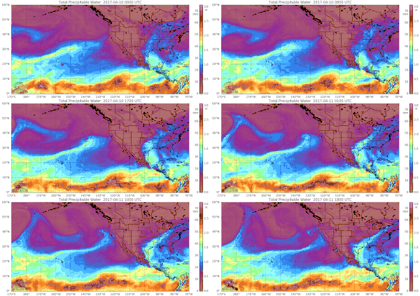
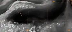
{{fairuse}}"Several times a year an atmospheric river [shown in the image on the right forming over Hawai'i]—a long, narrow conveyor belt of storms that stream in relentlessly from the Pacific Ocean—drops inches of rain or feet of snow on the U.S. west coast. Such a system triggered floods and mudslides in central and southern California this past weekend [2-3 February 2019]."[1]
"Atmospheric rivers flow through the sky about a mile above the ocean surface, and may extend across a thousand miles of ocean to the coast. Some bring routine rain but the more intense systems can carry as much water as 15 Mississippi Rivers. The series of storms striking land can arrive for days or, occasionally, weeks on end. They hit west-facing coastlines worldwide, although the U.S. experiences more than most other national coasts."[1]
The “atmospheric river scale” "ranks severity and impacts, from category 1 (weak) to category 5 (exceptional)."[1]
"Without a scale, we really had no way to objectively communicate what would be a strong storm or a weak one."[2]
"Scientists, the media and the public viewed atmospheric rivers as primarily a hazard, but the weaker ARs are quite beneficial. Water managers made it clear to us that a rating scale would be helpful."[2]
"The scale, published Tuesday in the Bulletin of the American Meteorological Society, ranks atmospheric rivers on five levels:"[1]
- Category 1: Weak—primarily beneficial
- Category 2: Moderate—mostly beneficial, but also somewhat hazardous
- Category 3: Strong—balance of beneficial and hazardous
- Category 4: Extreme—mostly hazardous, but also beneficial (if persistent drought)
- Category 5—Exceptional—primarily hazardous
Atmospheric rivers
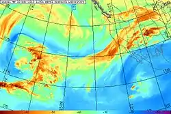
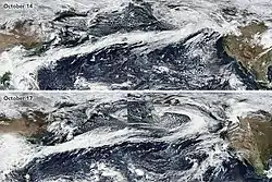

The particularly intense storm system in the image on the right produced as much as 26 in (66 cm) of precipitation in California and up to 17 ft (520 cm) of snowfall in the Sierra Nevada during December 17–22, 2010.
Atmospheric rivers consist of narrow bands of enhanced water vapor transport, typically along the boundaries between large areas of divergent surface air flow, including some frontal zones in association with extratropical cyclones that form over the oceans.[3][4][5][6]
Pineapple Express storms are the most commonly represented and recognized type of atmospheric rivers; they are given the name due to the warm water vapor plumes originating over the Hawaiian tropics that follow a path towards California.[7][8]
Atmospheric rivers are typically several thousand kilometers long and only a few hundred kilometers wide, and a single one can carry a greater flux of water than the Earth's largest river, the Amazon River.[4]
The length and width factors in conjunction with an integrated water vapor depth greater than 2.0 cm are used as standards to categorize atmospheric river events.[8][9][10][11]
Integrated water vapor transport (IVT) is more directly attributed to orographic precipitation, a key factor in the production of intense rainfall and subsequent flooding.[11]
On any given day, atmospheric rivers account for over 90% of the global meridional (north-south) water vapor transport, yet they cover less than 10% of the Earth's circumference.[4] Atmospheric rivers are also known to contribute to about 22% of total global runoff.[12]
They also are the major cause of extreme precipitation events that cause severe flooding in many mid-latitude, westerly coastal regions of the world, including the West Coast of North America,[13][14][15][9] Western Europe,[16][17][18] the west coast of North Africa,[5] the Iberian Peninsula, Iran and New Zealand.[12] Equally, the absence of atmospheric rivers has been linked with the occurrence of droughts in several parts of the world including South Africa, Spain and Portugal.[12]
The inconsistency of California's rainfall is due to the variability in strength and quantity of these storms, which can produce strenuous effects on California's water budget, which make California a perfect case study to show the importance of proper water management and prediction of these storms.[8] The significance atmospheric rivers have for the control of coastal water budgets juxtaposed against their creation of detrimental floods can be constructed and studied by looking at California and the surrounding coastal region of the western United States, where atmospheric rivers have contributed 30-50% of total annual rainfall.[19] The Fourth National Climate Assessment (NCA) report, released by the U.S. Global Change Research Program (USGCRP) on November 23, 2018[20] confirmed that along the U.S. western coast, landfalling atmospheric rivers "account for 30%–40% of precipitation and snowpack. These landfalling atmospheric rivers "are associated with severe flooding events in California and other western states."[7][9][21]
"As the world warms, the "landfalling atmospheric rivers on the West Coast are likely to increase" in "frequency and severity" because of "increasing evaporation and higher atmospheric water vapor levels in the atmosphere."[20][22][23][24][25]
Landfalling ARs were "responsible for nearly all the annual peak daily flow (APDF)s in western Washington" from 1998 through 2009.[26]
This AR in the image on the left brought a "stunning" end to the American West's 5-year drought with "some parts of California received nearly twice as much rain in a single deluge as normally falls in the preceding 5 months (October–February)".[27]
Anticyclones
{{free media}}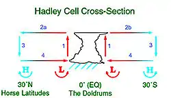
{{free media}}The Great Red Spot on Jupiter is, in fact, the inverse phenomenon, an anticyclone.[28]
An anticyclone is a weather phenomenon defined by the United States National Weather Service's glossary as "a large-scale circulation of winds around a central region of high atmospheric pressure, clockwise in the Northern Hemisphere, counterclockwise in the Southern Hemisphere".[29]
Def. "a system of winds that spiral out from a centre of high pressure"[30] is called an anticyclone.
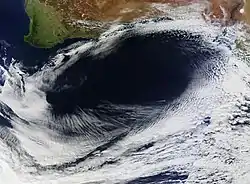
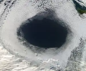
"High-pressure weather systems often bring fair weather and relatively clear skies. In early June 2012, a high off the coast of Tasmania did just that...and in spectacular fashion."[31]
"The Moderate Resolution Imaging Spectroradiometer (MODIS) on NASA’s Aqua satellite acquired this view of a hole in a cloud formation [in the image on the left] at 3:00 p.m. local time (05:00 Universal Time) on June 5, 2012. The weather system over the Great Australian Bight cut out the oval-shaped hole from a blanket of marine stratocumulus clouds."[31]
"The cloud hole, with a diameter that stretched as far as 1,000 kilometers (620 miles) across, was caused by sinking air associated with an area of high pressure near the surface. Globally, the average sea-level pressure is about 1013 millibars; at the center of this high, pressures topped 1,040 millibars."[31]
"Sea-level pressure maps published by the Australian Bureau of Meteorology on June 5 showed that the shape of the cloud hole matched the shape of the high-pressure area. However, the center of high pressure and the cloud hole didn't match precisely; the center of the high was near the western edge of the clear area, about 100 kilometers from the cloud edge."[31]
"In general, winds blow outward and away from areas of high pressure. As a result, areas of high pressure pull air downward. As the air sinks, it also warms, increasing the rate of evaporation and making it difficult for the air to sustain clouds. Areas of low pressure, by contrast, pull air upward and generate clouds and stormy weather."[31]
"While low-pressure systems often produce circular cyclonic storms and clouds, high-pressure systems (which are sometimes called anticyclones) can yield large circular areas of clear skies."[31]
"You could call it an anti-storm."[32]
"Weather models simulated the cloud formation quite accurately. We checked the Global Modeling and Assimilation Office (GMAO) forecast, and it really nailed the system."[33]
The evolution of an anticyclone depends on a few variables such as its size, intensity, moist-convection, Coriolis force etc.[34]
Surface anticyclones form due to downward motion through the troposphere, in areas within a synoptic flow pattern in higher levels of the troposphere, beneath the western side of troughs, on weather maps, these show converging winds (isotachs), also known as confluence, or converging height lines near or above the level of non-divergence, which is near the 500 hPa pressure surface about midway up the troposphere.[35][36]
Cyclogenesis
Cyclogenesis is the process of cyclone formation and intensification.[37]
Cyclogenesis is the development or strengthening of cyclonic circulation in the atmosphere (a low-pressure area).[38]
The anticyclonic equivalent, the process of formation of high pressure systems, dealing with surface systems is anticyclogenesis.[39]
Cyclogenesis is the opposite of cyclolysis, which concerns the weakening of surface cyclones. The term has an anticyclonic () equivalent—Anticyclogenesis.[39]
Cyclones

Def. a system of winds rotating around a center of low atmospheric pressure, the more or less violent small-scale circulations such as tornadoes, waterspouts, and dust devils is called a cyclone.
In meteorology, a cyclone is a large scale air mass that rotates around a strong center of low atmospheric pressure.[40][41]
Cyclones are characterized by inward spiraling winds that rotate about a zone of low-pressure.[42][43]
The largest low-pressure systems are polar vortices and extratropical cyclones of the largest scale (the synoptic scale), which includes warm-core cyclones such as tropical cyclones and subtropical cyclones.[44]
Mesocyclones, tornadoes and dust devils lie within the smaller mesoscale.[45]
Upper level cyclones can exist without the presence of a surface low, and can pinch off from the base of the tropical upper tropospheric trough during the summer months in the Northern Hemisphere.
Cyclones have also been seen on extraterrestrial planets, such as Mars and Neptune.[46][47]
Waterspouts
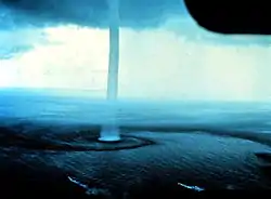

A waterspout is an intense columnar vortex (usually appearing as a funnel-shaped cloud) that occurs over a body of water.[48] Some are connected to a cumulus congestus cloud, some to a cumuliform cloud and some to a cumulonimbus cloud.[49] In the common form, it is a non-supercell tornado over water.[50][51][52]
While it is often weaker than most of its land counterparts, stronger versions spawned by mesocyclones do occur.[53][54] Most waterspouts do not suck up water; they are small and weak rotating columns of air over water.[50][55]
While waterspouts form mostly in the tropics and subtropical areas,[50] other areas also report waterspouts, including Europe, Australia, New Zealand, the Great Lakes, Antarctica[56][57] and on rare occasions, the Great Salt Lake.[58] Some are also found on the East Coast of the United States, and the coast of California.[48]
Dust devils
{{free media}}
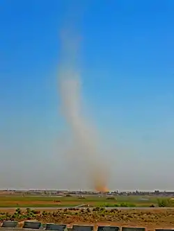
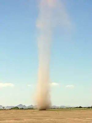
A dust devil is a strong, well-formed, and relatively long-lived whirlwind, ranging from small (half a metre wide and a few metres tall) to large (more than 10 metres wide and more than 1000 metres tall). The primary vertical motion is upward. Dust devils are usually harmless, but can on rare occasions grow large enough to pose a threat to both people and property.[59]
Dust devils form when a pocket of hot air near the surface rises quickly through cooler air above it, forming an updraft. If conditions are just right, the updraft may begin to rotate. As the air rapidly rises, the column of hot air is stretched vertically, thereby moving mass closer to the axis of rotation, which causes intensification of the spinning effect by conservation of angular momentum. The secondary flow in the dust devil causes other hot air to speed horizontally inward to the bottom of the newly forming vortex. As more hot air rushes in toward the developing vortex to replace the air that is rising, the spinning effect becomes further intensified and self-sustaining. A dust devil, fully formed, is a funnel-like chimney through which hot air moves, both upwards and in a circle. As the hot air rises, it cools, loses its buoyancy and eventually ceases to rise. As it rises, it displaces air which descends outside the core of the vortex. This cool air returning acts as a balance against the spinning hot-air outer wall and keeps the system stable.[60]
As available hot air near the surface is channeled up the dust devil, eventually surrounding cooler air will be sucked in. Once this occurs, the effect is dramatic, and the dust devil dissipates in seconds. Usually this occurs when the dust devil is not moving fast enough (depletion) or begins to enter a terrain where the surface temperatures are cooler.[61]
On rare occasions, a dust devil can grow very large and intense, sometimes reaching a diameter of up to 300 feet (90 m) with winds in excess of 60 mph (100 km/h+) and can last for upwards of 20 minutes before dissipating.[62]
Dust devils typically do not cause injuries, but rare, severe dust devils have caused damage and even deaths in the past. One such dust devil struck the Coconino County, Arizona, Fairgrounds in Flagstaff, Arizona, on September 14, 2000, causing extensive damage to several temporary tents, stands and booths well as some permanent fairgrounds structures. Several injuries were reported, but there were no fatalities. Based on the degree of damage left behind, it is estimated that the dust devil produced winds as high as 75 mph (120 km/h), which is equivalent to an Enhanced Fujita Scale (EF-0) tornado.[63] On May 19, 2003, a dust devil lifted the roof off a two-story building in Lebanon, Maine, causing it to collapse and kill a man inside.[64][65] In East El Paso, Texas in 2010, three children in an inflatable jump house were picked up by a dust devil and lifted over 10 feet (3 m), traveling over a fence and landing in a backyard three houses away.[66] In Commerce City, Colorado in 2018, a powerful dust devil hurtled two porta-potties into the air. No one was injured in the incident.[67] In 2019 a large dust devil in Yucheng county, Henan province, China killed 2 children and injured 18 children and 2 adults when a bouncy castle was lifted into the air.[68]
Dust devils have been implicated in around 100 aircraft accidents.[69] While many incidents have been simple taxiing problems, a few have had fatal consequences. Dust devils are also considered major hazards among skydivers and paragliding pilots as they can cause a parachute or a glider to collapse with little to no warning, at altitudes considered too low to cut away, and contribute to the serious injury or death of parachutists.[70][71][72]
Dust devils, even small ones (on Earth), can produce radio noise and electrical fields greater than 10,000 volts per meter.[73] A dust devil picks up small dirt and dust particles. As the particles whirl around, they bump and scrape into each other and become electrically charged. The whirling charged particles also create a magnetic field that fluctuates between 3 and 30 times each second.[74]
A large dust devil measuring about 100 metres (330 ft) across at its base can lift about 15 metric tonnes (17 short tons) of dust into the air in 30 minutes. Giant dust storms that sweep across the world's deserts contribute 8% of the mineral dust in the atmosphere each year during the handful of storms that occur. In comparison, the significantly smaller dust devils that twist across the deserts during the summer lift about three times as much dust, thus having a greater combined impact on the dust content of the atmosphere. When this occurs, they are often called sand pillars.[75]
Snow whirlwinds
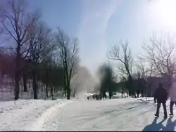
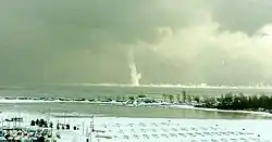
The same conditions can produce a snow whirlwind, although differential heating is more difficult in snow-covered areas.
A winter waterspout, also known as a snow devil, an icespout, an ice devil, a snownado, or a snowspout, is an extremely rare instance of a waterspout forming under the base of a snow squall.[76][77]
Like the more efficient lake-effect snow events, winds focusing down the axis of long lakes enhance wind convergence and likely enhance their development.[78]
Coal devils
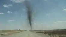
Coal devils are common at the coal town of Tsagaan Khad in Ömnögovi Province, South Gobi Province, Mongolia. They occur when dust devils pick up large amounts of stockpiled coal. Their dark color makes them resemble some tornados.
In the image on the right, a coal devil occurs at the coal storage town of Tsagaan Khad, Mongolia (15km north from Mongolia-China border). On the way from Oyu Tolgoi mine to the Gashuunsukhait-Ganqimaodao border crossing.
Fire whirls
_crop.jpg.webp)
{{free media}}A fire whirl or swirl, sometimes called fire devils or fire tornadoes, can be seen during intense fires in combustible building structures or, more commonly, in forest or bush fires. A fire whirl is a vortex-shaped formation of burning gases being released from the combustible material. The genesis of the vortex is probably similar to that of a dust devil. As distinct from the dust devil, it is improbable that the height reached by the fire gas vortex is greater than the visible height of the vertical flames because of turbulence in the surrounding gases that inhibit creation of a stable boundary layer between the rotating/rising gases relative to the surrounding gases.[79]
Fire whirls are sometimes colloquially called fire tornadoes, but are not usually classifiable as tornadoes as the vortex in most cases does not extend from the surface to cloud base. Also, even in such cases, those fire whirls very rarely are classic tornadoes, as their vorticity derives from surface winds and heat-induced lifting, rather than from a tornadic mesocyclone aloft, although a handful of suspected cases of the latter are known.[80]
Ash devils
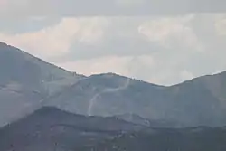
Ash devils form similar to dust devils and are often seen on unstable days in burn scar areas of recent fires.
Hot cinders underneath freshly deposited ash in recently burned areas may sometimes generate numerous dust devils. The lighter weight and the darker color of the ash may create dust devils that are visible hundreds of feet into the air.
Steam devils

Steam devils are phenomena often observed in the steam rising from power plants.[81]
Include steam devils in the International Field Year for the Great Lakes which was imminently to occur in 1972-3.[82]
Steam devils are a rare and short-lived phenomenon, typically surviving no more than three or four minutes, and the smaller ones over hot springs dissipating in a matter of seconds.[83][84]
Steam devils can become detached from their base and be blown downstream by the wind. On small bodies of water such as hot springs this can mean that the steam devil ends up over land away from the water altogether. Such steam devils continue to rotate even after they have become detached from the source of heat, but will soon dissipate.[85]
Very small steam devils may have a poorly defined column and no identifiable clear inner core. Such vortices are more properly called steam whirls by analogy with the dust whirls of land.[86]
Extratropical cyclones
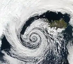
A beautifully-formed low-pressure system swirls off the southwestern coast of Iceland, illustrating the maxim that "nature abhors a vacuum." The vacuum in this case would be a region of low atmospheric pressure. In order to fill this void, air from a nearby high-pressure system moves in, in this case bringing clouds along for the ride. And because this low-pressure system occurred in the Northern Hemisphere, the winds spun in toward the center of the low-pressure system in a counter-clockwise direction; a phenomenon known as the Coriolis force (in the Southern Hemisphere, the Coriolis force would be manifested in a clockwise direction of movement).
The clouds in the image resembled pulled cotton and lace as they spun in a lazy hurricane-like pattern. This huge system swirled over the Denmark Strait in between Greenland and Iceland.
The process in which an extratropical cyclone undergoes a rapid drop in atmospheric pressure (24 millibars or more) in a 24-hour period is referred to as explosive cyclogenesis, and is usually present during the formation of a nor'easter.[87]
Jet streams
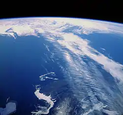
Def. any of the high-speed, high-altitude air currents that circle the Earth in a westerly direction is called a jet stream.
Jet streams are fast flowing, narrow air currents found in the atmospheres of some planets, including Earth. The main jet streams are located near the tropopause, the transition between the troposphere (where temperature decreases with altitude) and the stratosphere (where temperature increases with altitude).[88] The major jet streams on Earth are westerly winds (flowing west to east). Their paths typically have a meandering shape; jet streams may start, stop, split into two or more parts, combine into one stream, or flow in various directions including the opposite direction of most of the jet. The strongest jet streams are the polar jets, at around 7–12 km (23,000–39,000 ft) above sea level, and the higher and somewhat weaker subtropical jets at around 10–16 km (33,000–52,000 ft). The Northern Hemisphere and the Southern Hemisphere each have both a polar jet and a subtropical jet. The northern hemisphere polar jet flows over the middle to northern latitudes of North America, Europe, and Asia and their intervening oceans, while the southern hemisphere polar jet mostly circles Antarctica all year round.
Mesocyclones
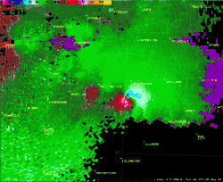
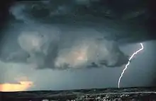
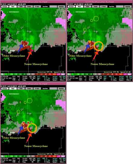
A mesocyclone is a vortex of air within a convective storm.[89] Mesocyclones are localized, approximately 2 km (1.2 mi) to 10 km (6.2 mi) in diameter within strong thunderstorms.[89]
Mesocyclones form when strong changes of wind speed and/or direction with height ("wind shear") sets parts of the lower part of the atmosphere spinning in invisible tube-like rolls. The convective updraft of a thunderstorm then draw up this spinning air, tilting the rolls' orientation upward (from parallel to the ground to perpendicular) and causing the entire updraft to rotate as a vertical column.[90]
The best way to detect and verify the presence of a mesocyclone is by Doppler weather radar. Nearby high values of opposite sign within velocity data are how they are detected.[91]
Polar lows
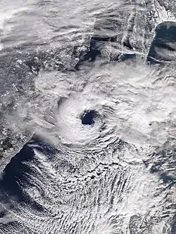
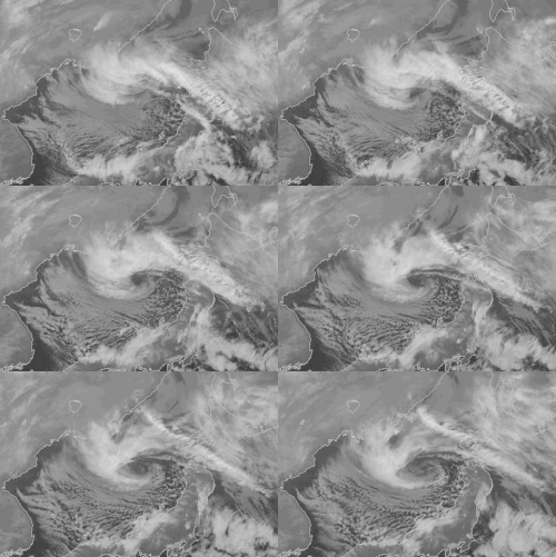
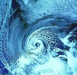
Polar lows have been referred to by many other terms, such as polar mesoscale vortex, Arctic hurricane, Arctic low, and cold air depression. Today the term is usually reserved for the more vigorous systems that have near-surface winds of at least 17 m/s (38 mph).[92]
During winter, when cold-core lows with temperatures in the mid-levels of the troposphere reach −45 °C (−49 °F) move over open waters, deep convection forms which allows polar low development to become possible.[93]
Polar lows can occur at any time during the year. However, summer lows tend to be weaker than winter lows.[94]
Polar vortices
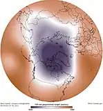
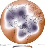
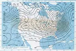

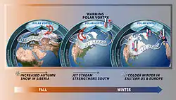
The interface between the cold dry air mass of the pole and the warm moist air mass farther south defines the location of the polar front. The polar front is centered, roughly at 60° latitude. A polar vortex strengthens in the winter and weakens in the summer because of its dependence on the temperature difference between the equator and the poles.[94]
When the northern vortex weakens, it separates into two or more vortices, the strongest of which are near Baffin Island, Canada, and the other over northeast Siberia.[95]
When the polar vortex is weak, high-pressure zones of the mid-latitudes may push poleward, moving the polar vortex, jet stream, and polar front equatorward. The jet stream is seen to "buckle" and deviate south. This rapidly brings cold dry air into contact with the warm, moist air of the mid-latitudes, resulting in a rapid and dramatic change of weather known as a "cold snap".[96]
The polar vortex was first described as early as 1853.[97] The phenomenon's sudden stratospheric warming (SSW) develops during the winter in the Northern Hemisphere and was discovered in 1952 with radiosonde observations at altitudes higher than 20 km.[98]
The phenomenon was mentioned frequently in the news and weather media in the cold North American winter of 2013–2014, popularizing the term as an explanation of very cold temperatures.[99]
A deep freeze that gripped much of the United States and Canada in late January 2019 has been blamed on a polar vortex. The US National Weather Service warned that frostbite is possible within just 10 minutes of being outside in such extreme temperatures, and hundreds of schools, colleges and universities in the affected areas were closed. Around 21 people died in US due to severe frostbite.[100][101] States within the midwest region of the United States had windchills just above -50°F (-45°C), which is colder than the frozen tundra and Antarctica.[102]
The Polar vortex has also thought to have had effects in Europe. For example, the 2013–14 United Kingdom winter floods were blamed on the Polar vortex bringing severe cold in the United States and Canada.[103] Similarly, the severe, brutal cold in the United Kingdom in the winters of 2009/10 and 2010/11 were also blamed on the Polar vortex.[104]
Polar cyclones are low-pressure zones embedded within the polar air masses, and exist year-round. The stratospheric polar vortex develops at latitudes above the subtropical jet stream.[105] Horizontally, most polar vortices have a radius of less than 1,000 kilometres (620 mi).[106] Since polar vortices exist from the stratosphere downward into the mid-troposphere,[95] a variety of heights/pressure levels are used to mark its position. The 50 mb pressure surface is most often used to identify its stratospheric location.[107] At the level of the tropopause, the extent of closed contours of potential temperature can be used to determine its strength. Others have used levels down to the 500 hPa pressure level (about 5,460 metres (17,910 ft) above sea level during the winter) to identify the polar vortex.[108]
Subtropical cyclones
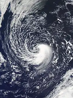
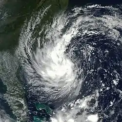
A subtropical cyclone is a weather system that has some characteristics of a tropical and an extratropical cyclone.[109]
Subtropical cyclones have broad wind patterns with maximum sustained winds located farther from the center than typical tropical cyclones, and have no weather fronts linked into their center.[110]
Subtropical cyclones are also observed to form in the South Atlantic; South Atlantic subtropical cyclones are observed in all months.[111]
Throughout the 1950s and 1960s, the term semi-tropical and quasi-tropical were used for what would become known as subtropical cyclones.[112] The term subtropical cyclone merely referred to any cyclone located in the subtropical belt near and just north of the horse latitudes. Intense debate ensued in the late 1960s, after a number of hybrid cyclones formed in the Atlantic Basin. In 1972, the National Hurricane Center (NHC) finally designated these storms as subtropical cyclones in real-time,[113] and updated the hurricane database to include subtropical cyclones from 1968 through 1971.
Subtropical ridges
Heating of the earth near the equator forces upward motion and convection along the monsoon trough or intertropical convergence zone, then divergence over the near-equatorial trough leads to air rising aloft and moving away from the equator: as air moves towards the mid-latitudes, it cools and sinks leading to subsidence near the 30° parallel of both hemispheres, resulting in circulation known as the Hadley cell which forms the subtropical ridge.[114]
Many of the world's deserts are caused by these climatological high-pressure areas.[115]
Because these anticyclones strengthen with height, they are known as warm core ridges.
Tornadoes
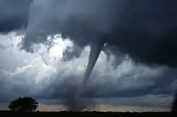

{{free media}}A tornado is a rapidly rotating column of air that is in contact with both the surface of the Earth and a cumulonimbus cloud or, in rare cases, the base of a cumulus cloud. The windstorm is often referred to as a twister, whirlwind or cyclone,[116] although the word cyclone is used in meteorology to name a weather system with a low-pressure area in the center around which, from an observer looking down toward the surface of the earth, winds blow counterclockwise in the Northern Hemisphere and clockwise in the Southern.[117] Tornadoes come in many shapes and sizes, and they are often visible in the form of a condensation funnel originating from the base of a cumulonimbus cloud, with a cloud of rotating debris and dust beneath it. Most tornadoes have wind speeds less than 110 miles per hour (180 km/h), are about 250 feet (80 m) across, and travel a few miles (several kilometers) before dissipating. The most extreme tornadoes can attain wind speeds of more than 300 miles per hour (480 km/h), are more than 2 miles (3.2 km) in diameter, and stay on the ground for dozens of miles (more than 100 km).[118][119][120]
Various types of tornadoes include the multiple vortex tornado, landspout, and waterspout. Waterspouts are characterized by a spiraling funnel-shaped wind current, connecting to a large cumulus or cumulonimbus cloud. They are generally classified as non-supercellular tornadoes that develop over bodies of water, but there is disagreement over whether to classify them as true tornadoes. These spiraling columns of air frequently develop in tropical areas close to the equator and are less common at high latitudes.[121]
Tornadoes occur most frequently in North America, particularly in central and southeastern regions of the United States colloquially known as tornado alley,[122] as well as in Southern Africa, northwestern and southeast Europe, western and southeastern Australia, New Zealand, Bangladesh and adjacent eastern India, and southeastern South America.[123]
There are several scales for rating the strength of tornadoes. The Fujita scale rates tornadoes by damage caused and has been replaced in some countries by the updated Enhanced Fujita Scale. An F0 or EF0 tornado, the weakest category, damages trees, but not substantial structures. An F5 or EF5 tornado, the strongest category, rips buildings off their foundations and can deform large skyscrapers. The similar TORRO scale ranges from a T0 for extremely weak tornadoes to T11 for the most powerful known tornadoes.[124] Doppler radar data, photogrammetry, and ground swirl patterns (trochoidal marks) may also be analyzed to determine intensity and assign a rating.[125][126]
Tornado formation often occurs in one of two ways.[127][128]
In the first method, two conditions must be satisfied.[129] One, a horizontal spinning effect must form on the Earth's surface. This usually originates in sudden changes in wind direction or speed, known as wind shear. Two, a thundercloud, or occasionally a cumulus cloud, must be present. During a thunderstorm, updrafts are occasionally powerful enough to lift the horizontal spinning row of air upwards, turning it into a vertical air column. This vertical air column then becomes the basic structure for the tornado. Tornadoes that form in this way are often weak and generally last less than 10 minutes.[129]
The second method occurs during a supercell thunderstorm, in updrafts within the storm. When winds intensify, the force released can cause the updrafts to rotate. This rotating updraft is known as a mesocyclone.[130] For a tornado to form in this manner, a rear-flank downdraft enters the center of the mesocyclone from the back. Cold air, being denser than warm air is able to penetrate through the updraft. The combination of the updraft and downdraft completes the development of a tornado. Tornadoes that form in this method are often violent and can last over an hour.[129]
Tropical cyclones
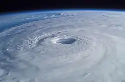
A tropical cyclone is a rapidly rotating storm system characterized by a low-pressure center, a closed low-level atmospheric circulation, strong winds, and a spiral arrangement of thunderstorms that produce heavy rain. Depending on its location and strength, a tropical cyclone is referred to by different names, including hurricane,[131][132][133] typhoon, tropical storm, cyclonic storm, tropical depression, and simply cyclone.[134] A hurricane is a tropical cyclone that occurs in the Atlantic Ocean and northeastern Pacific Ocean, and a typhoon occurs in the northwestern Pacific Ocean; in the south Pacific or Indian Ocean, comparable storms are referred to simply as "tropical cyclones" or "severe cyclonic storms".[134]
Upper level cyclones
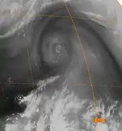
Case studies of upper tropospheric cyclones in the Atlantic and Pacific have been performed by using airplane reports (winds, temperatures and heights), radiosonde data, geostationary satellite cloud imagery, and cloud-tracked winds throughout the troposphere.[135] It was determined they were the origin of an upper tropospheric cold-core lows, or cut-off lows.[136]
The tropical upper tropospheric cyclone has a cold core, meaning it is stronger aloft than at the Earth's surface, or stronger in areas of the troposphere with lower pressures. This is explained by the thermal wind relationship.[137]
Warm-core cyclones
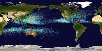
The mechanisms through which tropical cyclogenesis occurs are distinctly different from those through which temperate cyclogenesis occurs. Tropical cyclogenesis involves the development of a warm-core cyclone, due to significant convection in a favorable atmospheric environment.[138]
Theoretical aerometeors
Def. "movement of [atmospheric] air usually caused by convection or [subtle] differences in air pressure"[139] is called wind.
Def. a discrete unit of air, wind, or mist traveling or falling through or partially through an atmosphere is called an aerometeor.
Def. a "wind whose direction and speed are determined by a balance of the horizontal pressure gradient force and the force due to the earth's rotation to the left in the northern hemisphere and to the right in the southern hemisphere"[140] is called a geostrophic wind.
Def. a "warm dry wind blowing down the side of a mountain"[141] is called a foehn, or foehn wind, or chinook.
The chinook generally blows from the southwest, but its direction may be modified by topography. When it sets in after a spell of intense cold, the temperature may rise by 20–40°F in 15 minutes due to replacement of a cold air mass with a much warmer air mass in minutes."[142]
"Wind shear is a change in wind direction, wind speed, or both, along a given direction in space (e.g., along a horizontal or vertical distance)."[143]
Def. a "strong, abrupt rush of wind"[144] is called a gust.
Radars

On the right is a composite of hourly radar images. These wind gusts averaged ~75 mph over about 450 miles. This is referred to as the Derecho event.
Mars



"The [true] color images of Mars [at right] were taken in 1999, across almost 60 million miles (!) by a talented amateur astronomer in Oeiras, Portugal – Antonio Cidadao."[145]
"They were acquired with a modest 10-inch "Schmidt-Cassegrain" reflecting telescope, and a commercially available CCD (charge coupled device) camera. Mr. Cidadao’s total investment in his "Mars imaging system"—commercial telescope and electronic camera, plus computer to process the images, and the appropriate software—was approximately three thousand American dollars."[145]
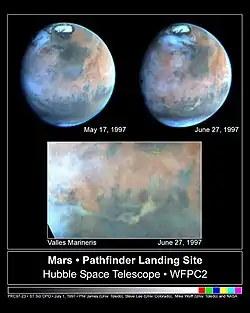
"In 1997, before the arrival of the Mars Pathfinder spacecraft (the first NASA Lander sent to Mars since Viking), the Hubble Telescope was tasked to acquire a series of "weather forecast Mars images" prior to the landing [at left]."[145]
"This long-distance reconnaissance detected a small dust storm less than a month before the Pathfinder arrival, which (with its potentially high winds) could have posed a serious threat to the Pathfinder entry and landing."[145]
"If dust diffuses to the landing site, the sky could turn out to be pink like that seen by Viking... otherwise [based on the Hubble images - above], Pathfinder will likely show blue sky with bright clouds."[146]
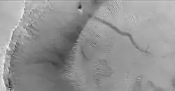
Dust devils also occur on Mars (see dust devil tracks) and were first photographed by the Viking orbiters in the 1970s. In 1997, the Mars Pathfinder lander detected a dust devil passing over it.[147][148] In the image shown here, photographed by the Mars Global Surveyor, the long dark streak is formed by a moving swirling column of Martian atmosphere. The dust devil itself (the black spot) is climbing the crater wall. The streaks on the right are sand dunes on the crater floor.
Martian dust devils can be up to fifty times as wide and ten times as high as terrestrial dust devils, and large ones may pose a threat to terrestrial technology sent to Mars.[149] On 7 November 2016, five such dust devils ranging in heights of 0.5 to 1.9 km were imaged in a single observation by Mars Orbiter Mission in martian southern hemisphere.[150]
Mission members monitoring the Spirit rover on Mars reported on March 12, 2005, that a lucky encounter with a dust devil had cleaned the solar panels of that robot. Power levels dramatically increased and daily science work was anticipated to be expanded.[151] A similar phenomenon (solar panels mysteriously cleaned of accumulated dust) had previously been observed with the Opportunity rover]], and dust devils had also been suspected as the cause.[152]
Jupiter
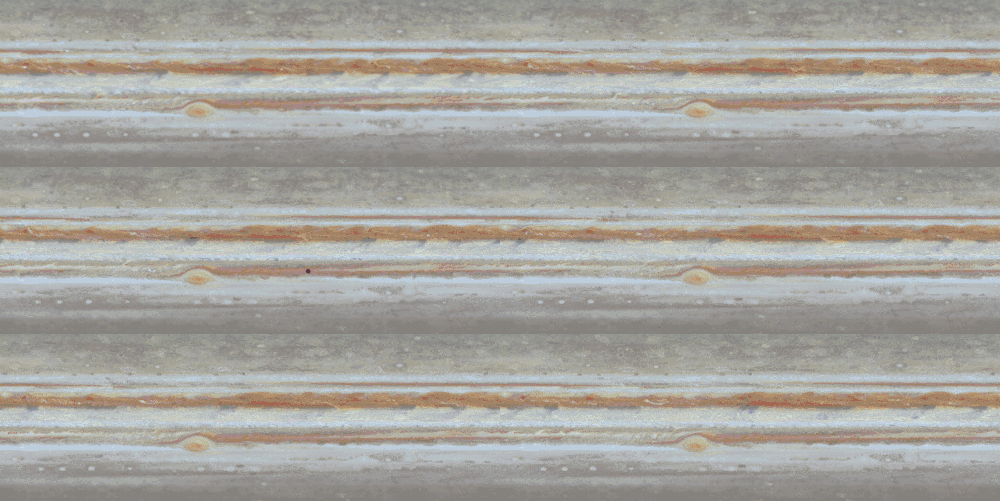
The wide equatorial zone is visible in the center surrounded by two dark equatorial belts (SEB and NEB).
"The large grayish-blue [irregular] "hot spots" at the northern edge of the white Equatorial Zone change over the course of time as they march eastward across the planet."[153]
"The Great Red Spot shows its counterclockwise rotation, and the uneven distribution of its high haze is obvious. To the east (right) of the Red Spot, oval storms, like ball bearings, roll over and pass each other. Horizontal bands adjacent to each other move at different rates. Strings of small storms rotate around northern-hemisphere ovals."[153]
"Small, very bright features appear quickly and randomly in turbulent regions, candidates for lightning storms."[153]
"The smallest visible features at the equator are about 600 kilometers (about 370 miles) across."[153]
"The clip consists of 14 unevenly spaced timesteps, each a true color cylindrical projection of the complete circumference of Jupiter, from 60 degrees south to 60 degrees north. The maps are made by first assembling mosaics of six images taken by Cassini's narrow-angle camera in the same spectral filter over the course of one Jupiter rotation and, consequently, covering the whole planet. Three such global maps -- in red, green and blue filters -- are combined to make one color map showing Jupiter during one Jovian rotation. Fourteen such maps, spanning 24 Jovian rotations at uneven time intervals comprise the movie."[153]
The passage of time is accelerated by a factor of 600,000.
Saturn

"The view [at right] from Hubble [of Saturn], taken on March 22, 2004, is so sharp that many individual Saturnian ringlets can be seen."[154]
"Hubble's exquisite optics, coupled with the high resolution of its Advanced Camera for Surveys, allow it to take pictures of Saturn which are nearly as sharp as Cassini's, even though Hubble is nearly a billion miles farther from Saturn than Cassini."[154]
"Camera exposures in four filters (blue, blue-green, green, and red) were combined to form the Hubble image, to render colors similar to what the eye would see through a telescope focused on Saturn. The subtle pastel colors of ammonia-methane clouds trace a variety of atmospheric dynamics. Saturn displays its familiar banded structure, and haze and clouds of various altitudes. Like Jupiter, all bands are parallel to Saturn's equator. Even the magnificent rings, at nearly their maximum tilt toward Earth, show subtle hues, which indicate the trace chemical differences in their icy composition."[154]
Uranus
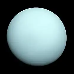
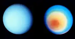
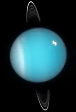
In larger amateur telescopes with an objective diameter of between 15 and 23 cm, the planet appears as a pale cyan disk with distinct limb darkening.
"Methane possesses prominent absorption bands in the visible and near-infrared (IR) making Uranus aquamarine or cyan in color."[155]
In 1986 Voyager 2 found that the visible southern hemisphere of Uranus can be subdivided into two regions: a bright polar cap and dark equatorial bands (see figure on the right).[156] Their boundary is located at about -45 degrees of latitude. A narrow band straddling the latitudinal range from -45 to -50 degrees is the brightest large feature on the visible surface of the planet.[156][157] It is called a southern "collar". The cap and collar are thought to be a dense region of methane clouds located within the pressure range of 1.3 to 2 bar (see above).[158] Besides the large-scale banded structure, Voyager 2 observed ten small bright clouds, most lying several degrees to the north from the collar.[156] In all other respects Uranus looked like a dynamically dead planet in 1986. Unfortunately Voyager 2 arrived during the height of the planet's southern summer and could not observe the northern hemisphere. At the beginning of the 21st century, when the northern polar region came into view, the Hubble Space Telescope (HST) and Keck telescope initially observed neither a collar nor a polar cap in the northern hemisphere.[157] So Uranus appeared to be asymmetric: bright near the south pole and uniformly dark in the region north of the southern collar.[157] In 2007, when Uranus passed its equinox, the southern collar almost disappeared, while a faint northern collar emerged near 45 degrees of latitude.[159]
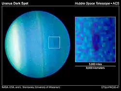
On August 23, 2006, researchers at the Space Science Institute (Boulder, CO) and the University of Wisconsin observed a dark spot on Uranus's surface, giving astronomers more insight into the planet's atmospheric activity.[160] Why this sudden upsurge in activity should be occurring is not fully known, but it appears that Uranus's extreme axial tilt results in extreme seasonal variations in its weather.[161][162] Determining the nature of this seasonal variation is difficult because good data on Uranus's atmosphere have existed for less than 84 years, or one full Uranian year. A number of discoveries have been made. Photometry over the course of half a Uranian year (beginning in the 1950s) has shown regular variation in the brightness in two spectral bands, with maxima occurring at the solstices and minima occurring at the equinoxes.[163] A similar periodic variation, with maxima at the solstices, has been noted in microwave measurements of the deep troposphere begun in the 1960s.[164] Stratospheric temperature measurements beginning in the 1970s also showed maximum values near the 1986 solstice.[165] The majority of this variability is believed to occur owing to changes in the viewing geometry.[166]
There are some reasons to believe that physical seasonal changes are happening in Uranus. While the planet is known to have a bright south polar region, the north pole is fairly dim, which is incompatible with the model of the seasonal change outlined above.[162] During its previous northern solstice in 1944, Uranus displayed elevated levels of brightness, which suggests that the north pole was not always so dim.[163] This information implies that the visible pole brightens some time before the solstice and darkens after the equinox.[162] Detailed analysis of the visible and microwave data revealed that the periodical changes of brightness are not completely symmetrical around the solstices, which also indicates a change in the meridional albedo patterns.[162] Finally in the 1990s, as Uranus moved away from its solstice, Hubble and ground based telescopes revealed that the south polar cap darkened noticeably (except the southern collar, which remained bright),[158] while the northern hemisphere demonstrated increasing activity,[167] such as cloud formations and stronger winds, bolstering expectations that it should brighten soon.[168] This indeed happened in 2007 when the planet passed an equinox: a faint northern polar collar arose, while the southern collar became nearly invisible, although the zonal wind profile remained slightly asymmetric, with northern winds being somewhat slower than southern.[159]
Neptune
.tif.jpg.webp)
On July 12, 2011, Neptune "has arrived at the same location in space where it was discovered nearly 165 years ago. To commemorate the event, NASA's Hubble Space Telescope has taken these "anniversary pictures" of the blue-green giant planet."[169]
"Neptune is the most distant major planet in our solar system. German astronomer Johann Galle discovered the planet on September 23, 1846. At the time, the discovery doubled the size of the known solar system. The planet is 2.8 billion miles (4.5 billion kilometers) from the Sun, 30 times farther than Earth. Under the Sun's weak pull at that distance, Neptune plods along in its huge orbit, slowly completing one revolution approximately every 165 years."[169]
"These four Hubble images of Neptune were taken with the Wide Field Camera 3 on June 25-26, during the planet's 16-hour rotation. The snapshots were taken at roughly four-hour intervals, offering a full view of the planet. The images reveal high-altitude clouds in the northern and southern hemispheres. The clouds are composed of methane ice crystals."[169]
"The giant planet experiences seasons just as Earth does, because it is tilted 29 degrees, similar to Earth's 23-degree-tilt. Instead of lasting a few months, each of Neptune's seasons continues for about 40 years."[169]
"The snapshots show that Neptune has more clouds than a few years ago, when most of the clouds were in the southern hemisphere. These Hubble views reveal that the cloud activity is shifting to the northern hemisphere. It is early summer in the southern hemisphere and winter in the northern hemisphere."[169]
"In the Hubble images, absorption of red light by methane in Neptune's atmosphere gives the planet its distinctive aqua color. The clouds are tinted pink because they are reflecting near-infrared light."[169]
"A faint, dark band near the bottom of the southern hemisphere is probably caused by a decrease in the hazes in the atmosphere that scatter blue light. The band was imaged by NASA's Voyager 2 spacecraft in 1989, and may be tied to circumpolar circulation created by high-velocity winds in that region."[169]
"The temperature difference between Neptune's strong internal heat source and its frigid cloud tops, about minus 260 degrees Fahrenheit, might trigger instabilities in the atmosphere that drive large-scale weather changes."[169]
Meteorology
There are four main scales, or sizes of systems, dealt with in meteorology: the macroscale, the synoptic scale, the mesoscale, and the microscale.[170]
The macroscale deals with systems with global size, such as the Madden–Julian oscillation.[171]
Synoptic scale systems cover a portion of a continent, such as extratropical cyclones, with dimensions of 1,000–2,500 km (620–1,550 mi) across.[171]
The mesoscale is the next smaller scale, and often is divided into two ranges: meso-alpha phenomena range from 200–2,000 km (120–1,240 mi) across (the realm of the tropical cyclone), while meso-beta phenomena range from 20–200 km (12–124 mi) across (the scale of the mesocyclone).[172]
The microscale is the smallest of the meteorological scales, with a size under 2 kilometres (1.2 miles) (the scale of tornadoes and waterspouts).[172]
See also
References
- 1 2 3 4 Mark Fischetti (February 5, 2019). Warning Scale Unveiled for Dangerous Rivers in the Sky. Scientific American. Retrieved 8 February 2019.
- 1 2 Martin Ralph (February 5, 2019). Warning Scale Unveiled for Dangerous Rivers in the Sky. Scientific American. Retrieved 8 February 2019.
- ↑ Zhu, Yong; Reginald E. Newell (1994). "Atmospheric rivers and bombs". Geophysical Research Letters 21 (18): 1999–2002. doi:10.1029/94GL01710. https://web.archive.org/web/20100610063041/http://paos.colorado.edu/~dcn/ATOC6020/papers/AtmosphericRivers_94GL01710.pdf.
- 1 2 3 Zhu, Yong; Reginald E. Newell (1998). "A Proposed Algorithm for Moisture Fluxes from Atmospheric Rivers". Monthly Weather Review 126 (3): 725–735. doi:10.1175/1520-0493(1998)126<0725:APAFMF>2.0.CO;2. ISSN 1520-0493.
- 1 2 Kerr, Richard A. (28 July 2006). "Rivers in the Sky Are Flooding The World With Tropical Waters". Science 313 (5786): 435. doi:10.1126/science.313.5786.435. PMID 16873624. http://tenaya.ucsd.edu/~dettinge/atmos_rivers.science.pdf.
- ↑ White, Allen B.; et al. (2009-10-08). The NOAA coastal atmospheric river observatory. 34th Conference on Radar Meteorology.
- 1 2 Dettinger, Michael (2011-06-01). "Climate Change, Atmospheric Rivers, and Floods in California – A Multimodel Analysis of Storm Frequency and Magnitude Changes1". JAWRA Journal of the American Water Resources Association 47 (3): 514–523. doi:10.1111/j.1752-1688.2011.00546.x. ISSN 1752-1688.
- 1 2 3 Dettinger, Michael D.; Ralph, Fred Martin; Das, Tapash; Neiman, Paul J.; Cayan, Daniel R. (2011-03-24). "Atmospheric Rivers, Floods and the Water Resources of California". Water 3 (2): 445–478. doi:10.3390/w3020445. http://www.mdpi.com/2073-4441/3/2/445.
- 1 2 3 Ralph, F. Martin (2006). "Flooding on California's Russian River: Role of atmospheric rivers". Geophys. Res. Lett. 33 (13): L13801. doi:10.1029/2006GL026689. http://tenaya.ucsd.edu/~dettinge/atmos_rivers.pdf.
- ↑ Guan, Bin; Waliser, Duane E.; Molotch, Noah P.; Fetzer, Eric J.; Neiman, Paul J. (2011-08-24). "Does the Madden–Julian Oscillation Influence Wintertime Atmospheric Rivers and Snowpack in the Sierra Nevada?". Monthly Weather Review 140 (2): 325–342. doi:10.1175/MWR-D-11-00087.1. ISSN 0027-0644.
- 1 2 Guan, Bin; Waliser, Duane E. (2015-12-27). "Detection of atmospheric rivers: Evaluation and application of an algorithm for global studies". Journal of Geophysical Research: Atmospheres 120 (24): 2015JD024257. doi:10.1002/2015JD024257. ISSN 2169-8996.
- 1 2 3 Paltan, Homero; Waliser, Duane; Lim, Wee Ho; Guan, Bin; Yamazaki, Dai; Pant, Raghav; Dadson, Simon (2017-10-25). "Global Floods and Water Availability Driven by Atmospheric Rivers". Geophysical Research Letters 44 (20): 10,387–10,395. doi:10.1002/2017gl074882. ISSN 0094-8276.
- ↑ Neiman, Paul J.; et al. (2009-06-08). Landfalling Impacts of Atmospheric Rivers: From Extreme Events to Long-term Consequences (PDF). The 2010 Mountain Climate Research Conference.
- ↑ Neiman, Paul J. (2008). "Diagnosis of an Intense Atmospheric River Impacting the Pacific Northwest: Storm Summary and Offshore Vertical Structure Observed with COSMIC Satellite Retrievals". Monthly Weather Review 136 (11): 4398–4420. doi:10.1175/2008MWR2550.1. http://tenaya.ucsd.edu/~dettinge/neiman_cosmic08.pdf.
- ↑ Neiman, Paul J. (2008). "Meteorological Characteristics and Overland Precipitation Impacts of Atmospheric Rivers Affecting the West Coast of North America Based on Eight Years of SSM/I Satellite Observations". Journal of Hydrometeorology 9 (1): 22–47. doi:10.1175/2007JHM855.1. http://tenaya.ucsd.edu/~dettinge/Neiman_Ar-JHM08.pdf.
- ↑ "Atmospheric river of moisture targets Britain and Ireland". CIMSS Satellite Blog. November 19, 2009.
- ↑ Stohl, A.; Forster, C.; Sodermann, H. (March 2008). "Remote sources of water vapor forming precipitation on the Norwegian west coast at 60°N–a tale of hurricanes and an atmospheric river". Journal of Geophysical Research 113 (D5): n/a. doi:10.1029/2007jd009006.
- ↑ Lavers, David A; R. P. Allan; E. F. Wood; G. Villarini; D. J. Brayshaw; A. J. Wade (6 December 2011). "Winter floods in Britain are connected to atmospheric rivers". Geophysical Research Letters 38 (23): n/a. doi:10.1029/2011GL049783. http://www.met.reading.ac.uk/~sgs02rpa/PAPERS/Lavers11GRL.pdf. Retrieved 12 August 2012.
- ↑ Dettinger, Michael D. (2013-06-28). "Atmospheric Rivers as Drought Busters on the U.S. West Coast". Journal of Hydrometeorology 14 (6): 1721–1732. doi:10.1175/JHM-D-13-02.1. ISSN 1525-755X.
- 1 2 Christensen, Jen; Nedelman, Michael (November 23, 2018). "Climate change will shrink US economy and kill thousands, government report warns". CNN. Retrieved November 23, 2018.
- ↑ Chapter 2: Our Changing Climate. National Climate Assessment (NCA). Washington, DC: USGCRP. November 23, 2018. Retrieved November 23, 2018.
- ↑ Wehner, M. F.; Arnold, J. R.; Knutson, T.; Kunkel, K. E.; LeGrande, A. N. (2017). Wuebbles, D. J.; Fahey, D. W.; Hibbard, K. A.; Dokken, D. J.; Stewart, B. C.; Maycock, T. K. (eds.). Droughts, Floods, and Wildfires (Report). Climate Science Special Report: Fourth National Climate Assessment. 1. Washington, DC: U.S. Global Change Research Program. pp. 231–256. doi:10.7930/J0CJ8BNN.
- ↑ Dettinger, M., 2011: Climate change, atmospheric rivers, and floods in California–a multimodel analysis of storm frequency and magnitude changes. Journal of the American Water Resources Association, 47 (3), 514–523. doi:10.1111/j.1752-1688.2011.00546.x.
- ↑ Warner, M. D., C. F. Mass, and E. P. Salathé Jr., 2015: Changes in winter atmospheric rivers along the North American West Coast in CMIP5 climate models. Journal of Hydrometeorology, 16 (1), 118–128. doi:10.1175/JHM-D-14-0080.1.
- ↑ Gao, Y., J. Lu, L. R. Leung, Q. Yang, S. Hagos, and Y. Qian, 2015: Dynamical and thermodynamical modulations on future changes of landfalling atmospheric rivers over western North America. Geophysical Research Letters, 42 (17), 7179–7186. doi:10.1002/2015GL065435.
- ↑ Neiman, Paul. J.; Schick, L. J.; Ralph, F. M.; Hughes, M.; Wick, G. A. (December 2011). "Flooding in western Washington: The connection to atmospheric rivers". American Meteorological Society (AMS) 12 (6): 1337–1358. doi:10.1175/2011JHM1358.1.
- ↑ Wuebbles, D. J.; Fahey, D. W.; Hibbard, K. A.; Dokken, D. J.; Stewart, B. C.; Maycock, T. K., eds. (October 2017). Climate Science Special Report (CSSR) (PDF) (Report). Fourth National Climate Assessment. 1. Washington, DC: U.S. Global Change Research Program. p. 470. doi:10.7930/J0J964J6.
- ↑ Ellen Cohen (2009). "Jupiter's Great Red Spot". Hayden Planetarium. Retrieved 2007-11-16.
- ↑ "Glossary: Anticyclone". National Weather Service. Retrieved January 19, 2010.
- ↑ SemperBlotto (15 August 2005). anticyclone. San Francisco, California: Wikimedia Foundation, Inc. Retrieved 9 February 2019.
- 1 2 3 4 5 6 Adam Voiland; Patrick Minnis; Joanna Joiner; Steve Lang; Heather Hyre (June 5, 2012). An Australian “Anti-storm”. Washington, DC USA: NASA. Retrieved 9 February 2019.
- ↑ Patrick Minnis (June 5, 2012). An Australian “Anti-storm”. Washington, DC USA: NASA. Retrieved 9 February 2019.
- ↑ Joanna Joiner; Arlindo da Silva (June 5, 2012). An Australian “Anti-storm”. Washington, DC USA: NASA. Retrieved 9 February 2019.
- ↑ Masoud Rostami & Vladimir Zeitlin (2017) Influence of condensation and latent heat release upon barotropic and baroclinic instabilities of vortices in a rotating shallow water f-plane model, Geophysical & Astrophysical Fluid Dynamics, 111:1, 1-31, DOI: 10.1080/03091929.2016.1269897 https://doi.org/10.1080/03091929.2016.1269897
- ↑ "Glossary of Meteorology". American Meteorological Society. 2009. Retrieved 2009-02-17.
- ↑ Konstantin Matchev (2009-02-25). Middle-Latitude Cyclones - II. University of Florida. Retrieved 2009-02-16.
- ↑ Nina A. Zaitseva (2006). "Cyclogenesis". National Snow and Ice Data Center. Retrieved 2006-12-04.
- ↑ Arctic Climatology and Meteorology (2006). "Cyclogenesis". National Snow and Ice Data Center. Retrieved 2006-12-04.
- 1 2 "Cyclogenesis". Glossary of Meteorology. American Meteorological Society. 26 January 2012. Retrieved 2016-07-23.
- ↑ Glossary of Meteorology (June 2000). "Cyclonic circulation". American Meteorological Society. Retrieved 2008-09-17.
- ↑ Glossary of Meteorology (June 2000). "Cyclone". American Meteorological Society. Retrieved 2008-09-17.
- ↑ BBC Weather Glossary (July 2006). "Cyclone". British Broadcasting Corporation. Retrieved 2006-10-24.
- ↑ "UCAR Glossary — Cyclone". University Corporation for Atmospheric Research. Retrieved 2006-10-24.
- ↑ National Hurricane Center (2012). Glossary of NHC terms. Retrieved on 2012-08-13.
- ↑ I. Orlanski (1975). "A rational subdivision of scales for atmospheric processes". Bulletin of the American Meteorological Society 56 (5): 527–530. doi:10.1175/1520-0477-56.5.527.
- ↑ David Brand (1999-05-19). "Colossal cyclone swirling near Martian north pole is observed by Cornell-led team on Hubble telescope". Cornell University. Retrieved 2008-06-15.
- ↑ Samantha Harvey (2006-10-02). "Historic Hurricanes". NASA. Retrieved 2008-06-14.
- 1 2 Burt, Christopher (2004). Extreme weather : a guide & record book. Cartography by Stroud, Mark. (1st ed.). New York: W.W. Norton. ISBN 978-0393326581. OCLC 55671731.
- ↑ "Waterspout definition". A Comprehensive Glossary Of Weather. Geographic.org. Retrieved 2014-07-10.
- 1 2 3 "Waterspout definition". A Comprehensive Glossary Of Weather. Geographic.org. Retrieved 2014-07-10.
- ↑ What Is a Waterspout? (Weather Channel video)
- ↑ Waterspout comes ashore in Galveston by Jessica Hamilton, Houston Chronicle, July 17, 2016
- ↑ Answer.com (ed.). "Waterspout". McGraw-Hill Encyclopedia of Science and Technology. Retrieved 6 December 2010.
- ↑ Keith C. Heidorn. Islandnet.com (ed.). "Water Twisters". The Weather Doctor Almanach. Retrieved 6 December 2010.
- ↑ Schwiesow, R.L.; Cupp, R.E.; Sinclair, P.C.; Abbey, R.F. (April 1981). "Waterspout Velocity Measurements by Airborne Doppler Lidar". Journal of Applied Meteorology 20 (4): 341–348. doi:10.1175/1520-0450(1981)020<0341:WVMBAD>2.0.CO;2.
- ↑ "Several waterspouts filmed on Lake Michigan in US". BBC News. 20 August 2012. Retrieved 20 August 2012.
- ↑ Taylor, Stanley (August 2011). "Antarctic Diary". Retrieved 4 June 2013.
- ↑ publisher=journals.ametsoc.org| url=journals.ametsoc.org/doi/pdf/10.1175/1520-0493-119-12-2740.1|author=J Simpson |date =1991
- ↑ Glossary of Meteorology. American Meteorological Society. 2000. ISBN 978-1-878220-34-9. Archived from the original on 2009-01-30.
- ↑ Ludlum, David M. (1997). National Audubon Society Field Guide to North American Weather. Knopf. ISBN 978-0-679-40851-2.
- ↑ http://www.death-valley.us/article559.html
- ↑ "Dust Devils: Ephemeral Whirlwinds Can Stir Up Trouble". Arizona Vacation Planner. Archived from the original on 2012-07-18. Retrieved 2007-10-05.
- ↑ "Damage From a Dust Devil at the Coconino County Fairgrounds - September 14, 2000". National Weather Service-Flagstaff, AZ. Retrieved 2007-10-05.
- ↑ {{ cite web |url=https://web.archive.org/web/20090129192229/http://www4.ncdc.noaa.gov/cgi-win/wwcgi.dll?wwevent~ShowEvent~499035 |date=2009-01-29 |title=National Climatic Data Center |accessdate=2008-06-05.
- ↑ "Man Dies In Windstorm". The New York Times. May 21, 2003. Retrieved May 1, 2010.
- ↑ This rare weather incident was the subject of a United States Air Force Weather Squadron study: Clarence Giles, "Air Force Weather Squadron forecasts, studies weather to keep servicemembers safe", http://fortblissbugle.com/air-force-weather-squadron-forecasts-studies-weather-to-keep-servicemembers-safe/ Fort Bliss Bugle, Unit News p.1A (January 12, 2011)
- ↑ Lane, Damon. "Colorado Dust Devil Tosses Porta-Potties". Texas Storm Watch. Retrieved 16 June 2018.
- ↑ Two children killed after bouncy castle is swept into air by ‘dust devil’ in central China, South China Morning Post, April 1, 2019
- ↑ Lorenz, Ralph (2005). "Dust Devil Hazard to Aviation: A Review of US Air Accident Reports,". Journal of Meteorology 28 (298): 178–184. http://www.lpl.arizona.edu/~rlorenz/dustdevilaviation.pdf. Retrieved 17 September 2012.
- ↑ "Dust Devils - July 9, 2012". United States Parachute Association. Archived from the original on 2017-09-17. Retrieved 2014-08-12.
- ↑ "Skydiving instructor Tony Rokov killed in accident at Goulburn airport". Sydney Morning Herald. 22 November 2015. Retrieved 22 November 2015.
- ↑ "Paraglider landed 180km away after being thrown off cliff by dust devil". Sydney Morning Herald. 3 January 2019. Retrieved 3 January 2019.
- ↑ "Stalking Arizona dust devils helps scientists understand electrical, atmospheric effects of dust storms on Mars" (Press release). University of California, Berkeley. 29 May 2002. Retrieved 2006-12-01.
- ↑ Koch, J.; N.O. Renno (Dec 5–9, 2005). "Convective-radiative feedback mechanisms by dusty convective plumes and vortices". Fall meeting of the American Geophysical Union.
- ↑ Kok, J.F.; Renno, N.O. (2006). "Enhancement of the emission of mineral dust aerosols by electric forces". Geophysical Research Letters 33 (Aug. 28): L19S10. doi:10.1029/2006GL026284. https://deepblue.lib.umich.edu/bitstream/2027.42/95661/1/grl21575.pdf.
- ↑ The Buffalo News (14 April 2003). "Waterspouts". State University of New York in Buffalo. Retrieved 21 July 2008.
- ↑ The Weather Channel (2008). "Snow Devil". Glossary. Archived from the original on 1 August 2008. Retrieved 21 July 2008.
- ↑ National Weather Service, Forecast Office, Burlington, Vermont (3 February 2009). "15 January 2009: Lake Champlain Sea Smoke, Steam Devils, and Waterspout: Chapters IV and V". Eastern Region Headquarters. Retrieved 21 June 2009.
- ↑ "WILDFIRE MODELING, IR OBSERVATIONS AND ANALYSIS" (PDF). 2007-03-27.
- ↑ McRae, Richard H. D.; J. J. Sharples; S. R. Wilkes; A. Walker (2013). "An Australian pyro-tornadogenesis event". Nat. Hazards 65 (3): 1801–1811. doi:10.1007/s11069-012-0443-7.
- ↑ Lyons, Walter A. (1997). The Handy Weather Answer Book. Detroit, MI: Visible Ink Press. ISBN 0-7876-1034-8.
- ↑ Barrick, p.213
Holle (2007), p.9
Lyons & Pease, pp.235, 237 - ↑ Barrick, p.213
Bluestein, p.151
Holle (2007), p.9
Lyons & Pease, pp.236-237
Zurn-Birkhimer et al., p.2431 - ↑ Bluestein differs from other sources in almost every metric describing steam devils, so much so that he might almost be describing a different phenomenon. Bluestein gives the diameter as 3 feet (1 m); Lyons and Pease have 50 to 200 m. Bluestein has the height as up to 20 feet, Lyons and Pease have 1,500 feet. Bluestein states the minimum necessary termperature difference between air and water to be 68°F; Lyons and Pease give a counter-example of 39°F. Bluestein states there is usually a clear sky; MacDougal and Lyons and Pease both provide photographs with cumulus cloud above. Barrick gives small dimensions comparable to Bluestein, but only in relation to steam devils over geyser basins.
- ↑ Holle (2007), p.9
- ↑ Holle (1977), p.931
- ↑ Sanders, F.; J. R. Gyakum (1980-06-12). "Synoptic-dynamic climatology of the "Bomb"" (PDF). Massachusetts Institute of Technology, Cambridge. Retrieved 2012-01-21.
- ↑ United States Department of Energy (26 June 2002). Ask a Scientist. Retrieved 5 May 2008.
- 1 2 Glossary of Meteorology (June 2000). "Mesocyclone". American Meteorological Society. Archived from the original on 2006-07-09. Retrieved 2006-12-07.
- ↑ University of Illinois. Vertical Wind Shear Retrieved on 2006-10-21.
- ↑ Glossary of Meteorology (June 2000). "Mesocyclone signature". American Meteorological Society. Archived from the original on 2011-05-14. Retrieved 2010-02-01.
- ↑ Rasmussen, E. A.; Turner, J. (2003), Polar Lows: Mesoscale Weather Systems in the Polar Regions, Cambridge: Cambridge University Press, p. 612, ISBN 0-521-62430-4.
- ↑ Erik A. Rasmussen; John Turner (2003). Polar lows: mesoscale weather systems in the polar regions. Cambridge University Press. p. 224. ISBN 978-0-521-62430-5. Retrieved 2011-01-27.
- 1 2 Halldór Björnsson. Global circulation. https://web.archive.org/web/20110807132251/http://andvari.vedur.is/~halldor/HB/Met210old/GlobCirc.html 2011-08-07 Veðurstofa Íslands. Retrieved on 2008-06-15.
- 1 2 "Polar vortex". Glossary of Meteorology. American Meteorological Society. June 2000. Retrieved 15 June 2008.
- ↑ "Stratospheric Polar Vortex Influences Winter Cold, Researchers Say" (Press release). American Association for the Advancement of Science. December 3, 2001. Retrieved May 23, 2015.
- ↑ "Air Maps", Littell's Living Age No. 495, 12 November 1853, p. 430.
- ↑ "GEOS-5 Analyses and Forecasts of the Major Stratospheric Sudden Warming of January 2013" (Press release). Goddard Space Flight Center. Retrieved January 8, 2014.
- ↑ http://blog.quarkexpeditions.com/polar-vortex-the-science-myth-media-hype-behind-north-american-weather-phenomenon%7Cdate=November 2016
- ↑ "Casualty". 1 Feb 2019. Retrieved 12 Feb 2019.
- ↑ "Polar vortex: What is it and how does it happen?". BBC video. 30 Jan 2019. Retrieved 31 Jan 2019.
- ↑ Chen, Angela (January 30, 2019). "The Midwest is colder than Antarctica, Alaska, and Siberia right now". The Verge.
- ↑ http://climatestate.com/2014/02/09/uk-flooding-and-the-science-of-climate-change/
- ↑ https://www.independent.co.uk/news/uk/home-news/polar-vortex-what-is-coldest-winter-uk-weather-cold-snap-why-arctic-met-office-a7402611.html
- ↑ Hartmann, D; Schoeberl, M (1991). "Mixing of polar vortex air into middle latitudes as revealed by tracer-tracer scatterplots". Journal of Geophysical Research 102 (D11): 13119. doi:10.1029/96JD03715.
- ↑ Cavallo, Steven M.; Hakim, Gregory J. (April 2009). "Potential Vorticity Diagnosis of a Tropopause Polar Cyclone". Monthly Weather Review 137 (4): 1358–71. doi:10.1175/2008MWR2670.1.
- ↑ Kolstad, Erik W.; Breiteig, Tarjei; Scaife, Adam A. (April 2010). "The association between stratospheric weak polar vortex events and cold air outbreaks in the Northern Hemisphere". Quarterly Journal of the Royal Meteorological Society 136 (649): 887. doi:10.1002/qj.620. https://www.academia.edu/223963.
- ↑ Abdolreza Kashki; Javad Khoshhal (2013-11-22). "Investigation of the Role of Polar Vortex in Iranian First and Last Snowfalls". Journal of Geology and Geography 5 (4). ISSN 1916-9779. http://www.ccsenet.org/journal/index.php/jgg/article/viewFile/28960/18761.
- ↑ Mark P. Guishard; Jenni L. Evans; Robert E. Hart (July 2009). "Atlantic Subtropical Storms. Part II: Climatology". Journal of Climate 22 (13): 3574–3594. doi:10.1175/2008JCLI2346.1.
- ↑ Jenni L. Evans; Mark P. Guishard (July 2009). "Atlantic Subtropical Storms. Part I: Diagnostic Criteria and Composite Analysis". Monthly Weather Review 137 (7): 2065–2080. doi:10.1175/2009MWR2468.1.
- ↑ Jenni L. Evans; Aviva J. Braun (November 2012). "A climatology of subtropical cyclones in the South Atlantic". Journal of Climate 25 (21): 7328–7340. doi:10.1175/JCLI-D-11-00212.1.
- ↑ David B. Spiegler (1973). Many times, subtropical cyclones have a small warm core. Reply. Monthly Weather Review, April 1973, p. 380. Retrieved on 2008-04-20.
- ↑ R. H. Simpson and Paul J. Hebert (1973). Atlantic Hurricane Season of 1972. Monthly Weather Review, April 1973, pp. 323–332. Retrieved on 2008-06-14.
- ↑ Owen E. Thompson (1996). "Hadley cell". Channel Video Productions. Retrieved 2007-02-11.
- ↑ ThinkQuest team 26634 (1999). "The Formation of Deserts". Oracle ThinkQuest Education Foundation. Retrieved 2009-02-16.
- ↑ "merriam-webster.com". merriam-webster.com. Retrieved 2012-09-03.
- ↑ Garrison, Tom (2012). Essentials of Oceanography. Cengage Learning. ISBN 978-0-8400-6155-3.
- ↑ Wurman, Joshua (2008-08-29). "Doppler on Wheels". Center for Severe Weather Research. Archived from the original on 2007-02-05. Retrieved 2009-12-13.
- ↑ "Hallam Nebraska Tornado". National Weather Service. National Oceanic and Atmospheric Administration. 2005-10-02. Retrieved 2009-11-15.
- ↑ Roger Edwards (2006-04-04). "The Online Tornado FAQ". Storm Prediction Center. National Oceanic and Atmospheric Administration. Archived from the original on 2006-09-29. Retrieved 2006-09-08.
- ↑ National Weather Service (2009-02-03). "15 January 2009: Lake Champlain Sea Smoke, Steam Devils, and Waterspout: Chapters IV and V". National Oceanic and Atmospheric Administration. Retrieved 2009-06-21.
- ↑ "Tornado Alley, USA: Science News Online, May 11, 2002". 25 August 2006. Archived from the original on 25 August 2006.
- ↑ "Tornado: Global occurrence". Encyclopædia Britannica Online. 2009. Retrieved 2009-12-13.
- ↑ Meaden, Terrance (2004). "Wind Scales: Beaufort, T – Scale, and Fujita's Scale". Tornado and Storm Research Organisation. Archived from the original on 2010-04-30. Retrieved 2009-09-11.
- ↑ "Enhanced F Scale for Tornado Damage". Storm Prediction Center. National Oceanic and Atmospheric Administration. 2007-02-01. Retrieved 2009-06-21.
- ↑ Edwards, Roger; Ladue, James G.; Ferree, John T.; Scharfenberg, Kevin; Maier, Chris; Coulbourne, William L. (2013). "Tornado Intensity Estimation: Past, Present, and Future". Bulletin of the American Meteorological Society 94 (5): 641–653. doi:10.1175/BAMS-D-11-00006.1.
- ↑ "Severe Weather 101: Tornado Basics". NOAA National Severe Storms Laboratory. Retrieved October 2, 2018.
- ↑ Edwards, Roger (April 19, 2018). "The Online Tornado FAQ". NOAA Storm Prediction Center. Retrieved October 2, 2018.
- 1 2 3 National Oceanic and Atmospheric Administration (September 1992). "tornadoes...Nature's Most Violent Storms". A Preparedness Guide. Archived from the original on 2008-06-24. Retrieved 2008-08-03.
- ↑ Thinkquest (October 2003). "Tornado Formation". Oracle Corporation. Archived from the original on 2008-04-21. Retrieved 2009-08-03.
- ↑ "hurricane". Oxford dictionary. Retrieved October 1, 2014.
- ↑ "Hurricane – Definition and More from the Free Merriam-Webster Dictionary". Retrieved October 1, 2014.
- ↑ "Definition of "hurricane" – Collins English Dictionary". Retrieved October 1, 2014.
- 1 2 "What is the difference between a hurricane, a cyclone, and a typhoon?". OCEAN FACTS. National Ocean Service. Retrieved December 24, 2016.
- ↑ MSGT Walter D. Wilkerson (November 1991). "Dust and Sand Forecasting in Iraq and Adjoining Countries". Air Weather Service. Retrieved 2009-12-23.
- ↑ Joint Typhoon Warning Center (2010). "2.5 Upper Tropospheric Cyclonic Vortices". United States Navy. Retrieved 2009-04-24.
- ↑ Glossary of Meteorology (June 2000). "Cold low". American Meteorological Society. Archived from the original on 2011-05-14. Retrieved 2010-05-02.
- ↑ Goldenberg, Stan (August 13, 2004). "What is an extra-tropical cyclone?". Frequently Asked Questions: Hurricanes, Typhoons and Tropical Cyclones. Atlantic Oceanographic and Meteorological Laboratory, Hurricane Research Division. Retrieved August 30, 2008.
- ↑ Emperorbma (8 December 2003). wind. San Francisco, California: Wikimedia Foundation, Inc. Retrieved 9 February 2019.
- ↑ geostrophic wind. San Francisco, California: Wikimedia Foundation, Inc. July 11, 2011. Retrieved 2013-02-17.
- ↑ foehn. San Francisco, California: Wikimedia Foundation, Inc. January 19, 2013. Retrieved 2013-02-17.
- ↑ chinook. San Francisco, California: Wikimedia Foundation, Inc. October 17, 2012. Retrieved 2013-02-17.
- ↑ Mark R. Mireles; Kirth L. Pederson; Charles H. Elford (February 21, 2007). Meteorologial Techniques. Offutt Air Force Base, Nebraska, USA: Air Force Weather Agency/DNT. Retrieved 2013-02-17.
- ↑ gust. San Francisco, California: Wikimedia Foundation, Inc. January 14, 2013. Retrieved 2013-02-17.
- 1 2 3 4 Richard C. Hoagland (2002). Revealing Mars' True Colors ... of NASA. TheEnterpriseMission Website. Retrieved 2014-02-25.
- ↑ Philip James (2002). Revealing Mars' True Colors ... of NASA. TheEnterpriseMission Website. Retrieved 2014-02-25.
- ↑ Metzger, S. M. "Dust Devil Vortices at the Ares Vallis MPF Landing Site" (PDF). Mars Exploration Program. JPL. Retrieved August 9, 2010.
- ↑ "Martian Dust Devils Caught". Climate Research USA. Ruhr-Universität Bochum. March 21, 2000. Archived from the original on 2006-10-30. Retrieved August 9, 2010.
- ↑ Smith, Peter; Renno, Nilton (6 June 2001). "Studying Earth Dust Devils For Possible Mars Mission". UniSci News. Retrieved December 1, 2006.
- ↑ Singh, Ramdayal; Arya, A.S. (29 January 2019). "Martian Dust Devils Observed by Mars Colour Camera Onboard Mars Orbiter Mission" (PDF). Archived from the original (PDF) on 19 February 2019. Retrieved 19 February 2019.
- ↑ David, Leonard (12 March 2005). "Spirit Gets A Dust Devil Once-Over". Space.com. Retrieved December 1, 2006.
- ↑ "Did You Know?". Mars Exploration Rovers. Cornell University. Retrieved December 1, 2006.
- 1 2 3 4 5 Sue Lavoie (28 December 2000). PIA02863: Planetwide Color Movie. Tucson, Arizona USA: NASA/JPL/University of Arizona. Retrieved 30 May 2013.
- 1 2 3 Erich Karkoschka (May 26, 2004). Saturn Seen from Far and Near. Baltimore, Maryland USA: Hubble Site. Retrieved 2014-02-26.
- ↑ Jonathan I. Lunine (1993). "The Atmospheres of Uranus and Neptune". Annual Review of Astronomy and Astrophysics 31: 217–63. doi:10.1146/annurev.aa.31.090193.001245.
- 1 2 3 Smith, B. A.; Soderblom, L. A.; Beebe, A.; Bliss, D.; Boyce, J. M.; Brahic, A.; Briggs, G. A.; Brown, R. H. et al (4 July 1986). "Voyager 2 in the Uranian System: Imaging Science Results". Science 233 (4759): 43–64. Bibcode 1986Sci...233...43S. doi:10.1126/science.233.4759.43. PMID 17812889
- 1 2 3 Hammel, H. B.; de Pater, I.; Gibbard, S. G.; Lockwood, G. W.; Rages, K. (June 2005). "Uranus in 2003: Zonal winds, banded structure, and discrete features" (PDF). Icarus 175 (2): 534–545. Bibcode 2005Icar..175..534H. doi:10.1016/j.icarus.2004.11.012
- 1 2 Rages, K. A.; Hammel, H. B.; Friedson, A. J. (11 September 2004). "Evidence for temporal change at Uranus' south pole". Icarus 172 (2): 548–554. Bibcode 2004Icar..172..548R. doi:10.1016/j.icarus.2004.07.009
- 1 2 Sromovsky, L. A.; Fry, P. M.; Hammel, H. B.; Ahue, W. M.; de Pater, I.; Rages, K. A.; Showalter, M. R.; van Dam, M. A. (September 2009). "Uranus at equinox: Cloud morphology and dynamics". Icarus 203 (1): 265–286. Bibcode 2009Icar..203..265S. doi:10.1016/j.icarus.2009.04.015.
- ↑ L. Sromovsky; Fry P.; Hammel, H.; Rages, K. Hubble Discovers a Dark Cloud in the Atmosphere of Uranus (PDF). physorg.com. Retrieved August 22, 2007.
- ↑ Hubble Discovers Dark Cloud In The Atmosphere Of Uranus. Science Daily. Retrieved April 16, 2007.
- 1 2 3 4 H.B. Hammel, G.W. Lockwood (2007). "Long-term atmospheric variability on Uranus and Neptune". Icarus 186: 291–301. doi:10.1016/j.icarus.2006.08.027.
- 1 2 Lockwood, G. W.; Jerzykiewicz, Mikołaj A. (February 2006). "Photometric variability of Uranus and Neptune, 1950–2004". Icarus 180 (2): 442–452. Bibcode 2006Icar..180..442L. doi:10.1016/j.icarus.2005.09.009.
- ↑ Klein, M. J.; Hofstadter, M. D. (September 2006). "Long-term variations in the microwave brightness temperature of the Uranus atmosphere". Icarus 184 (1): 170–180. Bibcode 2006Icar..184..170K. doi:10.1016/j.icarus.2006.04.012.
- ↑ Leslie A. Young; Amanda S. Bosh; Marc Buie; et al. (2001). "Uranus after Solstice: Results from the 1998 November 6 Occultation". Icarus 153 (2): 236–247. doi:10.1006/icar.2001.6698. http://www.boulder.swri.edu/~layoung/eprint/ur149/Young2001Uranus.pdf.
- ↑ Karkoschka, Erich (May 2001). "Uranus' Apparent Seasonal Variability in 25 HST Filters". Icarus 151 (1): 84–92. Bibcode 2001Icar..151...84K. doi:10.1006/icar.2001.6599.
- ↑ Emily Lakdawalla (2004). No Longer Boring: 'Fireworks' and Other Surprises at Uranus Spotted Through Adaptive Optics, In: The Planetary Society. Retrieved June 13, 2007.
- ↑ Hammel, H. B.; de Pater, I.; Gibbard, S. G.; Lockwood, G. W.; Rages, K. (May 2005). "New cloud activity on Uranus in 2004: First detection of a southern feature at 2.2 µm" (PDF). Icarus 175 (1): 284–288. Bibcode 2005Icar..175..284H. doi:10.1016/j.icarus.2004.11.016.
- 1 2 3 4 5 6 7 8 Donna Weaver; Ray Villard; Keith Noll (July 12, 2011). Neptune Completes Its First Circuit Around The Sun Since Its Discovery. Baltimore, Maryland USA: Hubblesite Newscenter. Retrieved 2014-02-23.
- ↑ Mesoscale Dynamics and Modeling Laboratory (2006-09-08). "Part I: Introduction to Mesoscale Dynamics". Retrieved 2006-12-04.
- 1 2 Arctic Climatology and Meteorology (2006). "Synoptic Scale". Retrieved 2006-10-25.
- 1 2 University Corporation for Atmospheric Research. Definition of Mesoscale. Retrieved on 2006-10-25.