Mayes County, Oklahoma
Mayes County is a county in the U.S. state of Oklahoma. As of 2020, 39,046 people lived there.[1] Its county seat is Pryor, also known as Pryor Creek.
Mayes County | |
|---|---|
 Pensacola Dam on the Neosho River in-between Disney and Langley on Oklahoma State Highway 28, creating Grand Lake o' the Cherokees. | |
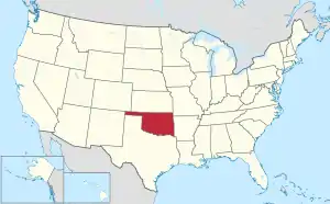
 Location within the U.S. state of Oklahoma | |
 Oklahoma's location within the U.S. | |
| Coordinates: 36°18′N 95°14′W | |
| Country | |
| State | |
| Founded | November 16, 1907 |
| Named for | Samuel Houston Mayes |
| Seat | Pryor Creek |
| Largest city | Pryor Creek |
| Area | |
| • Total | 684 sq mi (1,770 km2) |
| • Land | 655 sq mi (1,700 km2) |
| • Water | 28 sq mi (70 km2) 4.1% |
| Population (2020) | |
| • Total | 39,046 |
| • Density | 57/sq mi (22/km2) |
| Time zone | UTC−6 (Central) |
| • Summer (DST) | UTC−5 (CDT) |
| Congressional district | 2nd |
| Website | mayes |
Bordering counties
- Craig County (north)
- Delaware County (east)
- Cherokee County (southeast)
- Wagoner County (south)
- Rogers County (west)
Cities and towns
|
|
|
|
NRHP Sites
The following sites in Mayes County are listed on the National Register of Historic Places:
- Cabin Creek Battlefield, Pensacola
- Farmers and Merchants Bank, Chouteau
- Lewis Ross/Cherokee Orphan Asylum Springhouse, Salina
- Pensacola Dam, Langley
- Territorial Commercial District, Chouteau
- Union Mission Site, Mazie
References
- "QuickFacts: Mayes County, Oklahoma". United States Census Bureau. Retrieved January 19, 2024.

Municipalities and communities of Mayes County, Oklahoma, United States | ||
|---|---|---|
| City | Mayes County map | |
| Towns | ||
| CDPs |
| |
| Unincorporated communities |
| |
| Indian reservations |
| |
| Footnotes | ‡This populated place also has portions in an adjacent county or counties | |
This article is issued from Wikipedia. The text is licensed under Creative Commons - Attribution - Sharealike. Additional terms may apply for the media files.