Alfalfa County, Oklahoma
Alfalfa County is a county in the U.S. state of Oklahoma. As of 2020, 5,699 people lived there.[1] Its county seat is Cherokee.
Alfalfa County | |
|---|---|
 Alfalfa County Courthouse in Cherokee (2007) | |
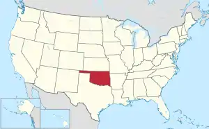
 Location within the U.S. state of Oklahoma | |
 Oklahoma's location within the U.S. | |
| Coordinates: 36°44′N 98°19′W | |
| Country | |
| State | |
| Founded | 1907 |
| Named for | William H. "Alfalfa Bill" Murray |
| Seat | Cherokee |
| Largest city | Helena |
| Area | |
| • Total | 881 sq mi (2,280 km2) |
| • Land | 866 sq mi (2,240 km2) |
| • Water | 15 sq mi (40 km2) 1.7% |
| Population (2020) | |
| • Total | 5,699 |
| • Density | 6.5/sq mi (2.5/km2) |
| Time zone | UTC−6 (Central) |
| • Summer (DST) | UTC−5 (CDT) |
| Congressional district | 3rd |
Geography
The county has a total area of 881 square miles.
Bordering counties
- Harper County, Kansas (northeast)
- Grant County (east)
- Garfield County (southeast)
- Major County (south)
- Woods County (west)
- Barber County, Kansas (northwest)
Places
City
- Cherokee
Towns
- Aline
- Amorita
- Burlington
- Byron
- Carmen
- Goltry
- Helena
- Jet
- Lambert
Other
- Ashley
- Driftwood
- Ingersoll
- Nescatunga
- Yewed
References
- "QuickFacts: Alfalfa County, Oklahoma". United States Census Bureau. Retrieved January 18, 2024.
Places next to Alfalfa County, Oklahoma | |
|---|---|
Municipalities and communities of Alfalfa County, Oklahoma, United States | ||
|---|---|---|
| City | Alfalfa County map | |
| Towns | ||
| CDP |
| |
| Other unincorporated communities |
| |

This article is issued from Wikipedia. The text is licensed under Creative Commons - Attribution - Sharealike. Additional terms may apply for the media files.