Atoka County, Oklahoma
Atoka County is a county in the U.S. state of Oklahoma, and was formed in 1907 from Choctaw Lands. As of 2020, 14,143 people lived there.[1] Its county seat is Atoka.
Atoka County | |
|---|---|
 The Atoka County Courthouse in Atoka. | |
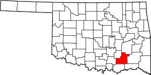 Location within the U.S. state of Oklahoma | |
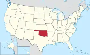 Oklahoma's location within the U.S. | |
| Coordinates: 34°23′N 96°03′W | |
| Country | |
| State | |
| Founded | 1907 |
| Seat | Atoka |
| Largest city | Atoka |
| Area | |
| • Total | 990 sq mi (2,600 km2) |
| • Land | 976 sq mi (2,530 km2) |
| • Water | 14 sq mi (40 km2) 1.5% |
| Population (2020) | |
| • Total | 14,143 |
| • Density | 14/sq mi (5.5/km2) |
| Time zone | UTC−6 (Central) |
| • Summer (DST) | UTC−5 (CDT) |
| Congressional district | 2nd |
Geography
The county has a total area of 990 square miles.
Places
City
- Atoka
Towns
- Caney
- Stringtown
- Tushka
Other
- Bentley
- Bethany
- Blackjack
- Boehler
- Boggy Depot
- Bruno
- Burg
- Centerpoint
- Chockie
- Cook
- Crystal
- Daisy
- Dok
- East Allison
- East Talico
- Farris
- Flora
- Forrest Hill
- Fugate
- Goss
- Grassy Lake
- Half Bank Crossing
- Harmony
- Hickory Hill
- High Hill
- Hopewell
- Iron Stob
- Lane
- Lone Pine
- Mayers Chapel
- McGee Valley
- Mt. Carmel
- Mt. Olive
- Negro Bend
- New Hope
- Nix
- Old Farris
- Patapoe
- Payton Crossing
- Pine Springs
- Plainview
- Pleasant Hill
- Redden
- Reynolds
- Rock Springs
- Standing Rock
- Star
- Taloah
- Valley View
- Voca
- Wards Chapel
- Wardville
- Webster
- Wesley
- West Allison
- West Telico
- Wilson
References
- "QuickFacts: Atoka County, Oklahoma". United States Census Bureau. Retrieved January 18, 2024.
Municipalities and communities of Atoka County, Oklahoma, United States | ||
|---|---|---|
| City | Atoka County map | |
| Towns | ||
| CDPs |
| |
| Other communities |
| |
| Ghost towns |
| |
| Indian reservation |
| |
| Footnotes | ‡This populated place also has portions in another county or counties | |

This article is issued from Wikipedia. The text is licensed under Creative Commons - Attribution - Sharealike. Additional terms may apply for the media files.