Shawnee, Oklahoma
Shawnee is a city in Oklahoma in the United States. It is the county seat of Pottawatomie County.
Shawnee, Oklahoma
Shânîheki | |
|---|---|
 Shawnee City Hall, December 2016 | |
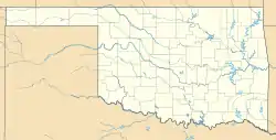 Shawnee Location in Oklahoma  Shawnee Location in the United States | |
| Coordinates: 35°20′33″N 96°56′2″W | |
| Country | |
| State | |
| County | Pottawatomie |
| Government | |
| • Type | Mayor-Council |
| Area | |
| • Total | 40.91 sq mi (105.95 km2) |
| • Land | 38.61 sq mi (99.99 km2) |
| • Water | 2.30 sq mi (5.96 km2) |
| Elevation | 1,053 ft (321 m) |
| Population (2020) | |
| • Total | 31,377 |
| • Density | 812.75/sq mi (313.81/km2) |
| Time zone | UTC−6 (Central (CST)) |
| • Summer (DST) | UTC−5 (CDT) |
| ZIP codes | 74801, 74802, 74804 |
| Area code(s) | 405/572 |
| FIPS code | 40-66800 [3] |
| GNIS feature ID | 2411879[2] |
| Website | ShawneeOK.org |
References
- "ArcGIS REST Services Directory". United States Census Bureau. Retrieved September 20, 2022.
- U.S. Geological Survey Geographic Names Information System: Shawnee, Oklahoma
- "U.S. Census website". United States Census Bureau. Retrieved January 31, 2008.
This article is issued from Wikipedia. The text is licensed under Creative Commons - Attribution - Sharealike. Additional terms may apply for the media files.