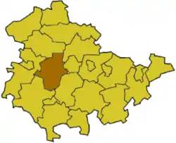
Gotha (district)
Gotha is a Kreis (rural district) in the middle of Thuringia, Germany.
Landkreis Gotha | |
|---|---|
 Coat of arms | |
 | |
| Coordinates: 50°55′N 10°45′E | |
| Country | Germany |
| State | Thuringia |
| Capital | Gotha |
| Area | |
| • Total | 936 km2 (361 sq mi) |
| Population (31 December 2022)[1] | |
| • Total | 134,941 |
| • Density | 140/km2 (370/sq mi) |
| Time zone | UTC+01:00 (CET) |
| • Summer (DST) | UTC+02:00 (CEST) |
| Vehicle registration | GTH |
| Website | http://www.landkreis-gotha.de |
History
The district was made on October 1, 1922, when the newly created state of Thuringia was divided into 15 rural districts (German: Landkreise) and 9 district free cities (German: Stadtkreise).
Partnerships
Since 1990 the district has had a partnership with Main-Kinzig Rural District in Hesse, Germany.
Coat of arms
|
The coat of arms shows the castle of Friedenstein in the top, the biggest baroque building in the city of Gotha. The wavy line below symbolizes the Leina canal, which was built between 1366 and 1369 from Schönau to Gotha, to bring water into the city. The star in bottom was the symbol of the Duchy of Saxe-Gotha-Altenburg. |
Towns and municipalities
| Verwaltungsgemeinschaft-free towns | and municipalities |
|---|---|
|
|
| Verwaltungsgemeinschaften | ||
|---|---|---|
|
1. Apfelstädtaue
2. Drei Gleichen
3. Fahner Höhe
|
4. Hörsel
5. Mittleres Nessetal
|
6. Nesse-Apfelstädt-Gemeinden
7. Nesseaue
|
| 1seat of the Verwaltungsgemeinschaft;2town | ||
Related pages
Other websites
- Official website (in German)
| Urban districts | |
|---|---|
| Rural districts | |
- "Bevölkerung der Gemeinden, erfüllenden Gemeinden und Verwaltungsgemeinschaften in Thüringen Gebietsstand: 31.12.2022" (in German). Thüringer Landesamt für Statistik. June 2023.
This article is issued from Wikipedia. The text is licensed under Creative Commons - Attribution - Sharealike. Additional terms may apply for the media files.