Gera
Gera is a city in the east of Germany, in the state of Thuringia.
Gera | |
|---|---|
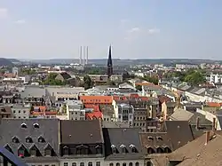
 A view of Gera. | |
|
Flag  Coat of arms | |
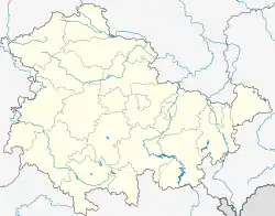
Location of Gera within Thuringia  | |
 Gera  Gera | |
| Coordinates: 50°52′50″N 12°05′00″E | |
| Country | Germany |
| State | Thuringia |
| District | Urban district |
| Founded | 995 |
| Government | |
| • Lord mayor | Julian Vonarb |
| Area | |
| • Total | 151.93 km2 (58.66 sq mi) |
| Elevation | 205 m (673 ft) |
| Population (2022-12-31)[1] | |
| • Total | 93,634 |
| • Density | 620/km2 (1,600/sq mi) |
| Time zone | UTC+01:00 (CET) |
| • Summer (DST) | UTC+02:00 (CEST) |
| Postal codes | 07457-07557 |
| Dialling codes | 0365, 036695 |
| Vehicle registration | G |
| Website | www.gera.de |
It has about 100,000 inhabitants.
History
In the beginning, "Gera" was not the name of a village or city, but of a region or district. This district was mentioned in a document for the first time in the year 995. Four years later, in 999, the Holy Roman Emperor Otto III gave this district to his sister Adelheid, who was an abbess in Quedlinburg.
In the center of this area, the "provincia Gera", a town with the same name was established. Another document, which is from the year 1237, said for the first time that there was a town called Gera. In this town, the abbesses of Quedlinburg had some officials which were called the Vögte of Gera. These officials were the ancestors of the counts and princes of Reuß, which reigned in Gera for many years, until the year 1918.
In the early modern period, Gera was famous for making textiles. There were some fires in which a lot of the town was destroyed, for example in 1686 and in 1780. In 1806, Napoleon was in Gera before the Battle of Jena.
In the 19th century, Gera became an important city of industry. Before that, Gera was a quite small town, but in the year 1900, it had already about 45,000 inhabitants.
In 1920, Thuringia was founded as a state of the Weimar Republic. Gera was the biggest city of the state, because Erfurt was not yet a part of Thuringia. At the end of World War II, some parts of Gera were destroyed by bombs, for example the Osterstein Castle.
After World War II, Gera was in the Soviet Occupation Zone and then in the German Democratic Republic (GDR). From 1952 to 1990, it was the capital of the Gera District (Bezirk Gera) of the GDR.
Since the German Reunification in 1990, Gera belongs to the Free State of Thuringia in the Federal Republic of Germany.
Population
Since 1959, Gera has had more than 100,000 inhabitants. The highest number of inhabitants of Gera was 134,834 in the year 1988. Since the German Reunification, the number of inhabitants becomes smaller and smaller. Now there are fewer people who live in Gera than in Jena, so Gera is only the third-biggest city in Thuringia. On 31 December 2008, there were only 100,643 people living in Gera.
Sights
- The Market Square with the City Hall (Rathaus) from 1575, the Simson Fountain (Simsonbrunnen) from 1686 and the City Pharmacy (Stadtapotheke) from about 1600
- The Geraer Höhler (cellars under the houses in the city center, in which the owners kept their beer in the 18th century)
- The Theatre from 1902
- The Orangerie from 1748, which is now the art gallery of Gera
- St. Salvator's Church (Salvatorkirche) from 1717 (Baroque)
- St. John's Church (Johanniskirche) from 1884 (Gothic Revival architecture
- St. Mary's Church (Marienkirche) in the quarter of Untermhaus with the Otto Dix Birthhouse
- The Hofwiesenpark, a new park where the Bundesgartenschau 2007 was held
Twin towns
Gera has got twelve twin towns. Eleven of them are in Europe.
|
|
People
These famous people were born in Gera:
- Otto Dix (1891–1969), painter
- Georg Buschner (1925–2007), head coach of the East Germany national football team
- Max Frankel (born 1930), executive editor of the New York Times and Pulitzer Prize winner
- Marlies Göhr (born 1958), athlete
- Olaf Ludwig (born 1960), cyclist
- Wolfgang Tiefensee (born 1955), politician
- Heike Drechsler (born 1964), athlete
References
- "Bevölkerung der Gemeinden, erfüllenden Gemeinden und Verwaltungsgemeinschaften in Thüringen Gebietsstand: 31.12.2022" (in German). Thüringer Landesamt für Statistik. June 2023.