Westons Mills, New Jersey | |
|---|---|
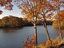 Westons Mill Pond in Westons Mills | |
 Westons Mills  Westons Mills  Westons Mills | |
| Coordinates: 40°29′07″N 74°24′45″W / 40.48528°N 74.41250°W | |
| Country | |
| State | |
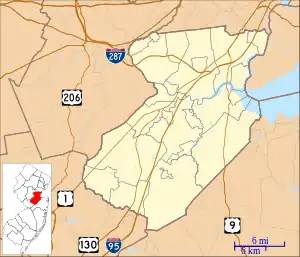
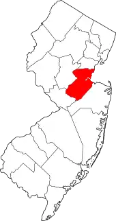
| County | Middlesex |
| City and Township | New Brunswick and East Brunswick |
| Elevation | 39 ft (12 m) |
| GNIS feature ID | 881750[1] |
Westons Mills or Westons Mill is an unincorporated community located along the border of East Brunswick and New Brunswick in Middlesex County, New Jersey, United States.[2] It is the location of Westons Mill Pond.
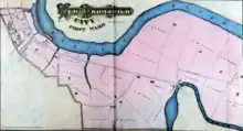
1876 map of New Brunswick's First Ward, showing Weston's Mill at the bend in Lawrence Brook.
See also
- Edward S. Kearney House – listed on the NRHP
References
- 1 2 "Westons Mills". Geographic Names Information System. United States Geological Survey, United States Department of the Interior.
- ↑ Locality Search, State of New Jersey. Accessed February 15, 2015.
| History and architecture |  | |
|---|---|---|
| Arts and entertainment | ||
| Government and education | ||
| Economy and healthcare | ||
| Parks and recreation | ||
| Transportation | ||
| Neighborhoods | ||
This article is issued from Wikipedia. The text is licensed under Creative Commons - Attribution - Sharealike. Additional terms may apply for the media files.