Stonebridge, New Jersey | |
|---|---|
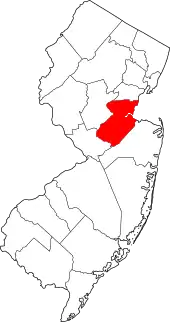
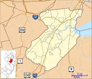 Stonebridge Location in Middlesex County 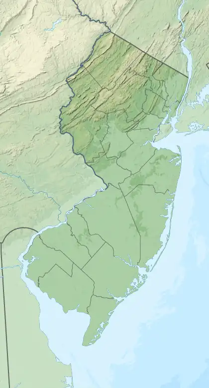 Stonebridge Location in New Jersey  Stonebridge Location in the United States | |
| Coordinates: 40°17′39″N 74°27′59″W / 40.29417°N 74.46639°W | |
| Country | |
| State | |
| County | Middlesex |
| Township | Monroe |
| Area | |
| • Total | 0.46 sq mi (1.19 km2) |
| • Land | 0.46 sq mi (1.19 km2) |
| • Water | 0.00 sq mi (0.00 km2) |
| Elevation | 125 ft (38 m) |
| Population | |
| • Total | 1,616 |
| • Density | 3,528.38/sq mi (1,361.03/km2) |
| Time zone | UTC−05:00 (Eastern (EST)) |
| • Summer (DST) | UTC−04:00 (EDT) |
| ZIP Code | 08831 (Monroe Township) |
| Area code(s) | 732/848 |
| FIPS code | 34-70987[3] |
| GNIS feature ID | 2806193[4] |
Stonebridge is a gated community and census-designated place (CDP) in Monroe Township, Middlesex County, in the U.S. state of New Jersey. It is in the southwestern part of the township, bordered to the north, across Union Valley Road, by Clearbrook, to the west by Applegarth Road, and to the south by Federal Road. It is 5 miles (8 km) south of Jamesburg and 4 miles (6 km) northeast of Hightstown.
The community was first listed as a CDP prior to the 2020 census.[4]
Demographics
| Census | Pop. | Note | %± |
|---|---|---|---|
| 2020 | 1,616 | — | |
| U.S. Decennial Census[5][2] | |||
References
- ↑ "ArcGIS REST Services Directory". United States Census Bureau. Retrieved October 11, 2022.
- 1 2 "Census Population API". United States Census Bureau. Retrieved October 11, 2022.
- ↑ Geographic Codes Lookup for New Jersey, Missouri Census Data Center. Accessed June 9, 2023.
- 1 2 "Stonebridge Census Designated Place". Geographic Names Information System. United States Geological Survey, United States Department of the Interior.
- ↑ "Census of Population and Housing". Census.gov. Retrieved June 4, 2016.
This article is issued from Wikipedia. The text is licensed under Creative Commons - Attribution - Sharealike. Additional terms may apply for the media files.