Raincheval | |
|---|---|
.JPG.webp) The town hall in Raincheval | |
Location of Raincheval | |
 Raincheval 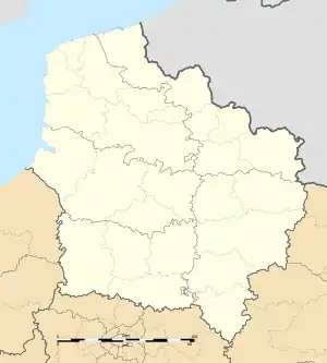 Raincheval | |
| Coordinates: 50°04′27″N 2°26′21″E / 50.0742°N 2.4392°E | |
| Country | France |
| Region | Hauts-de-France |
| Department | Somme |
| Arrondissement | Péronne |
| Canton | Albert |
| Intercommunality | Pays du Coquelicot |
| Government | |
| • Mayor (2020–2026) | Jean-Pierre Billoré[1] |
| Area 1 | 6.8 km2 (2.6 sq mi) |
| Population | 266 |
| • Density | 39/km2 (100/sq mi) |
| Time zone | UTC+01:00 (CET) |
| • Summer (DST) | UTC+02:00 (CEST) |
| INSEE/Postal code | 80659 /80600 |
| Elevation | 89–151 m (292–495 ft) (avg. 137 m or 449 ft) |
| 1 French Land Register data, which excludes lakes, ponds, glaciers > 1 km2 (0.386 sq mi or 247 acres) and river estuaries. | |
Raincheval (French pronunciation: [ʁɛ̃ʃval]; Picard: Rainchveu) is a commune in the Somme department in Hauts-de-France in northern France.
Geography
Raincheval is situated on the D31 road, some 16 miles (26 km) northeast of Amiens.
Population
| Year | Pop. | ±% p.a. |
|---|---|---|
| 1968 | 259 | — |
| 1975 | 260 | +0.06% |
| 1982 | 226 | −1.98% |
| 1990 | 233 | +0.38% |
| 1999 | 244 | +0.51% |
| 2007 | 266 | +1.08% |
| 2012 | 288 | +1.60% |
| 2017 | 282 | −0.42% |
| Source: INSEE[3] | ||
See also
References
- ↑ "Répertoire national des élus: les maires". data.gouv.fr, Plateforme ouverte des données publiques françaises (in French). 2 December 2020.
- ↑ "Populations légales 2021". The National Institute of Statistics and Economic Studies. 28 December 2023.
- ↑ Population en historique depuis 1968, INSEE
Wikimedia Commons has media related to Raincheval.
This article is issued from Wikipedia. The text is licensed under Creative Commons - Attribution - Sharealike. Additional terms may apply for the media files.