Buigny-Saint-Maclou | |
|---|---|
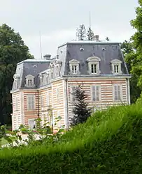 The chateau in Buigny-Saint-Maclou | |
 Coat of arms | |
Location of Buigny-Saint-Maclou | |
 Buigny-Saint-Maclou 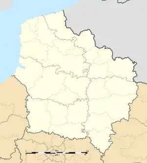 Buigny-Saint-Maclou | |
| Coordinates: 50°09′21″N 1°48′51″E / 50.1558°N 1.8142°E | |
| Country | France |
| Region | Hauts-de-France |
| Department | Somme |
| Arrondissement | Abbeville |
| Canton | Abbeville-1 |
| Intercommunality | CC Ponthieu-Marquenterre |
| Government | |
| • Mayor (2020–2026) | Eric Mouton[1] |
| Area 1 | 7.3 km2 (2.8 sq mi) |
| Population | 531 |
| • Density | 73/km2 (190/sq mi) |
| Time zone | UTC+01:00 (CET) |
| • Summer (DST) | UTC+02:00 (CEST) |
| INSEE/Postal code | 80149 /80132 |
| Elevation | 33–71 m (108–233 ft) (avg. 40 m or 130 ft) |
| 1 French Land Register data, which excludes lakes, ponds, glaciers > 1 km2 (0.386 sq mi or 247 acres) and river estuaries. | |
Buigny-Saint-Maclou (French pronunciation: [bɥiɲi sɛ̃ maklu]; Picard: Bugny-Saint-Maclou) is a commune in the Somme department in Hauts-de-France in northern France.
Geography
The commune is situated on the N1 road, just 4 miles (6 km) north of Abbeville. The Abbeville airport is within the boundaries of the commune.
Population
| Year | Pop. | ±% p.a. |
|---|---|---|
| 1968 | 335 | — |
| 1975 | 292 | −1.94% |
| 1982 | 467 | +6.94% |
| 1990 | 548 | +2.02% |
| 1999 | 523 | −0.52% |
| 2007 | 519 | −0.10% |
| 2012 | 514 | −0.19% |
| 2017 | 517 | +0.12% |
| Source: INSEE[3] | ||
See also
References
- ↑ "Répertoire national des élus: les maires" (in French). data.gouv.fr, Plateforme ouverte des données publiques françaises. 13 September 2022.
- ↑ "Populations légales 2021". The National Institute of Statistics and Economic Studies. 28 December 2023.
- ↑ Population en historique depuis 1968, INSEE
Wikimedia Commons has media related to Buigny-Saint-Maclou.
This article is issued from Wikipedia. The text is licensed under Creative Commons - Attribution - Sharealike. Additional terms may apply for the media files.