Frohen-sur-Authie | |
|---|---|
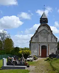 The church in Frohen-sur-Authie | |
.svg.png.webp) Coat of arms | |
Location of Frohen-sur-Authie | |
 Frohen-sur-Authie 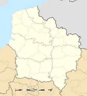 Frohen-sur-Authie | |
| Coordinates: 50°12′13″N 2°12′23″E / 50.2036°N 2.2064°E | |
| Country | France |
| Region | Hauts-de-France |
| Department | Somme |
| Arrondissement | Amiens |
| Canton | Doullens |
| Intercommunality | CC Territoire Nord Picardie |
| Government | |
| • Mayor (2020–2026) | Jean Pierre Devillers[1] |
| Area 1 | 7.08 km2 (2.73 sq mi) |
| Population | 240 |
| • Density | 34/km2 (88/sq mi) |
| Time zone | UTC+01:00 (CET) |
| • Summer (DST) | UTC+02:00 (CEST) |
| INSEE/Postal code | 80369 /80370 |
| Elevation | 39–120 m (128–394 ft) |
| 1 French Land Register data, which excludes lakes, ponds, glaciers > 1 km2 (0.386 sq mi or 247 acres) and river estuaries. | |
Frohen-sur-Authie (French pronunciation: [fʁɔɑ̃ syʁ oti], literally Frohen on Authie; Picard: Frouhin-su-Eutie) is a commune in the Somme department in Hauts-de-France in northern France.
Geography
The commune is situated on the D938 road, 32 kilometres (20 mi) northeast of Abbeville.
History
The commune was created on the January 1, 2007 by the joining of the two old communes of Frohen-le-Grand and Frohen-le-Petit.[3]
See also
References
- ↑ "Répertoire national des élus: les maires". data.gouv.fr, Plateforme ouverte des données publiques françaises (in French). 2 December 2020.
- ↑ "Populations légales 2021". The National Institute of Statistics and Economic Studies. 28 December 2023.
- ↑ Arrêté du 29 décembre 2006, Légifrance
Wikimedia Commons has media related to Frohen-sur-Authie.
This article is issued from Wikipedia. The text is licensed under Creative Commons - Attribution - Sharealike. Additional terms may apply for the media files.