Sergipe
Sergipe is the smallest state in Brazil. Aracaju is the capital and largest city. Sergipe borders two other states, Bahia and Alagoas.
State of Sergipe | |
|---|---|
 Flag  Coat of arms | |
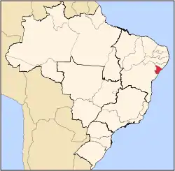 Location of State of Sergipe in Brazil | |
| Coordinates: 10.56°S 37.36°W | |
| Country | |
| Capital and Largest City | Aracaju |
| Government | |
| • Governor | Marcelo Déda |
| • Vice Governor | Belivaldo Chagas |
| Area | |
| • Total | 21,910.348 km2 (8,459.633 sq mi) |
| • Rank | 26th |
| Population (2012)[1] | |
| • Total | 2,110,867 |
| • Rank | 22nd |
| • Density | 96/km2 (250/sq mi) |
| • Rank | 5th |
| Demonym | Sergipano |
| GDP | |
| • Year | 2006 estimate |
| • Total | R$ 15,126,000,000 (21st) |
| • Per capita | R$ 7,560 (16th) |
| HDI | |
| • Year | 2005 |
| • Category | 0.742 – medium (20th) |
| Time zone | UTC-3 (BRT) |
| • Summer (DST) | UTC-2 (BRST) |
| Postal Code | 49000-000 to 49990-000 |
| ISO 3166 code | BR-SE |
| Website | se.gov.br |
Geography
Sergipe's land is mostly caatinga. A strip of rainforest runs down the Atlantic coast. There are also swamps near the coast.
Economy
Sergipe's main crop is sugarcane. Cassava is also grown. There is a small petroleum industry.
History
The first people to live in Sergipe were from the Tupi Tribe. The name "Sergipe" is the Tupi word for crab.
The Portugal took over the area, and made a settlement at São Cristóvão. Later, French pirates invaded Sergipe, but they left soon after.
Now, Sergipe is part of free Brazil.
References
| States of Brazil | |
|---|---|
| Acre | Alagoas | Amapá | Amazonas | Bahia | Ceará | Espírito Santo | Goiás | Maranhão | Mato Grosso | Mato Grosso do Sul | Minas Gerais | Pará | Paraíba | Paraná | Pernambuco | Piauí | Rio de Janeiro | Rio Grande do Norte | Rio Grande do Sul | Rondônia | Roraima | Santa Catarina | São Paulo | Sergipe | Tocantins | |
| Federal district: Distrito Federal | |
This article is issued from Wikipedia. The text is licensed under Creative Commons - Attribution - Sharealike. Additional terms may apply for the media files.