Amazonas (Brazilian state)
Amazonas is the largest state of Brazil. It is in the North Region and borders Acre, Mato Grosso, Pará, Rondônia, Roraima and some countries of Latin America. Its main city is Manaus. In Amazonas is found the highest part of Brazil, the Pico da Neblina.
Amazonas State
Estado do Amazonas | |
|---|---|
 Flag  Coat of arms | |
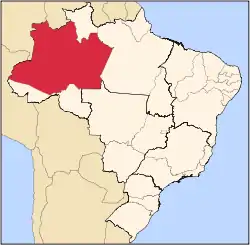 Location of State of Amazonas in Brazil | |
| Coordinates: 5°0′S 63°0′W | |
| Country | |
| Capital and Largest City | Manaus |
| Government | |
| • Governor | Wilson Lima (PSC) |
| • Vice Governor | Carlos Almeida |
| Area | |
| • Total | 1,570,745.7 km2 (606,468.3 sq mi) |
| • Rank | 1st |
| Population (2010 census)[1] | |
| • Total | 3,480,937 |
| • Rank | 15th |
| • Density | 2.2/km2 (5.7/sq mi) |
| • Rank | 26th |
| Demonym | Amazonense |
| GDP | |
| • Year | 2006 estimate |
| • Total | R$ 69,166,000,000 (10th) |
| • Per capita | R$ 23.043 (9th) |
| HDI | |
| • Year | 2006 |
| • Category | 0.780 – medium (13th) |
| Time zone | UTC-03 (UTC-4) |
| • Summer (DST) | UTC-02 (Brazilian DST) |
| Postal Code | 69000-000 to 69290-000 69400-000 to 69890-000 |
| ISO 3166 code | BR-AM |
| Website | amazonas.am.gov.br |
Its name was given because of the Amazons legend, and it is also the name of its major river, the second longest river in the world. Other rivers in Amazonas are Rio Juruá, Purus, Madeira, Rio Negro, Rio Içá, Rio Uaupés, and Rio Japurá.
Other websites
- Official homepage Archived 2005-10-29 at the Wayback Machine (in Portuguese)
- Brazilian Embassy in London's Amazonas page Archived 2006-02-07 at the Wayback Machine
| States of Brazil | |
|---|---|
| Acre | Alagoas | Amapá | Amazonas | Bahia | Ceará | Espírito Santo | Goiás | Maranhão | Mato Grosso | Mato Grosso do Sul | Minas Gerais | Pará | Paraíba | Paraná | Pernambuco | Piauí | Rio de Janeiro | Rio Grande do Norte | Rio Grande do Sul | Rondônia | Roraima | Santa Catarina | São Paulo | Sergipe | Tocantins | |
| Federal district: Distrito Federal | |
This article is issued from Wikipedia. The text is licensed under Creative Commons - Attribution - Sharealike. Additional terms may apply for the media files.