Escambia County, Alabama
Escambia County is a county of the U.S. state of Alabama. As of 2020, 36,757 people lived there.[1] Its county seat is Brewton.
Escambia County | |
|---|---|
 Escambia County, Alabama Courthouse | |
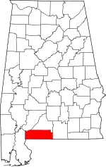 Location within the U.S. state of Alabama | |
 Alabama's location within the U.S. | |
| Coordinates: 31°07′36″N 87°09′44″W | |
| Country | |
| State | |
| Founded | December 10, 1868 |
| Seat | Brewton |
| Largest city | Atmore |
| Area | |
| • Total | 953 sq mi (2,470 km2) |
| • Land | 945 sq mi (2,450 km2) |
| • Water | 8.1 sq mi (21 km2) 0.8% |
| Population | |
| • Total | 36,757 |
| • Density | 39/sq mi (15/km2) |
| Time zone | UTC−6 (Central) |
| • Summer (DST) | UTC−5 (CDT) |
| Website | www |
History
Escambia County was formed after the American Civil War, on December 10, 1868. This was during the Reconstruction era. The name "Escambia" may come from the Creek name Shambia, meaning "clearwater",[2] or the Choctaw word for "cane-brake" or "reed-brake".
In September 1979, the county was declared a disaster area due to damage from Hurricane Frederic, and again in September 2004 due to damage from Hurricane Ivan.
Geography
According to the United States Census Bureau, the county has a total area of 953 square miles (2,470 km2), of which 945 square miles (2,450 km2) is land and 8.1 square miles (21 km2) (0.8%) is water.[3]
Major highways
.svg.png.webp) Interstate 65
Interstate 65 U.S. Highway 29
 U.S. Highway 31
 Alabama State Route 21
 Alabama State Route 41
 Alabama State Route 113
Border counties
- Conecuh County (north)
- Covington County (east)
- Okaloosa County, Florida (southeast)
- Santa Rosa County, Florida (south)
- Escambia County, Florida (southwest)
- Baldwin County (west)
- Monroe County (northwest)
National protected area
- Conecuh National Forest (part)
Cities and towns
- Atmore
- Brewton
- East Brewton
- Flomaton
- Foshee
- Pollard
- Riverview
References
- "QuickFacts: Escambia County, Alabama". United States Census Bureau. Retrieved August 8, 2023.
- Escambia County Alabama History - accessed August 18, 2009
- "2010 Census Gazetteer Files". United States Census Bureau. August 22, 2012. Retrieved August 22, 2015.
Municipalities and communities of Escambia County, Alabama, United States | ||
|---|---|---|
| Cities | Map of Alabama highlighting Escambia County | |
| Towns | ||
| Unincorporated communities |
| |
| Indian reservation |
| |
| Former Town | ||
| Footnotes | ‡This populated place also has portions in an adjacent county or counties | |
This article is issued from Wikipedia. The text is licensed under Creative Commons - Attribution - Sharealike. Additional terms may apply for the media files.