Montmerrei | |
|---|---|
 | |
Location of Montmerrei | |
 Montmerrei  Montmerrei | |
| Coordinates: 48°38′05″N 0°02′33″E / 48.6347°N 0.0425°E | |
| Country | France |
| Region | Normandy |
| Department | Orne |
| Arrondissement | Alençon |
| Canton | Sées |
| Intercommunality | Sources de l'Orne |
| Government | |
| • Mayor (2020–2026) | Claude Duval[1] |
| Area 1 | 12.67 km2 (4.89 sq mi) |
| Population | 543 |
| • Density | 43/km2 (110/sq mi) |
| Time zone | UTC+01:00 (CET) |
| • Summer (DST) | UTC+02:00 (CEST) |
| INSEE/Postal code | 61288 /61570 |
| Elevation | 175–333 m (574–1,093 ft) (avg. 220 m or 720 ft) |
| 1 French Land Register data, which excludes lakes, ponds, glaciers > 1 km2 (0.386 sq mi or 247 acres) and river estuaries. | |
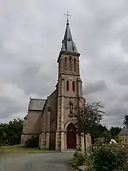
Montmerrei (French pronunciation: [mɔ̃mɛʁɛ] ⓘ) is a commune in the Orne department in north-western France.
Geography
The commune is made up of the following collection of villages and hamlets, La Villette, La Grande Forgé and Montmerrei.[3]
It is 12,700 hectares (49.0 sq mi) in size. The highest point in the commune is 200 metres (660 ft).[4]
The River Thouane, Landrion stream, Vallees stream and the Cercueil stream are the 4 watercourses that flow through the commune.[4]
Neighbouring communes[3] | ||||||||||||||||
|---|---|---|---|---|---|---|---|---|---|---|---|---|---|---|---|---|
| ||||||||||||||||
See also
References
- ↑ "Répertoire national des élus: les maires". data.gouv.fr, Plateforme ouverte des données publiques françaises (in French). 2 December 2020.
- ↑ "Populations légales 2021". The National Institute of Statistics and Economic Studies. 28 December 2023.
- 1 2 "Montmerrei · 61570, France". Montmerrei · 61570, France.
- 1 2 "Mairie de Montmerrei et sa commune (61570)". Annuaire-Mairie. 4 September 2023.
Wikimedia Commons has media related to Montmerrei.
This article is issued from Wikipedia. The text is licensed under Creative Commons - Attribution - Sharealike. Additional terms may apply for the media files.