La Coulonche | |
|---|---|
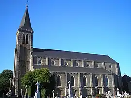 The church in La Coulonche | |
.svg.png.webp) Coat of arms | |
Location of La Coulonche | |
 La Coulonche  La Coulonche | |
| Coordinates: 48°38′52″N 0°27′18″W / 48.6478°N 0.455°W | |
| Country | France |
| Region | Normandy |
| Department | Orne |
| Arrondissement | Argentan |
| Canton | La Ferté-Macé |
| Intercommunality | CA Flers Agglo |
| Government | |
| • Mayor (2020–2026) | Jacky Lecoq[1] |
| Area 1 | 14.32 km2 (5.53 sq mi) |
| Population | 501 |
| • Density | 35/km2 (91/sq mi) |
| Time zone | UTC+01:00 (CET) |
| • Summer (DST) | UTC+02:00 (CEST) |
| INSEE/Postal code | 61124 /61220 |
| Elevation | 209–345 m (686–1,132 ft) (avg. 300 m or 980 ft) |
| 1 French Land Register data, which excludes lakes, ponds, glaciers > 1 km2 (0.386 sq mi or 247 acres) and river estuaries. | |
La Coulonche (French pronunciation: [la kulɔ̃ʃ] ⓘ) is a commune in the Orne department in north-western France.
Geography
The commune is made up of the following collection of villages and hamlets, Le Maupas, Langlècherie, La Rousselière, Le Val de Vée, Le Pistolet and La Coulonche.[3]
It is 1,430 hectares (5.5 sq mi) in size. The highest point in the commune is 301 metres (988 ft).[4]
The commune is within the Normandie-Maine Regional Natural Park.[5]
The Vee river, is the major watercourse running through this area.[4]
Neighbouring communes[3] | |
|---|---|
Twin towns – sister cities
La Coulonche is twinned with:[6]
 Wehretal, Germany
See also
References
- ↑ "Répertoire national des élus: les maires". data.gouv.fr, Plateforme ouverte des données publiques françaises (in French). 9 August 2021.
- ↑ "Populations légales 2021". The National Institute of Statistics and Economic Studies. 28 December 2023.
- 1 2 "La Coulonche · 61220, France". La Coulonche · 61220, France.
- 1 2 "Mairie de la Coulonche et sa commune (61220)". Annuaire-Mairie. 26 October 2023.
- ↑ "rapport de charte" (PDF), parc-naturel-normandie-maine.fr/
- ↑ "24 jumelages franco-allemands dans l'Orne". Ouest-France.fr. 21 January 2013.
Wikimedia Commons has media related to La Coulonche.
This article is issued from Wikipedia. The text is licensed under Creative Commons - Attribution - Sharealike. Additional terms may apply for the media files.