Feings | |
|---|---|
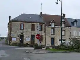 The town hall in Feings | |
Location of Feings | |
 Feings  Feings | |
| Coordinates: 48°32′48″N 0°38′04″E / 48.5467°N 0.6344°E | |
| Country | France |
| Region | Normandy |
| Department | Orne |
| Arrondissement | Mortagne-au-Perche |
| Canton | Mortagne-au-Perche |
| Intercommunality | Pays de Mortagne au Perche |
| Government | |
| • Mayor (2020–2026) | Lydia Bussy-Boiteux[1] |
| Area 1 | 20.24 km2 (7.81 sq mi) |
| Population | 187 |
| • Density | 9.2/km2 (24/sq mi) |
| Time zone | UTC+01:00 (CET) |
| • Summer (DST) | UTC+02:00 (CEST) |
| INSEE/Postal code | 61160 /61400 |
| Elevation | 167–261 m (548–856 ft) (avg. 200 m or 660 ft) |
| 1 French Land Register data, which excludes lakes, ponds, glaciers > 1 km2 (0.386 sq mi or 247 acres) and river estuaries. | |
Feings (French pronunciation: [fɛ̃]) is a commune in the Orne department in north-western France.
Notable buildings and places
- La Tourbière de Commeauche is a nature reserve that features a preserved peat bog in a clearing in the Réno-Valdieu forest.[3][4]
National heritage sites
- Ancienne chartreuse du Val-Dieu is a former Charterhouse that was listed as a Monument historique in 1997.[5]
See also
References
- ↑ "Répertoire national des élus: les maires". data.gouv.fr, Plateforme ouverte des données publiques françaises (in French). 2 December 2020.
- ↑ "Populations légales 2021". The National Institute of Statistics and Economic Studies. 28 December 2023.
- ↑ "La Tourbière de la Commeauche | Conseil départemental de l'Orne". www.orne.fr.
- ↑ "TOURBIERE DE COMMEAUCHE | Conservatoires d'espaces naturels de Normandie". cen-normandie.fr.
- ↑ "Ancienne chartreuse du Val-Dieu à Feings - PA61000004". monumentum.fr.
Wikimedia Commons has media related to Feings (Orne).
This article is issued from Wikipedia. The text is licensed under Creative Commons - Attribution - Sharealike. Additional terms may apply for the media files.