There are over 20,000 Grade II* listed buildings in England. This page is a list of these buildings in the Royal Borough of Kensington and Chelsea.
Buildings
| Name | Location | Type | Completed [note 1] | Date designated | Grid ref.[note 2] Geo-coordinates |
Entry number [note 3] | Image |
|---|---|---|---|---|---|---|---|
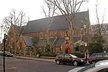
| All Saints Church, Talbot Road and Clydesdale Road | Kensington and Chelsea | Church | 1852–61 | 29 July 1949 | TQ2479481263 51°30′59″N 0°12′10″W / 51.516514°N 0.202875°W |
1080701 | 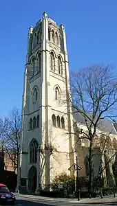 All Saints Church, Talbot Road and Clydesdale Road |
| Arcade Forming North East Quarter of Circle and Avenue | Brompton Cemetery, Kensington and Chelsea | Gate | 1839–40 | 15 April 1969 | TQ2578177710 51°29′04″N 0°11′24″W / 51.484364°N 0.189923°W |
1266242 | 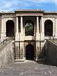 Arcade Forming North East Quarter of Circle and Avenue |
| Arcade Forming North West Quarter of Circle and Avenue | Brompton Cemetery, Kensington and Chelsea | Gate | 1839–40 | 15 April 1969 | TQ2575577693 51°29′03″N 0°11′25″W / 51.484217°N 0.190304°W |
1225713 | 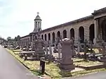 Arcade Forming North West Quarter of Circle and Avenue |
| Arcade Forming South East Quarter of Circle and Avenue | Brompton Cemetery, Kensington and Chelsea | Gate | 1839–40 | 15 April 1969 | TQ2583277640 51°29′01″N 0°11′21″W / 51.483724°N 0.189214°W |
1225714 | 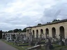 Arcade Forming South East Quarter of Circle and Avenue |
| Arcade Forming South Western Quarter of Circle and Avenue | Kensington and Chelsea | Gate | 1839–40 | 15 April 1969 | TQ2579477619 51°29′01″N 0°11′23″W / 51.483544°N 0.189769°W |
1266205 | 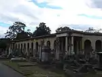 Arcade Forming South Western Quarter of Circle and Avenue |
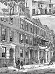
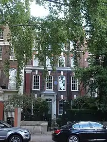
| Argyle House and Gates and Railings, 211 King's Road | Kensington and Chelsea | House | 1723 | 24 June 1954 | TQ2714178002 51°29′12″N 0°10′13″W / 51.486685°N 0.170243°W |
1224631 | 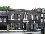 Argyle House and Gates and Railings, 211 King's Road |
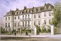
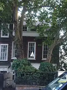
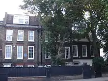
| Aubrey House, Aubrey Road | Kensington and Chelsea | House | Circa 1730–1740 | 29 July 1949 | TQ2484380078 51°30′21″N 0°12′09″W / 51.505853°N 0.202588°W |
1188804 | 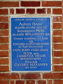 Aubrey House, Aubrey Road |
| Building to Centre of South West Side of College Court, Royal Hospital Chelsea | Kensington and Chelsea | Railings | Early 19th century | 15 April 1969 | TQ2791177967 51°29′10″N 0°09′33″W / 51.486197°N 0.159172°W |
1226383 |  Upload Photo |
| Building to South of Range West of Chelsea Gate Roadway Royal Hospital | Kensington and Chelsea | Orangery | Late 17th century and later | 15 April 1969 | TQ2794977934 51°29′09″N 0°09′31″W / 51.485892°N 0.158637°W |
1226450 | Upload Photo |
| Carlyle's House, 24 Cheyne Row | Kensington and Chelsea | House | 1708 | 24 June 1954 | TQ2717877718 51°29′03″N 0°10′11″W / 51.484124°N 0.169812°W |
1358142 | |
| St Luke's Chapel, Royal Brompton Hospital, Fulham Road | Sydney Street, London SW3 | Chapel | 1849–50 | 3 October 1988 | TQ2681578490 51°29′28″N 0°10′29″W / 51.491143°N 0.17476°W |
1272410 | 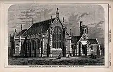 St Luke's Chapel, Royal Brompton Hospital, Fulham Road |
| Chapel to Duke of York's Headquarters | King's Road, Chelsea SW3 | Chapel | Consecrated 1824 | 7 November 1984 | TQ2778578483 51°29′27″N 0°09′39″W / 51.490862°N 0.160799°W |
1224627 | |
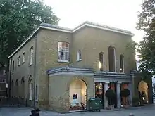
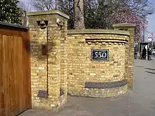
| Chelsea Public Library, now part of Chelsea College of Science and Technology | Manresa Road, Chelsea | Public Library | 1890 | 15 April 1969 | TQ2704378042 51°29′13″N 0°10′18″W / 51.487066°N 0.171639°W |
1266312 | 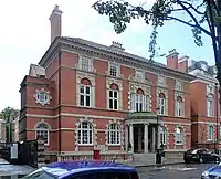 Chelsea Public Library, now part of Chelsea College of Science and Technology |
| Church of England Chapel | Brompton Cemetery, Kensington and Chelsea | Cemetery Chapel | 1839–40 | 15 April 1969 | TQ2584777592 51°29′00″N 0°11′20″W / 51.483289°N 0.189015°W |
1266241 | 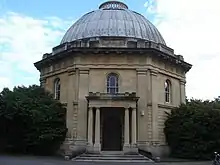 Church of England Chapel |
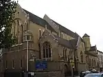
| St Augustine's, Queen's Gate | Kensington and Chelsea | Church | 1865 | 29 July 1949 | TQ2658578731 51°29′36″N 0°10′41″W / 51.493361°N 0.177985°W |
1226161 | |
| St Cuthbert's, Earls Court | 52/3 Philbeach Gardens, Earls Court SW5 | Church | 1884-7 | 15 April 1969 | TQ2502578455 51°29′28″N 0°12′02″W / 51.491227°N 0.200542°W |
1266119 | |
| Church of St Francis Assisi, Pottery Lane W11 | Kensington and Chelsea | Church | 1860 | 15 April 1969 | TQ2426280502 51°30′35″N 0°12′39″W / 51.509792°N 0.210806°W |
1226049 | 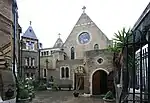 Church of St Francis Assisi, Pottery Lane W11 |
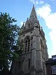
| St Jude's Church, Kensington, Collingham Road SW5 | Kensington and Chelsea | Church | 1870 | 7 November 1984 | TQ2591978720 51°29′36″N 0°11′15″W / 51.49341°N 0.187577°W |
1080661 | 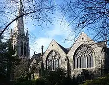 St Jude's Church, Kensington, Collingham Road SW5 |
| St Mary's, Cadogan Street | Cadogan Street, Chelsea SW3 | Roman Catholic Church | Circa 1877–79 | 15 April 1969 | TQ2773078744 51°29′36″N 0°09′41″W / 51.49322°N 0.161496°W |
1294258 | |
| St Peter's, Notting Hill, Kensington Park Road W11 | Kensington and Chelsea | Church | 1855-7 | 29 July 1949 | TQ2481580840 51°30′46″N 0°12′10″W / 51.512708°N 0.202722°W |
1224309 |  St Peter's, Notting Hill, Kensington Park Road W11 |
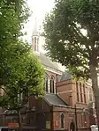
| Church of St Yeghiche, South Kensington (Armenian Church) | Cranley Gardens, London SW7 | Church | 1907–09 | 7 November 1984 | TQ2659778296 51°29′22″N 0°10′41″W / 51.489449°N 0.177968°W |
1190125 | 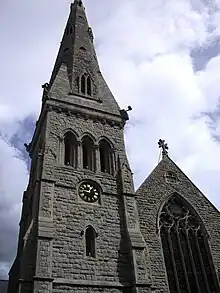 Church of St Yeghiche, South Kensington (Armenian Church) |
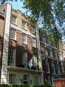
| St Sarkis, Kensington (Armenian Church) | Iverna Gardens, London W8 | Church | 1922–23 | 16 January 1981 | TQ2548279397 51°29′59″N 0°11′37″W / 51.499592°N 0.193628°W |
1080556 | 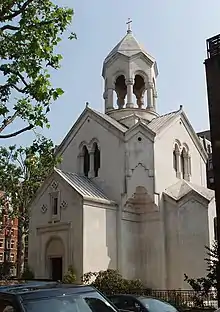 St Sarkis, Kensington (Armenian Church) |
| St Stephen's, Gloucester Road | Gloucester Road, London SW7 4RL | Church | 1866-7 | 7 November 1984 | TQ2619078979 51°29′44″N 0°11′01″W / 51.495678°N 0.183583°W |
1293603 | |
| Cole Wing, Victoria and Albert Museum, Exhibition Road | Kensington and Chelsea | Museum | 1868–73 | 15 April 1969 | TQ2688579176 51°29′50″N 0°10′25″W / 51.497293°N 0.173506°W |
1080654 | 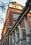 Cole Wing, Victoria and Albert Museum, Exhibition Road |
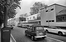
| Commonwealth Institute, Kensington High Street | Kensington and Chelsea | Conference centre | 1960-2 | 12 October 1988 | TQ2499279424 51°30′00″N 0°12′02″W / 51.499943°N 0.200674°W |
1227441 | 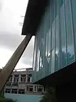 Commonwealth Institute, Kensington High Street |
| Crosby Hall, Cheyne Walk and Danvers Street SW3 | Kensington and Chelsea | Merchants House | 1466 | 24 June 1954 | TQ2699177560 51°28′58″N 0°10′21″W / 51.482746°N 0.172561°W |
1358160 | 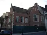 Crosby Hall, Cheyne Walk and Danvers Street SW3 |
| Duke of York's Headquarters (Territorial Army), King's Road | Kensington and Chelsea | Psychiatric Hospital | 1801 | 15 April 1969 | TQ2792678462 51°29′26″N 0°09′32″W / 51.490642°N 0.158776°W |
1266717 |  Duke of York's Headquarters (Territorial Army), King's Road |
| Entrance Gates and Screen on Old Brompton Road | Brompton Cemetery, Kensington and Chelsea | Gate | 1839–40 | 15 April 1969 | TQ2549078097 51°29′16″N 0°11′38″W / 51.487907°N 0.193975°W |
1225715 | 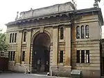 Entrance Gates and Screen on Old Brompton Road |
| Entrance Gateway opposite Wellington Road, Harrow Road | Kensal Green Cemetery, Kensington and Chelsea | Gate | 1833 | 15 April 1969 | TQ2375882538 51°31′42″N 0°13′02″W / 51.5282°N 0.21735°W |
1358176 | 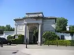 Entrance Gateway opposite Wellington Road, Harrow Road |
| 4 Cheyne Walk | Chelsea SW3 | House | 1718 | 24 June 1954 | TQ2755177744 51°29′03″N 0°09′52″W / 51.484274°N 0.164434°W |
1080721 | |
| Forecourt Railings and Gate to Number 4 Cheyne Walk | Kensington and Chelsea | Gate | 18th century | 15 April 1969 | TQ2755677729 51°29′03″N 0°09′52″W / 51.484138°N 0.164368°W |
1294130 | 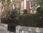 Forecourt Railings and Gate to Number 4 Cheyne Walk |
| 5 Cheyne Walk | Chelsea SW3 | House | 1718 | 24 June 1954 | TQ2754277743 51°29′03″N 0°09′52″W / 51.484267°N 0.164564°W |
1294123 | |
| Forecourt Railings Piers to Gate to Number 5 Cheyne Walk | Kensington and Chelsea | Gate | 18th century | 15 April 1969 | TQ2754877726 51°29′03″N 0°09′52″W / 51.484113°N 0.164484°W |
1358144 | 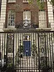 Forecourt Railings Piers to Gate to Number 5 Cheyne Walk |
| 15 Cheyne Walk | Chelsea SW3 | House | c. 1718 | 24 June 1954 | TQ2745777716 51°29′03″N 0°09′57″W / 51.484043°N 0.165797°W |
1358125 | |
| Queens House | 16 Cheyne Walk, Chelsea SW3 | House | 1717 | 24 June 1954 | TQ2744577713 51°29′02″N 0°09′57″W / 51.484019°N 0.165971°W |
1080685 | 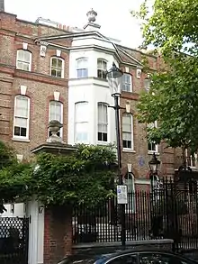 Queens House |
| Forecourt Railings, Piers and Gate to Number 15 and 16, Cheyne Walk | Kensington and Chelsea | Gate | 18th century | 15 April 1969 | TQ2746177696 51°29′02″N 0°09′57″W / 51.483863°N 0.165747°W |
1080687 | 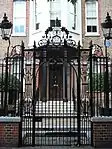 Forecourt Railings, Piers and Gate to Number 15 and 16, Cheyne Walk |
| 6 Cheyne Walk | Chelsea SW3 | House | 1718 | 24 June 1954 | TQ2752577740 51°29′03″N 0°09′53″W / 51.484244°N 0.16481°W |
1358143 | |
| Forecourt Walls Railings Gates and Piers to Number 6 Cheyne Walk | Kensington and Chelsea | Gate | Mid-late 18th century | 15 April 1969 | TQ2753777722 51°29′03″N 0°09′53″W / 51.484079°N 0.164644°W |
1080681 | 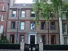 Forecourt Walls Railings Gates and Piers to Number 6 Cheyne Walk |
| Garden Corner | 13 Chelsea Embankment | House | 1879 | 15 April 1969 | TQ2766777726 51°29′03″N 0°09′46″W / 51.484086°N 0.162771°W |
1080708 | |
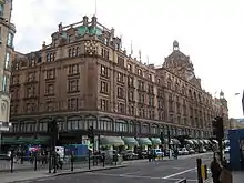
| Harrods | Kensington and Chelsea | Department Store | 1901-5 | 15 April 1969 | TQ2761779413 51°29′57″N 0°09′46″W / 51.499258°N 0.162881°W |
1294346 | |
| Monument to HRH Augustus Frederick | Kensington and Chelsea | Commemorative Monument | 1843 | 13 June 2001 | TQ2322682571 51°31′43″N 0°13′30″W / 51.528613°N 0.225004°W |
1389385 | Upload Photo |
| Kensal House | 1–68, Ladbroke Grove, North Kensington W10 | Flats | 1936-8 | 19 March 1981 | TQ2391382184 51°31′30″N 0°12′55″W / 51.524985°N 0.215242°W |
1225244 | Upload Photo |
| Kensal House Day Nursery | Ladbroke Grove, North Kensington W10 | Nursery | 1936-8 | 19 March 1981 | TQ2388082234 51°31′32″N 0°12′57″W / 51.525441°N 0.215699°W |
1266444 | Upload Photo |
| Kensington Central Library including adjoining Pylons | Hornton Street, Kensington W8 | Library | 1958–1960 | 24 April 1998 | TQ2542279598 51°30′05″N 0°11′40″W / 51.501411°N 0.194421°W |
1119724 |  Kensington Central Library including adjoining Pylons |
| Leighton House | 12 Holland Park Road, West Kensington W14 | Studio House | 1866–96 | 30 August 1961 | TQ2482279271 51°29′55″N 0°12′11″W / 51.498605°N 0.203176°W |
1191541 | |
| Lindsey House | 96–101 Cheyne Walk, Chelsea SW3 | House | 1674 | 24 June 1954 | TQ2684777495 51°28′56″N 0°10′29″W / 51.482194°N 0.174657°W |
1189891 | |
| Linley Sambourne House | 18 Stafford Terrace, Kensington W8 7BH | Town House | 1868 | 26 September 2012 | TQ2525479490 51°30′02″N 0°11′49″W / 51.500478°N 0.196878°W |
1409861 | |
| Lodge Immediately South of Stable Yard, Royal Hospital Chelsea | Kensington and Chelsea | Lodge | Late 17th century | 15 April 1969 | TQ2787377998 51°29′11″N 0°09′35″W / 51.486484°N 0.159707°W |
1226381 | Upload Photo |
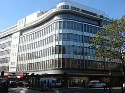
| Marks and Spencers, British Home Stores and the Roof Garden | 99–121 Kensington High St W8 | Department Store | 1933 | 16 January 1981 | TQ2562279527 51°30′03″N 0°11′30″W / 51.500729°N 0.191566°W |
1222781 | 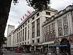 Marks and Spencers, British Home Stores and the Roof Garden |
| Monument to Hrh Princess Sophia, Kensal Green Cemetery | Kensington and Chelsea | Tomb Chest | Erected 1848 | 7 November 1984 | TQ2322482549 51°31′42″N 0°13′30″W / 51.528415°N 0.22504°W |
1080633 | 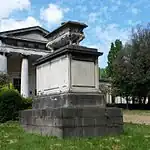 Monument to Hrh Princess Sophia, Kensal Green Cemetery |
| Monument to Ninon Michaelis, Kensal Green Cemetery | Kensington and Chelsea | Tomb | Erected 1895 | 13 June 2001 | TQ2355382556 51°31′42″N 0°13′13″W / 51.528407°N 0.220298°W |
1246089 | 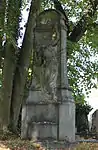 Monument to Ninon Michaelis, Kensal Green Cemetery |
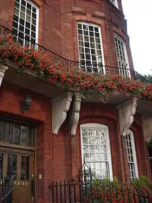
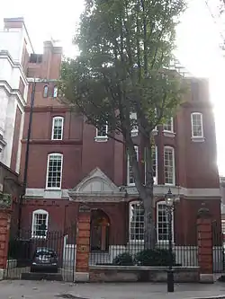
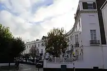
| 1a Palace Gate, including Area Railings | Kensington W8 | Town House | 1896–98 | 15 April 1969 | TQ2612179603 51°30′05″N 0°11′04″W / 51.501301°N 0.184354°W |
1066003 | 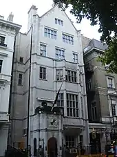 1a Palace Gate, including Area Railings |
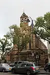
| Old Vestry Hall (part of Chelsea Town Hall) | CHELSEA MANOR GARDENS, Chelsea SW3 | Town Hall | 1886 | 15 April 1969 | TQ2727778047 51°29′13″N 0°10′06″W / 51.487059°N 0.168269°W |
1294164 | 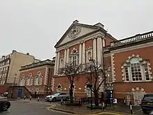 Old Vestry Hall (part of Chelsea Town Hall) |
| Parish Church of St Mary Abbot and Railings to Churchyard | Kensington and Chelsea | Church | 1869–1872 | 29 July 1949 | TQ2560579707 51°30′08″N 0°11′30″W / 51.50235°N 0.191747°W |
1239529 | |
| Peter Jones Store | Kensington and Chelsea | Department Store | 1936 | 7 November 1984 | TQ2791078651 51°29′32″N 0°09′32″W / 51.492344°N 0.158938°W |
1226626 | |
| Principal's House College of St Mark and St John | King's Road, Kensington and Chelsea | House | c. 1691 | 24 June 1954 | TQ2608477328 51°28′51″N 0°11′09″W / 51.480864°N 0.185698°W |
1266547 | |
| Stable Yard, to West of Chelsea Gate Roadway, Royal Hospital | Kensington and Chelsea | Yard | 1814–17 | 15 April 1969 | TQ2783678021 51°29′12″N 0°09′37″W / 51.486699°N 0.160232°W |
1226380 | Upload Photo |
| Swan House, 17 Chelsea Embankment | Kensington and Chelsea | House | 1876 | 24 June 1954 | TQ2762177720 51°29′03″N 0°09′48″W / 51.484042°N 0.163435°W |
1294208 | 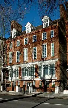 Swan House, 17 Chelsea Embankment |
| The Dissenters Chapel | Kensal Green Cemetery, Kensington and Chelsea | Nonconformist Chapel | 1831–34 | 15 April 1969 | TQ2386382399 51°31′37″N 0°12′57″W / 51.526928°N 0.215886°W |
1080628 | 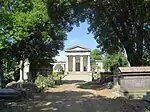 The Dissenters Chapel |
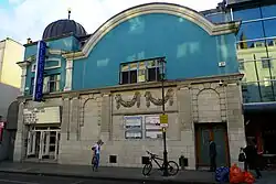
| Electric Cinema | 191 Portobello Road, Notting Hill W11 | Cinema | 1910–12 | 8 February 1974 | TQ2464481150 51°30′56″N 0°12′18″W / 51.515531°N 0.205075°W |
1266083 | |
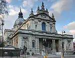
| Brompton Oratory | Brompton Road, Chelsea | Church | 1884 | 15 April 1969 | TQ2715679165 51°29′50″N 0°10′11″W / 51.497133°N 0.169608°W |
1358123 | |
| The Oratory House (Block parallel to Brompton Road, Brompton Oratory) | Kensington and Chelsea | House | 1853 | 7 November 1984 | TQ2711579156 51°29′49″N 0°10′13″W / 51.497061°N 0.170202°W |
1080763 | 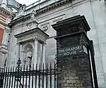 The Oratory House (Block parallel to Brompton Road, Brompton Oratory) |
| The Royal Hospital North East Range | Kensington and Chelsea | Hospital | Late C17/early 18th century | 15 April 1969 | TQ2810178181 51°29′17″N 0°09′23″W / 51.488077°N 0.156359°W |
1226303 | 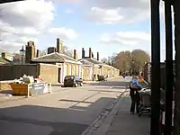 The Royal Hospital North East Range |
| Tomb of Andrew Ducrow | Kensal Green Cemetery, Kensington and Chelsea | Mausoleum | 1837 | 7 November 1984 | TQ2335882552 51°31′42″N 0°13′23″W / 51.528413°N 0.223109°W |
1358179 | 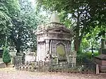 Tomb of Andrew Ducrow |
| Tomb of Commander Charles Spencer Ricketts, Royal Navy | Kensal Green Cemetery, Kensington and Chelsea | Chest Tomb | 1867 | 7 November 1984 | TQ2347282535 51°31′42″N 0°13′17″W / 51.528236°N 0.221472°W |
1080630 | |
| Tomb of Elizabeth and Alexis Soyer | Kensal Green Cemetery, Kensington and Chelsea | Statue | 1850s | 7 November 1984 | TQ2334882670 51°31′46″N 0°13′24″W / 51.529476°N 0.223212°W |
1191060 | 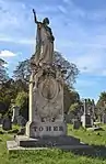 Tomb of Elizabeth and Alexis Soyer |
| Tomb of Frederick Richards Leyland, Brompton Cemetery | Kensington and Chelsea | Chest Tomb | c. 1892 | 7 November 1984 | TQ2565377846 51°29′08″N 0°11′30″W / 51.485615°N 0.191718°W |
1225750 | |
| Tomb of John St John Long | Kensal Green Cemetery, Kensington and Chelsea | Tomb | 1834 | 7 November 1984 | TQ2335782560 51°31′43″N 0°13′23″W / 51.528485°N 0.22312°W |
1191149 | Upload Photo |
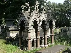
| Tomb of Major General Sir William Casement, Knight Commander of the Bath | Kensal Green Cemetery, Kensington and Chelsea | Mausoleum | 1844 | 7 November 1984 | TQ2341482551 51°31′42″N 0°13′20″W / 51.528392°N 0.222302°W |
1293515 | 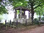 Tomb of Major General Sir William Casement, Knight Commander of the Bath |
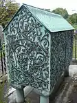
| Tomb of Mary Gibson | Kensal Green Cemetery, Kensington and Chelsea | Chest Tomb | 1872 | 7 November 1984 | TQ2339882561 51°31′43″N 0°13′21″W / 51.528485°N 0.222529°W |
1293490 | 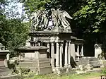 Tomb of Mary Gibson |
| Tomb of William Mulready, Royal Academy | Kensal Green Cemetery, Kensington and Chelsea | Tomb | 1863 | 7 November 1984 | TQ2339382561 51°31′43″N 0°13′21″W / 51.528486°N 0.222601°W |
1358178 | 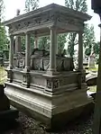 Tomb of William Mulready, Royal Academy |
| Trellick Tower, Cheltenham Estate | Golborne Road, Kensington and Chelsea | Flats | 1968–1972 | 22 December 1998 | TQ2460082053 51°31′25″N 0°12′19″W / 51.523656°N 0.20539°W |
1246688 | 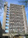 Trellick Tower, Cheltenham Estate |
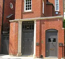
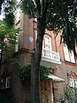
| West House | Bramerton Street, London SW3 5JP | House | 1876 | 24 June 1954 | TQ2708877834 51°29′07″N 0°10′16″W / 51.485187°N 0.171066°W |
1080657 | |
| Wilbraham House and Wall to Right | D'OYLEY STREET SW1 | House | 1922 | 7 November 1984 | TQ2808178841 51°29′38″N 0°09′23″W / 51.494013°N 0.156408°W |
1358161 | 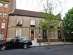 Wilbraham House and Wall to Right |
| Woodland House | 31 Melbury Road, Holland Park, W14 | Detached House | 1875 | 29 July 1949 | TQ2484979415 51°30′00″N 0°12′10″W / 51.499894°N 0.202736°W |
1225541 | |
| 1 Palace Green | Kensington W8 | Detached House | 1868 | 15 April 1969 | TQ2575179762 51°30′10″N 0°11′23″W / 51.502812°N 0.189625°W |
1065945 | |
| 2 Palace Green | Kensington W8 | Detached House | 1860-2 | 15 April 1969 | TQ2574179806 51°30′12″N 0°11′23″W / 51.50321°N 0.189753°W |
1357462 | Upload Photo |
| 2–14 Pelham Place | Kensington and Chelsea | Terrace | c. 1825 | 29 July 1949 | TQ2706478743 51°29′36″N 0°10′16″W / 51.493361°N 0.171085°W |
1065845 | |
| 1–14 Pelham Crescent | Kensington and Chelsea | Terrace | c. 1825 | 29 July 1949 | TQ2715078744 51°29′36″N 0°10′11″W / 51.493351°N 0.169846°W |
1065887 | |
| 15–27 Pelham Crescent | Kensington and Chelsea | Terrace | c. 1825 | 29 July 1949 | TQ2704378662 51°29′33″N 0°10′17″W / 51.492638°N 0.171416°W |
1357470 | |
| 4 Cadogan Square | Kensington and Chelsea | House | c. 1880 | 15 April 1969 | TQ2778679054 51°29′46″N 0°09′38″W / 51.495994°N 0.160578°W |
1080740 | Upload Photo |
| 52 Cadogan Square | Kensington and Chelsea SW1 | House | 1886-7 | 26 September 1962 | TQ2771378977 51°29′43″N 0°09′42″W / 51.495318°N 0.161657°W |
1358109 | |
| 62 and 62b Cadogan Square | Kensington and Chelsea, London SW1 | House | 1803 | 24 June 1954 | TQ2772178916 51°29′41″N 0°09′42″W / 51.494768°N 0.161563°W |
1189431 | |
| 68 Cadogan Square | Kensington and Chelsea, London SW1 | House | 1878 | 15 April 1969 | TQ2772878892 51°29′40″N 0°09′41″W / 51.494551°N 0.161471°W |
1080738 | |
| 72 Cadogan Square | Kensington and Chelsea, London SW1 | House | 1878 | 15 April 1969 | TQ2774078875 51°29′40″N 0°09′41″W / 51.494395°N 0.161305°W |
1080739 | |
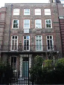
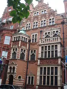
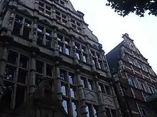
| 35 and 37, Harrington Gardens SW7 | Kensington and Chelsea | Semi Detached House | 1881-4 | 15 April 1969 | TQ2613578646 51°29′34″N 0°11′04″W / 51.492697°N 0.184494°W |
1080620 |  35 and 37, Harrington Gardens SW7 |
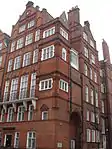
| 45 Harrington Gardens SW7 | Kensington and Chelsea | House | 1881-4 | 15 April 1969 | TQ2606278629 51°29′33″N 0°11′08″W / 51.492561°N 0.185551°W |
1080624 | 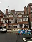 45 Harrington Gardens SW7 |
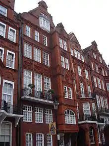
| 39 Harrington Gardens SW7 | Kensington and Chelsea | House | 1881-4 | 15 April 1969 | TQ2610678639 51°29′34″N 0°11′06″W / 51.492641°N 0.184914°W |
1080621 | 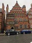 39 Harrington Gardens SW7 |
| 28 AND 29, KENSINGTON GATE W8 | Kensington and Chelsea | Semi Detached House | 1847 | 15 April 1969 | TQ2620279429 51°29′59″N 0°11′00″W / 51.499719°N 0.18325°W |
1222711 | 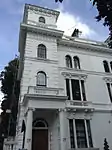 28 AND 29, KENSINGTON GATE W8 |
| 12, Kensington Palace Gardens W8 | Kensington and Chelsea | House | After 1844 | 15 April 1969 | TQ2564980313 51°30′28″N 0°11′27″W / 51.507787°N 0.190898°W |
1223941 | Upload Photo |
| 44, Tite Street SW3 | Kensington and Chelsea | House | 1878–80 | 15 April 1969 | TQ2780377885 51°29′08″N 0°09′39″W / 51.485484°N 0.160756°W |
1227011 | 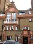 44, Tite Street SW3 |
| 1–3, KENSINGTON GATE W8 | Kensington and Chelsea | Terrace | 1847 | 15 April 1969 | TQ2619679382 51°29′57″N 0°11′00″W / 51.499298°N 0.183353°W |
1222679 | 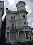 1–3, KENSINGTON GATE W8 |
| 16 AND 17, KENSINGTON GATE W8 | Kensington and Chelsea | Semi Detached House | 1847 | 15 April 1969 | TQ2627879429 51°29′59″N 0°10′56″W / 51.499702°N 0.182155°W |
1222710 | Upload Photo |
| 1–6, Royal Crescent, W11 | Kensington and Chelsea | House | 1846 | 15 April 1969 | TQ2413480054 51°30′21″N 0°12′46″W / 51.505794°N 0.212807°W |
1226300 | 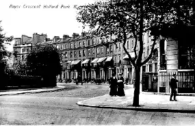 1–6, Royal Crescent, W11 |
| Cohen House | 64 Old Church Street, SW3 | House | 1936 | 23 March 1970 | TQ2687778092 51°29′15″N 0°10′26″W / 51.487553°N 0.174011°W |
1225772 | |
| 14 AND 15, KENSINGTON GATE W8 | Kensington and Chelsea | Semi Detached House | 1847 | 15 April 1969 | TQ2628079387 51°29′58″N 0°10′56″W / 51.499324°N 0.182141°W |
1222708 | Upload Photo |
| 15, Kensington Palace Gardens W8 | Kensington and Chelsea | House | 1854-6 | 15 April 1969 | TQ2570480148 51°30′23″N 0°11′25″W / 51.506292°N 0.190164°W |
1224113 | Upload Photo |
| 18 and 19, Kensington Palace Gardens, W8 | Kensington and Chelsea | House | 1845–47 | 15 April 1969 | TQ2558080236 51°30′26″N 0°11′31″W / 51.50711°N 0.191919°W |
1266954 | Upload Photo |
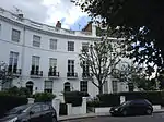
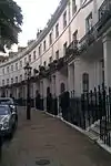
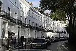
| 7–44 Royal Crescent, W11 | Kensington and Chelsea | Terrace | 1846 | 15 April 1969 | TQ2394979988 51°30′19″N 0°12′56″W / 51.505241°N 0.215494°W |
1265914 | 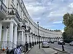 7–44 Royal Crescent, W11 |
| 24, Kensington Palace, W8 | Kensington and Chelsea | Town House | 1845-circa 1849 | 15 April 1969 | TQ2552280432 51°30′32″N 0°11′34″W / 51.508884°N 0.192684°W |
1266930 | Upload Photo |
| 4–13, Kensington Gate, W8 | Kensington and Chelsea | Terrace | 1847 | 15 April 1969 | TQ2624079385 51°29′58″N 0°10′58″W / 51.499315°N 0.182718°W |
1267726 | Upload Photo |
| 167, Queen's Gate, SW7 | Kensington and Chelsea | Town House | 1888-9 | 7 November 1984 | TQ2649779175 51°29′51″N 0°10′45″W / 51.497371°N 0.179093°W |
1266000 | .JPG.webp) 167, Queen's Gate, SW7 |
| 18–27, KENSINGTON GATE W8 | Kensington and Chelsea | Terrace | 1847 | 15 April 1969 | TQ2622979430 51°29′59″N 0°10′58″W / 51.499722°N 0.18286°W |
1267642 | 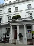 18–27, KENSINGTON GATE W8 |
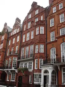
| 9–18,11A and 18A, Collingham Gardens, SW5 | Kensington and Chelsea | House | 1881-4 | 15 April 1969 | TQ2588478528 51°29′30″N 0°11′17″W / 51.491693°N 0.18815°W |
1294000 | 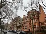 9–18,11A and 18A, Collingham Gardens, SW5 |
| 1–29 Pelham Place | Kensington and Chelsea | Terrace | 1833 | 29 July 1949 | TQ2702878723 51°29′35″N 0°10′18″W / 51.49319°N 0.17161°W |
1357487 | |
| 1-8 Collingham Gardens | Earls Court SW5 | House | 1881-4 | 15 April 1969 | TQ2593878531 51°29′30″N 0°11′15″W / 51.491708°N 0.187371°W |
1358133 | |
| 40, Chelsea Square SW3 | Kensington and Chelsea | House | 1930 | 6 July 1981 | TQ2693478115 51°29′16″N 0°10′23″W / 51.487747°N 0.173182°W |
1358140 | 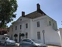 40, Chelsea Square SW3 |
| 170–178, Holland Park Avenue, W11 | Kensington and Chelsea | Terrace | c. 1840 | 7 November 1984 | TQ2417480052 51°30′21″N 0°12′44″W / 51.505767°N 0.212232°W |
1358200 | Upload Photo |
| 10 Palace Gate SW7 | Kensington and Chelsea | Flats | 1937 | 9 March 1982 | TQ2617579459 51°30′00″N 0°11′01″W / 51.499995°N 0.183628°W |
1357457 | 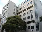 10 Palace Gate SW7 |
| 43, HARRINGTON GARDENS SW7 | Kensington and Chelsea | House | 1881-4 | 15 April 1969 | TQ2608378629 51°29′33″N 0°11′07″W / 51.492556°N 0.185249°W |
1080623 | 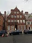 43, HARRINGTON GARDENS SW7 |
| 41, HARRINGTON GARDENS SW7 | Kensington and Chelsea | House | 1883 | 15 April 1969 | TQ2609678635 51°29′33″N 0°11′06″W / 51.492607°N 0.185059°W |
1080622 | 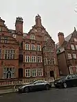 41, HARRINGTON GARDENS SW7 |
| 8 Melbury Road | Kensington and Chelsea | Detached House | 1875 | 30 August 1961 | TQ2478379344 51°29′57″N 0°12′13″W / 51.49927°N 0.203712°W |
1225615 | |
| 217 King's Road | Kensington and Chelsea | House | c. 1750 | 24 June 1954 | TQ2712177988 51°29′12″N 0°10′14″W / 51.486563°N 0.170536°W |
1266669 | |
| 213 and 215 King's Road | Chelsea SW3 | Terrace | 1720 | 24 June 1954 | TQ2712477996 51°29′12″N 0°10′14″W / 51.486635°N 0.17049°W |
1266690 | |
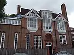
| 55 and 57, Melbury Road W14 | Kensington and Chelsea | House | Late 19th century | 30 August 1961 | TQ2495179326 51°29′57″N 0°12′05″W / 51.499071°N 0.201299°W |
1225641 | 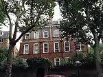 55 and 57, Melbury Road W14 |
| Tomb of Emmeline Pankhurst | Brompton Cemetery | Tomb | 1930 | 7 November 1984 | TQ 25522 78066 51°29′15″N 0°11′37″W / 51.487621°N 0.19352511°W |
1225716 | 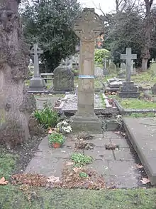 Tomb of Emmeline Pankhurst |


See also
Notes
- ↑ The date given is the date used by Historic England as significant for the initial building or that of an important part in the structure's description.
- ↑ Sometimes known as OSGB36, the grid reference is based on the British national grid reference system used by the Ordnance Survey.
- ↑ The "List Entry Number" is a unique number assigned to each listed building and scheduled monument by Historic England.
External links
 Media related to Grade II* listed buildings in the Royal Borough of Kensington and Chelsea at Wikimedia Commons

This article is issued from Wikipedia. The text is licensed under Creative Commons - Attribution - Sharealike. Additional terms may apply for the media files.