There are over 20,000 Grade II* listed buildings in England. This is a list of these buildings in the London Borough of Richmond upon Thames.
Almshouses
| Name | Location | Type | Completed [note 1] | Date designated | Grid ref.[note 2] Geo-coordinates |
Entry number [note 3] | Image |
|---|---|---|---|---|---|---|---|
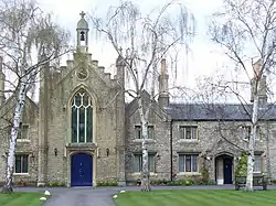
| Hickeys Almshouses, Including Chapel and Lodges | Sheen Road, Richmond TW9 1XB | Almshouses, chapel and lodges | 1834 | 10 January 1950 | TQ1886375104 51°27′45″N 0°17′25″W / 51.462438°N 0.290382°W |
1262108 | |
| Houblon's Almshouses | Worple Way, Richmond TW10 6DA | Almshouses | 1757–58 | 10 January 1950 | TQ1840674978 51°27′41″N 0°17′49″W / 51.461401°N 0.296999°W |
1253033 |

Bridges
| Name | Location | Type | Completed [note 1] | Date designated | Grid ref.[note 2] Geo-coordinates |
Entry number [note 3] | Image |
|---|---|---|---|---|---|---|---|
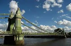
| Hammersmith Bridge | Castelnau | Suspension bridge | 1884 | 25 June 1983 | TQ2293878036 51°29′17″N 0°13′51″W / 51.487919°N 0.230733°W |
1080793 | |
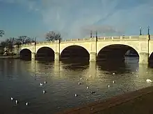
| Kingston Bridge | A308, Richmond KT1 4DP | Road bridge | 1825–28 | 2 September 1952 | TQ1769069379 51°24′40″N 0°18′33″W / 51.411228°N 0.30916°W |
1065378 | |
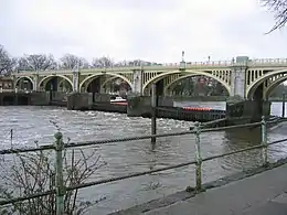
| Richmond Footbridge, Lock and Sluices | Richmond | Footbridge and lock | 1891 | 25 May 1983 | TQ1701575056 51°27′45″N 0°19′01″W / 51.462391°N 0.316987°W |
1250044 | |
| Twickenham Bridge and Attached Railings, Lamp Standards and Light Brackets | A316, Richmond TW1 1QX | Road bridge | 1933 | 25 May 1983 | TQ1721274846 51°27′38″N 0°18′51″W / 51.460463°N 0.314222°W |
1253011 | 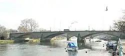 Twickenham Bridge and Attached Railings, Lamp Standards and Light Brackets |
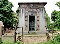
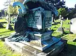
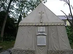
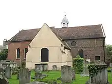
Churches, memorials and tombs

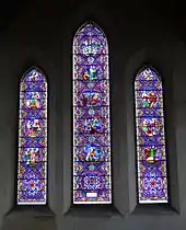
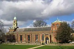
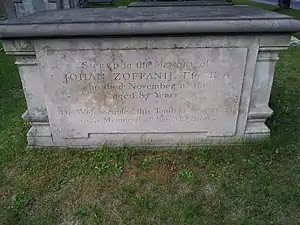
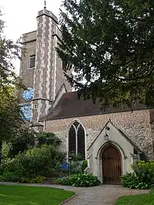
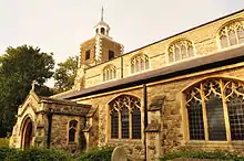
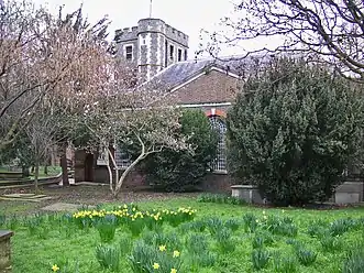
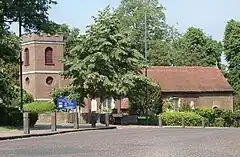
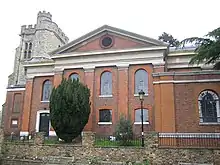
.jpg.webp)
Royal Botanic Gardens, Kew
| Name | Location | Type | Completed [note 1] | Date designated | Grid ref.[note 2] Geo-coordinates |
Entry number [note 3] | Image |
|---|---|---|---|---|---|---|---|
| Aroid House | Royal Botanic Gardens, Kew, Richmond TW9 3AE | Pavilion | Reerected | 10 January 1950 | TQ1866177534 51°29′04″N 0°17′33″W / 51.48432°N 0.292473°W |
1250800 | 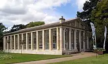 Aroid House |
| Avenue Lodge | Royal Botanic Gardens, Kew, Richmond TW9 3AE | Lodge | 1866 | 25 May 1983 | TQ1867676402 51°28′27″N 0°17′33″W / 51.474143°N 0.292637°W |
1251933 |  Avenue Lodge |
| Marianne North Gallery | Royal Botanic Gardens, Kew, Richmond TW9 3AE | Art gallery | 1879–1882 | 10 January 1950 | TQ1868276431 51°28′28″N 0°17′33″W / 51.474402°N 0.292541°W |
1251787 | |
| Principal Entrance Gates and Railings Fronting Kew Green (now known as Elizabeth Gate) | Royal Botanic Gardens, Kew, Richmond TW9 3AE | Gate | 1848 | 25 May 1983 | TQ1873877548 51°29′04″N 0°17′29″W / 51.484429°N 0.29136°W |
1250801 |  Principal Entrance Gates and Railings Fronting Kew Green (now known as Elizabeth Gate) |
| The Queen's Cottage | Royal Botanic Gardens, Kew, Richmond TW9 3AE | Timber-framed house | c. 1772 | 10 January 1950 | TQ1790776250 51°28′23″N 0°18′14″W / 51.472937°N 0.303755°W |
1262486 | 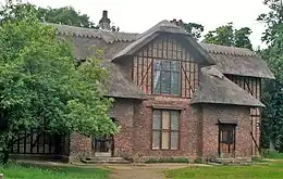 The Queen's Cottage |
| Ruined Arch, Including Fragments of Masonry at the Base of the Arch | Royal Botanic Gardens, Kew, Richmond TW9 3AE | Folly | 1759 | 25 May 1983 | TQ1865476371 51°28′26″N 0°17′35″W / 51.473869°N 0.292964°W |
1251956 | 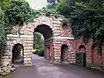 Ruined Arch, Including Fragments of Masonry at the Base of the Arch |
| Herbarium Complex, Royal Botanic Gardens, Kew - Hunter House and Wings C, B and A, including the entrance gates and railings | Royal Botanic Gardens, Kew, Richmond TW9 3AE | Herbarium | various | 10 January 1950 | TQ1876977629 51°29′07″N 0°17′27″W / 51.485151°N 0.29088614°W |
1065399 | .jpg.webp) Herbarium Complex, Royal Botanic Gardens, Kew - Hunter House and Wings C, B and A, including the entrance gates and railings |
Other buildings
| Name | Location | Type | Completed [note 1] | Date designated | Grid ref.[note 2] Geo-coordinates |
Entry number [note 3] | Image |
|---|---|---|---|---|---|---|---|
| Box Cottage (The Red House) | Sudbrook Lane, Petersham, Richmond TW10 7AT | House | Late 17th/early 18th century | 10 January 1950 | TQ1812073024 51°26′38″N 0°18′06″W / 51.443899°N 0.301766°W |
1252876 |  Upload Photo |
| Buckingham House Dudley House Farthingwood and Gate and Railing Norfolk House | Montpelier Row, Twickenham TW1 2NQ | Terrace | 1720 | 2 September 1952 | TQ1700473765 51°27′03″N 0°19′03″W / 51.45079°N 0.317572°W |
1065390 | Upload Photo |
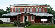
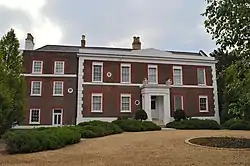
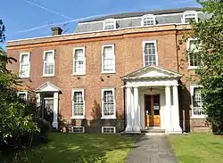
| Bushy House | Bushy Road, Teddington TW11 0EB | House | Early 19th century | 2 September 1952 | TQ1557770357 51°25′14″N 0°20′21″W / 51.420453°N 0.33921°W |
1080870 | |
| Cross Deep and Coach House | 3 Cross Deep, Twickenham TW1 1QY | House | Late 17th/early 18th century | 2 September 1952 | TQ1612972947 51°26′37″N 0°19′50″W / 51.443618°N 0.330426°W |
1358068 | 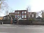 Cross Deep and Coach House |
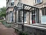
| Douglas House | Petersham Road, Petersham, Richmond TW10 7AH | House | Late 17th century | 25 June 1983 | TQ1787973156 51°26′42″N 0°18′19″W / 51.445135°N 0.305188°W |
1285296 | |
| Entrance Gate and Piers to Rutland Lodge Rutland Lodge | 145 Petersham Road, Petersham, Richmond TW10 7AA | House | Late 17th century | 10 January 1950 | TQ1801173292 51°26′47″N 0°18′12″W / 51.44633°N 0.303244°W |
1065338 | 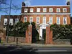 Entrance Gate and Piers to Rutland Lodge Rutland Lodge |
| Fotheringay House and Tennyson House | Montpelier Row, Twickenham TW1 2NQ | Terrace | 1720 | 2 September 1952 | TQ1701373745 51°27′02″N 0°19′03″W / 51.450609°N 0.317449°W |
1285639 | .jpg.webp) Fotheringay House and Tennyson House |
| Fountain Garden, Statue in Front of Canal | Hampton Court | Statue | after 16th century statue | 2 September 1952 | TQ1600968410 51°24′10″N 0°20′01″W / 51.402865°N 0.333636°W |
1065453 | 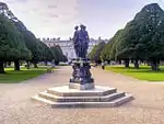 Fountain Garden, Statue in Front of Canal |
| Garden Gates and Railings Petersham House | Church Lane, Petersham, Richmond TW10 7AG | House | Late 17th century | 10 January 1950 | TQ1811073311 51°26′47″N 0°18′07″W / 51.44648°N 0.301814°W |
1065336 |  Garden Gates and Railings Petersham House |
| Gate and Railings to Old Friars Old Friars | Richmond Green | Terraced house | Late 17th century | 10 January 1950 | TQ1765474833 51°27′37″N 0°18′28″W / 51.460254°N 0.307867°W |
1065315 | 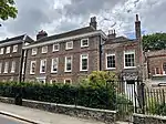 Gate and Railings to Old Friars Old Friars |
| Gates and Railings to Oak House Oak House | Richmond Green, Richmond TW9 1NQ | Terraced house | Mid 18th century | 10 January 1950 | TQ1768374820 51°27′36″N 0°18′27″W / 51.460132°N 0.307454°W |
1065313 | 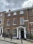 Gates and Railings to Oak House Oak House |
| Gordon House Maria Grey Training College | St Margarets | House | c. 1720 | 21 May 1973 | TQ1669375276 51°27′52″N 0°19′18″W / 51.464435°N 0.321547°W |
1240076 | 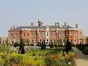 Gordon House Maria Grey Training College |
| Grotto in Grounds of Hampton Court House | Hampton Court Road KT8 9BS | Grotto | Completed by 1769 | 18 February 1976 | TQ1527768984 51°24′29″N 0°20′38″W / 51.408173°N 0.343968°W |
1253959 | Upload Photo |
| Grotto or Shell House in the Grounds of Thames Eyot | 3 Cross Deep, Twickenham TW1 1QY | Grotto | Late 18th century or early 19th century | 25 June 1983 | TQ1616572951 51°26′37″N 0°19′48″W / 51.443647°N 0.329907°W |
1080812 | Upload Photo |
| Grove House including Moorish Room | 100 High Street, Hampton TW12 2ST[1] | House | Late 17th century | 2 February 1952 | TQ1426769909 51°25′00″N 0°21′29″W / 51.416691°N 0.358185°W |
1357703 | |
| Harrington Lodge | Sudbrook Lane, Petersham TW10 7AT | House | Late C17/Early 18th century | 10 January 1950 | TQ1812573009 51°26′38″N 0°18′06″W / 51.443763°N 0.301699°W |
1252875 | Upload Photo |
| Langham House Close, nos. 1–18 | Ham Common, Ham TW10 7JE | Flats | 1957–1958 | 22 December 1998 | TQ1760771851 51°26′00″N 0°18′34″W / 51.433463°N 0.309533°W |
1033380 | 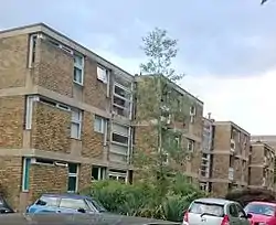 Langham House Close, nos. 1–18 |
| Langham House Close, nos. 19–24 | Ham Common, Ham TW10 7JE | Flats | 1957–1958 | 23 December 1998 | TQ1757871814 51°25′59″N 0°18′36″W / 51.433137°N 0.309962°W |
1033381 | Upload Photo |
| Langham House Close, nos. 25–30 | Ham Common, Ham TW10 7JE | Flats | 1957–1958 | 22 December 1998 | TQ1754171772 51°25′58″N 0°18′38″W / 51.432767°N 0.310508°W |
1051027 | Upload Photo |
| Leicester House Queen Anne House Wolsey House and Gate | Montpelier Row, Twickenham | Terrace | 1720 | 2 September 1952 | TQ1699073797 51°27′04″N 0°19′04″W / 51.451081°N 0.317762°W |
1065389 | Upload Photo |
| Limes House and Forecourt Piers | 123 Mortlake High Street, London SW14 8SN[2] | House | c. 1720 | 25 October 1951[2] | TQ2113276050 51°28′14″N 0°15′27″W / 51.470459°N 0.257412°W |
1065428 | |
| Lissoy | Ormond Road, Richmond TW10 6TH | Terraced house | Early 18th century | 10 January 1950 | TQ1785374611 51°27′30″N 0°18′18″W / 51.458218°N 0.305078°W |
1065353 | Upload Photo |
| Manor House | Ham Street, Ham TW10 7HA | House | Early to mid 18th century | 10 January 1950 | TQ1729072605 51°26′25″N 0°18′50″W / 51.440305°N 0.313842°W |
1358099 |  Manor House |
| Montpelier House South End House Walls, Piers, Railings and Gazebo in Grounds | Twickenham | Terrace | 18th century | 2 September 1952 | TQ1706673647 51°26′59″N 0°19′00″W / 51.449717°N 0.316719°W |
1065391 | Upload Photo |
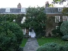
| Montrose House | 186, Petersham Road, Petersham, Richmond TW10 7AD | House | Late 17th century | 25 June 1983 | TQ1805473255 51°26′46″N 0°18′09″W / 51.445989°N 0.302638°W |
1065342 | |
| Newark House | 9 The Vineyard, Richmond TW10 6AQ | House | Mid 18th century | 10 January 1950 | TQ1804474581 51°27′28″N 0°18′08″W / 51.457908°N 0.30234°W |
1253134 | Upload Photo |
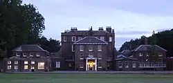
| Normansfield Hospital | Kingston Road, Teddington TW11 9JH | House | 1866 | 25 May 1983 | TQ1725970177 51°25′07″N 0°18′54″W / 51.41849°N 0.31509°W |
1065379 | |
| No. 19, 21, and 23 Kew Foot Road | Richmond TW9 2SS | Terrace | c. 1711 | 10 January 1950 | TQ1806575452 51°27′57″N 0°18′06″W / 51.465732°N 0.301747°W |
1065436 | Upload Photo |
| No. 356 and 358 Kew Road | Richmond | House | Early/mid 18th century | 10 January 1950 | TQ1906177329 51°28′57″N 0°17′12″W / 51.482393°N 0.286784°W |
1357700 | Upload Photo |
| No. 18 King Street | Richmond TW9 1ND | Terraced house | Early 18th century | 10 January 1950 | TQ1769774830 51°27′37″N 0°18′26″W / 51.460219°N 0.307249°W |
1065373 | Upload Photo |
| No. 6 Ormond Road | Richmond TW10 6TH | Terraced house | Early 18th century | 10 January 1950 | TQ1787774627 51°27′30″N 0°18′17″W / 51.458357°N 0.304727°W |
1065356 | Upload Photo |
| No. 1 Richmond Green | Richmond TW9 1NQ | Terraced house | Early 18th century | 10 January 1950 | TQ1769874835 51°27′37″N 0°18′26″W / 51.460263°N 0.307233°W |
1065311 | 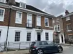 No. 1 Richmond Green |
| No. 2-6 Richmond Green | Richmond | Terrace | Early 18th century | 10 January 1950 | TQ1770974850 51°27′37″N 0°18′25″W / 51.460396°N 0.30707°W |
1065312 | 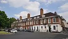 No. 2-6 Richmond Green |
| No. 10 Richmond Green | Richmond TW9 1PX | Terraced house | Early 18th century | 10 January 1950 | TQ1783074935 51°27′40″N 0°18′19″W / 51.461135°N 0.305301°W |
1357746 | 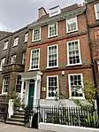 No. 10 Richmond Green |
| No 11, and Railings | Richmond | Terraced house, and railings | 18th century | 10 January 1950 | TQ1782774931 51°27′40″N 0°18′19″W / 51.461099°N 0.305345°W |
1065348 | 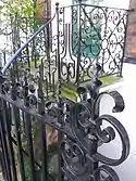 No 11, and Railings |
| No. 12 Richmond Green | Richmond TW9 1PX | Terraced house | 18th century | 10 January 1950 | TQ1782374926 51°27′40″N 0°18′19″W / 51.461055°N 0.305404°W |
1181111 | Upload Photo |
| No. 32 Richmond Green | Richmond | Terraced house | Early 18th century | 10 January 1950 | TQ1772274868 51°27′38″N 0°18′25″W / 51.460555°N 0.306877°W |
1357770 | 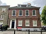 No. 32 Richmond Green |
| No. 3-12 Sion Road | Twickenham TW1 3DR | Terrace | Early 18th century | 2 September 1952 | TQ1668273396 51°26′51″N 0°19′20″W / 51.44754°N 0.322325°W |
1262089 | 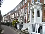 No. 3-12 Sion Road |
| 18 Station Road | Barnes, London SW13 0LW | House | Earlier | 12 May 1950 | TQ2180176319 51°28′22″N 0°14′52″W / 51.472733°N 0.247692°W |
1252850 | |
| Old Court House | The Wardrobe, Richmond TW9 1PB | House | Early 18th century | 9 February 1952 | TQ1756774959 51°27′41″N 0°18′33″W / 51.461405°N 0.309077°W |
1181217 | 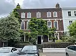 Old Court House |
| Old Palace Place | The Green, Richmond TW9 1NQ | House | Late C16/C17 | 10 January 1950 | TQ1767374825 51°27′37″N 0°18′27″W / 51.460179°N 0.307596°W |
1065314 | 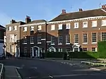 Old Palace Place |
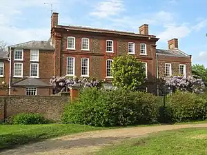
| Ormeley Lodge, with Gates and Railings to Front | Ham Gate Avenue, Ham, TW10 5HB | Country house | Late C17/Early 18th century | 10 January 1950 | TQ1807672051 51°26′07″N 0°18′10″W / 51.435163°N 0.302723°W |
1286489 | |
| Pope's Grotto in Grounds of St Catherine's High School | Twickenham | Grotto | C19-20 | 2 September 1952 | TQ1595672690 51°26′29″N 0°19′59″W / 51.441344°N 0.332998°W |
1192178 |  Pope's Grotto in Grounds of St Catherine's High School |
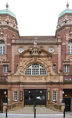
| Richmond Theatre | Little Green, Richmond TW9 1QJ | Theatre | 1899 | 28 June 1972 | TQ1792875046 51°27′44″N 0°18′14″W / 51.462112°N 0.303854°W |
1065384 | |
| Sandycombe Lodge | 40 Sandycoombe Road, Twickenham TW1 2LR | Studio house | Early 19th century | 2 September 1952 | TQ1708774105 51°27′14″N 0°18′59″W / 51.453829°N 0.316265°W |
1262429 | |
| Seaforth House | Church Terrace, Richmond TW10 6SE | Terraced house | Early 18th century | 10 January 1950 | TQ1795874744 51°27′34″N 0°18′13″W / 51.459391°N 0.303523°W |
1261555 | Upload Photo |
| Seymour House Warwick House | Montpelier Row, Twickenham TW1 2NQ | House | 1720 | 2 September 1952 | TQ1697473820 51°27′05″N 0°19′05″W / 51.451291°N 0.317985°W |
1194493 | Upload Photo |
| Sion Cottage | Sion Road, Twickenham TW1 3DD | House | Early 18th century | 2 September 1952 | TQ1671173358 51°26′50″N 0°19′19″W / 51.447193°N 0.32192°W |
1262088 | Upload Photo |
| Sion House, Railings and Piers | Sion Road, Twickenham TW1 3DD | House | Early 18th century | 2 September 1952 | TQ1670673360 51°26′50″N 0°19′19″W / 51.447212°N 0.321992°W |
1252847 | Upload Photo |
| Sudbrook Cottage | Sudbrook Lane, Petersham TW10 7AT | House | Late C17/Early 18th century | 10 January 1950 | TQ1810873040 51°26′39″N 0°18′07″W / 51.444045°N 0.301933°W |
1262065 | Upload Photo |
| Sudbrook Lodge | Petersham Road, Richmond TW10 5HA | House | Early 18th century | 10 January 1950 | TQ1793672133 51°26′09″N 0°18′17″W / 51.435929°N 0.304709°W |
1253016 | Upload Photo |
| The Old Court House | Hampton Court Road, Hampton KT8 9BW | House | Early 18th century | 25 June 1983 | TQ1539768645 51°24′18″N 0°20′32″W / 51.405102°N 0.342354°W |
1080796 | |
| The Old Vicarage School | 48 Richmond Hill, Richmond TW10 6QX | House | Extant c1680 | 24 December 1968 | TQ1806474399 51°27′23″N 0°18′08″W / 51.456269°N 0.302113°W |
1249946 | 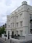 The Old Vicarage School |
| The Pavilion | Hampton Court Palace, East Molesey KT8 9AP | Bowling green pavilion | 1700–01 | 2 September 1952 | TQ1627167534 51°23′42″N 0°19′49″W / 51.394938°N 0.330158°W |
1080801 | |
| The Terrace | 3 Richmond Hill, Richmond TW10 6RE | House | 1767 | 10 January 1950 | TQ1797474460 51°27′25″N 0°18′12″W / 51.456836°N 0.303387°W |
1249952 | 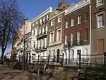 The Terrace |
| Underground Passage at Radnor Lodge | Radnor Road, Twickenham | Grotto | 18th century | 25 June 1983 | TQ1578272840 51°26′34″N 0°20′08″W / 51.442728°N 0.335452°W |
1065344 | Upload Photo |
| Underground Passage in Grounds of St Catherine's High School | Under the junction of Radnor Road and Grotto Road, Cross Deep, Twickenham TW1 4QJ | Grotto | 18th century | 25 June 1983 | TQ1580072823 51°26′33″N 0°20′07″W / 51.442571°N 0.335198°W |
1080811 | Upload Photo |
| York House, Garden Walls Wrought Iron Gates and Boundary Walls Along Sion Road on the East Side and Riverside on the South | Richmond Road, Twickenham TW1 3AA | House | Earlier | 2 September 1952 | TQ1654273401 51°26′51″N 0°19′28″W / 51.447614°N 0.324337°W |
1263365 |  York House, Garden Walls Wrought Iron Gates and Boundary Walls Along Sion Road on the East Side and Riverside on the South |


See also
Notes
- 1 2 3 4 5 The date given is the date used by Historic England as significant for the initial building or that of an important part in the structure's description.
- 1 2 3 4 5 Sometimes known as OSGB36, the grid reference is based on the British national grid reference system used by the Ordnance Survey.
- 1 2 3 4 5 The "List Entry Number" is a unique number assigned to each listed building and scheduled monument by Historic England.
References
- ↑ "Hampton: Grove House". Places. Twickenham Museum. Retrieved 12 February 2022.
- 1 2 Historic England (25 October 1951). "Limes House and Forecourt Piers (1065428)". National Heritage List for England. Retrieved 10 February 2022.
External links
 Media related to Grade II* listed buildings in the London Borough of Richmond upon Thames at Wikimedia Commons

This article is issued from Wikipedia. The text is licensed under Creative Commons - Attribution - Sharealike. Additional terms may apply for the media files.