West Bengal
West Bengal (/bɛŋˈɡɔːl/ beng-GAWL; Bengali: পশ্চিমবঙ্গ, romanised: Paścimbaṅga, pronounced [ˈpoʃtʃimbɔŋɡo] (![]() listen)) is a state in India. It is in the eastern part of the country. It is along the Bay of Bengal. Its area is 88,752 square kilometres (34,267 square miles). Its population was about 91 million in 2011. It became about 103 million in 2023.[13] West Bengal is the fourth-largest state in India by population. It is the thirteenth-largest state in India by area. It is also the eighth-largest administrative division of the world.
listen)) is a state in India. It is in the eastern part of the country. It is along the Bay of Bengal. Its area is 88,752 square kilometres (34,267 square miles). Its population was about 91 million in 2011. It became about 103 million in 2023.[13] West Bengal is the fourth-largest state in India by population. It is the thirteenth-largest state in India by area. It is also the eighth-largest administrative division of the world.
West Bengal
| |
|---|---|
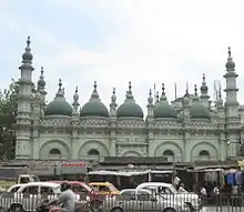
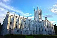
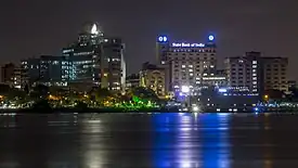 .jpg.webp)  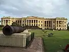 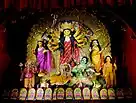    Along the clock, from top: View of Kolkata from Howrah; Chhau dance, Purulia; Durga Puja; Bengal tiger, Sundarbans; Darjeeling from Happy Valley Tea Estate; Digha; Hazarduari Palace; Dakshineswar Kali Temple | |
| Etymology: Western part of Bengal | |
| Nickname: "Hub of all cultural traits" | |
| Motto(s): | |
| Anthem: Banglar Mati Banglar Jol (The Soil of Bengal, The Water of Bengal)[1] | |
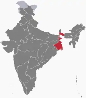 Location of West Bengal in India | |
| Coordinates: 22.57°N 88.37°E | |
| Country | |
| Region | East India |
| Before was | Bengal Province |
| Started (by division into parts) | 15 August 1947 |
| Capital and largest city | Kolkata |
| Largest metro (city and suburbs) | Kolkata Metropolitan Area |
| Districts | 23 (5 divisions) |
| Government | |
| • Body | Government of West Bengal |
| • Governor | C. V. Ananda Bose |
| • Chief minister | Mamata Banerjee (TMC) |
| State Legislature | Unicameral |
| • Assembly | West Bengal Legislative Assembly (294 seats) |
| National Parliament | Parliament of India |
| • Rajya Sabha | 16 seats |
| • Lok Sabha | 42 seats |
| High Court | Calcutta High Court |
| Area | |
| • Total | 88,752 km2 (34,267 sq mi) |
| • Rank | 13th |
| Dimensions | |
| • Length | 623 km (387 mi) |
| • Width | 320 km (200 mi) |
| Elevation | 500 m (1,600 ft) |
| Highest elevation | 3,636 m (11,929 ft) |
| Lowest elevation (Near Bay of Bengal) | 11 m (36 ft) |
| Population (2011)[3] | |
| • Total | |
| • Rank | 4th |
| • Density | 1,029/km2 (2,670/sq mi) |
| • Urban | 31.87% |
| • Rural | 68.13% |
| Demonym | Bengali |
| Language | |
| • Official | Bengali[4] • English |
| • Additional official | Nepali • Urdu • Hindi • Odia • Santali • Punjabi • Kamtapuri • Rajbanshi • Kudmali/Kurmali • Kurukh • Telugu[4] |
| • Official script | Bengali–Assamese script |
| GDP | |
| • Total (2023) | |
| • Rank | 6th |
| • Per capita | |
| Time zone | UTC+05:30 (IST) |
| ISO 3166 code | IN-WB |
| Vehicle registration | WB |
| HDI (2022) | |
| Literacy (2017) | |
| Sex ratio (2011) | 950♀/1000 ♂[10] (8th) |
| Website | wb |
| Symbols of West Bengal | |
| Song | Banglar Mati Banglar Jol (The Soil of Bengal, The Water of Bengal)[11] |
| Mammal | Fishing cat |
| Bird | White-throated kingfisher |
| Fish | Ilish |
| Flower | Night-flowering jasmine |
| Fruit | Mango |
| Tree | Chhaatim tree |
| State highway mark | |
 | |
| State highway of West Bengal WB SH1 to WB SH15 | |
| List of Indian state symbols | |
| ^The Indian Independence Act 1947 divided the Province of Bengal into two parts: West Bengal and East Bengal. East Bengal became independent to become Bangladesh in 1971.[12] †† Partition of Bengal (1947) | |
Both West Bengal and Bangladesh are parts of the region of Bengal. Bangladesh is a country east of West Bengal. Nepal and Bhutan are two countries north of the Indian state. Bihar and Jharkhand are two Indian states west of West Bengal. Odisha is another Indian state southwest of West Bengal. Sikkim is an Indian state north of West Bengal. Assam is an Indian state east of West Bengal. Kolkata is the capital city of West Bengal. Kolkata is the third-largest metropolis and seventh-largest city by population.
West Bengal is divided into some regions, for example the Darjeeling Hills, the Ganges Delta, the Rarh region, the Sundarbans and the Bay of Bengal. West Bengal has a tropical climate, so it is very hot and humid in summer and cool in winter. The people who live here are called Bengalis. Bengalis also live in Bangladesh.
History
The British Empire once ruled most of the Indian subcontinent. The Indians wanted freedom, but the Hindus and the Muslims of India always argued. So it was decided to divide the country into two parts—one part for Muslims and the other part for Hindus. In 1947 Bengal, which was a province of India, was divided into West Bengal and East Bengal,which is now called Bangladesh. West Bengal went to India, and East Bengal went to Pakistan and was called East Pakistan. In 1971, Bangladesh became independent, as a result of the Bangladesh Liberation War.
Geography
West Bengal is on the eastern part of India. It stretches from the Himalayas in the north to the Bay of Bengal in the south. Its total area is 88,752 square kilometres (34,267 square miles).[3] The Darjeeling Hills is the most northern region of West Bengal. It is a part of the eastern Himalayas. Sandakphu is the highest peak in the state. It is a part of the Darjeeling Hills. Its height is 3,636 metres (11,929 feet).[14]
The Terai is a narrow region between the hills and the North Bengal plains. The Ganges Delta is the most southern region of the state. The Rarh region is between the Ganges Delta in the east and the Chota Nagpur Plateau in the west. There is a coastal region south of the state. The Sundarbans is a mangrove forest at the Ganges Delta. It forms a geographical landmark of the region.[15]
The Ganges is the main river of West Bengal. It divides into two branches called distributaries. One branch enters Bangladesh as the Padma River. Another branch flows through West Bengal as the Hooghly River. The Farakka Barrage is a barrage over the Ganges. A canal from the Ganges gives water to the Hooghly branch of the river. There is a dispute between India and Bangladesh on sharing the water of the Ganges for a long time.[16]
There are some rivers from the northern region, for example the Teesta, Torsa, Jaldhaka and Mahananda rivers. There are also rivers from the Chota Nagpur Plateau, for example the Damodar, Ajay and Kangsabati. The Ganges Delta has more rivers and creeks. The Ganges River becoms polluted because people throw waste into the Ganges River. It is a main problem in West Bengal.[17]
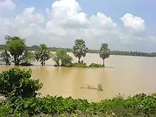
The Damodar River is a tributary—a river meeting with another river—of the Ganges. It was once known as the "Sorrow of Bengal" because there were frequent floods on the valley. The river has several dams under the Damodar Valley Project.
There amount of arsenic in the groundwaters of at least nine districts of West Bengal is very high. As of 2017, about 10.4 million people were poisoned by arsenic.[18]
Politics
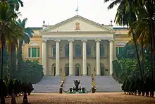

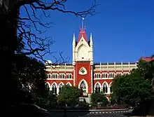

The Government of West Bengal is a parliamentary system of representative democracy. The same type of government is also found in other Indian states. The residents are given universal suffrage. There are three branches of government: the legislature, the executive and the judiciary.
The West Bengal Legislative Assembly is the legislature of the state. It has 295 elected members, the Speaker and the Deputy Speaker. The members are called MLAs.[19] One of the elected members is from the Anglo-Indian community. The MLAs elect Speaker and the Deputy Speaker. The Speaker preside over the assembly meetings. The Deputy Speaker would preside over the assembly meetings in the absence of the Speaker.
The Council of Ministers is the executive branch of West Bengal. The Governor is the head of state. The President of India appoints the Governor. The Chief Minister is the head of government. The Governor appoints the leader of the political party or coalition with a majority in the Legislative Assembly. The Chief Minister gives an advice to the Governor to appoint the Council of Ministers. The Governor do so. The Council of Ministers reports to the Legislative Assembly. The people of the government run the office for five years unless the Assembly is dissolved before this period.
There are 42 seats to the Lok Sabha[20] and 16 seats to the Rajya Sabha of the Parliament of India in West Bengal.[21]
The Calcutta High Court and other lower courts are the judiciary of West Bengal.
The All India Trinamool Congress (AITC), Bharatiya Janata Party (BJP), Indian National Congress (INC) and the Left Front political alliance have controlled the politics of West Bengal. The Communist Party of India (Marxist) (CPI(M)) leads the Left Front. In the 2011 West Bengal state assembly election, people elected the coalition of the All India Trinamool Congress and the Indian National Congress to power. Mamata Banerjee was the leader of the coalition. The coalition won 225 seats of the Assembly.[22] The Left Front had ruled the state for 34 years (1977–2011) before the election. It was the world's longest-running democratically elected communist government.[23]
Districts and cities
Districts
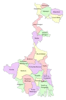
As of 1 November 2023, West Bengal is divided into 23 districts.[24]
| District | Population | Growth rate | Sex ratio | Literacy | Density per square Kilometer |
|---|---|---|---|---|---|
| North 24 Parganas | 10,009,781 | 12.04 | 955 | 84.06 | 2445 |
| South 24 Parganas | 8,161,961 | 18.17 | 956 | 77.51 | 819 |
| Purba Bardhaman | 4,835,432 | – | 945 | 74.73 | 890 |
| Paschim Bardhaman | 2,882,031 | – | 922 | 78.75 | 1800 |
| Murshidabad | 7,103,807 | 21.09 | 958 | 66.59 | 1334 |
| Paschim Medinipur | 5,913,457 | 13.86 | 966 | 78.00 | 631 |
| Hooghly | 5,519,145 | 9.46 | 961 | 81.80 | 1753 |
| Nadia | 5,167,600 | 12.22 | 947 | 74.97 | 1316 |
| Purba Medinipur | 5,095,875 | 15.36 | 938 | 87.02 | 1081 |
| Howrah | 4,850,029 | 13.50 | 939 | 83.31 | 3306 |
| Kolkata | 4,496,694 | −1.67 | 908 | 86.31 | 24306 |
| Malda | 3,988,845 | 21.22 | 944 | 61.73 | 1069 |
| Jalpaiguri | 3,872,846 | 13.87 | 953 | 73.25 | 622 |
| Alipurduar[lower-alpha 1] | 1,700,000 | – | – | – | 400 |
| Bankura | 3,596,292 | 12.64 | 954 | 70.95 | 523 |
| Birbhum | 3,502,404 | 16.15 | 956 | 70.68 | 771 |
| Uttar Dinajpur | 3,007,134 | 23.15 | 939 | 59.07 | 958 |
| Purulia | 2,930,115 | 15.52 | 957 | 64.48 | 468 |
| Cooch Behar | 2,819,086 | 13.71 | 942 | 74.78 | 832 |
| Darjeeling | 1,846,823 | 14.77 | 970 | 79.56 | 586 |
| Dakshin Dinajpur | 1,676,276 | 11.52 | 956 | 72.82 | 755 |
| Kalimpong[lower-alpha 1] | 202,239 | – | – | – | 270 |
| Jhargram[lower-alpha 1] | 1,136,548 | – | – | – | 374 |
- The district was created after the 2011 Census of India.
A district collector or district magistrate rule over a district. The Indian Administrative Service or the West Bengal Civil Service appoints them.[25] Each district is divided into subdivisions. A subdivisional magistrate rule over a subdivision. The subdivisions are divided into blocks. Blocks are divided into panchayats (village councils) and municipalities.[26]
Cities
Kolkata is the capital city of West Bengal. It is also the largest city of the state. Kolkata is the third-largest urban agglomeration in India.[27] It is also the seventh-largest city in India.[28] Asansol is the second-largest urban agglomeration in West Bengal.[27]
West Bengal has some planned cities, for example Bidhannagar, Durgapur, Haldia, Kalyani, Kharagpur and New Town. Siliguri is an economically important city. It is in the Siliguri Corridor of India.[29] Howrah, Chandannagar, Bardhaman, Berhampore, Jalpaiguri and Purulia are some other large cities in West Bengal.[30]
Transport

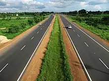
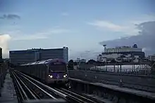
As of 2011, the total length of surface roads in West Bengal was more than 92,023 kilometres (57,180 miles).[31]: 18 The total length of national highways was 2,578 kilometres (1,602 miles).[32] The total length of state highways was 2,393 kilometres (1,487 miles).[31]: 18 As of 2006, the road density of the state was 103.69 kilometres per square kilometre (166.87 miles per square mile). It is higher than the average road density of 74.7 kilometres per square kilometre (120.2 miles per square mile) in India.[33]
As of 2011, the total length of railways in West Bengal was about 4,481 kilometres (2,784 miles).[31]: 20 Kolkata is the headquarters of three zones of the Indian Railways—Eastern Railway (ER), South Eastern Railway (SER) and Kolkata Metro. Kolkata Metro is India's first underground railway.[34] Northeast Frontier Railway (NFR) covers northern West Bengal. The Darjeeling Himalayan Railway is a UNESCO World Heritage Site. It is a part of the NFR.[35]
Netaji Subhas Chandra Bose International Airport is an airport at Dum Dum, near Kolkata. It is the largest airport in West Bengal. Bagdogra Airport near Siliguri is a customs airport. It offers regular domestic service. It has international service to Bhutan and Thailand. Kazi Nazrul Islam Airport is a domestic airport at Andal, near Durgapur. It is India's first private sector airport.[36][37]
Kolkata is a major river port in East India. The Syama Prasad Mookerjee Port Trust looks after Kolkata and Haldia docks.[38] There is a passenger service to Port Blair on the Andaman and Nicobar Islands. Ferries are a main form of transport in southern West Bengal. It is more common in the Sundarbans.
The West Bengal Government own some organisations that run buses, for example the North Bengal State Transport Corporation (NBSTC), the South Bengal State Transport Corporation (SBSTC) and the West Bengal Transport Corporation (WBTC). There are also private bus companies. There are some hired forms of transport, for example metered taxis and auto-rickshaws. They sometimes have their own routes in cities. In most of West Bengal, cycle rickshaws are used to travel short distances. In Kolkata, hand-pulled rickshaws and electric rickshaws are used it.[39]
Kolkata is the only city in India to have trams as a form of transport.[40] The West Bengal Transport Corporation (WBTC) runs these trams since 2016.
Demographics
From the provisional results of the 2011 national census, West Bengal is the fourth-largest state in India by population. Its population is 91,347,736. It is 7.55% of India's population.[3]
The state's rate of population growth in ten years from 2001 to 2011 was 13.93%.[3] It is lower than the growth rate of 17.8% from 1991 to 2001.[3] It is also lower than India's population growth rate of 17.64%.[41]
The state's gender ratio is 947 females per 1,000 males.[41] West Bengal's population density was 1,029 inhabitants per square kilometre (2,670/sq mi) in 2011. So, it the second-largest state in India by population density.[41]
West Bengal's literacy rate is 77.08%. It is higher than India's rate of 74.04%.[42]
From 2010 to 2014, we can see that the life expectancy in the state was 70.2 years. It is higher than India's life expectancy of 67.9.[43][44]
In 2013, the percentage of people living below the poverty line was 19.98%. It is lower than the percentage of 31.8% ten years ago.[45] In rural areas, 28.6% of people were Scheduled Castes and 5.8% of people were Scheduled Tribes. In urban areas, 19.9% of people were Scheduled Castes and 1.5% of people were Scheduled Tribes.[46]
In September 2017, some far-away villages in the Sundarbans of West Bengal became the last villages to get electricity. So, West Bengal became completely electrified.[47]
Bengali people are the largest ethnic group (group of people with same culture) of West Bengal. Most people of the state are Bengalis. Bengali people also live in Bangladesh. The Bengali people are divided into Bengali Hindus, Bengali Muslims, Bengali Christians and some Bengali Buddhists.[48] There are also Marwari, Maithili and Bhojpuri people spread across the state. Buddhist communities, for example Sherpas, Bhutias, Lepchas, Tamangs, Yolmos and Tibetans live in the Darjeeling Hills.[49]
Languages
Bengali and English are two official languages of West Bengal.[4] Nepali is an additional official language in Darjeeling Sadar, Kurseong and Kalimpong subdivisions.[4] In 2012, the state government passed a bill of law. It gave additional official status to Hindi, Odia, Punjabi, Santali and Urdu in areas where more than 10% of people speak one of those languages.[4] In 2019, the government passed another bill. It gave additional official status to Kamtapuri, Kurmali and Rajbanshi as additional official languages in blocks, divisions or districts where more than 10% of people speak one of those languages.[4]
From the 2011 census, 86.22% of people spoke Bengali, 5.00% of people spoke Hindi, 2.66% of people spoke Santali, 1.82% of people spoke Urdu and 1.26% of people spoke Nepali as their first language.[50]
Culture
Literature

The Bengali language has a rich heritage in literature. The Charyapada is one of the oldest literature in Bengali. It is a collection of Buddhist mystic songs. The songs were sung in the 10th and 11th centuries. The Mangalkavya is a collection of Hindu narrative poetry. It was written about the 13th century.
People
Famous people from West Bengal include:
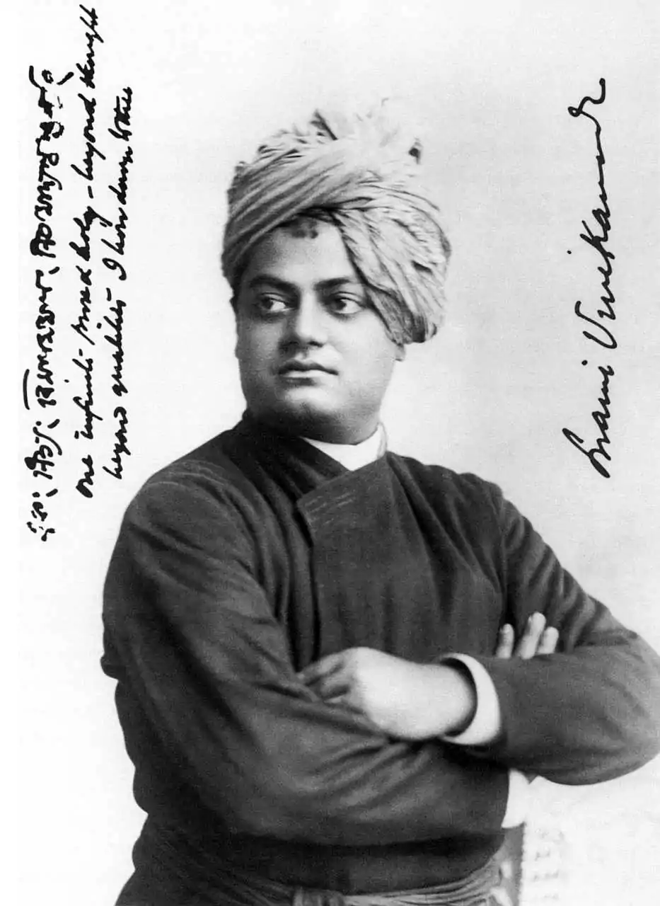
- Swami Vivekananda
- Rabindranath Tagore
- Subhas Chandra Bose
- Satyendranath Bose
- Surendranath Banerjee
- Jagadish Chandra Bose
- Ishwar Chandra Vidyasagar
- Ramakrishna
- Shibdas Bhaduri
- Khudiram Bose
- Syama Prasad Mukherjee
- Kadambini Ganguly
- Satyajit Ray
- Ritwik Ghatak
- Pradeep Kumar Banerjee
- Victor Banerjee
- Kishore Kumar
- Biswajit Chatterjee
- Bappi Lahiri
- Michael Madhusudan Dutt
- Rahul Dev Burman
- Sourav Ganguly
- Pranab Mukherjee
- Uttam Kumar
- Suchitra Sen
- Sushmita Sen
- Shreya Ghosal
- Arijit Singh
- Mithun Chakraborty
Notes
References
- "West Bengal Assembly passes resolution declaring Rabindranath Tagore composition as state anthem". Scroll.in. 7 September 2023. Retrieved 8 September 2023.
- "Sandakphu". 25 December 2008. Archived from the original on 25 December 2008. Retrieved 24 March 2023.
- "Area, population, decennial growth rate and density for 2001 and 2011 at a glance for West Bengal and the districts: provisional population totals paper 1 of 2011: West Bengal". Registrar General & Census Commissioner, India. Archived from the original on 7 January 2012. Retrieved 26 January 2012.
- —"Report of the Commissioner for linguistic minorities: 52nd report (July 2014 to June 2015)" (PDF). Commissioner for Linguistic Minorities, Ministry of Minority Affairs, Government of India. pp. 85–86. Archived from the original (PDF) on 15 November 2016. Retrieved 16 February 2016.
—Singh, Shiv Sahay (3 April 2012). "Official language status for Urdu in some West Bengal areas". The Hindu. Archived from the original on 3 June 2019. Retrieved 3 June 2019.
—"Multi-lingual Bengal". The Telegraph. 11 December 2012. Archived from the original on 25 March 2018. Retrieved 25 March 2018.
—"Kurukh language given official status by Bengal government". Outlook. 21 February 2017. Archived from the original on 22 January 2021. Retrieved 12 October 2020.
—Roy, Anirban (28 February 2018). "Kamtapuri, Rajbanshi make it to list of official languages in". India Today. Archived from the original on 30 March 2018. Retrieved 30 March 2018.
—"West Bengal shows 'Mamata' to Telugus". The Hans India. 24 December 2020. Archived from the original on 23 December 2020. Retrieved 31 December 2020. - "Financial Statements 2023-24, Government of West Bengal" (PDF). Government of West Bengal. 1 February 2023. p. 21. Archived (PDF) from the original on 23 February 2023. Retrieved 1 February 2023.
- "Handbook of Statistics of Indian States 2022-23" (PDF). Reserve Bank of India. pp. 11, 33. Retrieved 15 September 2023.
- "STATE-WISE DATA ON PER CAPITA INCOME". Delhi: PIB Delhi. 24 July 2023. Retrieved 12 September 2023.
- "Sub-national HDI – Area Database". Global Data Lab. 15 June 2021. Retrieved 7 March 2023.
- NSO (2018). "Sex ratio, 0–6 age population, literates and literacy rate by sex for 2001 and 2011 at a glance for West Bengal and the districts: provisional population totals paper 1 of 2011: West Bengal" (PDF). Government of India:Ministry of Home Affairs. Archived from the original on 7 January 2012.
- "Sex ratio, 0–6 age population, literates and literacy rate by sex for 2001 and 2011 at a glance for West Bengal and the districts: provisional population totals paper 1 of 2011: West Bengal". Government of India:Ministry of Home Affairs. Archived from the original on 7 January 2012. Retrieved 29 January 2012.
- "West Bengal Assembly passes resolution declaring Rabindranath Tagore composition as state anthem". Scroll.in. 7 September 2023. Retrieved 8 September 2023.
- Mukherjee 1987, p. 230.
- "West Bengal Population 2023". World Population Review. 13 July 2023. Retrieved 13 July 2023.
- Pal, Supratim (14 May 2007). "Top of world in kingdom of cloud". The Telegraph. Kolkata. Archived from the original on 31 July 2013. Retrieved 16 February 2012.
- Jana, Bipal Kr; Majumder, Mrinmoy (27 June 2010). Impact of Climate Change on Natural Resource Management-west bengal. Springer Science+Business Media. ISBN 9789048135813. Archived from the original on 2 February 2023. Retrieved 13 December 2017.
- Jayapalan, N (2001). Foreign policy of India. New Delhi: Atlantic Publishers and Distributors. p. 344. ISBN 978-81-7156-898-7.
- "Alarming rise in bacterial percentage in Ganga waters". The Hindu Business Line. Chennai. 4 August 2006. Archived from the original on 7 May 2013. Retrieved 4 March 2012.
- "1.04 cr hit by arsenic contamination in Bengal". The Hindu. 19 March 2017. ISSN 0971-751X. Archived from the original on 18 March 2017. Retrieved 26 January 2018.
- "West Bengal legislative assembly". Legislative bodies in India. National Informatics Centre, India. Archived from the original on 13 March 2016. Retrieved 28 October 2006.
- Delimitation Commission (15 February 2006). "Notification: order no. 18" (PDF). New Delhi: Election Commission of India. pp. 23–25. Archived from the original (PDF) on 13 August 2011. Retrieved 11 February 2012.
- "Composition of Rajya Sabha" (PDF). Rajya Sabha at work. New Delhi: Rajya Sabha Secretariat. pp. 24–25. Archived from the original (PDF) on 5 March 2016. Retrieved 15 February 2012.
- "Statewise results – West Bengal". Election Commission of India. Archived from the original on 16 May 2011. Retrieved 13 May 2011.
- "District Profiles". Archived from the original on 22 April 2017.
- "Section 2 of West Bengal Panchayat Act, 1973 – West Bengal Judicial Academy" (PDF). West Bengal Judicial Academy. Archived (PDF) from the original on 22 December 2016. Retrieved 26 January 2018.
- "Directory of district, sub division, panchayat samiti/ block and gram panchayats in West Bengal, March 2008". West Bengal Electronics Industry Development Corporation Limited, Government of West Bengal. March 2008. p. 1. Archived from the original (DOC) on 7 December 2013. Retrieved 15 February 2012.
- "Urban agglomerations/cities having population 1 million and above" (PDF). Provisional population totals, census of India 2011. The Registrar General & Census Commissioner, India. 2011. Archived (PDF) from the original on 15 December 2011. Retrieved 26 January 2012.
- "Cities having population 1 lakh and above, census 2011" (PDF). Provisional population totals, census of India 2011. The Registrar General & Census Commissioner, India. Archived (PDF) from the original on 7 May 2012. Retrieved 18 October 2011.
- Diplomat, Ankit Panda, The. "Geography's Curse: India's Vulnerable 'Chicken's Neck'". The Diplomat. Archived from the original on 21 October 2017. Retrieved 10 December 2017.
{{cite news}}: CS1 maint: multiple names: authors list (link) - "2011 Census of India" (PDF). censusindia.gov.in. Archived (PDF) from the original on 23 July 2013.
- "Statewise Length of national highways in India". National Highways. Department of Road Transport and Highways; Ministry of Shipping, Road Transport and Highways; Government of India. Archived from the original on 22 October 2012. Retrieved 9 February 2012.
- Chattopadhyay, Suhrid Sankar (January–February 2006). "Remarkable Growth". The Hindu; Frontline. 23 (2). Archived from the original on 19 March 2012. Retrieved 15 October 2013.
- "About Kolkata Metro". Kolkata Metro. Archived from the original on 20 August 2007. Retrieved 1 September 2007.
- "Mountain Railways of India". UNESCO World Heritage Center. Archived from the original on 3 May 2006. Retrieved 30 April 2006.
- "Profile on Kazi Nazrul Islam International Airport". Centre for Asia Pacific Aviation. Archived from the original on 8 August 2014. Retrieved 5 August 2014.
- Mishra, Mihir (18 May 2015). "Air India operates inaugural flight between Durgapur & Kolkata". The Economic Times. Archived from the original on 2 August 2017. Retrieved 19 May 2015.
- "Port info: cargo statistics". Kolkata Port Trust. Kolkata Port Trust, India. Archived from the original on 19 January 2012. Retrieved 9 February 2012.
- Nilanjan, Ghosh (31 January 2014). Sustainability Science for Social, Economic, and Environmental Development. IGI Global. ISBN 978-1-4666-4996-5. Archived from the original on 2 February 2023. Retrieved 21 October 2020.
- "Intra-city train travel". reaching India. Times Internet Limited. Archived from the original on 16 October 2007. Retrieved 31 August 2007.
- "Table 1: Distribution of population, sex ratio, density and decadal growth rate of population: 2011". Provisional population totals paper 1 of 2011 India: series 1. Registrar General & Census Commissioner, India. Archived from the original on 12 February 2012. Retrieved 16 February 2012.
- "Table 2(3): Literates and literacy rates by sex : 2011". Provisional population totals paper 1 of 2011 India: series 1. Registrar General & Census Commissioner, India. Archived from the original on 12 February 2012. Retrieved 16 February 2012.
- "Contents 2010–14" (PDF). Registrar General and Census Commissioner of India. Archived (PDF) from the original on 13 November 2016. Retrieved 12 January 2017.
- "Abridged Life Tables- 2010–14" (PDF). Registrar General and Census Commissioner of India. p. 5. Archived (PDF) from the original on 10 January 2017. Retrieved 12 January 2017.
- "Table 162, Number and Percentage of Population Below Poverty Line". Reserve Bank of India. 2013. Archived from the original on 7 April 2014. Retrieved 20 April 2014.
- "Bengal is 100% electrified now". The Times of India, Kolkata. 3 November 2017.
- Hoddie, Matthew (2006). Ethnic realignments: a comparative study of government influences on identity. Lexington Books. pp. 114–115. ISBN 978-0-7391-1325-7. Archived from the original on 10 May 2013. Retrieved 16 February 2012.
- International Encyclopedia of Linguistics: AAVE – Esperanto. Oxford University Press. 10 March 2018. ISBN 978-0-19-513977-8. Archived from the original on 2 February 2023. Retrieved 21 October 2020 – via Google Books.
- "Table C-16 - Population by Mother Tongue". www.censusindia.gov.in. Office of the Registrar General & Census Commissioner, India. Archived from the original on 15 August 2018. Retrieved 18 September 2021.
- Georg, Feuerstein (2002). The Yoga Tradition. Motilal Banarsidass. p. 600. ISBN 978-3-935001-06-9.
- Clarke, Peter Bernard (2006). New Religions in Global Perspective. Routledge. p. 209. ISBN 978-0-7007-1185-7.
