Washakie County, Wyoming
Washakie County is a county in the U.S. state of Wyoming. As of the 2020 census, 7,685 people lived there.[1] Its county seat is Worland.[2] The county was created on February 21, 1911.[3]
Washakie County | |
|---|---|
.jpg.webp) Indian Totem in Worland | |
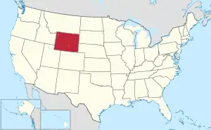
 Location within the U.S. state of Wyoming | |
 Wyoming's location within the U.S. | |
| Coordinates: 43°55′N 107°41′W | |
| Country | |
| State | |
| Founded | February 21, 1911 (authorized) 1913 (organized) |
| Named for | Chief Washakie |
| Seat | Worland |
| Largest city | Worland |
| Area | |
| • Total | 2,243 sq mi (5,810 km2) |
| • Land | 2,239 sq mi (5,800 km2) |
| • Water | 4.2 sq mi (11 km2) 0.2% |
| Population (2020) | |
| • Total | 7,685 |
| • Density | 3.4/sq mi (1.3/km2) |
| Time zone | UTC−7 (Mountain) |
| • Summer (DST) | UTC−6 (MDT) |
| Congressional district | At-large |
| Website | www |
Communities
City
- Worland (county seat)
Town
- Ten Sleep
Census-designated places
- Airport Road
- Mc Nutt
- South Flat
- Washakie Ten
- West River
- Winchester
Unincorporated community
- Big Trails
References
- "QuickFacts: Washakie County, Wyoming". United States Census Bureau. Retrieved January 21, 2024.
- "Find a County". National Association of Counties. Retrieved June 7, 2011.
- Long, John H., ed. (2004). "Wyoming: Individual County Chronologies". Wyoming Atlas of Historical County Boundaries. The Newberry Library. Archived from the original on August 3, 2015. Retrieved August 19, 2015.
Other websites
Wikimedia Commons has media related to Washakie County, Wyoming.
Places next to Washakie County, Wyoming | ||||||||||
|---|---|---|---|---|---|---|---|---|---|---|
| ||||||||||
This article is issued from Wikipedia. The text is licensed under Creative Commons - Attribution - Sharealike. Additional terms may apply for the media files.