Lincoln County, Wyoming
Lincoln County is a county in the U.S. state of Wyoming. As of the 2020 census, 19,581 people lived there.[1] Its county seat is Kemmerer.[2]
Lincoln County | |
|---|---|
 Lincoln County Courthouse in Kemmerer | |
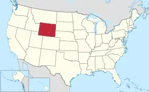
 Location within the U.S. state of Wyoming | |
 Wyoming's location within the U.S. | |
| Coordinates: 42.26°N 110.70°W | |
| Country | |
| State | |
| Founded | February 21, 1911 (authorized) 1913 (organized) |
| Named for | Abraham Lincoln |
| Seat | Kemmerer |
| Largest city | Kemmerer |
| Area | |
| • Total | 4,095 sq mi (10,610 km2) |
| • Land | 4,076 sq mi (10,560 km2) |
| • Water | 19 sq mi (50 km2) 0.5% |
| Population (2020) | |
| • Total | 19,581 |
| • Density | 4.8/sq mi (1.8/km2) |
| Time zone | UTC−7 (Mountain) |
| • Summer (DST) | UTC−6 (MDT) |
| Congressional district | At-large |
| Website | www |
Its western border abuts the east border of the state of Utah.
History
Lincoln County was created on February 21, 1911.[3] The county was named for Abraham Lincoln, 16th President of the United States.[4]
Geography
According to the US Census Bureau, the county has a total area of 4,095 square miles (10,610 km2), of which 4,076 square miles (10,560 km2) is land and 19 square miles (49 km2) (0.5%) is water.[5]
Bordering counties
- Teton County – north
- Sublette County – northeast
- Sweetwater County – east
- Uinta County – south
- Rich County, Utah – southwest
- Bear Lake County, Idaho – west
- Caribou County, Idaho – northwest
- Bonneville County, Idaho – northwest
Communities
City
- Kemmerer (county seat)
Census-designated places
- Alpine Northeast
- Alpine Northwest
- Auburn
- Bedford
- Etna
- Fairview
- Fontenelle
- Freedom
- Grover
- Nordic
- Oakley
- Osmond
- Smoot
- Taylor
- Turnerville
Unincorporated communities
- Alpine Junction
- Border Junction
- Frontier
- Hamsfork
- Sage
References
- "QuickFacts: Lincoln County, Wyoming". United States Census Bureau. Retrieved January 21, 2024.
- "Find a County". National Association of Counties. Retrieved June 7, 2011.
- Long, John H., ed. (2004). "Wyoming: Individual County Chronologies". Wyoming Atlas of Historical County Boundaries. The Newberry Library. Archived from the original on August 3, 2015. Retrieved August 19, 2015.
- Urbanek, Mae (1988). Wyoming Place Names. Missoula MT: Mountain Press Pub. Co. ISBN 0-87842-204-8.
- "2010 Census Gazetteer Files". US Census Bureau. August 22, 2012. Retrieved August 18, 2015.
Other websites
Wikimedia Commons has media related to Lincoln County, Wyoming.
Places next to Lincoln County, Wyoming | |
|---|---|
This article is issued from Wikipedia. The text is licensed under Creative Commons - Attribution - Sharealike. Additional terms may apply for the media files.