Sweetwater County, Wyoming
Sweetwater County is a county in southwestern Wyoming, United States.[1] As of the 2020 census, 42,272 people lived there.[2] Its county seat is Green River.[3] Its southern boundary line abuts the north lines of the states of Colorado and Utah.
Sweetwater County | |
|---|---|
 Rock Springs City Hall, 2007 | |
 Flag | |
 Location within the U.S. state of Wyoming | |
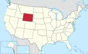 Wyoming's location within the U.S. | |
| Coordinates: 41.66°N 108.89°W | |
| Country | |
| State | |
| Founded | December 17, 1867 |
| Named for | Sweetwater River |
| Seat | Green River |
| Largest city | Rock Springs |
| Area | |
| • Total | 10,491 sq mi (27,170 km2) |
| • Land | 10,427 sq mi (27,010 km2) |
| • Water | 64 sq mi (170 km2) 0.6% |
| Population (2020) | |
| • Total | 42,272 |
| • Density | 4.0/sq mi (1.6/km2) |
| Time zone | UTC−7 (Mountain) |
| • Summer (DST) | UTC−6 (MDT) |
| Area code | 307 |
| Congressional district | At-large |
| Website | www |
History
Sweetwater County was created on December 17, 1867.[4]
Geography
According to the US Census Bureau, the county has a total area of 10,491 square miles (27,170 km2), of which 10,427 square miles (27,010 km2) is land and 64 square miles (170 km2) (0.6%) is water.[5] It is the largest county in Wyoming by area.
Bordering counties
- Fremont County (north)
- Carbon County (east)
- Moffat County, Colorado (south)
- Daggett County, Utah (southwest)
- Summit County, Utah (west-southwest)
- Uinta County (southwest)
- Lincoln County (west)
- Sublette County (northwest)
Communities
Cities
- Green River (county seat)
- Rock Springs
Towns
- Bairoil
- Granger
- Superior
- Wamsutter
Census-designated places
- Arrowhead Springs
- Clearview Acres
- Eden
- Farson
- James Town
- Little America
- McKinnon
- North Rock Springs
- Point of Rocks
- Purple Sage
- Reliance
- Sweeney Ranch
- Table Rock
- Washam
Other unincorporated communities
- Blairtown
- Creston
- Quealy
- Red Desert
- Riner
Ghost towns
- Bryan
- Linwood (mostly within the State of Utah)
- Table Rock
- Winton
References
- U.S. Geological Survey Geographic Names Information System: Sweetwater County
- "QuickFacts: Sweetwater County, Wyoming". United States Census Bureau. Retrieved January 21, 2024.
- "Find a County". National Association of Counties. Retrieved June 7, 2011.
- Long, John H. (2006). "Wyoming: Individual County Chronologies". Wyoming Atlas of Historical County Boundaries. The Newberry Library. Archived from the original on July 18, 2011. Retrieved September 1, 2011.
- "2010 Census Gazetteer Files". US Census Bureau. August 22, 2012. Retrieved August 18, 2015.
Other websites
Wikimedia Commons has media related to Sweetwater County, Wyoming.
Places next to Sweetwater County, Wyoming | ||||||||||
|---|---|---|---|---|---|---|---|---|---|---|
| ||||||||||
This article is issued from Wikipedia. The text is licensed under Creative Commons - Attribution - Sharealike. Additional terms may apply for the media files.