Todd County, South Dakota
Todd County is a county located in the U.S. state of South Dakota. As of the 2020 census, 9,319 people lived there.[2] Todd County does not have its own county seat. Instead, Winner in neighboring Tripp County serves as its administrative center.[3] Its largest city is Mission. It was created in 1909.[1][4]
Todd County | |
|---|---|
_from_S_1.JPG.webp) St. Charles Borromeo church in St. Francis, South Dakota at the Rosebud Indian Reservation | |
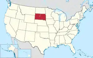
 Location within the U.S. state of South Dakota | |
 South Dakota's location within the U.S. | |
| Coordinates: 43°11′N 100°44′W | |
| Country | |
| State | |
| Founded | 1909[1] |
| Named for | John Blair Smith Todd |
| Seat | None (de jure) Winner (de facto) |
| Largest city | Mission |
| Area | |
| • Total | 1,391 sq mi (3,600 km2) |
| • Land | 1,389 sq mi (3,600 km2) |
| • Water | 2.3 sq mi (6 km2) 0.2% |
| Population (2020) | |
| • Total | 9,319 |
| • Density | 6.7/sq mi (2.6/km2) |
| Time zone | UTC−6 (Central) |
| • Summer (DST) | UTC−5 (CDT) |
| Congressional district | At-large |
| Winner in neighboring Tripp County serves as Todd County's administrative center. | |
Origin of the name
The county was named after John Blair Smith Todd, who was a delegate from Dakota Territory to the United States House of Representatives[1] and a general in the Union Army during the American Civil War.
References
- Legislative Manual, South Dakota, 2005, p. 597
- "QuickFacts: Todd County, South Dakota". United States Census Bureau. Retrieved January 20, 2024.
- "Find a County". National Association of Counties. Retrieved 2011-06-07.
- "Dakota Territory, South Dakota, and North Dakota: Individual County Chronologies". Dakota Territory Atlas of Historical County Boundaries. The Newberry Library. 2006. Archived from the original on April 2, 2018. Retrieved March 31, 2015.
This article is issued from Wikipedia. The text is licensed under Creative Commons - Attribution - Sharealike. Additional terms may apply for the media files.