Brookings County, South Dakota
Brookings County is a county located in the U.S. state of South Dakota. As of the 2020 census, 34,375 people lived there,[1] making it the fifth-most populous county in South Dakota. Its county seat is Brookings.[2] The county was created in 1862 and organized in 1871.[3]
Brookings County | |
|---|---|
 Brookings County Courthouse in Brookings | |
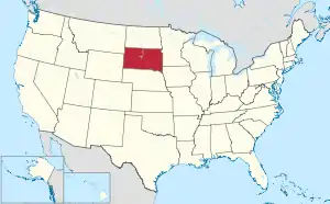
 Location within the U.S. state of South Dakota | |
 South Dakota's location within the U.S. | |
| Coordinates: 44°22′N 96°47′W | |
| Country | |
| State | |
| Founded | 1862 (created) July 3, 1871 (organized) |
| Named for | Wilmot Wood Brookings |
| Seat | Brookings |
| Largest city | Brookings |
| Area | |
| • Total | 805 sq mi (2,080 km2) |
| • Land | 792 sq mi (2,050 km2) |
| • Water | 13 sq mi (30 km2) 1.6% |
| Population (2020) | |
| • Total | 34,375 |
| • Density | 43/sq mi (16/km2) |
| Time zone | UTC−6 (Central) |
| • Summer (DST) | UTC−5 (CDT) |
| Congressional district | At-large |
| Website | brookingscountysd |
Brookings County comprises the Brookings, SD Micropolitan Statistical Area.
Communities
Towns
- Aurora
- Bushnell
- Sinai
Census-designated place
- Lake Poinsett
Unincorporated communities
- Ahnberg
- Medary
Townships
The county is divided into twenty-three townships:
- Afton
- Alton
- Argo
- Aurora
- Bangor
- Brookings
- Elkton
- Eureka
- Lake Hendricks
- Lake Sinai
- Laketon
- Medary
- Oaklake
- Oakwood
- Oslo
- Parnell
- Preston
- Richland
- Sherman
- Sterling
- Trenton
- Volga
- Winsor
References
- "QuickFacts: Brookings County, South Dakota". United States Census Bureau. Retrieved January 20, 2024.
- National Association of Counties. "NACo County Explorer". Retrieved January 20, 2024.
- "Dakota Territory, South Dakota, and North Dakota: Individual County Chronologies". Dakota Territory Atlas of Historical County Boundaries. The Newberry Library. 2006. Archived from the original on April 2, 2018. Retrieved March 28, 2015.
Other websites
Wikimedia Commons has media related to Brookings County, South Dakota.
Places next to Brookings County, South Dakota | ||||||||||
|---|---|---|---|---|---|---|---|---|---|---|
| ||||||||||
This article is issued from Wikipedia. The text is licensed under Creative Commons - Attribution - Sharealike. Additional terms may apply for the media files.