Senegal
The Republic of Senegal (French République da Sénégal) is a country in West Africa. The capital is Dakar. Senegal covers a land area of almost 197,000 square kilometres. It has population of about 13 million. The climate is tropical with two seasons: the dry season and the rainy cold season. Senegal was given independence by France in 1960.
Republic of Senegal | |
|---|---|
 Coat of arms
| |
| Motto: "Un Peuple, Un But, Une Foi" (French) "One People, One Goal, One Faith" | |
| Anthem: Pincez Tous vos Koras, Frappez les Balafons Everyone strum your koras, strike the balafons | |
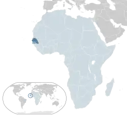 Location of Senegal (dark blue) – in Africa (light blue & dark grey) | |
_-_SEN_-_UNOCHA.svg.png.webp) | |
| Capital and largest city | Dakar |
| Official languages | French |
| Recognised regional languages | |
| Ethnic groups | |
| Demonym(s) | Senegalese |
| Government | Semi-presidential republic |
| Bassirou Diomaye Faye | |
| Ousmane Sonko | |
| Legislature | National Assembly |
| Independence | |
• from Francea | 20 June 1960 |
| 20 August 1960 | |
| Area | |
• Total | 196,712 km2 (75,951 sq mi) (87th) |
• Water (%) | 2.1 |
| Population | |
• 2013 estimate | 13,567,338 (67th) |
• 2013 census | 13,508,715 |
• Density | 68.7/km2 (177.9/sq mi) (134th) |
| GDP (PPP) | 2012 estimate |
• Total | $26.574 billion[1] |
• Per capita | $2,026[1] |
| GDP (nominal) | 2012 estimate |
• Total | $13.864 billion[1] |
• Per capita | $1,057[1] |
| Gini (2011) | 40.3[2] medium |
| HDI (2013) | low · 163rd |
| Currency | CFA franc (XOF) |
| Time zone | UTC |
| Driving side | right |
| Calling code | +221 |
| ISO 3166 code | SN |
| Internet TLD | .sn |
| |
Major industries are fish processing, phosphate mining, fertilizer production, petroleum refining, construction materials, ship construction and repair. Peanuts, sugarcane, cotton, green beans, industrial tomato, cherry tomato, melon, and mango are important cash crops.
French is the official language. Since April 2012, Senegal's president has been Macky Sall.
History
In the 15th century, Portuguese people came to Gorée Island off the coast of Dakar. In the 17th century, French people and Dutch people came there, too. These European countries used the island as a trading post in slaves from the mainland, and was controlled by the Muslim Wolof Empires. Slavery was later made illegal by France, but soon after, around 1850, the French started to conquer the Wolof. By 1902 Senegal was a part of the French colony French West Africa.
In January 1959, Senegal and the French Sudan became one to form the Mali Federation, which became fully independent on June 20, 1960, as a result of the independence and transfer of power agreement signed with France on April 4, 1960. This did not last long and Senegal and Mali broke apart into separate nations. Between 1982 and 1989, Senegal and The Gambia joined together to make Senegambia.
Geography
In the north of Senegal is the Senegal River. To the north of the river is Mauritania. The nation borders Mali in the east, Guinea-Bissau in the south, and Guinea in the south-east. The Gambia is another country inside of Senegal, along the Gambia River. It is about 300 km long.
The north of Senegal is part of the Sahel. The highest mountain is 581 m high. The rainy season is between June and October. The average temperature on the coast is about 24° C, and inland about 27° C.
References
- "Senegal". International Monetary Fund. Retrieved 17 April 2013.
- "Gini Index". World Bank. Retrieved 2 March 2011.
- "2014 Human Development Report Summary" (PDF). United Nations Development Programme. 2014. pp. 21–25. Retrieved 27 July 2014.
.svg.png.webp)