Saint-Palais, Allier
Saint-Palais is a commune. It is found in the Allier department in the center of France.
Saint-Palais | |
|---|---|
 | |
.svg.png.webp) Coat of arms | |
Location of Saint-Palais | |
 Saint-Palais 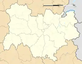 Saint-Palais | |
| Coordinates: 46°26′25″N 2°18′03″E | |
| Country | France |
| Region | Auvergne-Rhône-Alpes |
| Department | Allier |
| Arrondissement | Montluçon |
| Canton | Huriel |
| Intercommunality | Pays d'Huriel |
| Government | |
| • Mayor (2008–2014) | Arlette Philippon |
| Area 1 | 20.3 km2 (7.8 sq mi) |
| Population (2008) | 191 |
| • Density | 9.4/km2 (24/sq mi) |
| Time zone | UTC+01:00 (CET) |
| • Summer (DST) | UTC+02:00 (CEST) |
| INSEE/Postal code | 03249 /03370 |
| Elevation | 304–448 m (997–1,470 ft) (avg. 380 m or 1,250 ft) |
| 1 French Land Register data, which excludes lakes, ponds, glaciers > 1 km2 (0.386 sq mi or 247 acres) and river estuaries. | |
References
This article is issued from Wikipedia. The text is licensed under Creative Commons - Attribution - Sharealike. Additional terms may apply for the media files.