Palak
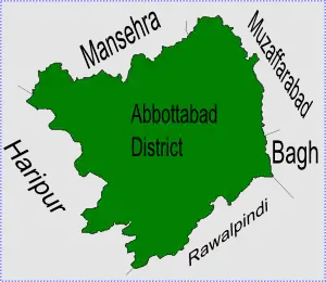
Palak is one of the 51 Union Councils of Abbottabad District in the Khyber Pakhtunkhwa province of Pakistan.[3]
Palak | |
|---|---|
 Palak is in Abbottabad District | |
| Coordinates: 34°N 73°E | |
| Country | Pakistan |
| Province | Khyber Pakhtunkhwa |
| District | Abbottabad |
| Tehsil | Abbottabad |
| Government | |
| • Nazim | Abdul Razzaq Abbassi |
| • Naib Nazim | Tariq Shahid[1] |
| Population | |
| • Total | 18,997[2] |
Location
Palak is in the southeastern edge of Abbottabad District and is next to Punjab province and Kashmir, it is also next to the following Union Councils of Abbottabad District, Seer Gharbi to the west, Nathiagali to the North and Malkot to the north west.
Palak is the gateway into Abbottabad District.
Subdivisions
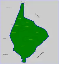
Palak is the largest Union Council of the Circle Bakote area, in 2000 Malkot which used to be a Union Council was joined into Palak.
Palak UC is subdivided into the following areas: Arwar, Darwaza, Kala Bon, Longal, Malkot, Palak, Riala (Riyala) and Soorjal (Surajaal).[1]
People
The total population of the Palak is almost 5,000, the main tribes of Palak are the Dhund Abbasi, Gujars and Sattis.
References
- Palak Union Council
- "List of Union Councils Abbottabad". Archived from the original on 2007-06-27. Retrieved 2008-08-01.
- "Administrative Units of District Abbottabad". Archived from the original on 2007-04-03. Retrieved 2008-08-01.
Administrative Divisions of Abbottabad District | ||
|---|---|---|
| Capital | ||
| Tehsils | Abbottabad and Havelian | |
| Union Councils | Abbottabad Central · Bagh · Bagnotar · Bakot · Baldheri · Bandi Atti Khan · Banda Pir Khan · Beerangali · Berote Kalan · Boi · Chamhad · Dalola · Dewal Manal · Dhamtour · Ghari Phulgran · Goreeni · Haveliani Urban · Jarral · Jhangi · Jhangra · Kakul · Kehal Urban · Kukmang · Kuthiala · Kuthwal · Langra · Langrial · Lora · Malikpura Urban · Mirpur · Mojohan · Nagri Bala · Nagri Totial · Nambal · Namli Maira · Nara · Nathia Gali · Nawansher Urban · Palak · Pattan Kalan · Pawa · Phalkot · Phallah · Pind Kargu Khan · Salhad · Sarbhana · Seer Gharbi · Seer Sharqi Bhattian · Sheikh-ul-Bandi · Sherwan · Tajwal | |