Abbottabad District
Abbottabad District is a district in the Hazara Division of Khyber Pakhtunkhwa province of Pakistan. The district has an area of 1,969 km2, with the city of Abbottabad being the capital. Neighbouring districts are Mansehra to the north, Muzaffarabad to the east, Haripur to the west, and Rawalpindi to the south.
Abottabad District | |
|---|---|
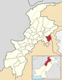 Map of Khyber Pakhtunkhwa with Abbottabad District highlighted | |
| Coordinates: 34°09′N 73°13′E | |
| Country | Pakistan |
| Province | Khyber Pakhtunkhwa |
| Capital | Abbottabad |
| Government | |
| • District Naib- Nazim | Malik Muhammad Junaid[1] |
| Area | |
| • Total | 1,969 km2 (760 sq mi) |
| Population (1998) | |
| • Total | 880,666 |
| • Density | 448/km2 (1,160/sq mi) |
| Time zone | UTC+5 (PST) |
| Number of Union Councils | 51 |
| Number of Tehsils | 3 |
| Website | http://www.abbottabad.gov.pk |
Name
The district is named after Major James Abbott, the first deputy commissioner of Hazara (1849–1853).
Demographics
According to the 1981 census data for Abbottabad tehsil, 95% of the population have Hindko dialect of Panjabi as their first language, while Pashto account for 1.7% and 0.9% respectively.
Protected areas
The Ayubia National Park was established in 1984, this park covers an area of over 3,312 ha.
The Qalanderabad game reserve was established in 1980 with an area of 8,940ha.
Subdivisions
Abbottabad district is divided into four tehsils, Abbottabad, Lower Tanawal, Havelian and Lora Hazara as well as one urban administration area - Nawanshehr. There are fifty-one Union Councils in the district, 35 in Abbottabad tehsil and 16 in Havelian. These are:
Abbottabad Tehsil
Havelian Tehsil
|
Other website
- Abbottabad government website Archived 2007-12-04 at the Wayback Machine
References
| Provincial capital | ||
|---|---|---|
| Districts |
Abbottabad • Bannu • Battagram • Buner • Charsadda • Chitral • Dera Ismail Khan • Hangu • Haripur • Karak • Kohat • Upper Kohistan • Lower Kohistan • Lakki Marwat • Lower Dir • Malakand • Mansehra • Mardan • Nowshera • Peshawar • Shangla District • Swabi • Swat • Tank • Upper Dir • Torghar | |