Pacific Ocean
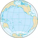
The Pacific Ocean is the body of water between Asia and Australia in the west, the Americas in the east, the Southern Ocean to the south, and the Arctic Ocean to the north. It is the largest named ocean and it covers one-third of the surface of the entire world. It joins the Atlantic Ocean at a line drawn south from Cape Horn, Chile/Argentina to Antarctica, and joins the Indian Ocean at a line drawn south from Tasmania, Australia to Antarctica.
| Earth's oceans (World Ocean) |
|---|
|
|
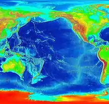
As the Atlantic slowly gets wider, the Pacific is slowly shrinking. It does this by folding the sea floor in towards the centre of the Earth - this is called subduction. This bumping and grinding is hard so there are many earthquakes and volcanoes when the pressure builds up and is quickly released as large explosions of hot rocks and dust. When an earthquake happens under the sea, the quick jerk causes a tsunami. This is why tsunamis are more common around the edge of the Pacific than anywhere else. Many of the Earth's volcanoes are either islands in the Pacific, or are on continents within a few hundred kilometers of the ocean's edge. Plate tectonics are another reason which makes Pacific Ocean smaller.
Other websites
- EPIC Pacific Ocean Data Collection Viewable on-line collection of observational data
- NOAA In-situ Ocean Data Viewer Archived 2006-02-11 at the Wayback Machine plot and download ocean observations
- NOAA PMEL Argo profiling floats Realtime Pacific Ocean data
- NOAA TAO El Niño data Realtime Pacific Ocean El Niño buoy data
- NOAA Ocean Surface Current Analyses – Realtime (OSCAR) Near-realtime Pacific Ocean Surface Currents derived from satellite altimeter and scatterometer data

