Mahoning County, Ohio
Mahoning County is a county of Ohio in the United States. In 2020, 228,614 people lived there.[1] The county seat is Youngstown.[2]
Mahoning County | |
|---|---|
 Mahoning County Courthouse | |
.svg.png.webp) Seal | |
 Location within the U.S. state of Ohio | |
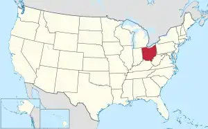 Ohio's location within the U.S. | |
| Coordinates: 41°01′N 80°46′W | |
| Country | |
| State | |
| Founded | March 1, 1846 |
| Named for | A Native American word for salt lick |
| Seat | Youngstown |
| Largest city | Youngstown |
| Area | |
| • Total | 425 sq mi (1,100 km2) |
| • Land | 412 sq mi (1,070 km2) |
| • Water | 14 sq mi (40 km2) 3.2% |
| Population (2020) | |
| • Total | 228,614 |
| • Density | 540/sq mi (210/km2) |
| Time zone | UTC−5 (Eastern) |
| • Summer (DST) | UTC−4 (EDT) |
| Congressional districts | 6th, 13th |
| Website | www |
References
- 2020 census
- "Find a County". National Association of Counties. Retrieved June 7, 2011.
.svg.png.webp)
This article is issued from Wikipedia. The text is licensed under Creative Commons - Attribution - Sharealike. Additional terms may apply for the media files.