Brown County, Ohio
Brown County is a county in the U.S. state of Ohio. As of the 2020 census, the population was 43,676.[1] The county seat is Georgetown.[2] The county was created in 1818[3] and is named for Major General Jacob Brown, an officer in the War of 1812 who was wounded at the Battle of Lundy's Lane.[4]
Brown County | |
|---|---|
 Brown County Courthouse | |
 Seal | |
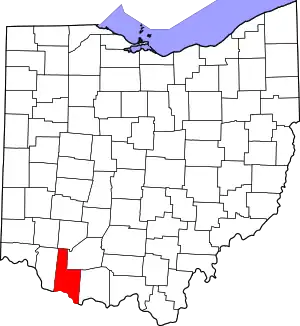 Location within the U.S. state of Ohio | |
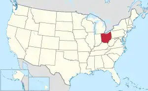 Ohio's location within the U.S. | |
| Coordinates: 38°56′N 83°52′W | |
| Country | |
| State | |
| Founded | 1 March 1818 |
| Named for | General Jacob Brown |
| Seat | Georgetown |
| Largest village | Georgetown |
| Area | |
| • Total | 493 sq mi (1,280 km2) |
| • Land | 490 sq mi (1,300 km2) |
| • Water | 3.4 sq mi (9 km2) 0.7% |
| Population (2020) | |
| • Total | 43,676 |
| • Density | 89/sq mi (34/km2) |
| Time zone | UTC−5 (Eastern) |
| • Summer (DST) | UTC−4 (EDT) |
| Congressional district | 2nd |
| Website | www |
Brown County is part of the Cincinnati-Middletown, OH-KY-IN Metropolitan Statistical Area.
Brown County was said to be the place of origin of the White Burley type of tobacco, grown in 1864 by George Webb and Joseph Fore on the farm of Captain Frederick Kautz near Higginsport from seed from Bracken County, Kentucky.
References
- "QuickFacts: Brown County, Ohio". United States Census Bureau. Retrieved January 18, 2024.
- "Find a County". National Association of Counties. Archived from the original on May 31, 2011. Retrieved June 7, 2011.
- "Ohio: Individual County Chronologies". Ohio Atlas of Historical County Boundaries. The Newberry Library. 2007. Archived from the original on April 6, 2016. Retrieved February 12, 2015.
- Taylor, William Alexander (1899). Ohio Statesmen and Annals of Progress. Press of the Westbote Company. p. 243.
Municipalities and communities of Brown County, Ohio, United States | ||
|---|---|---|
| Villages |
| Map of Ohio highlighting Brown County |
| Townships |
| |
| CDPs |
| |
| Unincorporated communities |
| |
| Footnotes | ‡This populated place also has portions in an adjacent county or counties | |
.svg.png.webp)
This article is issued from Wikipedia. The text is licensed under Creative Commons - Attribution - Sharealike. Additional terms may apply for the media files.