Ashtabula County, Ohio
Ashtabula County is the northeasternmost county in the U.S. state of Ohio. As of the 2020 census, the population was 97,574.[1] The county seat is Jefferson.[2]
Ashtabula County | |
|---|---|
 Ashtabula County Courthouse | |
 Seal | |
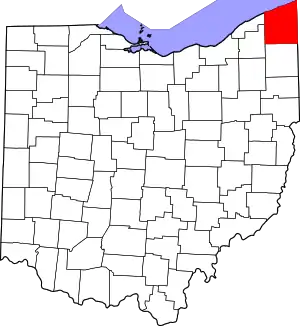 Location within the U.S. state of Ohio | |
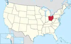 Ohio's location within the U.S. | |
| Coordinates: 41°53′N 80°46′W | |
| Country | |
| State | |
| Founded | May 1, 1811 |
| Named for | Lenape ashtepihële 'always enough fish to go around' |
| Seat | Jefferson |
| Largest city | Ashtabula |
| Area | |
| • Total | 1,368 sq mi (3,540 km2) |
| • Land | 702 sq mi (1,820 km2) |
| • Water | 666 sq mi (1,720 km2) 49% |
| Population (2020) | |
| • Total | 97,574 |
| • Density | 71/sq mi (27/km2) |
| Time zone | UTC−5 (Eastern) |
| • Summer (DST) | UTC−4 (EDT) |
| Congressional district | 14th |
| Website | www |
References
- "QuickFacts: Ashtabula County, Ohio". United States Census Bureau. Retrieved January 18, 2024.
- National Association of Counties. "NACo County Explorer". Retrieved January 18, 2024.
Municipalities and communities of Ashtabula County, Ohio, United States | ||
|---|---|---|
| Cities | Map of Ohio highlighting Ashtabula County | |
| Villages |
| |
| Townships |
| |
| CDPs |
| |
| Unincorporated communities |
| |
| Footnotes | ‡This populated place also has portions in an adjacent county or counties | |
.svg.png.webp)
This article is issued from Wikipedia. The text is licensed under Creative Commons - Attribution - Sharealike. Additional terms may apply for the media files.