Elsenfeld
Elsenfeld is a market community in the Miltenberg district in the Lower Franconia region in Bavaria, Germany. It is on the river Main between the hills of the Spessart, east of the river, and Odenwald, west of the river. Elsenfeld has about 9,000 people living there.
Elsenfeld | |
|---|---|
 Coat of arms | |
Location of Elsenfeld within Miltenberg district 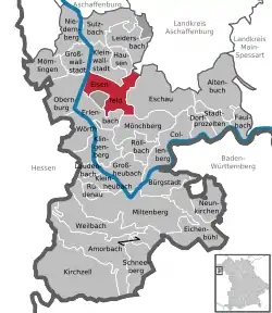 | |
 Elsenfeld  Elsenfeld | |
| Coordinates: 49°51′N 9°10′E | |
| Country | Germany |
| State | Bavaria |
| Admin. region | Unterfranken |
| District | Miltenberg |
| Subdivisions | 3 Ortsteile |
| Government | |
| • Mayor (2020–26) | Kai Hohmann[1] (CSU) |
| Area | |
| • Total | 24.38 km2 (9.41 sq mi) |
| Elevation | 123 m (404 ft) |
| Population (2022-12-31)[2] | |
| • Total | 9,275 |
| • Density | 380/km2 (990/sq mi) |
| Time zone | UTC+01:00 (CET) |
| • Summer (DST) | UTC+02:00 (CEST) |
| Postal codes | 63820 |
| Dialling codes | 06022 (Eichelsbach: 09374) |
| Vehicle registration | MIL |
| Website | www.elsenfeld.de |
Geography
Place
Elsenfeld is in the "Bavarian Lower Main Region" (Bayerischer Untermain) on the Main's right edge. Running through the community is the brook Elsava, which releases into the Main at Elsenfeld.
Subdivisions
The community has the following districts: Eichelsbach, Elsenfeld, Rück, Schippach and Himmelthal (formerly a monastery estate).

The Elsava between Rück (left) and Schippach (right)
References
- Liste der ersten Bürgermeister/Oberbürgermeister in kreisangehörigen Gemeinden, Bayerisches Landesamt für Statistik, 15 July 2021.
- Genesis Online-Datenbank des Bayerischen Landesamtes für Statistik Tabelle 12411-003r Fortschreibung des Bevölkerungsstandes: Gemeinden, Stichtag (Einwohnerzahlen auf Grundlage des Zensus 2011) .
Other websites
Wikimedia Commons has media related to Elsenfeld.
- Elsavatal cycle path (in German)
Towns and municipalities in Miltenberg (district) | ||
|---|---|---|
| Coat of Arms of Miltenberg district | |
This article is issued from Wikipedia. The text is licensed under Creative Commons - Attribution - Sharealike. Additional terms may apply for the media files.