Dhawalagiri Zone
Dhawalagiri (Nepali: धौलागिरी अञ्चल![]() Listen ) was one of the fourteen administrative zones of Nepal.[1] According to the 2001 census, it had a population of 556,191.
Listen ) was one of the fourteen administrative zones of Nepal.[1] According to the 2001 census, it had a population of 556,191.
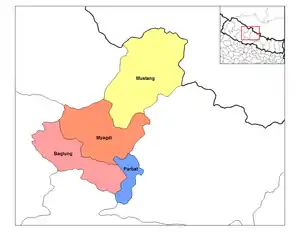
| District | Type | Headquarters |
|---|---|---|
| Baglung | Hill | Baglung |
| Mustang | Mountain | Jomsom |
| Myagdi | Hill | Beni |
| Parbat | Hill | Kusma |
Dhaulagiri Zone
धौलागिरी अञ्चल | |
|---|---|
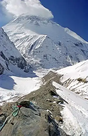
 Dhaulagiri Mountain Range | |
 Dhaulagiri Zone | |
| Coordinates: 28°50′N 83°30′E | |
| Country | Nepal |
| Area | |
| • Total | 8,148 km2 (3,146 sq mi) |
| Population (2001) | |
| • Total | 556,191 |
| • Density | 68/km2 (180/sq mi) |
| Time zone | UTC+5:45 (Nepal Time) |
Related pages
References
- "Dhaulagiri Zone in Nepal". visit-nepal.com. Archived from the original on 4 March 2016. Retrieved 23 November 2015.
Other websites
Wikimedia Commons has media related to Dhawalagiri Zone.
- Introduction of Western Archived 2016-01-15 at the Wayback Machine regions of Nepal.
- About Dhawalagiri Zone and also it's locations.
This article is issued from Wikipedia. The text is licensed under Creative Commons - Attribution - Sharealike. Additional terms may apply for the media files.