Clark County, Wisconsin
Clark County is a county in the U.S. state of Wisconsin. As of 2020, 34,659 people lived there.[1] Its county seat is Neillsville.[2]
Clark County | |
|---|---|
 Clark County Courthouse | |
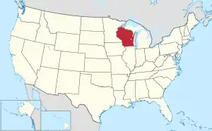
 Location within the U.S. state of Wisconsin | |
 Wisconsin's location within the U.S. | |
| Coordinates: 44°44′N 90°37′W | |
| Country | |
| State | |
| Founded | 1854 |
| Named for | George Rogers Clark |
| Seat | Neillsville |
| Largest city | Neillsville |
| Area | |
| • Total | 1,219 sq mi (3,160 km2) |
| • Land | 1,210 sq mi (3,100 km2) |
| • Water | 9.0 sq mi (23 km2) 0.7% |
| Population | |
| • Total | 34,659 |
| • Density | 28.7/sq mi (11.1/km2) |
| Time zone | UTC−6 (Central) |
| • Summer (DST) | UTC−5 (CDT) |
| Congressional district | 7th |
| Website | www |
Geography
According to the U.S. Census Bureau, the county has a total area of 1,219 square miles (3,157.2 km2). It has 1,216 square miles (3,149.4 km2) of land. Water covers 3 square miles (7.8 km2) (0.28%) of the county.
Demographics
| Historical population | |||
|---|---|---|---|
| Census | Pop. | %± | |
| 1860 | 789 | — | |
| 1870 | 3,450 | 337.3% | |
| 1880 | 10,715 | 210.6% | |
| 1890 | 17,708 | 65.3% | |
| 1900 | 25,848 | 46.0% | |
| 1910 | 30,074 | 16.3% | |
| 1920 | 35,120 | 16.8% | |
| 1930 | 34,165 | −2.7% | |
| 1940 | 33,972 | −0.6% | |
| 1950 | 32,459 | −4.5% | |
| 1960 | 31,527 | −2.9% | |
| 1970 | 30,361 | −3.7% | |
| 1980 | 32,910 | 8.4% | |
| 1990 | 31,647 | −3.8% | |
| 2000 | 33,557 | 6.0% | |
| 2010 | 34,690 | 3.4% | |
| 2020 | 34,659 | −0.1% | |
| U.S. Decennial Census[3] 1790–1960[4] 1900–1990[5] 1990–2000[6] 2010–2020[1] | |||
As of the census[7] of 2000, the county had 33,557 people living there. There were 12,047 households and 8,673 families living in the county. The population density was 28 people per square mile (11/km²). Clark County had 13,531 housing units. There were, on average, about 11 housing units per square mile (4/km²). The racial makeup of the county was 98.05% White, 0.13% Black or African American, 0.48% Native American, 0.30% Asian, 0.01% Pacific Islander, 0.56% from other races, and 0.47% from two or more races. 1.20% of the population were Hispanic or Latino of any race. 54.0% were of German, 9.0% Polish, 6.2% Norwegian and 6.1% United States or American ancestry according to Census 2000. 6.62% said that they spoke German, Pennsylvania German, or Dutch at home. 1.34% said that they spoke Spanish.
Cities, villages, and towns
Cities and villages
|
|
Towns
|
|
|
|
|
|
Unincorporated communities
- Atwood
- Bright
- Christie
- Chili
- Clark
- Columbia
- Eadsville
- Eidsvold
- Globe
- Hemlock
- Humbird
- Junction
- Lombard
- Longwood
- Lynn
- Nevins
- Reseburg
- Riplinger
- Sherwood
- Shortville
- Tioga
- Sidney
- Spokeville
- Veefkind
- Willard
Ghost towns
- Kurth
- Maple Works
- Trow
- Worden
References
- "QuickFacts: Clark County, Wisconsin". United States Census Bureau. Retrieved January 20, 2024.
- "Find a County". National Association of Counties. Retrieved 2008-01-31.
- "U.S. Decennial Census". United States Census Bureau. Retrieved August 2, 2015.
- "Historical Census Browser". University of Virginia Library. Archived from the original on August 11, 2012. Retrieved August 2, 2015.
- Forstall, Richard L., ed. (March 27, 1995). "Population of Counties by Decennial Census: 1900 to 1990". United States Census Bureau. Retrieved August 2, 2015.
- "Census 2000 PHC-T-4. Ranking Tables for Counties: 1990 and 2000" (PDF). United States Census Bureau. April 2, 2001. Archived (PDF) from the original on 2022-10-09. Retrieved August 2, 2015.
- "American FactFinder". United States Census Bureau. Retrieved 2008-01-31.
Other websites
- Official Clark County Government website Archived 2011-02-21 at the Wayback Machine
- History of Clark County Wisconsin
Places next to Clark County, Wisconsin | ||||||||||
|---|---|---|---|---|---|---|---|---|---|---|
| ||||||||||
