Bhola District
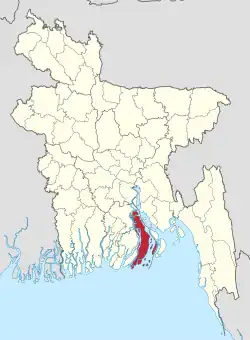
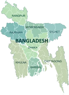
Bhola (Bengali: ভোলা) is a district in south-western Bangladesh. It is in the Barisal Division. It is also the largest offshore island region in Bangladesh, with an area of 3403.48 km². It is bordered by Lakshmipur and Barisal districts to the north. Bay of Bengal is to the south; Lakshmipur and Noakhali districts, Meghna (lower) river and Shahbazpur Channel are to the east. Patuakhali district and Tentulia river are to the west.[2]
Bhola | |
|---|---|
 Location of Bhola in Bangladesh | |
Expandable map of Bhola District | |
| Coordinates: 22.69°N 90.6525°E | |
| Country | |
| Division | Barisal Division |
| Government | |
| • Deputy Commissioner | Mohammad Masud Alam Siddique |
| Area | |
| • Total | 3,403.48 km2 (1,314.09 sq mi) |
| Population (2011 Census) | |
| • Total | 2,037,201 |
| • Density | 600/km2 (1,600/sq mi) |
| Literacy rate | |
| • Total | 43.2% |
| Time zone | UTC+06:00 (BST) |
| Postal code | 8300 |
| HDI (2018) | 0.586[1] medium · 16th of 21 |
| Website | www.bhola.gov.bd |
Subdistricts
Bhola district comprises the following upazilas:
- Bhola Sadar Upazila
- Burhanuddin Upazila
- Char Fasson Upazila
- Daulatkhan Upazila
- Lalmohan Upazila
- Manpura Upazila
- Tazumuddin Upazila
Places of interest
- Bhola Shishu Park
- Charfashion College
Related pages
References
- "Sub-national HDI - Area Database - Global Data Lab". hdi.globaldatalab.org. Retrieved 2020-03-18.
- http://banglapedia.search.com.bd/HT/B_0489.htm Bhola district in Banglapedia, Retrieved on 07-08-2008.
This article is issued from Wikipedia. The text is licensed under Creative Commons - Attribution - Sharealike. Additional terms may apply for the media files.
