Asher, Oklahoma
Asher is a town in Pottawatomie County, Oklahoma, United States. The population was 370 at the 2020 census, a decline of 5.9 percent from 393 at the 2010 census.[4]
Asher, Oklahoma | |
|---|---|
| Nickname: Baseball City | |
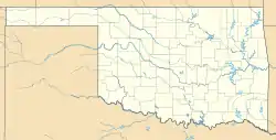 Asher, Oklahoma Location in the state of Oklahoma | |
| Coordinates: 34°59′19″N 96°55′31″W | |
| Country | United States |
| State | Oklahoma |
| County | Pottawatomie |
| Area | |
| • Total | 0.77 sq mi (1.99 km2) |
| • Land | 0.77 sq mi (1.99 km2) |
| • Water | 0.00 sq mi (0.00 km2) 0% |
| Elevation | 997 ft (304 m) |
| Population (2020) | |
| • Total | 370 |
| • Density | 481.77/sq mi (186.02/km2) |
| Time zone | UTC-6 (CST) |
| • Summer (DST) | UTC-5 (CDT) |
| ZIP code | 74826 |
| Area code(s) | 405/572 |
| FIPS code | 40-03000[3] |
| GNIS feature ID | 2411648[2] |
| Website | www.asherok.info |
Geography
Asher is located at 34°59′19″N 96°55′36″W (34.988580, -96.926550),[5] at the intersection of U.S. Highway 177 and State Highway 39 in Pottawatomie County. According to the United States Census Bureau, the town has a total area of 0.8 square miles (2.1 km2), all of it land.
Sources
- "ArcGIS REST Services Directory". United States Census Bureau. Retrieved September 20, 2022.
- U.S. Geological Survey Geographic Names Information System: Asher, Oklahoma
- "U.S. Census website". United States Census Bureau. Retrieved 2008-01-31.
- "DP1: PROFILE OF GENERAL POPULATION AND HOUSING CHARACTERISTICS". United States Census Bureau. Retrieved January 28, 2024.
- "US Gazetteer files: 2000 and 1990". United States Census Bureau. 2005-05-03. Retrieved 2008-01-31.

This article is issued from Wikipedia. The text is licensed under Creative Commons - Attribution - Sharealike. Additional terms may apply for the media files.