Villepot
| |
|---|---|
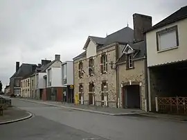 The town hall in Villepot | |
.svg.png.webp) Coat of arms | |
Location of Villepot | |
 Villepot 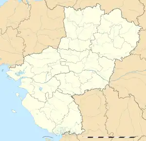 Villepot | |
| Coordinates: 47°46′34″N 1°16′35″W / 47.7761°N 1.2764°W | |
| Country | France |
| Region | Pays de la Loire |
| Department | Loire-Atlantique |
| Arrondissement | Châteaubriant-Ancenis |
| Canton | Châteaubriant |
| Intercommunality | Châteaubriant-Derval |
| Government | |
| • Mayor (2020–2026) | Philippe Dugravot[1] |
| Area 1 | 20.59 km2 (7.95 sq mi) |
| Population | 683 |
| • Density | 33/km2 (86/sq mi) |
| Demonym(s) | Villepotaises, Villepotais |
| Time zone | UTC+01:00 (CET) |
| • Summer (DST) | UTC+02:00 (CEST) |
| INSEE/Postal code | 44218 /44110 |
| Elevation | 66–116 m (217–381 ft) |
| Website | http://www.cc-castelbriantais.fr/ |
| 1 French Land Register data, which excludes lakes, ponds, glaciers > 1 km2 (0.386 sq mi or 247 acres) and river estuaries. | |
Villepot (French pronunciation: [vilpo] ⓘ; Breton: Kerbod) is a commune in the Loire-Atlantique department in western France.
Geography
The river Verzée flows eastward through the southern part of the commune.
See also
- Communes of the Loire-Atlantique department
- The works of Jean Fréour Works in the Notre Dame de l’Assomption church in Villepot.
References
- ↑ "Répertoire national des élus: les maires" (in French). data.gouv.fr, Plateforme ouverte des données publiques françaises. 4 May 2022.
- ↑ "Populations légales 2021". The National Institute of Statistics and Economic Studies. 28 December 2023.
Wikimedia Commons has media related to Villepot.
This article is issued from Wikipedia. The text is licensed under Creative Commons - Attribution - Sharealike. Additional terms may apply for the media files.